Derryvree’s Sealed Plant Bed30834 BCE
Labelled 30,834 BCE only by modern calculation, this period belongs broadly to Marine Isotope Stage 3, not a recoverable Irish calendar year. Derryvree, County Fermanagh, preserves freshwater and organic deposits between tills, recording a temporary ice-free, cold treeless wetland with mosses, sedges, herbs and aquatic plants before renewed glaciation. Its radiocarbon date spans a wide calibrated range. Castlepook Cave, County Cork, contains diverse Ice Age fauna, demonstrating ecological links with north-west Europe. A possibly tool-marked reindeer bone suggests brief human activity, but cannot prove settlement. Lower sea levels altered connections, while later ice advances buried evidence and severely constrain interpretation.
Dateline
30,834 BCE is a modern calendar label, not a year that can be recovered from Irish evidence. Nobody in Ireland left a written date, a named event, or a record of a particular season at this depth in time. In the archaeological convention that counts backwards from 1950, it lies roughly 32,783 years before present; that arithmetic conversion is not itself a calibrated age. The responsible setting is the later part of the Late Pleistocene, within Marine Isotope Stage 3 (MIS 3), when climates around the North Atlantic changed sharply and repeatedly. Ireland is known here through scattered environmental deposits, cave bones and traces left by ice, not through an annual chronicle.
The most informative Irish evidence relevant to this broad interval comes from Derryvree, near Maguiresbridge in County Fermanagh. There, a road cutting exposed fine sand, freshwater silt and organic sediment trapped between two tills: the unsorted material laid down by glacier ice. The sequence establishes an important order of events. Ice had occupied the locality; an interval followed in which open water, wet ground and vegetation developed; later glacial activity buried the deposits. It is an unusually valuable archive because subsequent ice destroyed or concealed so much of Ireland’s earlier Pleistocene record.
A Date Within a Broad Range
The Derryvree organic bed produced a conventional radiocarbon determination of about 30,500 ± 1,200 radiocarbon years BP. Such a measurement cannot be equated directly with either a BCE year or an exact number of calendar years ago: atmospheric carbon-14 has varied through time, and uncertainty grows towards the practical limit of radiocarbon dating. Published calibration places the deposit broadly at about 36,900–31,700 calibrated years BP, approximately 34,950–29,750 BCE. The notional year 30,834 BCE falls within that wide range, but neither begins nor ends it, and cannot be tied to a particular layer, animal, plant or human action.
This qualification matters. Derryvree was a local basin in Fermanagh, not a weather station for the whole landmass now called Ireland. Its sediments demonstrate that this particular place was temporarily free of overriding ice and held freshwater before a later advance; they do not prove that every Irish region was similarly exposed at once. Nor do old names such as the “Derryvree Cold Phase” denote a single, universally synchronous episode. They are useful stratigraphic labels for a fragmentary record, increasingly interpreted alongside ice-core chronologies, improved radiocarbon methods and reconstructions of the British–Irish Ice Sheet.
Wet Ground Between Glaciers
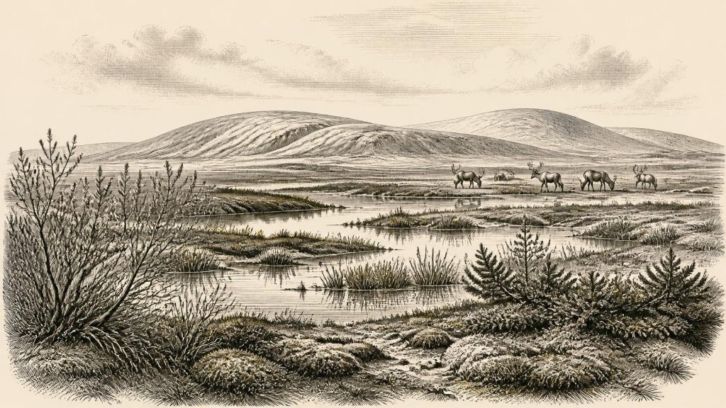
The plant evidence from Derryvree points to a cold, treeless landscape rather than woodland. Mosses, sedges, grasses and hardy herbs occurred alongside aquatic or wet-ground plants; reported remains include bogbean, while other finds indicate dwarf willow, juniper and mountain-avens. These are not the ingredients of the later Irish forest. They suggest a patchwork of shallow water, sedge-rich margins, wet mossy ground and exposed mineral soils, with short growing seasons and severe winters. Permafrost or deeply seasonally frozen ground may have affected surrounding land, although the precise local extent cannot be reconstructed from one deposit alone.
Such vegetation was productive in a limited but real way. In summer, meltwater-fed pools and wetland margins could support aquatic plants, insects and birds, while sedges and herbs supplied forage for herbivores. In winter, the same country would have been far less forgiving: snow cover, frozen soil, sparse browse and windswept exposure restricted plant growth. The evidence therefore supports neither an image of an empty white desert nor one of a settled green Ireland. It instead reveals a cold periglacial environment capable of sustaining life in favourable pockets, vulnerable to rapid climatic change and, eventually, to renewed ice cover.
The Cave Fauna of Southern Ireland
Caves in southern Ireland provide a second, differently formed body of evidence. Castlepook Cave near Doneraile, County Cork—known historically as Mammoth Cave—has produced one of Ireland’s most important Pleistocene faunal collections. Its accumulated bones include woolly mammoth, reindeer, giant deer, horse, brown bear, Arctic fox, hare, lemmings and spotted hyaena. Individual remains date across long spans of the Late Pleistocene rather than to one shared moment. Even so, together they show that Ireland participated in the wider north-west European world of cold-adapted animals and open habitats before the Last Glacial Maximum.
These animals should not be assembled into a single imagined herd standing outside the cave in 30,834 BCE. Cave deposits are selective. Carnivores may have carried prey in; animals may have died in or near entrances; running water, collapse and nineteenth- and early twentieth-century excavation disturbed original positions. Modern re-dating has also demonstrated that some older Irish radiocarbon results require revision. The secure conclusion is modest but substantial: over parts of MIS 3, large herbivores and predators reached Ireland, and conditions at times allowed them to survive. The exact combinations, population sizes and seasonal movements remain poorly resolved.
Reindeer are especially evocative because they connect the Fermanagh wetland evidence with the open-country fauna of Cork, but their presence does not automatically disclose a human hunting economy. Reindeer can travel widely through cold landscapes without people. Mammoth and giant deer likewise attest to habitats and ecological connectivity, not to an Irish population able to control or exploit them. The animal record is strongest as environmental history: it indicates that land, vegetation and perhaps exposed continental-shelf terrain offered routes and feeding grounds under lower sea levels than today.
A Single Mark, Not a Settlement
Castlepook also contains a potentially momentous but still limited clue to human activity: a reindeer femur reported to bear a deep modification interpreted as a stone-tool cut or chop made during carcass processing. County Cork heritage material has presented the object as roughly 31,000 BC, and the broader dating of Castlepook fauna makes it directly relevant to the period considered here. If the mark is securely anthropogenic and belongs to the bone’s original Ice Age context, it would extend the possible human story of Ireland dramatically earlier than the well-established terminal-Pleistocene evidence from Alice and Gwendoline Cave in County Clare.
It must not, however, be made to carry more than it can bear. A modified bone would document an act involving an animal, not a village, a camp, a migration route or continuous residence. Castlepook has not yielded a securely associated hearth, stone-tool assemblage, dwelling floor, burial or food-storage feature of this age. Its key collections were excavated by Richard J. Ussher and colleagues before modern excavation standards, leaving difficult questions about context and disturbance. Further microscopic study, direct dating and excavation of intact deposits are needed before the case can be treated as settled.
For that reason, it is not responsible to name a people living in Ireland in 30,834 BCE, assign them a language, or describe a stable Upper Palaeolithic society on the island. Neanderthals had disappeared from most of Europe by this time, while Homo sapiens were established elsewhere in north-west Europe, but the Irish evidence does not identify who, if anyone, made the Castlepook mark. The least speculative interpretation is that people may have made brief, intermittent incursions into a landscape shared with reindeer and large carnivores. Even that remains an inference rather than a demonstrated settlement history.
No Politics, No Proven Trade
There is no evidence for political affairs, diplomacy, territorial rule or organised conflict in Ireland at this point. No settlements, defensive works, graves, monuments or symbolic objects can be securely assigned to this period. Nor is there evidence for farming, herding, pottery, metallurgy, long-distance trade or a formal exchange network. The familiar categories of later Irish history simply do not yet have an archaeological footing. If people did visit, their social ties, beliefs, rituals, skills and relationships to animals are unknown from Irish material.
Movement is nonetheless a central environmental question. Sea level was much lower during glacial conditions, so the outlines of Ireland, Britain and the surrounding shelves differed profoundly from those of today. Yet low sea level alone does not prove a continuous walkable land bridge between Ireland and Britain, much less identify a route used by people or animals. Ice margins, sea channels, local topography and changing crustal levels all mattered. The cautious picture is of shifting connections and barriers in a dynamic north-west European borderland, not a guaranteed highway into Ireland.
Before the Greatest Ice Advance
The Derryvree sequence belongs before the fullest development of the last British–Irish Ice Sheet. Ice-sheet reconstructions show advance and retreat varied greatly by region between about 31,000 and 15,000 years ago, with the maximum total ice volume later, around 23,000 years ago. A later expansion buried Derryvree’s wetland under till and transformed much of Ireland’s landscape. That destruction helps explain why the island’s evidence for this time is so sparse and why arguments must remain proportionate to a few surviving archives.
Thus the historical value of 30,834 BCE lies not in an invented event but in a landscape caught between ice advances. At Derryvree, plants and freshwater sediment survived long enough to preserve a glimpse of cold wet ground in Fermanagh. At Castlepook, bones reveal an Ice Age fauna in Cork and raise a carefully qualified possibility of human carcass processing. Together they show Ireland as neither timeless island nor blank space, but as a changing part of the Pleistocene North Atlantic world—ecologically connected, climatically unstable, and still far beyond the reach of calendar-year history.
Primary Sources
- A Middle Midlandian Freshwater Series at Derryvree, Maguiresbridge, County Fermanagh, Northern Ireland
- Figure 6.— The Subdivision of the Quaternary Period in Ireland
- The Irish Quaternary Fauna Project
- A Reconsideration of the Radiocarbon Dating of the Marine Isotope Stage 3 Fauna from Southern Ireland
- Heritage Artefacts of County Cork
- New Insights on the Fauna of Ireland’s Younger Dryas and Early Holocene from Alice & Gwendoline Cave
- First Evidence of a Late Upper Palaeolithic Human Presence in Ireland
- Ireland’s Palaeolithic Archaeology – Fleeting Footprints in a Frozen Land
- Growth and Retreat of the Last British–Irish Ice Sheet, 31,000 to 15,000 Years Ago: the BRITICE-CHRONO Reconstruction
- Exploring Controls on the Last Irish Ice Sheet Using Numerical Modelling and Geological Data
- Dimensions and Chronology of the Last Ice Sheet in Western Ireland
- Radiocarbon Constraints on the Age of the Maximum Advance of the British–Irish Ice Sheet in the Celtic Sea
- The Problem of a Late Quaternary Landbridge Between Britain and Ireland
- Deglaciation, Earth Crustal Behaviour and Sea-Level Changes in the Determination of Insularity: A Perspective from Ireland
- The Geology of Ireland: Cenozoic—Tertiary and Quaternary
- Soils of County Waterford
- Biogeography of Ireland: Past, Present, and Future
- The Mesolithic in Ireland: When Was It?
- Radiocarbon Age Calibration Curve (0–55 cal kBP)
- A Complete Terrestrial Radiocarbon Record for 11.2 to 52.8 kyr BP
- IntCal20 Northern Hemisphere Radiocarbon Age Calibration Curve (0–55 cal kBP)
- Derryvree, County Fermanagh: Site Record
