Exposed Celtic Sea Shelf31960 BCE
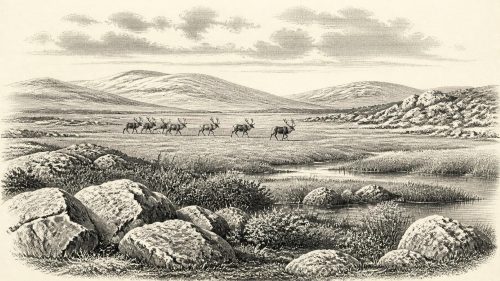
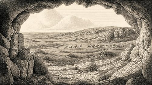
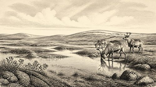
Around 31,960 BCE, Ireland was a cold, glaciated Late Pleistocene landscape, though not uniformly ice-covered. Lower sea levels exposed surrounding shelf lands, but changing channels, ice and difficult terrain still impeded access. Castlepook Cave in County Cork preserves important, imperfectly excavated animal remains, including mammoth, reindeer, giant deer, bear and hyaena, indicating open habitats and diverse fauna accumulated over long periods. A cut-marked reindeer bone may record butchery by Upper Palaeolithic visitors, potentially Ireland’s earliest human trace. However, no tools, hearths or settlements confirm occupation. Later glaciation and disturbed cave deposits limit interpretation; Ireland remains an intermittently habitable Ice-Age frontier.
Dateline
Modern calendar-year precision is not available for Ireland in 31,960 BCE. The label is a convenient modern conversion, not a date that anyone then recognised or that archaeological science can isolate to a single year. It corresponds roughly to 33,910 years before the conventional radiocarbon “present” of 1950, within the Late Pleistocene and Marine Isotope Stage 3. At this depth of time, evidence is dated in calibrated ranges, often spanning centuries or millennia; cave deposits can also be mixed by water, animals and earlier excavations. The responsible question is therefore not what happened in an Irish year, but what the surviving evidence can tell us about Ireland around this broad interval.
An Ice-Age Landscape
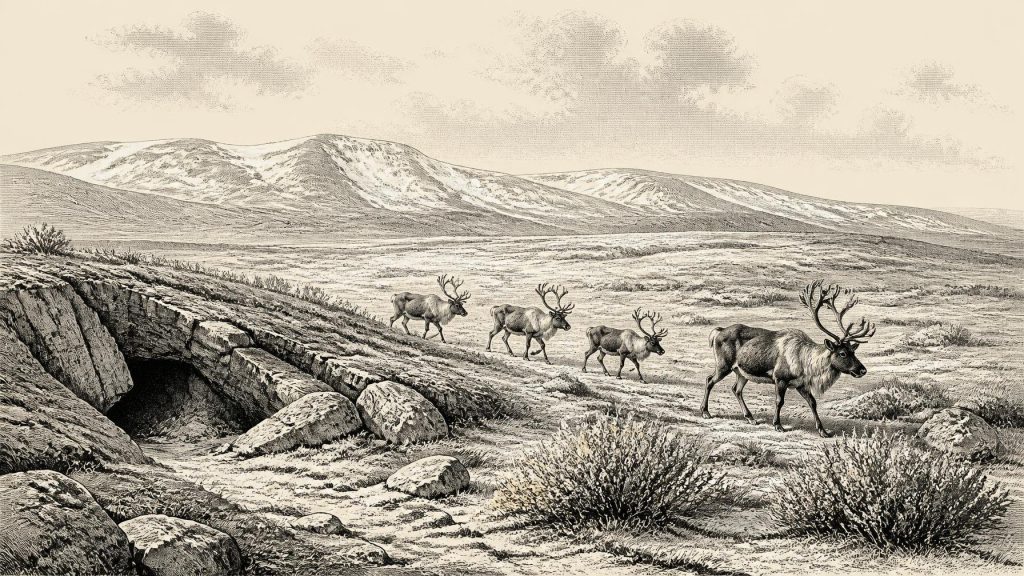
Ireland was entering a severe late phase of the last Ice Age, but it was not yet at the full Last Glacial Maximum. The British–Irish Ice Sheet expanded dramatically during the later part of Marine Isotope Stage 3, while its greatest overall extent came later, broadly between about 27,000 and 23,000 years ago. Reconstructions are necessarily regional rather than year-specific: ice margins advanced and retreated unevenly, and conditions differed between western uplands, southern lowlands and the basins now submerged beneath the Irish and Celtic Seas. It would be misleading to picture every part of the island in 31,960 BCE as a single, permanent white ice cap. Equally, it would be wrong to imagine a mild, wooded Ireland. This was a cold, exposed northern landscape increasingly affected by ice growth, frost action and powerful seasonal change.
Sea level was far lower than it is today because vast quantities of water were held in continental ice sheets. The coastline and surrounding shelves were consequently very different, with land now underwater exposed in places. Yet lower sea level does not prove that people could simply walk from Britain or continental Europe into Ireland. The geography of the Irish Sea region changed through time, and rivers, sea channels, ice, marshy ground and glacial barriers may all have obstructed movement. No securely mapped route can be assigned to this particular date. The most that can safely be said is that Ireland was less isolated geographically than the modern island, while still being a difficult and changeable north-western edge of Europe.
Castlepook and Its Animals
The crucial Irish evidence for this distant period comes not from villages or monuments, but from cave bone assemblages. Castlepook Cave, near Doneraile in north County Cork, is especially important. Early twentieth-century excavations led by Richard J. Ussher recovered an exceptionally large collection, although only a fraction survives and the original excavation standards cannot meet modern expectations. Geological Survey Ireland describes Castlepook as Ireland’s richest known archive for vertebrate life in the period leading towards the Last Glacial Maximum. Direct dating and reassessment have placed individual bones from the cave within a very long span, rather than within one single occupation horizon.
Its fauna provides the clearest glimpse of the wider environment. Remains attributed to woolly mammoth, giant deer, reindeer, brown bear and spotted hyaena show that, during parts of the middle and later Ice Age, southern Ireland supported a strikingly varied large-mammal community. Wolves, Arctic foxes, mountain hares and lemmings occur in later cold-phase material. Such animals should not be assembled into an imagined parade on one day in 31,960 BCE: their bones were accumulated over long periods, and the presence of a species in a cave does not establish that every species lived together or in every Irish region. Nevertheless, reindeer and mammoth point towards open, treeless or sparsely vegetated habitats, while hyaena indicates a carnivore guild far removed from modern Irish ecology.
The cave itself was not necessarily a human home. Carnivores could drag carcass parts underground; scavengers, flowing water and collapsing sediment could later redistribute them. Recent work at another Irish cave, Alice and Gwendoline Cave in County Clare, has demonstrated just how important such processes are: analysis there found that much bone-bearing sediment had entered through runoff or slope movement rather than preserving an intact floor of human activity. This is a valuable warning for Castlepook. Cave bones are powerful evidence for animals and climate, but they are not automatically evidence for a campsite, a hunting stand or a household.
A Possible Human Trace
One reindeer femur from Castlepook has made this period especially significant. It has been reported as bearing a deep mark interpreted by Ruth Carden as having been made with a sharp stone implement during butchery, and has been presented in County Cork heritage publications as evidence for human activity around 31,000 BCE. If that interpretation is correct, it would indicate that Upper Palaeolithic hunter-gatherers reached Ireland many millennia earlier than the previously accepted Mesolithic settlement record. It would not, however, demonstrate a settled population, a named people or a continuous occupation. The bone may represent a brief visit by a small mobile group, and the carcass remains may subsequently have been taken into the cave by carnivores.
The qualification matters. No associated stone-tool assemblage, hearth, dwelling floor, grave or repeated series of securely excavated Palaeolithic camps has yet been found in Ireland for this early interval. Castlepook’s surviving material derives largely from antiquarian work, and modern investigation has concentrated on determining whether undisturbed Pleistocene deposits survive. Archaeologists are therefore right to distinguish a plausible, potentially transformative trace of butchery from proof of a resident community. The difference is not pedantry: a cut-marked bone can establish contact between people and an animal, but it cannot independently tell us how long people stayed, how many came, where they slept or whether they returned.
People Without a Recorded Society
For political affairs, conflict and diplomacy, the evidence is silent. There were no states, borders, written agreements or named leaders that can be recovered from Ireland around this date. If people entered the island, they would have belonged to small, highly mobile Upper Palaeolithic hunting and gathering groups, comparable in broad economic character to communities elsewhere in north-west Europe, not to later Irish tribes or kingdoms. Their social relationships, languages, kinship systems and decision-making structures remain unknown. It is possible that access to animal herds, sheltering places and safe travel routes caused cooperation or competition, but there is no Irish evidence from which to identify a conflict, alliance or territorial boundary.
Everyday life is similarly visible only by inference. A party capable of butchering a reindeer would have needed sharp stone edges and detailed practical knowledge of animal bodies, weather and movement across unfamiliar terrain. Reindeer meat, fat, hide, sinew and bone could all have been valuable. Yet no Irish material allows us to say how the animal was hunted, whether it was killed by people or found dead, how much of it was carried away, or whether its hide became clothing or shelter. Flint and other workable stone may have been transported across substantial distances by mobile groups, but there is no demonstrated trade network in Ireland at this date. The safest description is one of possible short-term subsistence activity, not an established economy.
Culture, Belief and Absence
There is no responsible basis for reconstructing religion, art, formal learning or ritual in Ireland in 31,960 BCE. The wider Upper Palaeolithic world certainly produced sophisticated stone technologies, portable art and cave imagery, but none of that permits those practices to be projected onto Ireland. Nor should later Irish mythology, medieval traditions or the island’s celebrated megalithic monuments be carried backwards into this remote era. At Castlepook, the evidence presently concerns animals, landscape processes and one disputed or cautiously interpreted human modification, not symbolic culture.
That absence is historically meaningful. It reflects both the likelihood that any human presence was brief and the destructive force of later glaciation. Advancing ice, meltwater and repeated freeze–thaw processes eroded or buried much of the earlier landscape. Camps on exposed ground would have been especially vulnerable, while cave deposits have their own complicated histories. Future excavations, refined dating, microscopic study of cut marks, ancient environmental DNA and sediment analysis may alter the picture. For now, Ireland around 31,960 BCE is best understood as a harsh but intermittently habitable Ice-Age frontier: rich enough in animals to attract mobile hunters, yet represented by evidence too sparse to turn a possible visit into a settled prehistoric society.
Primary Sources
- Cork County Geological Site Report: Castlepook Cave
- A Reconsideration of the Radiocarbon Dating of the Marine Isotope Stage 3 Fauna from Southern Ireland
- The Irish Quaternary Fauna Project
- The Exploration of Castlepook Cave, County Cork, Being the Third Report from the Committee Appointed to Explore Irish Caves
- Heritage Artefacts of County Cork
- The Archaeological Heritage of County Cork
- 2022:564 – Castlepook Cave, Castlepook South, Cork
- First Evidence of a Late Upper Palaeolithic Human Presence in Ireland
- New Insights on the Fauna of Ireland’s Younger Dryas and Early Holocene from Alice & Gwendoline Cave
- Growth and Retreat of the Last British–Irish Ice Sheet, 31,000 to 15,000 Years Ago: the BRITICE-CHRONO Reconstruction
- Pattern and Timing of Retreat of the Last British-Irish Ice Sheet
- Stratigraphic and Palaeo-Geomorphological Evidence for the Glacial-Deglacial History of the Last British-Irish Ice Sheet in the North-Western Irish Sea
- Late Pleistocene Chronostratigraphy and Ice Sheet Limits, Southern Ireland
- Character of Advance and Retreat of the Southwest Sector of the British-Irish Ice Sheet During the Last Glaciation
- Last Glacial Maximum Cirque Glaciation in Ireland and Implications for Reconstructions of the Irish Ice Sheet
- The IntCal20 Northern Hemisphere Radiocarbon Age Calibration Curve (0–55 cal kBP)
- OxCal Online
- Timing, Pace and Controls on Ice Sheet Retreat: an Introduction to the BRITICE-CHRONO Transect Reconstructions of the British-Irish Ice Sheet
- A 10Be-Dated Record of Glacial Retreat in Connemara, Ireland, Following the Last Glacial Maximum and Implications for Regional Climate
- The Exploration of the Caves of County Clare