
Hollymount’s Freshwater Bed31774 BCE
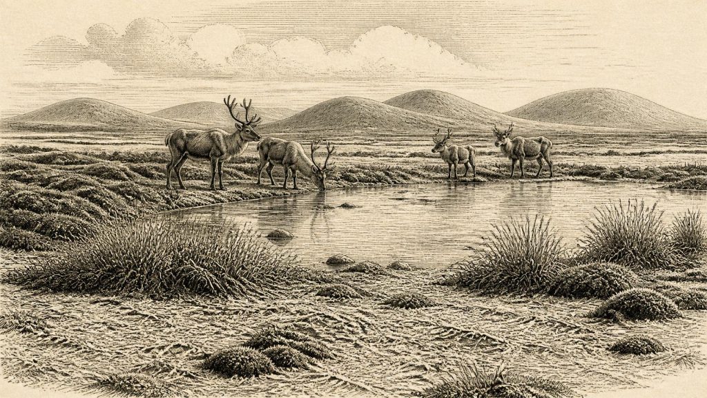
About 31,774 BCE, Ireland lay within the fluctuating cold conditions of Marine Isotope Stage 3, rather than a recoverable historical year. Freshwater sediments at Hollymount/Derryvree, County Fermanagh, dated broadly to 36,900–31,700 calendar years before present, preserve evidence of marshy tundra, mosses, herbs, insects and pools between glacial advances. Comparable northern deposits confirm episodic ice-free conditions. Southern caves indicate cold-adapted fauna, including reindeer, mammoth and predators, although dates and associations remain uncertain. Human presence is unproven: a possibly cut-marked reindeer bone may suggest brief visitation, not settlement. Subsequent British–Irish Ice Sheet expansion transformed and obscured this ecologically active landscape across Ireland.
Dateline
31,774 BCE is not a year that can be recovered in the manner of a later historical date. No Irish chronicle, settlement sequence or securely dated human event identifies a moment within that calendar year. In modern chronological terms it falls roughly 33,700 calendar years before AD 1950, within the later part of Marine Isotope Stage 3 (MIS 3), a fluctuating cold phase of the last Ice Age. The responsible approach is therefore to describe a broad archaeological and environmental horizon, using calibrated ranges where they exist, rather than to invent an event, leader or community for a single year.
For Ireland, the most revealing evidence close to this horizon comes not from houses or tools but from sediments, pollen, mosses, insects, animal bones and the geology of advancing ice. These remains show an Irish landscape that was changing sharply, unevenly and regionally. It was a world before the Last Glacial Maximum, when the British–Irish Ice Sheet later expanded across most of the island and its surrounding shelf. Around this point, parts of Ireland still sustained tundra and wetland habitats, but the conditions that would bring extensive glaciation were gathering force.
Evidence Beneath the Drumlins
The key local archive is in south Fermanagh, near Maguiresbridge. Roadworks at Derryvree exposed freshwater silts and fine sands sealed between glacial deposits within a drumlin landscape. Such a sequence matters because the organic-rich sediments were laid down during an interval when this ground was not overridden by ice; later ice deposited till above them. A radiocarbon determination of about 30,500 years before present was obtained from the Derryvree material. Calibrated chronologies place the deposit broadly within about 36,900 to 31,700 calendar years before present, a range that encompasses the modern calendar label 31,774 BCE.
This does not mean that every layer at Derryvree formed in that precise year, or that the site gives a complete picture of Ireland. It does, however, provide unusually direct evidence for the sort of environment available in at least one northern Irish district during this phase. The deposits contained plant and animal remains characteristic of a cold, open, periglacial setting. Pollen was poorly preserved, but was chiefly herbaceous. Moss macrofossils were especially valuable, while insect evidence suggested wet ground with pools and productive vegetation. The reconstruction is of a marshy tundra or muskeg-like landscape rather than woodland, farmland or a bare, lifeless ice desert.
Cold Wetlands, Open Ground
In a landscape such as Derryvree’s, water was fundamental. Fine sediments accumulated in quiet freshwater; sedges, mosses and low herbs could exploit damp margins; and shallow pools offered sheltered niches amid an otherwise exposed terrain. The climate was cold enough for periglacial processes—repeated freezing and thawing of ground outside permanent ice—to shape soils and slopes. Yet the preserved biology shows that plants grew and freshwater habitats functioned. This is important corrective to the popular image of Ice-Age Ireland as uniformly buried beneath an ice sheet throughout the period.
Nearby Greenagho, near Belcoo in County Fermanagh, preserves another interstadial deposit between tills, reinforcing the conclusion that northern Ireland experienced ice-free episodes during the Midlandian glaciation. Farther north, deposits at Aghnadarragh in County Antrim record similarly complicated alternations of ice advance, deglaciation and renewed glaciation. These sites should not be treated as a single synchronised national landscape. Together, however, they demonstrate that the ice sheet’s history was not one simple, uninterrupted advance. Habitats opened, contracted and disappeared as climate, snowfall, ice flow and drainage altered.
The land surface was also geographically unlike modern Ireland. Global sea level was much lower than today because enormous quantities of water were stored in northern ice sheets. Exposed shelf areas and altered coastlines changed the setting of the Irish Sea and Atlantic margins. Lower seas did not necessarily create an easy, dry route for animals or people: local relative sea level depended upon ice loading, land movement, channels and the position of glaciers. It is safer to say that Ireland stood within a changing north-west European ice-and-shelf geography, not to imagine a fixed land bridge or a familiar modern coastline.
The Animals of the Irish Cold Stage
Southern cave assemblages provide the principal record of larger animals during broad MIS 3 intervals. Castlepook Cave near Doneraile in County Cork, and Shandon Cave near Dungarvan in County Waterford, have yielded remains attributed to reindeer, mammoth, giant deer, horse, brown bear, wolf, fox, Arctic fox, spotted hyaena and lemmings. These are not a photographic snapshot of a single living community. Cave deposits can accumulate over long periods, and bones may have been dragged in by carnivores, redeposited by water, disturbed during excavation or mixed with material of other ages.
That warning has gained force through modern radiocarbon re-dating. Improved pretreatment of bone samples has shown that several earlier dates from southern Irish caves were too young, shifting some fauna farther back into MIS 3. The revised evidence establishes that sizeable mammals reached Ireland before the Last Glacial Maximum, but it also makes simple species lists for one exact date unreliable. Mammoth or hyaena remains demonstrate the ecological possibilities of the wider period; they do not prove that every animal stood beside the Fermanagh pools in 31,774 BCE.
Nevertheless, the broad pattern is clear. Ireland could support animal communities adapted to open, cold landscapes with enough forage for large herbivores and enough prey or carrion for predators and scavengers. Reindeer are particularly compatible with open tundra conditions. Mammoths and giant deer indicate substantial, though seasonally variable, plant productivity. Wolves, hyaenas and bears point to a food web in which caves may have served as dens, refuges, traps for remains or places where carnivores accumulated bone. The cave record is therefore evidence for fauna and habitat, not simply a catalogue of dramatic extinct beasts.
People: A Possibility, Not a Population
The question of human presence requires even greater restraint. Ireland has no securely excavated Upper Palaeolithic house, hearth, stone-tool scatter, burial or repeated occupation sequence dated to this phase. The National Museum of Ireland accordingly continues to stress the lack of clear evidence for a Palaeolithic human population on the island. The first well-supported evidence for people comes vastly later, after the ice had retreated, with the Late Upper Palaeolithic cut-marked bear bone from Alice and Gwendoline Cave in County Clare, and with more substantial Mesolithic settlement after about 8000 BCE.
A reindeer femur from Castlepook has been reported as bearing a deep mark consistent with cutting or chopping by a sharp stone implement, and has been presented as evidence for human processing of reindeer around 33,000 BCE. If that interpretation is sustained, it would show a fleeting Upper Palaeolithic visit or episode of butchery in Ireland. It would not establish permanent settlement, a named people or a continuous Irish population. The specimen derives from an old cave collection rather than a modern excavation with a fully recorded context, so its date, modification and association demand continuing critical study.
Accordingly, there is no basis for describing political affairs, diplomacy, organised warfare, religious institutions, learning, trade networks or social ranks in Ireland at this time. Even if small groups briefly entered the island’s changing landscape, their language, beliefs, family arrangements, routes and tools remain unknown. A passing hunting party would have made choices about food, shelter and risk, but those choices cannot responsibly be enlarged into a lost society. Silence in the record is not proof that nothing happened; it is a limit on what the evidence can carry.
Approaching a Transformed Ireland
The long-term significance of this period lies in its instability. The freshwater world recorded at Derryvree belonged to a window between glacial episodes. Later expansion of the British–Irish Ice Sheet would cover most of Ireland and the adjacent continental shelf, eroding, burying or reworking much older evidence. Modern reconstructions indicate that ice growth and maximum extent varied between sectors, with major advances beginning across the wider ice-sheet system from around 30,000 years ago and peak volume later, around 23,000 years ago. The precise timing in every Irish locality remains an active research question.
Thus Ireland around 31,774 BCE was neither a timeless frozen blank nor a recognisable prehistoric homeland. It was a cold, exposed and ecologically active land of wetlands, open vegetation and roaming animals, already vulnerable to profound glacial change. The Hollymount and Derryvree freshwater evidence in Fermanagh, together with the cave fauna of the south, gives this otherwise anonymous point in deep time a material reality. It also teaches the central rule of Ice-Age history: calibrated ranges, depositional context and uncertainty are not obstacles to the story; they are the story.
Primary Sources
- An Inter-Till Freshwater Deposit at Hollymount, Maguiresbridge, County Fermanagh
- Middle Midlandian Interstadial Deposits at Greenagho, Near Belcoo, County Fermanagh, Northern Ireland
- Freshwater Organic Deposits and Stratified Sediments Between Early and Late Midlandian (Devensian) Till Sheets, at Aghnadarragh, County Antrim, Northern Ireland
- The Irish Quaternary Fauna Project
- A Reconsideration of the Radiocarbon Dating of the Marine Isotope Stage 3 Fauna from Southern Ireland
- Growth and Retreat of the Last British–Irish Ice Sheet, 31,000 to 15,000 Years Ago: The BRITICE-CHRONO Reconstruction
- Extent and Timing of the Last Glacial Maximum (LGM) in Britain and Ireland: A Review
- Maximum Extent and Dynamic Behaviour of the Last British–Irish Ice Sheet West of Ireland
- Stratigraphic and Palaeo-Geomorphological Evidence for the Glacial-Deglacial History of the Last British-Irish Ice Sheet in the North-Western Irish Sea
- Maximum Extent and Readvance Dynamics of the Irish Sea Ice Stream and Irish Sea Glacier Since the Last Glacial Maximum
- Pattern and Timing of Retreat of the Last British-Irish Ice Sheet
- BRITICE-CHRONO Maps and GIS Data of the Last British-Irish Ice Sheet 31 to 15 ka
- The Island of Ireland: Drowning the Myth of an Irish Land-Bridge?
- The IntCal20 Northern Hemisphere Radiocarbon Age Calibration Curve (0–55 cal kBP)
- OxCal
- Could Brown Bears (Ursus arctos) Have Survived in Ireland During the Last Glacial Maximum?
- First Evidence of a Late Upper Palaeolithic Human Presence in Ireland
- New Insights on the Fauna of Ireland’s Younger Dryas and Early Holocene from Alice & Gwendoline Cave
- Prehistoric Details
- Our Ancient Landscapes: Hunter-Gatherers in Ireland
