

Derryvree Before the Drumlin31653 BCE
Around 31,653 BCE, Ireland experienced unstable Late Pleistocene conditions during Marine Isotope Stage 3, before the Last Glacial Maximum. Derryvree, County Fermanagh, preserves freshwater sediments indicating locally ice-free tundra wetland, open pools and severe periglacial conditions between glacial advances. Cave records show intermittent milder phases and a varied fauna, including reindeer, mammoth, giant deer, bear, wolf and hyaena. Low sea levels may have enabled animal movement, though connections remained variable. No secure human settlement is known. A possibly butchered reindeer bone from Castlepook Cave may indicate brief Palaeolithic visitation, but remains inconclusive. Expanding ice later reshaped and obscured much evidence.
Dateline
31,653 BCE is a modern calendar label, not a year that anyone in Pleistocene Ireland could have named or counted. It corresponds approximately to 33,602 years before the conventional radiocarbon baseline of 1950, but archaeology cannot resolve an event, a season or a human life within that single notional year. At this depth of time, the responsible frame is the later part of the Late Pleistocene, within Marine Isotope Stage 3, and the evidence comes in broad, calibrated ranges rather than calendar dates. Radiocarbon results must be calibrated because atmospheric carbon-14 has varied through time; even then, their uncertainties are usually measured in centuries or millennia. Ireland at this horizon is therefore best understood as a changing Ice Age landscape, not as a polity with a recoverable annual history.
An Ice Age Interval, Not the Ice Maximum
This was not yet the Last Glacial Maximum, the period when ice later covered the whole island and much of its continental shelf, conventionally dated in Ireland to roughly 27,000–23,000 calibrated years before present. The broad build-up to that maximum was nevertheless under way. Reconstructions of the British–Irish Ice Sheet place the onset of substantial expansion after about 35,000–32,000 years ago, but they also stress that ice advanced unevenly, with local upland glaciers, ice caps and ice-sheet sectors responding differently. At roughly 33,600 years before present, Ireland was not simply either ‘ice-covered’ or ‘ice-free’. It was a region of severe climatic instability in which open ground, seasonal snow, frozen soils, freshwater basins and growing upland ice could coexist across different districts.
The later maximum would radically alter both terrain and evidence. Moving ice eroded bedrock, reworked sediments and removed or buried many older surfaces. That is one reason why the archaeological record for this period is so sparse: absence of camps, tools or burials cannot by itself demonstrate that people never visited. It may instead reflect a destructive glacial history, difficult cave deposits and the limited survival of buried landscapes on land and beneath the sea. Modern reconstructions are powerful but remain models constrained by landforms, sediments and dates; their mapped ice margins are not exact photographs of a single year.
Derryvree’s Buried Freshwater World
The clearest Irish environmental archive relevant to this date lies at Derryvree, near Maguiresbridge in County Fermanagh. Road works in 1969 cut through a drumlin and exposed organic freshwater silts and fine sands trapped between two thick sheets of till. The lower and upper tills record glacial episodes; the intervening deposits preserve a period when ice was absent locally and a wetland or shallow-water environment supported living communities of plants and animals. A conventional radiocarbon measurement from the deposit, Birm-166, gave 30,500 radiocarbon years before present, with a substantial error margin. Later calibration places the material broadly around 36,900–31,700 calibrated years before present. That range includes 31,653 BCE, but does not identify that exact year.
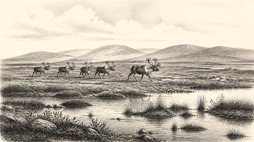
What can be said is striking enough. The Derryvree plant and animal evidence indicates open tundra vegetation and a periglacial climate: ground subject to intense cold, freezing and thawing, rather than a wooded Irish countryside. Fossil insects and plant remains have been interpreted as evidence for a moss-rich wetland, open pools and abundant decaying vegetation. The wider scene was probably treeless or nearly so, with low herbaceous plants and shrubs adapted to short growing seasons. This was not an empty white wilderness. Freshwater margins could be biologically productive in summer, while the long winters remained severe. Derryvree gives a local window rather than an island-wide map, but it demonstrates that north-central Ireland could sustain active terrestrial and wetland ecosystems during a cold interval before the major advance of the last ice sheet.
Water, Caves and Changing Ground
Other Irish evidence supports the picture of fluctuation rather than permanence. At Crag Cave in County Kerry, uranium-thorium dates on speleothems show that calcite sometimes formed during Marine Isotope Stage 3. In a shallow cave system, such growth requires liquid water moving through the limestone and is taken to indicate intervals when mean annual temperatures rose above freezing. The cave record cannot assign a precise temperature to Derryvree or prove that every Irish region experienced the same conditions simultaneously. It does, however, show that the late Pleistocene climate at Ireland’s Atlantic edge shifted on millennial scales, in step with wider North Atlantic climatic variability.
For people and animals, these environmental shifts mattered more than any imagined frontier. Rivers and pools offered water; exposed limestone caves offered dens, traps, shelters and places where bones could accumulate; open ground created routes across which herds and predators moved. But the coastlines familiar today did not exist. Sea level was much lower globally, and the surrounding shelf had a different form, although glacial ice and marine waters made connections between Ireland, Britain and continental Europe variable rather than straightforward. The sensible conclusion is that animal movements into Ireland were possible during favourable phases, not that a simple permanent land bridge can be drawn for this exact date.
Animals at the Western Edge
Cave collections, especially from Castlepook Cave near Doneraile in north County Cork, provide the principal evidence for Ireland’s larger Pleistocene fauna. Work on Irish Quaternary animal remains has identified a changing assemblage that included reindeer, woolly mammoth, giant deer, brown bear, wolf, fox, hare, arctic lemmings and spotted hyaena. These species did not necessarily all share Castlepook at one moment: cave deposits may contain material accumulated over long periods, and many early excavations disturbed original layers. The strongest use of the assemblage is therefore ecological. It establishes that Ireland, at different stages before the Last Glacial Maximum, formed part of a wider north-west European zone through which cold-adapted mammals could disperse.
Reindeer are particularly evocative but should not be made to carry more historical weight than the evidence permits. Their presence indicates open, cold-country habitat and the availability of grazing, not a known annual migration route. Mammoth and hyaena remains likewise show that the island could support, or intermittently receive, large herbivores and powerful carnivores. A 2026 sedimentary ancient-DNA study from Castlepook, currently a preprint rather than a peer-reviewed article, reports genetic traces consistent with faunal connectivity between Ireland and Eurasia before the Last Glacial Maximum. It reinforces a long-standing interpretation of interchange, while remaining provisional evidence whose detailed conclusions may change after review.
The Human Question
There is no securely excavated settlement, hearth, tool assemblage, human burial, named group or continuous population from Ireland that can be assigned to 31,653 BCE. Consequently, there is no responsible basis for describing political authority, diplomacy, warfare, language, religious practice, trade institutions or a social hierarchy on the island at this date. Nor may later labels such as Gaelic, Celtic or Irish be projected back into this period. The established evidence for substantial, sustained human settlement belongs far later, in the Mesolithic after the final retreat of the great ice sheets.
There is, however, one debated and important clue from Castlepook. A reindeer femur from an older cave collection has been publicly reported as about 33,000 years old and as bearing a deep incision interpreted by zooarchaeologist Ruth Carden as a stone-tool butchery mark. If that interpretation is upheld, it may indicate that Palaeolithic people processed a reindeer in Ireland during a broadly comparable pre-glacial phase. Yet the specimen was not recovered from a modern, intact occupation layer, and the date is the age of the animal bone rather than automatic proof of when the mark was made, who made it, or how long anyone stayed. Recent excavation has located surviving cave sediments but reported no cultural artefacts in its 2022 fieldwork. The bone is thus a potentially transformative trace of a visit, not proof of a settled society.
Everyday Life Beyond Recovery
If humans did reach Ireland in this wider period, their most plausible activities would have been short-term and mobile: moving through a cold, resource-variable landscape, seeking animal carcasses or game, water, shelter and workable stone. That is an inference from the setting, not direct evidence for a camp at Derryvree or Castlepook. No Irish artefacts of this age allow archaeologists to identify a particular Upper Palaeolithic tradition, reconstruct clothing, determine family size or describe food-sharing practices. Equally, there is no material basis for religious claims: caves may later have acquired symbolic significance in many societies, but Ice Age animal bones alone do not reveal rites, stories or beliefs.
The dominant development around this modernly numbered year was environmental transformation. Freshwater silts beneath a Fermanagh drumlin record an ice-free tundra wetland; caves in Cork preserve fragments of a wider animal world; and ice-sheet research shows that a far more extensive glaciation was approaching. These records make Ireland’s deep past intelligible without inventing a dated event. They reveal an island-edge landscape with living waters, open ground, mobile fauna and perhaps fleeting human contact—soon to be reshaped by the expanding ice that would erase much of what had come before.
Primary Sources
- A Middle Midlandian Freshwater Series at Derryvree, Maguiresbridge, County Fermanagh, Northern Ireland
- Irish Pleistocene Biostratigraphy
- Figure 6.— The Subdivision of the Quaternary Period in Ireland
- The Last Irish Ice Sheet: Extent and Chronology
- Growth and Retreat of the Last British–Irish Ice Sheet, 31,000 to 15,000 Years Ago: the BRITICE-CHRONO Reconstruction
- Extent and Timing of the Last Glacial Maximum in Britain and Ireland: a Review
- Episodic Speleothem Deposition Tracks the Terrestrial Impact of Millennial-Scale Last Glacial Climate Variability in SW Ireland
- Ireland: Submerged Prehistoric Sites and Landscapes
- The Irish Quaternary Fauna Project
- Phylogeographic, Ancient DNA, Fossil and Morphometric Analyses Reveal Ancient and Modern Introductions of a Large Mammal: the Complex Case of Red Deer (Cervus elaphus) in Ireland
- First Evidence of a Late Upper Palaeolithic Human Presence in Ireland
- The Archaeology of Caves in Ireland
- 2022:564 – Castlepook Cave, Castlepook South, Cork
- Advance and Retreat of the Marine-Terminating Irish Sea Ice Stream into the Celtic Sea During the Last Glacial: Timing and Maximum Extent
- Maximum Extent and Readvance Dynamics of the Irish Sea Ice Stream and Irish Sea Glacier Since the Last Glacial Maximum
- BRITICE Glacial Map, Version 2: a Map and GIS Database of Glacial Landforms of the Last British–Irish Ice Sheet
- Trimlines, Blockfields and the Vertical Extent of the Last Ice Sheet in Southern Ireland
- A Stratigraphic Framework for Abrupt Climatic Changes During the Last Glacial Period Based on Three Synchronized Greenland Ice-Core Records: Refining and Extending the INTIMATE Event Stratigraphy
- The IntCal20 Northern Hemisphere Radiocarbon Age Calibration Curve (0–55 cal kBP)
- Sedimentary Ancient DNA Reveals Late Pleistocene Faunal Connectivity Between Ireland and Eurasia