
Derryvree’s Moss Flora31594 BCE
At the nominal date of 31,594 BCE, Ireland’s evidence is environmental and archaeological, not historical in the political sense. Derryvree, County Fermanagh, preserves wetland sediments between glacial tills, indicating a locally ice-free MIS 3 interval with cold, open, treeless vegetation of mosses, sedges, grasses and shrubs. Castlepook Cave, County Cork, records a time-mixed cold-stage fauna including mammoth, reindeer, giant deer, predators and smaller mammals. Possible cut marks on reindeer bone suggest fleeting human activity, but cannot establish settlement. Changing sea levels and advancing ice shaped access and survival of evidence before extensive later glaciation erased much of Ireland’s earlier landscape.
Dateline
Modern calendar-year precision is not available for Ireland in 31,594 BCE. Nobody on the island recorded years, and neither radiocarbon dating nor glacial stratigraphy can isolate an event within this particular twelve-month span. The date is therefore a useful point on a modern timeline, not a historical anniversary. Measured from the radiocarbon convention of AD 1950, it lies about 33,544 years before present. The responsible setting is the later part of Marine Isotope Stage 3 (MIS 3), a long, unstable interval of the last Ice Age.
For this period, Irish history is environmental and archaeological rather than political. There are no named peoples, leaders, states, treaties, battles, farms, villages or religious monuments to describe. The evidence consists of rare sediments, pollen, fossil plants, insects, cave bones and the marks left by ice. It can show that parts of Ireland supported life during particular broad intervals. It cannot provide a continuous narrative, a national map for one nominal year, or certainty that people lived here permanently.
A Date Within Deep Time
The strongest Irish environmental record relevant to this date comes from Derryvree, near Maguiresbridge in County Fermanagh. Roadworks exposed a remarkable sequence beneath a drumlin: organic-rich freshwater sediments and sands lying between two deposits of till, the unsorted material laid down by glacier ice. The lower till demonstrates an earlier ice advance; the upper till shows that ice later returned and sealed the intervening wetland deposits. That sequence is valuable precisely because such fragile evidence normally did not survive later glaciation.
Organic matter from Derryvree produced a conventional radiocarbon age of 30,500 ± 1,100 radiocarbon years BP. This is not the same thing as a calendar age. Atmospheric radiocarbon changed through time, and the older a sample is, the less defensible it is to translate its laboratory age mechanically into a single BCE date. A later Bayesian treatment used Derryvree as evidence for ice-free conditions at about 33.5 ± 1.2 thousand calibrated years BP. In other words, its plausible range overlaps the modern label 31,594 BCE, but it cannot establish what occurred in that exact year.
Older Irish Quaternary schemes called this broad interval the Derryvree Cold Phase, and correlated it cautiously with cold-stage episodes recognised elsewhere in north-west Europe. Such terminology remains useful as a descriptive framework, but it must not imply that Ireland’s climate changed everywhere at once or that every deposit belongs to one neatly bounded episode. The Atlantic fringe was affected by rapid climatic swings, shifting sea levels and the uneven growth of the British–Irish Ice Sheet.
Wet Ground Beneath Later Ice
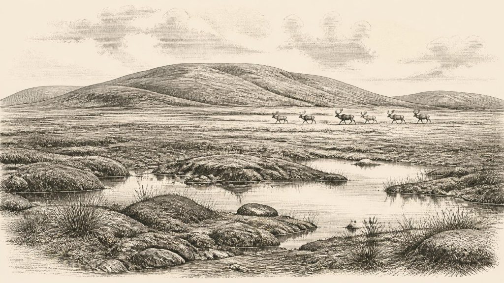
Derryvree’s plant and insect remains give the clearest local picture. The evidence supports open, largely treeless vegetation, with freshwater mosses, sedges, grasses, herbs and low shrubs around shallow water and waterlogged hollows. Earlier researchers used the term muskeg for this peaty, mossy, wet-ground environment. It was not the forested, hedged landscape of modern Fermanagh. Nor was it necessarily a lifeless snowfield: plants grew, insects lived and enough unfrozen freshwater existed for organic sediment to accumulate.
This should not be made into an overly detailed landscape painting. Pollen can travel long distances, be redeposited, or survive unevenly. A few grains from trees do not prove nearby woodland; equally, a treeless pollen assemblage from one basin cannot prove that not a single tree stood elsewhere in Ireland. The more secure conclusion is local: at Derryvree, a cold, open, wetland-tundra mosaic supported low vegetation during an ice-free interval.
Everyday conditions would have been demanding. Seasonal freezing, exposed mineral ground, short growing seasons and wind would have restricted soil development and tall vegetation. Drainage mattered greatly. A sedgy hollow, a mossy pool margin and a drier gravelly rise could have offered sharply different ecological opportunities within a short distance. The low productivity of winter would have contrasted with a brief but important growing season. These are inferences from the environmental evidence, not observations of a known community.
Animals of the Open Country
Southern Ireland offers a second, very different archive at Castlepook Cave, also known as Mammoth Cave, near Doneraile in north County Cork. Excavations there in the early twentieth century recovered an immense and complicated collection of bones. The cave remains are directly relevant to the wider MIS 3 world, but they are not a sealed deposit from one moment. Water movement, carnivore activity, earlier excavation practices and the mixing of material from different passages mean that the assemblage must be read as a succession of visits and accumulations, not as a census of animals living together in 31,594 BCE.
Even so, the cave demonstrates that Ireland was periodically part of a wider north-west European cold-stage faunal zone. Mammoth, reindeer, giant deer, brown bear, wolf, Arctic fox, mountain hare, lemmings and spotted hyaena are among the animals represented in the Castlepook record. Re-dating with improved preparation methods has shown that several earlier Irish cave dates were too young, strengthening the evidence for a substantial pre-Last Glacial Maximum fauna. It also suggests that some species, notably spotted hyaena and giant deer, may have disappeared locally before the later maximum of the ice sheet.
The cave’s hyaenas matter because they complicate any simple account of hunting. Hyaenas could drag carcass parts into a den; bears and other carnivores could also use sheltered caves; falling animals and water could add bones. A mammoth bone in a cave does not show that a mammoth entered it, still less that people killed it there. The assemblage nevertheless indicates food webs with large herbivores, scavengers and predators, sustained at least seasonally by open-country habitats.
The Human Question
A reindeer femur from Castlepook has been reported as bearing marks consistent with stone-tool processing and has been publicised as possible evidence of human activity in Ireland around 33,000 years ago. If that interpretation is confirmed, it would be exceptionally important: it would show that Upper Palaeolithic people reached Ireland many millennia before the island’s well-attested post-glacial hunter-gatherer settlement.
For this date, however, the claim must remain carefully qualified. No securely associated stone-tool assemblage, hearth, dwelling floor, burial, human bone, artwork or repeatedly occupied Palaeolithic living surface has yet established a resident community in Ireland around the thirty-second millennium BCE. The cave’s disturbed and time-mixed deposits make association difficult. A marked bone may record a brief visit, an episode of carcass processing outside the cave, or an interpretation that further microscopic study may revise. It cannot by itself demonstrate a population, language, kin group or settlement system.
It is reasonable to say that humans in neighbouring parts of Britain and continental Europe possessed sophisticated Upper Palaeolithic hunting knowledge, mobile social networks and varied stone technologies. It is not reasonable to assign those attributes automatically to a proven Irish group at Derryvree’s date. The evidence allows the possibility of short-lived human presence; it does not yet support a story of Irish colonisation, political organisation, trade routes or cultural continuity.
No Politics, No Proven Trade
Accordingly, there were no political affairs or diplomacy in the documentary sense, and no evidence for warfare in Ireland at this horizon. Nor is there evidence for agriculture, herding, metalworking, pottery, formal burial, ritual monuments, long-distance trade or permanent settlement. Such absences are not proof that every human action left no trace. They reflect both the scarcity of confirmed human material and the destructive power of later ice, erosion and changing sea levels.
Movement across the wider region was nevertheless ecologically important. The presence of cold-adapted mammals shows that animal populations could reach Ireland during suitable phases, whether over exposed terrain, coastal corridors, ice-associated routes or changing marine passages. Lower sea levels altered the geography of the Irish Sea basin, but they did not automatically create a simple, continuous and safe land bridge at every stage. For people as for animals, access would have depended on the precise configuration of sea, land, ice, weather and food resources at the time.
Approaching a Larger Glaciation
The dominant long-term development was the approach of more extensive glaciation. Derryvree records an interval when its locality was free of overriding ice; the upper till records that this condition did not last. Reconstructions place the major expansion towards the Last Glacial Maximum later, with Ireland and its continental shelf extensively ice-covered around 27,000–23,000 calibrated years BP. The timing and thickness of ice varied by region, but the outcome was transformative: glaciers eroded older surfaces, remade drainage, deposited till and helped create many of the landforms later familiar in Ireland.
That later transformation explains the peculiar shape of the evidence. An open-air camp on a river terrace would have had little chance of surviving repeated frost action, erosion and glacial overriding. A small pocket of mossy mud trapped between tills, or a bone protected in a limestone cave, had a better chance. Derryvree and Castlepook are therefore not marginal curiosities. They are rare survivors that allow a disciplined glimpse of an Irish world otherwise almost erased.
Ireland around this nominal year was a changing Ice Age landscape: locally ice-free in places, cold and seasonally severe, with wetlands and low vegetation in Fermanagh and a broader record of large mammals in Cork. It may also have been visited by people, but that remains a question rather than an established chapter of settlement. The most important lesson is methodological. At this distance in time, careful limits on what can be claimed are not a lack of history; they are the foundation for telling Ireland’s earliest past truthfully.
Primary Sources
- A Middle Midlandian Freshwater Series at Derryvree, Maguiresbridge, County Fermanagh, Northern Ireland
- A Reconsideration of the Radiocarbon Dating of the Marine Isotope Stage 3 Fauna from Southern Ireland
- The Irish Quaternary Fauna Project
- Irish Pleistocene Biostratigraphy
- Figure 6.— The Subdivision of the Quaternary Period in Ireland
- Early Midlandian–Middle Midlandian, Pleistocene, Northern Ireland
- Exploring Controls of the Early and Stepped Deglaciation on the Western Margin of the British Irish Ice Sheet
- Maximum Extent and Dynamic Behaviour of the Last British–Irish Ice Sheet West of Ireland
- Marine Geophysical Evidence for Late Pleistocene Ice Sheet Extent and Recession off Northwest Ireland
- Vertical Dimensions and Age of the Wicklow Mountains Ice Dome, Eastern Ireland, and Implications for the Extent of the Last Irish Ice Sheet
- Dimensions and Chronology of the Last Ice Sheet in Western Ireland
- Last Glacial Maximum Cirque Glaciation in Ireland and Implications for Reconstructions of the Irish Ice Sheet
- Ireland: Submerged Prehistoric Sites and Landscapes
- The IntCal20 Northern Hemisphere Radiocarbon Age Calibration Curve (0–55 cal kBP)
- Composition and Consequences of the IntCal20 Radiocarbon Calibration Curve
- Non-parametric Calibration of Multiple Related Radiocarbon Determinations and Their Calendar Age Summarisation
- The Tolsta Interstadial, Scotland: Correlation with D–O Cycles GI-8 to GI-5?
- The Exploration of Castlepook Cave, County Cork, Being the Third Report from the Committee Appointed to Explore Irish Caves
- Occurrence of Mammalia Relicts at Site Castlepook Cave
- Heritage Artefacts of County Cork
- New Insights on the Fauna of Ireland’s Younger Dryas and Early Holocene