Derryvree’s Juniper Pollen31363 BCE
Around 31,363 BCE, Ireland lay within the unstable MIS 3 phase of the Late Pleistocene, not a date permitting annual historical reconstruction. At Derryvree, County Fermanagh, organic sediments between glacial tills indicate a cold, open, wet periglacial landscape with freshwater pools, grasses, sedges, juniper, mosses and insects. Comparable deposits and Kerry speleothems show locally varied climatic and ice conditions. Before the ice sheet’s later maximum, Ireland supported large mammals, documented at Castlepook Cave, including mammoth, reindeer, giant deer, bear and hyena. Human settlement is unproven; one possibly cut-marked reindeer bone suggests only a tentative, fleeting human presence on the island.
Dateline
Modern calendar-year precision is not available for Ireland in 31,363 BCE. This label is a convenient point on a modern chronological scale, roughly 33,300 calendar years before AD 1950, rather than a date at which an Irish event, ruler, settlement or individual can be identified. Ireland then belonged to the Late Pleistocene, within Marine Isotope Stage 3 (MIS 3), a climatically unstable part of the last Ice Age. Its history must be reconstructed from deposits, fossils and dating methods that generally describe centuries or millennia. The responsible question is therefore not what happened in one numbered year, but what the best evidence can tell us about the island during the broad interval into which that year falls.
A Date Within a Depositional Record
The most informative Irish evidence close to this notional date comes from Derryvree, near Maguiresbridge in County Fermanagh. A road cutting through a drumlin exposed a remarkable sequence: glacial till at the bottom, freshwater silts and fine sands with organic material in the middle, and another till above. Till is the unsorted debris deposited by glacier ice. The order of these layers is firm evidence for change in the local landscape: ice crossed the area; an interval without overriding ice allowed water, mud and organic remains to gather; then a later glacier buried the deposit.
Organic material from the Derryvree succession, laboratory number BIRM-166, produced a conventional radiocarbon age of about 30,500 radiocarbon years BP, with a substantial error margin. A radiocarbon age is not a calendar age. Atmospheric carbon-14 levels have altered through time, and results must be calibrated against internationally maintained curves. At this depth in time, calibration produces broad and sometimes uneven probability ranges rather than a date precise to a year. Later modelling places the Derryvree evidence around 33,500 ± 1,200 calendar years BP. Thus 31,363 BCE lies plausibly within the environmental horizon represented by the deposit, but it cannot be assigned to a particular stratum, pool, season or generation.
Older terminology called this interval the Derryvree Cold Phase or, at times, an interstadial. The latter label can mislead if it suggests a prolonged warm interval. The plant and insect evidence instead indicates cold, open conditions, although conditions were sufficiently variable for freshwater habitats and vegetation to persist locally. In modern terms, Derryvree is best treated as a rare, time-averaged window onto a changing periglacial environment.
Wet Ground in a Treeless Country
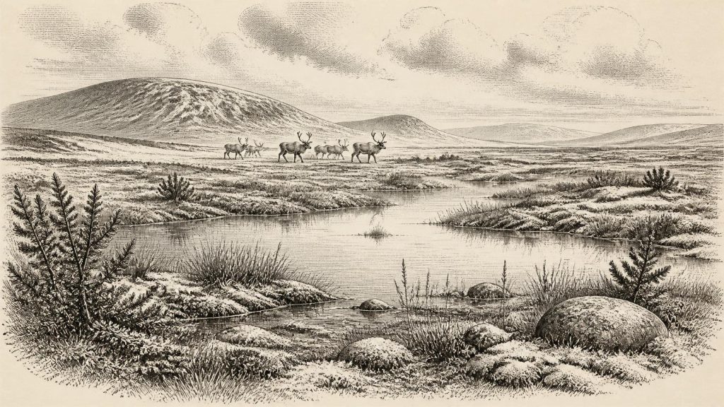
The Derryvree organic sediments preserve pollen, plant remains, mosses and insects from a landscape unlike later wooded Ireland. Grasses and sedges, juniper and herb pollen, together with a specialised moss flora, point to open ground rather than closed forest. The insect assemblage supports the picture of wet, plant-rich terrain with shallow pools and mossy margins. This was a tundra or muskeg-like setting: waterlogged in places, affected by frost and short growing seasons, and probably surrounded by sparsely vegetated ground.
That description must not be turned into a single national map. Derryvree records one locality in what is now northern Ireland, and sediments there were preserved precisely because they were later sealed beneath ice. It demonstrates that this district supported freshwater life during part of MIS 3; it does not prove that every coast, upland and interior basin on the island was simultaneously ice-free, equally wet or equally cold. Other buried organic deposits in Fermanagh, including those at Hollymount and Greenagho, likewise indicate episodes of open, cold country. Together they show that the Irish landscape changed repeatedly as climate, snow accumulation, glacier behaviour and drainage altered.
South-western Ireland provides a different form of evidence. Speleothems in Crag Cave, County Kerry, grew during phases when water percolated through limestone underground. Their uranium-thorium chronologies help demonstrate that conditions and ice cover varied across the island during the wider period. Speleothem growth is not proof of pleasant surface weather, nor does a cave record translate directly into a regional temperature. It does, however, reinforce the central point made by Derryvree: Ice Age Ireland was dynamic, with local environments responding differently to climatic shifts.
Ice Was Advancing, Not Immutable
At this broad date, Ireland stood before the fullest expansion of the last British–Irish Ice Sheet. Reconstructions of that ice sheet show that its maximum volume and broadest extent came later, principally between about 27,000 and 23,000 years ago, though individual sectors advanced and retreated at different times. The tills enclosing the Derryvree sediments are a local expression of that larger history. They warn against imagining the island as either wholly entombed beneath permanent ice or wholly open for thousands of years.
Glaciers were political boundaries only in the loosest metaphorical sense. There were no states, territories, rulers, diplomatic relations or recorded conflicts in Ireland at this time. Yet ice, sea and terrain imposed real limits on movement. During colder phases, lowered global sea level exposed more continental shelf than exists today, but the precise configuration of dry land, sea ice, channels and possible routes towards Britain changed with sea level, crustal movement and expanding ice. The evidence does not permit a confident claim that a stable land bridge joined Ireland to Britain in 31,363 BCE. Any crossing by animals or people would have depended on temporary and geographically complicated conditions, not an assumed permanent corridor.
Castlepook’s Time-Averaged Fauna
In north Cork, Castlepook Cave near Doneraile provides the island’s richest archive of vertebrate remains from the period leading towards the Last Glacial Maximum. Its deposits have yielded woolly mammoth, reindeer, giant deer, brown bear and spotted hyena, as well as foxes, wolves and lemmings from later cold-stage contexts. The presence of spotted hyena is particularly striking: Castlepook is the only known Irish site for the species. Hyenas were not merely animals passing through a cave. Their scavenging, bone-collecting and denning behaviour helped create the assemblage that archaeologists now study.
These remains show beyond doubt that sizeable mammals reached Ireland during parts of MIS 3. They make an ecological case for open, productive landscapes capable of sustaining grazers, browsers, predators and scavengers. Mammoth and reindeer evoke an Ice Age steppe-tundra world, but the cave should not be treated as a photograph of one day’s animal community. Excavations occurred mainly in the early twentieth century, sediments were disturbed by water and later activity, and radiocarbon determinations on bones from different galleries span a long period. A mammoth, a hyena and a reindeer from Castlepook need not have lived together, much less in the specific year 31,363 BCE.
The cave’s importance lies in its accumulated evidence. It indicates repeated opportunities for large mammals to enter Ireland before the major late glacial ice expansion. Equally important are its absences and uncertainties. Fossil recovery is uneven, cave preservation is selective, and a missing species in an Irish collection does not automatically mean it never reached the island. The economy visible here is ecological, not human: grazing, browsing, predation, scavenging and seasonal survival in an exposed landscape.
The Human Question
No permanent human population in Ireland at this date has been demonstrated. There are no securely associated stone-tool assemblages, hearths, built dwellings, burials or repeated occupation surfaces from around 33,300 calendar years BP. The National Museum of Ireland therefore continues to emphasise that clear evidence for Palaeolithic human presence on the island has not emerged. The earliest substantial evidence of sustained settlement belongs far later, after the final ice retreat, in the Mesolithic.
Castlepook nevertheless raises a careful question. A reindeer femur has been interpreted by zooarchaeologist Ruth Carden as bearing a cut mark made on fresh bone by a sharp stone tool. If that interpretation is accepted, it may indicate that people butchered a reindeer in Ireland during MIS 3, perhaps as highly mobile visitors rather than settlers. It does not, by itself, establish a camp, a community, a route of arrival or an enduring population. The bone was recovered from an old cave collection rather than a modern controlled excavation, while cave carnivores and water disturbance complicate context. The evidence is important precisely because it is unusual, but it remains too slight to support a confident narrative of Irish Palaeolithic society.
What Cannot Yet Be Written
Consequently, society and everyday life cannot responsibly be described for Ireland in this year. We cannot identify households, language, kinship, diet, clothing, ritual practice, artistic traditions or systems of authority. There is no evidence for agriculture, metalworking, pottery, trade networks, monuments, formal religion or diplomacy. Upper Palaeolithic peoples elsewhere in Europe made sophisticated tools, art and ornaments, but those achievements cannot simply be transferred across the sea to Ireland without Irish finds to support them.
The strongest account of Ireland around 31,363 BCE is environmental. In Fermanagh, an open, wet and cold landscape supported plants, insects and freshwater pools between episodes of glaciation. Across the island, shifting ice, sea and climate continually reshaped possible habitats and routes. In Cork, animal bones in a limestone cave preserve evidence of mammals moving through this northern Atlantic world. A single potentially modified reindeer bone keeps open the possibility of a fleeting human encounter. It cannot turn a long, uncertain environmental record into an annual chronicle. That restraint is not a failure of history; it is the essential discipline required by Ireland’s deep past.
Primary Sources
- Prehistoric Details
- Spotted Hyena Skull
- The Irish Quaternary Fauna Project
- A Reconsideration of the Radiocarbon Dating of the Marine Isotope Stage 3 Fauna from Southern Ireland
- Castlepook Cave: Cork County Geological Site Report
- Irish Pleistocene Biostratigraphy
- The Subdivision of the Quaternary Period in Ireland
- Section 1: Fermanagh Quaternary Studies
- Landscapes and Environments of the Last Glacial-Interglacial Transition: A Time of Amazingly Rapid Change in Ireland
- Exploring Controls of the Early and Stepped Deglaciation on the Western Margin of the British-Irish Ice Sheet
- Growth and Retreat of the Last British-Irish Ice Sheet, 31,000 to 15,000 Years Ago: The BRITICE-CHRONO Reconstruction
- Pattern and Timing of Retreat of the Last British-Irish Ice Sheet
- New Age Constraints for the Maximum Extent of the Last British-Irish Ice Sheet (NW Sector)
- Trimlines, Blockfields and the Vertical Extent of the Last Ice Sheet in Southern Ireland
- Spatio-Temporal Dynamics of Speleothem Growth and Glaciation in the British Isles
- The IntCal20 Northern Hemisphere Radiocarbon Age Calibration Curve (0–55 cal kBP)
- IntCal Publications
- The Problem of a Late Quaternary Landbridge Between Britain and Ireland
- Deglaciation, Earth Crustal Behaviour and Sea-Level Changes in the Determination of Insularity: A Perspective from Ireland
- The Location and Duration of Possible Land-Bridges Between Ireland and Britain
- Quaternary Site Descriptions
- Quaternary Geology of Ireland
