Derryvree Silts31157 BCE
31,157 BCE is a notional date within Marine Isotope Stage 3, not an annually recoverable Irish event. At Derryvree near Maguiresbridge, Fermanagh, organic silts beneath glacial till, dated broadly to 36,900–31,700 calibrated years before present, record an ice-free local tundra wetland. Plants, mosses and insects indicate sedges, grasses, dwarf shrubs, pools and harsh periglacial conditions. Cave and faunal evidence shows climatic instability and cold-adapted animals, including reindeer and mammoth. A modified reindeer bone from Castlepook may suggest fleeting human activity, but cannot prove settlement. Ireland remained environmentally variable, intermittently connected to wider lands, and later reshaped by expanding ice sheets.
Dateline
31,157 BCE is a modern chronological label, not a recoverable year in Irish prehistory. It corresponds to roughly 33,106 years before the conventional radiocarbon baseline of 1950, but neither archaeology nor palaeoenvironmental science can identify an event, a person or a season in Ireland at that annual resolution. The responsible approach is to place this notional date within a wider Late Pleistocene interval, in Marine Isotope Stage 3, when climates in the North Atlantic region changed sharply and repeatedly. The most useful Irish evidence comes not from settlements or written records, but from buried sediments, fossil plants, insects, animal bones and cave deposits.
That evidence shows an Ireland very different from the later island of farms, monuments and kingdoms. Yet it does not permit a single, uniform picture for every region. Around this broad period, parts of the island could be ice-free while glaciers were expanding elsewhere; conditions also shifted over centuries and millennia. The later Last Glacial Maximum, when the Irish Ice Sheet became far more extensive, still lay ahead. Ireland at this horizon was therefore a landscape in transition: cold, exposed and ecologically demanding, but not simply a featureless land buried beneath ice.
A Date Range, Not a Dateline
The best direct environmental archive relevant to this date lies at Derryvree, near Maguiresbridge in County Fermanagh. Road works in 1969 cut through a drumlin and exposed organic silts and fine sands trapped between two thick layers of glacial till. The sediments produced the conventional radiocarbon determination Birm-166, about 30,500 radiocarbon years before present, with a substantial uncertainty. Using modern calibration, scholarship has placed this evidence broadly within approximately 36,900–31,700 calibrated years before present: in rough BCE terms, about 34,950–29,750 BCE.
That range includes 31,157 BCE, but it must not be treated as proof that the Derryvree wetland existed in precisely that named year. A radiocarbon result dates carbon in a sample, not a neatly bounded historical episode; calibration converts it into a probability range rather than a point on a modern calendar. The fact that organic sediment survived beneath later glacial deposits is itself important. It demonstrates that this part of Fermanagh was ice-free during at least part of the interval represented by the deposit, before renewed ice movement built or reworked the drumlin above it.
Open Tundra and Freshwater Pools
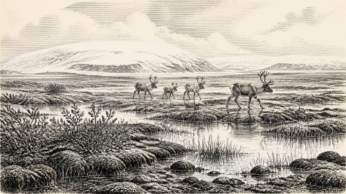
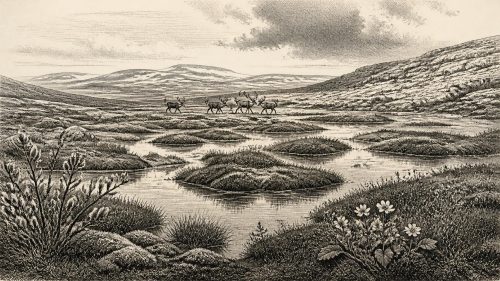
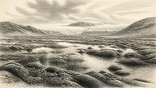
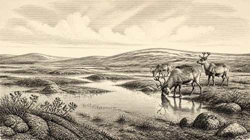
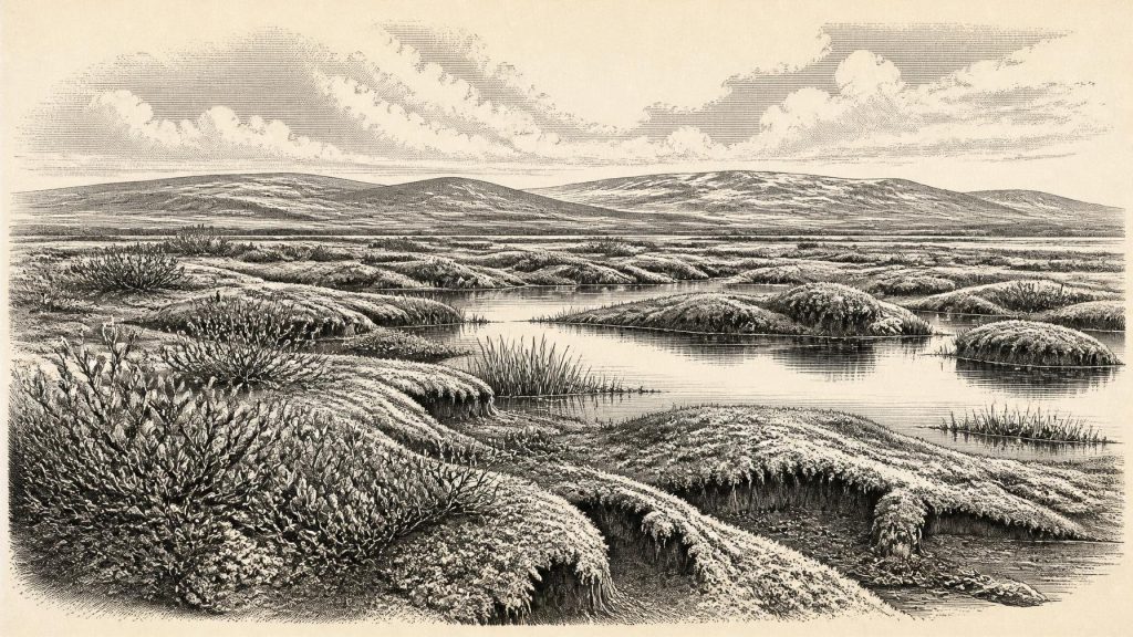
The Derryvree silts preserve a small but unusually informative ecological record. Plant remains, pollen, mosses and insects were interpreted by the original investigators as evidence for an open, treeless tundra or muskeg landscape. Grasses, sedges, herbs, dwarf willow, juniper and cold-adapted aquatic plants indicate low vegetation rather than forest. Mosses and insect remains point to wet ground with standing or slow-moving freshwater, open pools and abundant plant matter. This was a periglacial environment: land exposed to persistent frost and severe winters, but not necessarily lying under glacier ice.
Such a reconstruction should be read locally. Derryvree records a particular lowland basin, not all Ireland. Nevertheless, it supplies a vivid corrective to the idea that the country was either wholly frozen or comfortably temperate. Its landscape probably combined waterlogged hollows, sedge beds, mossy ground, stony open surfaces and patches of low shrub. Summers may have allowed a brief burst of plant growth, while winters were harsh enough for repeated freezing of the ground. The exposed character of the vegetation also suggests that shelter and fuelwood would have been scarce.
Other Irish records reinforce the broader conclusion that the late Middle Midlandian was climatically unstable. Speleothems in Crag Cave, County Kerry, were deposited episodically during the last glacial period. Because cave calcite requires liquid water moving through the rock, these deposits offer evidence for intervals in which mean annual conditions locally rose above freezing. They do not describe daily weather at Derryvree, and they cannot be matched to a particular calendar year. Together with glacial and sedimentary evidence, however, they show that Irish environments responded to the rapid warmings and coolings that affected the North Atlantic world.
Animals at the Edge of Ice
County Cork provides the principal Irish faunal evidence for this broad period. Castlepook Cave, near Doneraile and sometimes called Mammoth Cave, yielded remains attributed to woolly mammoth, reindeer, giant deer, brown bear, wolf, fox, hare, lemmings and spotted hyaena. This is not a single living community frozen at one moment. Cave deposits accumulate over time; early excavations disturbed contexts; and later redating has shown that some older determinations needed revision. The careful conclusion is that a varied cold-stage fauna reached Ireland during Marine Isotope Stage 3, rather than that every listed animal shared one valley in 31,157 BCE.
Even so, the assemblage gives a strong impression of the ecological possibilities. Reindeer and lemmings suit open, cold country. Mammoth and giant deer evoke extensive grazing grounds, though their Irish remains are rare and chronologically dispersed. Carnivores such as hyaena, wolf and bear show that Ireland formed part of a wider north-west European zone in which large herbivores and predators could move through changing landscapes. A cave could have been a den, a place where animals died naturally, a trap for washed-in bones, or more than one of these over long periods. Its bones illuminate animal presence and ecological connection, not a settled human economy.
Lower sea levels exposed land now submerged around Ireland and altered coastlines profoundly. This may have made movement between Ireland, Britain and the continental shelf easier at some stages, whether across exposed ground, ice-connected terrain or short water crossings. The precise routes available around 33,000 years ago remain debated because ice extent, sea level and local topography changed together. It is safer to say that Ireland was less geographically isolated than it is today, while recognising that cold seas, ice margins and difficult terrain could still have been formidable barriers.
The Human Question at Castlepook
The possibility of human activity makes this period especially significant. A reindeer femur from Castlepook Cave has been reported as bearing a deep modification interpreted as a fresh-bone cut or chop made with a stone implement. Public discussion of the find associated the bone with an age of about 33,000 years. If that interpretation is sustained, it would indicate that one or more Upper Palaeolithic people processed a reindeer in Ireland during the broad period close to this article’s notional date.
Yet the evidence must be kept in proportion. The bone is not a house, hearth, tool assemblage, burial, camp floor or stratified hunting site. Its date is the age of the animal bone, not a timestamp for the making of the mark. Nor can one modified bone establish whether people lived in Ireland permanently, made occasional expeditions, followed migrating game, or arrived only once. It does, however, challenge the older assumption that human presence in Ireland began only after the final retreat of the ice. Continued excavation and careful re-examination of surviving cave deposits are essential before large claims are made.
No Polities, No Proven Diplomacy
There is no evidence from Ireland around this horizon for political communities, leaders, territorial states, warfare, diplomacy, named peoples or institutions. Likewise, archaeology cannot responsibly identify religious practices, myths, language, artistic traditions, formal learning or social ranks. Absence of evidence does not mean that any people who briefly entered Ireland lacked beliefs, knowledge or social bonds. It means that the Irish record has not preserved material evidence capable of describing them.
The same caution applies to economy and trade. If people processed the Castlepook reindeer, they possessed at least the practical knowledge needed to use a sharp stone edge on fresh bone. Beyond that narrow inference, there is no securely dated evidence for regular hunting territories, exchange networks, boat travel, clothing manufacture or long-term provisioning in Ireland at this time. No field system, domestic animal, crop, mine, monument or durable settlement belongs to the period. The familiar structures of Irish history are tens of millennia away.
A Landscape Before Settlement
What can be said is both limited and important. During the broad interval that includes 31,157 BCE, Ireland contained environments capable of supporting cold-adapted plants and animals in at least some ice-free areas. Derryvree preserves freshwater tundra under later glacial deposits; Castlepook preserves traces of a richer Ice Age fauna; Crag Cave records wider climatic oscillations; and the expanding British–Irish Ice Sheet threatened to erase or bury much of what had existed before. Any human presence was, at most, fleeting in the evidence presently available.
This is not yet the history of an Irish population, much less of an Irish society. It is the deeper precondition for that history: a changing northern landscape, connected intermittently to wider worlds, occupied by animals and perhaps visited by people, then repeatedly transformed by ice. The Maguiresbridge silt bed matters because its fragile organic remains make that vanished landscape briefly legible.
Primary Sources
- A Middle Midlandian Freshwater Series at Derryvree, Maguiresbridge, County Fermanagh, Northern Ireland
- Irish Pleistocene Biostratigraphy
- The Irish Quaternary Fauna Project
- A Reconsideration of the Radiocarbon Dating of the Marine Isotope Stage 3 Fauna from Southern Ireland
- Trimlines, Blockfields and the Vertical Extent of the Last Ice Sheet in Southern Ireland
- New Data for the Last Glacial Maximum in Great Britain and Ireland
- Radiocarbon Constraints on the Age of the Maximum Advance of the British-Irish Ice Sheet in the Celtic Sea
- Dimensions and Chronology of the Last Ice Sheet in Western Ireland
- Episodic Speleothem Deposition Tracks the Terrestrial Impact of Millennial-Scale Last Glacial Climate Variability in SW Ireland
- Growth and Retreat of the Last British–Irish Ice Sheet, 31,000 to 15,000 Years Ago: the BRITICE-CHRONO Reconstruction
- BRITICE-CHRONO Maps and GIS Data of the Last British-Irish Ice Sheet 31 to 15 ka
- The IntCal20 Northern Hemisphere Radiocarbon Age Calibration Curve (0–55 cal kBP)
- IntCal Publications
- Figure 6: The Subdivision of the Quaternary Period in Ireland
- Introduction to the Late Quaternary and Holocene of Northern Ireland
- 2022:564 – Castlepook Cave, Castlepook South, Cork
- Heritage Artefacts of County Cork 2021
- New Insights on the Fauna of Ireland’s Younger Dryas Refugium
- Stoats (Mustela erminea) Provide Evidence of Natural Overland Colonization of Ireland
- The Problem of a Late Quaternary Landbridge Between Britain and Ireland
- Deglaciation, Earth Crustal Behaviour and Sea-Level Changes in the Determination of Insularity: A Perspective from Ireland
- Ireland: Submerged Prehistoric Sites and Landscapes
- The Mesolithic in Ireland: When Was It?
- A North-Western Habitat: the Paleoethology and Colonisation of a European Peninsula