
A Reindeer Bone at Castlepook31011 BCE
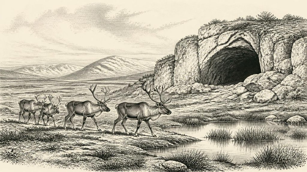
31,011 BCE is a modern label within the fluctuating late Marine Isotope Stage 3, not a precisely datable Irish event. Ireland was approaching major British-Irish Ice Sheet expansion, yet some areas retained open, cold ecosystems. Derryvree, County Fermanagh, preserves evidence of treeless wetlands, tundra plants and freshwater habitats before glacial overriding. Castlepook Cave, County Cork, yielded diverse fauna, including reindeer, mammoth, hyaena and Arctic fox, indicating periodically viable habitats. A reindeer femur, dated about 33,000 years ago, may bear butchery marks, suggesting possible human presence. However, it proves neither settlement nor continuous occupation; ice later destroyed or buried much evidence.
Dateline
31,011 BCE is a modern chronological label, not a date at which archaeology can identify an Irish event, ruler, settlement or expedition. Calendar-year precision is not available for Ireland at this depth of time. The most responsible approach is to place the notional year within the later part of Marine Isotope Stage 3 (MIS 3), a highly variable phase of the last Ice Age, and to use calibrated ranges and individual scientific measurements rather than imagine a single day or year. Around this point, Ireland was approaching the expansion of the British–Irish Ice Sheet that would later transform much of the island. What survives is a small, difficult body of environmental and faunal evidence, supplemented by one especially provocative bone from a cave near Doneraile in north County Cork.
A Landscape Without Annals
There were no written records, named peoples, political boundaries or recoverable institutions in Ireland in 31,011 BCE. There is no basis for describing kingdoms, diplomacy, formal warfare, religious leadership, language or a national society. Even the basic question of whether people were present is unresolved. The evidence is instead geological: sediments trapped beneath later glacial deposits, animal bones preserved in caves, pollen and plant fragments, insect remains, and radiocarbon measurements. Each records a particular place and process; none supplies a complete map of the island.
The nominal date falls roughly 32,960 years before AD 1950, the conventional reference point for “before present” dating. That arithmetic does not turn it into an archaeological timestamp. Radiocarbon ages are not calendar years and must be calibrated against changing atmospheric carbon levels. At this antiquity, calibrated ranges can be broad, and a bone dates the death of an animal rather than necessarily the human action, sediment layer or climatic episode with which it is now associated. The distinction matters particularly in caves, where carnivores, water, frost, collapse and nineteenth- or twentieth-century excavation can mix materials from different periods.
Before the Greatest Ice Advance
In broad climatic terms, this was an interval of the Late Pleistocene before the Last Glacial Maximum. MIS 3, conventionally spanning about 59,400 to 27,800 years ago, was not a single unchanging “Ice Age winter”. Greenland ice-core records demonstrate repeated abrupt swings between colder stadials and relatively milder interstadials, changes capable of reshaping vegetation, animal ranges and the viability of travel across north-west Europe. Ireland’s local record is far less continuous than Greenland’s, so those wider climatic oscillations cannot be assigned mechanically to a particular Irish valley or cave.
Nevertheless, the long-term direction was towards more severe conditions and greater ice-sheet growth. The large BRITICE-CHRONO reconstruction places the growth and retreat of the last British–Irish Ice Sheet within roughly 31,000 to 15,000 years ago, with its maximum volume later, around 23,000 years ago. Thus 31,011 BCE should not be pictured as the island uniformly buried beneath the maximum ice cover. It was, rather, a threshold period: parts of Ireland could still support open cold-climate ecosystems, while the conditions that would ultimately envelop and scour extensive areas were gathering force.
Sea level was lower globally than today because water was stored in continental ice sheets. Exposed shelf landscapes changed the geography around Ireland, Britain and continental Europe, but this does not demonstrate a simple, continuous land bridge usable by animals or people at this particular moment. Reconstructions of the Irish Sea are contested and depend on ice extent, relative sea level and local topography. For human movement, cold water, tidal channels, glacial margins and the availability of food may have been more significant than a line on a map labelled “land”.
Derryvree’s Cold Wetland
The clearest Irish environmental evidence relevant to this broad timeframe comes not from a habitation site but from Derryvree near Maguiresbridge, County Fermanagh. Road works in 1969 exposed organic freshwater silts and fine sands enclosed between tills within a drumlin. The deposit produced a conventional radiocarbon determination of 30,500 ± 1,170/1,030 radiocarbon years before present. Calibration places such a measurement several millennia earlier than the modern BCE label used here, rather than precisely in 31,011 BCE; its importance is that it preserves a rare pre-maximum Irish landscape from the same climatic world.
Pollen, seeds, plant macrofossils, mosses and small animal remains from Derryvree point to treeless, periglacial terrain with shallow freshwater, saturated ground and open tundra vegetation. Finds include sedges, bogbean, water-milfoil, dwarf willow, mountain-avens, Arctic clubmoss and a rich moss flora. This was not the later, familiar Ireland of oak woodland, enclosed fields and blanket bog. Nor was it necessarily a featureless white desert. It was a patchwork of pools, wet sedge ground, sparse herb-rich surfaces and seasonally frozen soils: a cold wetland or muskeg within an exposed landscape.
Derryvree is especially valuable because it demonstrates that, during at least one cold phase before overriding ice, parts of Ireland sustained freshwater habitats and a specialised flora. It cannot prove that every region had identical conditions, or that the exact mix of species survived uninterrupted through every climatic fluctuation. Its sediments were later sealed beneath glacial material, a reminder that much of the evidence for earlier landscapes was destroyed, displaced or buried when ice advanced.
Castlepook’s Faunal Archive
In the south, Castlepook Cave—also known historically as Mammoth Cave—near Doneraile has yielded Ireland’s most celebrated assemblage of older Ice Age animal remains. Excavations begun by Richard J. Ussher in the early twentieth century, followed by later investigations and reassessments, produced bones of woolly mammoth, giant deer, reindeer, brown bear, spotted hyaena, wolf, Arctic fox, hare and lemmings. Revised radiocarbon work has shown that some Castlepook fauna belongs to MIS 3, with mammals present in Ireland between at least about 45,000 and 20,000 years ago. It is therefore reasonable to place reindeer and other cold-adapted or open-country animals in the wider Irish environmental setting relevant to this article.
The cave was not a village. Its bones chiefly illuminate animal behaviour and site formation. Carnivores could have carried limbs and carcass fragments into chambers; hyaenas in particular may have used caves as dens. A cave collection can therefore combine prey, scavengers and animals dying at different times. Mammoth or hyaena remains do not mean that a mixed herd or pack stood outside the entrance together, still less that humans hunted every species represented. The strongest conclusion is ecological: Ice Age Ireland periodically possessed enough open habitat, forage and connectivity for a diverse large-mammal fauna to reach and inhabit parts of the island.
The Marked Reindeer Femur
The object most closely connected with the conventional date of 31,011 BCE is a reindeer femur from Castlepook. It has been presented by zooarchaeologist Ruth Carden and in County Cork heritage material as dating to about 33,000 years ago, commonly rendered as c.31,000 BCE, and as bearing a deep mark made by a sharp stone implement during butchery. If that interpretation is sustained, it would be extraordinary: evidence that an Upper Palaeolithic person processed a reindeer in Ireland long before the better-established terminal Pleistocene human evidence from Alice and Gwendoline Cave in County Clare, dated to approximately 12,810–12,590 calibrated years before present.
But the correct historical language remains cautious. The femur is evidence for a possible act of carcass processing, not proof of a settlement, a hunting camp, a permanent population or a route by which people arrived. No securely associated hearth, stone-tool assemblage, dwelling floor, burial, food store or stratified occupation surface of the same age has yet been published from Castlepook. Earlier cave excavations did not meet modern recording standards, while later glacial and cave processes complicate association. The important fact is not that “Ireland had been settled” in 31,011 BCE; it is that one marked bone has opened a serious question about earlier human incursions.
People, If Present
If people did reach Ireland in this period, they would have been mobile Upper Palaeolithic hunter-gatherers, reliant on intimate knowledge of weather, animal movement, shelter, fuel and routes through changing coastal and glacial landscapes. Reindeer offered meat, fat, hide, sinew, antler and bone; a single limb bone, however, cannot reveal whether a group killed the animal, found it already dead, exchanged it, or encountered it after carnivores had fed. It cannot identify group size, sex, ancestry, spoken language, belief or technology beyond the possible use of a sharp stone edge.
There is likewise no direct Irish evidence at this date for domestic animals, cultivation, pottery, metalworking, built monuments, formal exchange networks or seafaring. “Economy” can only mean subsistence within a demanding wild environment: animals exploiting seasonal grasslands and wetlands, predators following prey, and perhaps occasional people exploiting carcasses and game. The practical social world, if human visitors were present, would have depended on relationships beyond Ireland, because survival at Europe’s north-western edge required wider knowledge and contact. That is an inference from the setting, not evidence for diplomatic links or a mapped trading system.
Silence, Then Overrunning Ice
The next major regional development was environmental rather than political. As the ice sheet expanded, it remodelled valleys and lowlands, deposited tills, altered drainage and removed or deeply buried earlier surfaces. This helps explain why the Irish Palaeolithic record is so slight compared with those of Britain and continental Europe. Absence of discovered camps is not proof that no person ever entered Ireland; equally, the possibility raised by a cut-marked bone must not be inflated into a narrative of continuous occupation.
For 31,011 BCE, the most vivid defensible image is consequently not a tribe or a battle but an unstable cold-world landscape: open tundra and wet hollows in Fermanagh; reindeer and other mammals moving through suitable habitat; caves in the Cork limestone serving animals and carnivores; and a climate heading towards a glacial maximum that would erase much of what came before. Ireland’s history at this depth is real, but it is fragmentary. Its principal witnesses are silt, pollen, bone and ice.
Primary Sources
- A reconsideration of the radiocarbon dating of the Marine Isotope Stage 3 fauna from southern Ireland
- The Irish Quaternary Fauna Project
- Palaeoecology: Irish Quaternary Association Field Guide No. 16
- Castlepook Cave, County Geological Site Report
- Growth and retreat of the last British–Irish Ice Sheet, 31 000 to 15 000 years ago: the BRITICE-CHRONO reconstruction
- Pattern and timing of retreat of the last British-Irish Ice Sheet
- Dimensions and chronology of the last ice sheet in Western Ireland
- Radiocarbon constraints on the age of the maximum advance of the British-Irish Ice Sheet in the Celtic Sea
- Trimlines, blockfields and the vertical extent of the last ice sheet in southern Ireland
- First evidence of a Late Upper Palaeolithic human presence in Ireland
- The colonization of Ireland: A human ecology perspective
- New insights on the fauna of Ireland's Younger Dryas and Early Holocene from Alice & Gwendoline Cave
- The IntCal20 Northern Hemisphere radiocarbon age calibration curve (0–55 kcal BP)
- Dansgaard–Oeschger events in climate models: review and baseline Marine Isotope Stage 3 protocol
- The problem of a late Quaternary landbridge between Britain and Ireland
- The Island of Ireland: Drowning the Myth of an Irish Land-Bridge?
- Ireland: Submerged Prehistoric Sites and Landscapes
- Introduction to the Late Quaternary and Holocene of Northern Ireland
- Heritage Artefacts of County Cork
- Castlepook Cave, Castlepook South, County Cork, Excavation Report 2022
