Derryvree’s Treeless Waters30511 BCE
Around 30,511 BCE, Ireland lay within the unstable MIS 3 phase of the last glacial cycle, not a date resolvable through Irish evidence. Changing ice margins, lowered seas and permafrost produced variable conditions. Derryvree, County Fermanagh, preserves freshwater sediments between tills, indicating a treeless, cold wetland of sedges, mosses, dwarf shrubs and aquatic plants. Castlepook Cave and other southern sites show that diverse mammals, including reindeer, giant deer, mammoths and predators, occurred during broader intervals. A possibly tool-marked reindeer bone suggests early human visits, but cannot prove settlement. This landscape was environmentally dynamic, ecologically inhabited and lacking documented political institutions.
Dateline
30,511 BCE is a useful modern label, but not a date that can be matched to an event in Ireland. No contemporary written record, settlement sequence or annually resolved environmental archive permits that degree of precision. In archaeological terms it lies within the Upper Palaeolithic and the later part of Marine Isotope Stage 3, a long, unstable phase of the last glacial cycle. The responsible history of Ireland at this point is therefore a history of deposits, bones, pollen, plant remains and ice—not kings, campaigns or named peoples.
The conversion itself needs care. A year expressed as 30,511 BCE is about 32,460 calendar years before AD 1950, the conventional ‘present’ of radiocarbon science. Radiocarbon ages are not calendar ages: atmospheric carbon levels changed through time, and the results must be calibrated against independently dated records. At such antiquity, ranges may span centuries or more. The best Irish evidence does not identify conditions in one calendar year; it illuminates broader intervals before the Last Glacial Maximum, conventionally placed at roughly 26,500–19,000 years before present.
A Cold, Interrupted Ireland
Ireland was then part of a far larger north-west European world, though its precise coastline and connections changed with sea level, glacial loading and ice advance. It was not yet the familiar temperate island of woods, pasture and enclosed fields. During glacial phases, much water was locked in continental ice sheets, lowering sea levels and exposing substantial areas of what are now shallow seas. That could reduce marine barriers between Ireland and Britain, but it does not prove that a continuous, easy land route existed at every moment, or that people used one.
Nor should Ireland be pictured as either wholly ice-covered or wholly hospitable. The British–Irish Ice Sheet repeatedly grew and withdrew in complex ways. Its extent before the climatic maximum remains actively debated, and evidence from different regions is difficult to synchronise. Around the nominal date, some ground may have been ice-free for intervals, while other areas were affected by glaciers, permafrost, unstable slopes and meltwater. The key fact is variability: this was a cold landscape shaped by changing ice margins, not a static polar desert.
One of the most valuable Irish environmental records comes from Derryvree near Maguiresbridge in County Fermanagh. There, organic-rich silts and fine sands survived between two layers of glacial till. The stratigraphy shows that freshwater and wetland sediment accumulated after one episode of glaciation and before a later ice advance overrode and sealed it. A radiocarbon determination, Birm-166, produced an age of 30,500 radiocarbon years before present, with a large uncertainty. Later calibration and comparison place the deposit broadly in the Middle Midlandian, or MIS 3, rather than securely in the single year 30,511 BCE. It is best treated as a nearby window on the kind of Ireland that could occur in this general climatic world, not as a snapshot of that year.
The Derryvree Wetland
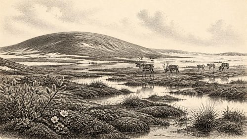
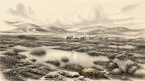
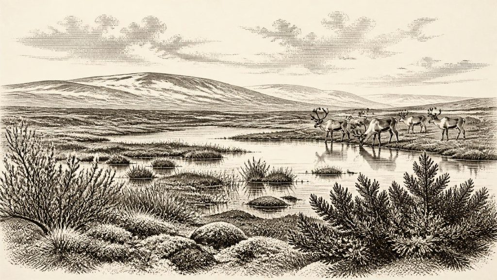
The plant evidence from Derryvree is unusually eloquent. Pollen, seeds and other plant remains point to an open, treeless landscape with sedges, grasses, mosses, herbs, dwarf shrubs and cold-adapted aquatic or wet-ground plants. Finds reported from the freshwater series include water-milfoil, bogbean, dwarf willow, juniper and alpine or arctic-alpine herbs. Together, these indicate shallow fresh water, saturated ground and patches of vegetation rather than an unbroken snowfield.
Descriptions of Derryvree as ‘muskeg’ convey an important qualification. This was not a modern Irish bog transported unchanged into the distant past. It was a cold, waterlogged mosaic: pools, sedge-rich margins, mossy ground and exposed mineral soils, probably broken by frost action and seasonal thaw. Trees were absent or extremely scarce. The absence of woodland matters for every aspect of life. There was little timber for building or fuel, little shelter from wind, and a food web based on low vegetation, wetland plants and the animals able to exploit open country.
The record nevertheless has limits. Pollen can travel; plant macrofossils are more local but still represent material deposited within a particular basin; and sediments may be disturbed or reworked by water and ice. Derryvree demonstrates that such a wetland existed during its depositional interval. It does not map every valley in Ireland, establish annual temperatures, or prove a single uniform climate across the island. The strongest interpretation is regional: parts of Fermanagh had ice-free freshwater habitats amid a severe, treeless glacial environment.
Cork Caves and Ice-Age Animals
Southern Irish cave deposits provide a different line of evidence. Castlepook Cave, near Doneraile in north County Cork, was explored in the early twentieth century and yielded an impressive collection of Pleistocene animal remains. Subsequent radiocarbon work, including modern re-dating, has shown that the old collections contain material from more than one period and that several earlier determinations required revision. That warning is central: caves are not always neat, sealed time capsules. Bones can be moved by carnivores, water, sediment collapse, excavation and later disturbance.
Even so, the fauna establishes that Ireland supported, at various points during MIS 3, mammals now absent from the island. Castlepook and related southern cave sites have produced remains attributed to reindeer, giant deer, brown bear, wolf, Arctic fox, hare, lemmings, spotted hyaena and woolly mammoth. Not all species were necessarily contemporary, and none can responsibly be assigned to 30,511 BCE without a directly dated, securely stratified specimen. Yet the assemblage is powerful evidence for a periodically connected, ecologically varied landmass rather than an isolated, lifeless block of ice.
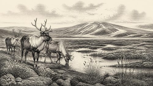
Reindeer are especially revealing because they thrive in open, cold environments and could have moved through wide grazing ranges. Giant deer, mammoths and horses—where present—would likewise have required extensive forage, though the Irish record is patchy. Carnivores such as wolves and spotted hyaenas point to prey and scavenging opportunities, but not necessarily to permanent local populations. A cave may have been a den, a death trap, a temporary refuge or a place into which bones were dragged. The fauna describes ecological possibility and repeated animal movement, not a census of a settled landscape.
The Human Question
The most provocative object for this period is a reindeer femur from Castlepook Cave bearing a deep linear mark interpreted by researchers as possibly made with a sharp stone tool while the bone was fresh. Public discussion has connected the bone with an age of about 33,000 years ago, and its re-examination has rightly reopened the question of very early human activity in Ireland. If the modification is confirmed as human butchery, it would show that people handled a reindeer in Ireland far earlier than the island’s securely documented terminal-Pleistocene occupation.
But it would not demonstrate a village, a colony or an unbroken population. The bone’s date is the date of the animal, not automatically the date, maker or location of the mark. No securely associated hearth, tool assemblage, human burial, dwelling floor or repeated occupation deposit of comparable age has yet established a human community in Ireland around this nominal year. Researchers must also distinguish stone-tool damage from carnivore scoring, trampling, weathering, sediment abrasion, breakage and marks made during excavation or storage.
For that reason, it is better to describe Ireland’s human story around 30,511 BCE as unresolved rather than empty. Mobile Upper Palaeolithic groups elsewhere in north-west Europe possessed sophisticated knowledge of animal behaviour, stone technology, clothing and seasonal movement. It is plausible that people could have reached suitable Irish landscapes when routes and resources allowed. Plausibility, however, is interpretation by comparison. The Irish evidence presently supports at most brief, uncertain human visits—not a named society or continuous settlement.
No Politics, but a Living Landscape
There is no evidence from Ireland at this date for political institutions, diplomacy, warfare, territorial boundaries, formal religion, trade networks or learning in the later historical senses. Nor can archaeology identify families, languages, personal identities or beliefs. Claims about chiefs, tribal conflict, ritual caves or organised commerce would be inventions. Even the possible humanly modified reindeer bone cannot disclose whether its maker travelled alone, with a small hunting party, or as part of a wider seasonal group.
What can be said is that the practical demands of life—if people were present—would have been exacting. Shelter, firewood, water, clothing and food would depend upon local conditions and movement. A treeless wetland such as Derryvree could offer fresh water and plant-rich animal habitat, but would expose travellers to cold winds and seasonal flooding. Limestone caves around Castlepook offered sheltering spaces, yet their bone deposits also record predators and scavengers. Any human visitors would have entered an ecosystem already occupied by formidable animals and altered by ice, frost and meltwater.
The principal development appropriate to this date is therefore environmental rather than political: Ireland was part of a fluctuating Late Pleistocene frontier. Derryvree preserves the delicate remains of a cold freshwater landscape between glacial advances; Castlepook preserves evidence that large mammals occupied southern Ireland during the broader MIS 3 interval; and one marked reindeer bone raises, but does not settle, the possibility of human activity. Later ice-sheet growth would erase, bury or rework much of this world. Its survival in a few silts and caves is precisely why caution is necessary—and why the fragments are so important.
Primary Sources
- A Middle Midlandian Freshwater Series at Derryvree, Maguiresbridge, County Fermanagh, Northern Ireland
- Irish Pleistocene Biostratigraphy
- Landscapes and Environments of the Last Glacial-Interglacial Transition: A Time of Amazingly Rapid Change in Ireland
- The Irish Quaternary Fauna Project
- A Reconsideration of the Radiocarbon Dating of the Marine Isotope Stage 3 Fauna from Southern Ireland
- Trimlines, Blockfields and the Vertical Extent of the Last Ice Sheet in Southern Ireland
- The Timing and Magnitude of the British–Irish Ice Sheet Between Marine Isotope Stages 5d and 2: Implications for Glacio-Isostatic Adjustment, High Relative Sea Levels and ‘Giant Erratic’ Emplacement
- Timing, Pace and Controls on Ice Sheet Retreat: An Introduction to the BRITICE-CHRONO Transect Reconstructions of the British-Irish Ice Sheet
- The IntCal20 Northern Hemisphere Radiocarbon Age Calibration Curve (0–55 kcal BP)
- IntCal
- Occurrence of Mammalia Relicts at Site Castlepook Cave
- The Exploration of Castlepook Cave, County Cork
- The Exploration of Castlepook Cave, Co. Cork. With 3 Plates.
- 2022:564 – Castlepook Cave, Castlepook South, Cork
- New Insights on the Fauna of Ireland's Younger Dryas and Early Holocene from Alice & Gwendoline Cave
- First Evidence of a Late Upper Palaeolithic Human Presence in Ireland
- Phylogeographic, Ancient DNA, Fossil and Morphometric Analyses Reveal Ancient and Modern Introductions of a Large Mammal: The Complex Case of Red Deer (Cervus elaphus) in Ireland
- Figure 6.— The Subdivision of the Quaternary Period in Ireland
- Mammoth Cave, County Cork
- Dublin Radiocarbon Dates II