Derryvree’s Periglacial Mosaic30709 BCE
30,709 BCE is a modern label for an uncertain Late Pleistocene interval, not a recoverable Irish year. At Derryvree, County Fermanagh, freshwater sediments between tills record an ice-free local wetland, supporting tundra vegetation, insects and cold-adapted plants during fluctuating MIS 3 conditions. Cave calcite and glacial evidence likewise indicate changing climate and ice extent, before the later Last Glacial Maximum. Irish caves preserve mammals including mammoth, reindeer, giant deer and predators, although dates and pathways remain uncertain. A cut-marked reindeer bone from Castlepook may indicate human butchery, but cannot demonstrate settlement. No evidence supports polities, agriculture, permanent communities or culture.
Dateline
30,709 BCE is not a recoverable Irish year. It is a modern calendar label imposed on a time roughly 32,700 calendar years before AD 1950, within the Late Pleistocene and Marine Isotope Stage 3 (MIS 3). Nobody in Ireland counted years in this fashion; there are no written records, named rulers or annual chronicles; and neither radiocarbon dating nor glacial stratigraphy can distinguish an event in one particular year so far back. The responsible subject is therefore Ireland during a broad archaeological and environmental interval, not an invented episode dated to a day, season or named generation.
The closest important Irish evidence is a buried freshwater deposit at Derryvree, near Maguiresbridge in County Fermanagh. Its organic silts and fine sands accumulated between two separate tills, deposits left by moving ice. The original radiocarbon determination, Birm-166, was 30,500 radiocarbon years BP, with a substantial uncertainty. Calibrated estimates place the deposit broadly at about 36,900–31,700 calendar years BP. The modern year-label falls within that wide range, but it cannot be assigned to a particular layer, pond episode or human action. Derryvree is valuable precisely because it supplies a rare local record of life between phases of glaciation.
A Wetland Between Ice Advances
Roadworks exposed the Derryvree sequence in 1969 by cutting through a drumlin, a streamlined hill of glacial sediment. Beneath and above lay thick tills; between them was evidence of a period when water occupied a low basin and mud, sand, plant remains and tiny animal traces could gather. This establishes an important but limited fact: at the time the freshwater sediments formed, that locality in what is now south Fermanagh was ice-free. It does not prove that all Ireland was free of ice, nor does it provide a complete map of the island’s coastlines, glaciers or routes of animal movement.
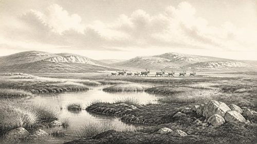
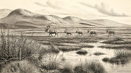
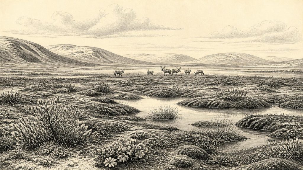
The biological evidence points to a severe but living landscape. Plant macrofossils, mosses, pollen and insects were interpreted by the original investigators as evidence for open tundra vegetation and a periglacial climate. Periglacial does not mean that the site itself lay permanently beneath ice. It describes country strongly shaped by cold: long freezing seasons, frost-disturbed ground, thaw water, imperfect soils and a short productive summer. The best picture is of low, mostly treeless vegetation around wet hollows and shallow freshwater, rather than either a familiar green Irish bog or an unbroken sheet of snow.
Sedges, grasses, herbs, mosses and low shrubs would have formed a patchwork across saturated margins and more exposed ground. Finds associated with the Derryvree flora include aquatic or wetland plants such as bogbean and water-milfoil, alongside cold-adapted plants including mountain avens, dwarf willow and lesser clubmoss. These remains support the interpretation of standing or slow-moving freshwater, mossy and sedgy margins, and nearby open ground. They do not establish every plant species across Ireland, because pollen can travel and sediments can be redeposited. Yet the combined evidence is much stronger than any single fossil grain: this was a functioning cold-climate wetland ecosystem.
Climate Was Not a Single Condition
MIS 3 was climatically unstable. Greenland ice-core records show abrupt shifts between colder stadials and relatively milder interstadials, while Irish evidence is too sparse to match every local deposit securely to each northern-climate oscillation. Derryvree should not therefore be presented as an average weather report for a whole millennium. Its sedimentary sequence captures one environmental interval at one place. It does, however, rule out the simplistic claim that Ireland was continuously and uniformly ice-covered throughout this part of the last Ice Age.
Other evidence reinforces the importance of change. Uranium-thorium dates from calcite formations in Crag Cave, County Kerry, show episodic speleothem growth during MIS 3. Such calcite required water to move through the cave, indicating intervals when local conditions allowed groundwater circulation, separated by times hostile to deposition. This does not mean that Crag Cave shared Derryvree’s exact conditions, but it independently supports a picture of fluctuating cold, moisture and ice extent rather than a motionless frozen landscape.
The greater British–Irish Ice Sheet was developing and changing around Ireland, but the date and scale of its early phases remain debated. Recent syntheses distinguish the well-constrained expansion and retreat from about 31,000 years ago from more tentative evidence for earlier ice-sheet growth and dynamic advances during MIS 3. The Last Glacial Maximum, when ice covered much or perhaps almost all of Ireland, lay later, broadly within the interval after c. 27,000 calendar years BP. Later ice scoured, buried and redistributed older landscapes, helping to explain why an exposed road cutting and a few cave collections carry so much of the evidence for this earlier world.
Animals in an Open Country
The animal record shows that Ireland was not biologically empty before the maximum glaciation. The Irish Quaternary Fauna Project found evidence that a range of mammals colonised the island between at least about 45,000 and 20,000 years ago. Cave collections, especially from Castlepook Cave near Doneraile in north County Cork, include remains attributed to woolly mammoth, reindeer, giant deer, brown bear, wolf, Arctic fox, stoat and spotted hyaena. Such collections were accumulated over long periods and by several processes: carnivores dragging material into caves, natural deaths, water movement, sediment disturbance and old excavation. They must not be treated as a single contemporary herd or one frozen scene.
Nevertheless, the fauna fits the open, cold setting suggested by Derryvree. Reindeer and Arctic fox are especially compatible with exposed northern environments; mammoth, giant deer and predators indicate a more varied food web than survives in Ireland today. Recent work on Irish deer remains has also produced pre-Last Glacial Maximum dates from caves in County Waterford, including calibrated ranges overlapping the broad era of this article. These finds demonstrate animal presence, not stable population sizes, migration routes or an unbroken ecological corridor to Britain and continental Europe.
Sea level was lower than today because much water was locked in global ice sheets, but this should not be converted automatically into a dry land bridge from Ireland to Britain. Coastlines, ice margins, channels and marine conditions altered repeatedly. Animals evidently reached Ireland at various points in the Late Pleistocene, but the precise pathways remain uncertain. The Irish Sea could have been an obstacle, a changing coastal landscape, or a route affected by ice and low sea level at different times. For this particular date-range, the evidence permits connectivity in broad ecological terms, not a confident reconstruction of a walkable route or a mapped frontier.
The Narrow Human Question
A reindeer femur from Castlepook Cave is the principal item relevant to possible human activity in Ireland around this broad period. County Cork heritage material dates it approximately to 31,000 BC and identifies a deep mark which zooarchaeologist Ruth Carden interpreted as having been made by a sharp stone tool while fresh bone was butchered. If that interpretation is sustained, it would show that people processed a reindeer in Ireland during the Upper Palaeolithic, vastly earlier than the island’s long-recognised post-glacial settlement record.
The conclusion must remain narrow. The bone came from an old cave collection, not a modern excavation with a fully recorded occupation surface. A date on animal bone identifies when the animal lived; it does not by itself date the incision, establish where the carcass was killed, or demonstrate how long people were present. Castlepook has no securely associated hearth, dwelling floor, stone-tool assemblage, human burial, art or repeated settlement sequence of this age. Carnivores, water, frost, cave collapse and early collecting all complicate the reconstruction. A butchered bone, if correctly identified, is evidence for an episode of handling or processing, not proof of a permanent population.
It is possible that a small, mobile group visited an open Irish landscape to hunt, scavenge or process reindeer. Reindeer could supply meat, fat, hide, sinew, bone and antler. But each of those possibilities is interpretation, informed by Upper Palaeolithic evidence elsewhere in Europe rather than demonstrated directly at Castlepook. No Irish evidence supports claims about the group’s language, ancestry, clothing, camp layout, family structure or ritual practices. European comparison can show what contemporary hunter-gatherers were capable of; it cannot import their cave art, ornaments, tool traditions or burial customs into Ireland without local finds.
No Polities, No Recorded Conflict
Political affairs, diplomacy and organised warfare cannot responsibly be described for Ireland at this date. There are no named peoples, territories, leaders, monuments or institutions. Nor is there evidence for farming, herding, metalworking, long-distance trade or permanent villages. The economy visible in the Irish record is ecological rather than documentary: plants grew in wet hollows; herbivores and carnivores moved through open country; and, at most, a possible human visit may have involved animal processing. There is no basis for imagining a prehistoric kingdom, tribal alliance or regular commercial network.
Religion, culture and learning are equally beyond direct recovery. Humans elsewhere in Upper Palaeolithic Europe made sophisticated tools, images, ornaments and burial places, but none has been securely linked to Ireland in this interval. Derryvree instead preserves a different kind of cultural inheritance: scientific evidence of how later ice nearly erased an older Irish environment. Its freshwater silts, mosses, seeds, insect remains and enclosing tills show that the island’s deep past was neither static nor empty. Around the notional date of 30,709 BCE, the strongest evidence is for a cold, open and watery Fermanagh landscape, with a wider island fauna adapted to instability and ice. Human presence remains a striking possibility, not a settled chapter of recorded Irish society.
Primary Sources
- A Middle Midlandian Freshwater Series at Derryvree, Maguiresbridge, County Fermanagh, Northern Ireland
- The Irish Quaternary Fauna Project
- Phylogeographic, Ancient DNA, Fossil and Morphometric Analyses Reveal Ancient and Modern Introductions of a Large Mammal: the Complex Case of Red Deer (Cervus elaphus) in Ireland
- Growth and Retreat of the Last British–Irish Ice Sheet, 31,000 to 15,000 Years Ago: the BRITICE-CHRONO Reconstruction
- The Timing and Magnitude of the British–Irish Ice Sheet Between Marine Isotope Stages 5d and 2: Implications for Glacio-Isostatic Adjustment, High Relative Sea Levels and ‘Giant Erratic’ Emplacement
- Pattern and Timing of Retreat of the Last British-Irish Ice Sheet
- Episodic Speleothem Deposition Tracks the Terrestrial Impact of Millennial-Scale Last Glacial Climate Variability in SW Ireland
- New Insights on the Fauna of Ireland’s Younger Dryas and Early Holocene from Alice & Gwendoline Cave
- Heritage Artefacts of County Cork
- Archaeological Heritage of County Cork
- Our Ancient Landscapes: Hunter-Gatherers in Ireland
- Figure 6.—The Subdivision of the Quaternary Period in Ireland
- The Late Quaternary History of East-Central Ireland
- Character of Advance and Retreat of the Southwest Sector of the British-Irish Ice Sheet During the Last Glaciation
- Maximum Extent and Dynamic Behaviour of the Last British–Irish Ice Sheet West of Ireland
- Britain and Ireland: Glacial Landforms from the Last Glacial Maximum
- Reindeer Bone Found in Cork Cave Shows Human Activity in Ireland 33,000 Years Ago
- Ireland’s Palaeolithic Archaeology – Fleeting Footprints in a Frozen Land
- The Irish Quaternary Fauna Project (Full Text)
- A Middle Midlandian Freshwater Series at Derryvree, Maguiresbridge, County Fermanagh, Northern Ireland (Full Text)