Juniper Beneath Fermanagh Till30494 BCE
Around 30,494 BCE, Ireland was not continuously ice-covered but experienced unstable cold-stage intervals between glacial advances. At Derryvree, County Fermanagh, freshwater sediments beneath later till preserve juniper, grasses, sedges, mosses, aquatic plants and insects, indicating open tundra-like wetland with pools and seasonal extremes. Comparable deposits and cave calcite show episodic climatic amelioration elsewhere. Castlepook Cave fauna, accumulated across Marine Isotope Stage 3, includes reindeer, mammoth, giant deer, predators and other cold-adapted animals, demonstrating ecological connectivity. A possible tool-marked reindeer bone suggests transient human visits, but lacks secure corroborating artefacts. No settlements, polities, religion or calendar-year events can be established there.

Dateline
30,494 BCE is a modern way of marking a point far beyond the reach of historical calendars. No community in Ireland counted years in this fashion, and no archaeological deposit can be assigned responsibly to this single year. In radiocarbon terms, it falls roughly 32,443 years before AD 1950, the conventional ‘present’ of dating science. That conversion is only a guide: radiocarbon ages must be calibrated, and the resulting calendar ranges are wide. The most relevant Irish evidence comes from deposits dated broadly to the later part of Marine Isotope Stage 3, a long, cold and climatically volatile portion of the last Ice Age.
The closest firm chronological anchor is the Derryvree sequence near Maguiresbridge in County Fermanagh. Organic-rich freshwater sediments there have a calibrated range of approximately 36,900–31,700 years before present, or roughly 34,950–29,750 BCE. The notional year considered here sits within that span, but Derryvree is not a yearly record. Its silts, sands and fossils accumulated over an interval; they illuminate a type of Irish environment rather than a day, season or event in 30,494 BCE.
A Wetland Between Ice Advances
Road works in 1969 cut through a drumlin at Derryvree and exposed an exceptional sequence. Beneath one thick layer of glacial till lay fine sands, freshwater silts and organic material; another thick till sealed them above. Till is the unsorted debris left directly by glacier ice. The order of the layers therefore provides the essential story: ice had occupied the locality, a non-glacial interval allowed water, sediment, plants and small animals to accumulate, and ice later returned. It is powerful evidence against any simple picture of Ireland as continuously blanketed by ice throughout the whole last glacial cycle.
The original radiocarbon determination from the organic sediments, BIRM-166, was 30,500 radiocarbon years before present, with a large uncertainty. Calibration translates that measurement into the broader range above, not a pinpoint date. Later research links the Derryvree interval only approximately to a sequence of relatively milder Greenland interstadials, within an overall cold period. This distinction matters. The evidence supports locally ice-free ground and fresh water in Fermanagh during part of this range; it does not establish that every district of Ireland was ice-free, nor that the whole island experienced identical conditions at once.
At around 30,494 BCE, then, Ireland should be imagined as a changing north-western Atlantic landscape at the edge of an unstable climatic system. The major Last Glacial Maximum, when the British–Irish Ice Sheet became far more extensive, still lay ahead. Yet this was no gentle prelude to it. Advances and retreats of ice, shifts in sea ice and ocean circulation, and repeated alterations in temperature and moisture shaped which areas could sustain plants and animals. The landscape was dynamic on timescales much shorter than conventional archaeological periods, let alone a named calendar year.
Open Tundra, Pools and Mosses
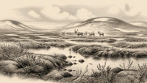
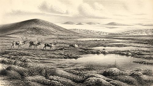
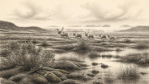
Derryvree’s biological remains give the clearest available picture of everyday surroundings. Pollen, plant macrofossils, mosses and insects indicate open tundra or muskeg-like wet ground, rather than forest. Grasses, sedges, herbs and juniper formed part of the vegetation; aquatic plants show that freshwater stood in pools or slow water. Moss-rich, waterlogged patches lay beside more exposed ground. Such a mosaic would have changed strongly with season, with short productive summers contrasting with long, severe winters and repeated freezing and thawing.
This was not a modern bog transplanted into the Ice Age. ‘Muskeg’ is a useful ecological comparison for cold, wet, organic ground, but Derryvree records a particular basin beneath a later drumlin, not a complete map of Fermanagh. Plant remains demonstrate that living vegetation occupied the locality. They do not give a precise annual temperature, rainfall total or growing-season length. Nor should individual species be stretched into a claim that the landscape looked exactly the same across Cork, Clare, the western seaboard or the Irish Sea basin.
Other Irish evidence reinforces the broader conclusion that conditions varied. Freshwater and organic deposits at Greenagho near Belcoo and at Aghnadarragh in County Antrim preserve episodes between glacial sediments. In south-west Ireland, uranium-series dates from speleothems in Crag Cave show that cave calcite formed episodically during Marine Isotope Stage 3. Because dripstone requires liquid water moving through soil and rock, these growth phases are evidence for intervals of relative climatic amelioration. They do not make the period warm by modern standards, but they show that the Irish climate repeatedly crossed ecological thresholds.
Animals in a Connected Landscape
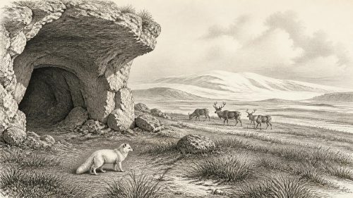
Fossil animal remains provide another window. The important cave complex at Castlepook, near Doneraile in north Cork, has yielded a notably diverse Ice Age fauna. Re-dating has shown that some previously misleadingly young radiocarbon results were substantially too recent. The wider Castlepook record includes reindeer, giant deer, brown bear, wolf, Arctic fox, hare, lemming, woolly mammoth and spotted hyaena, although the individual specimens do not all belong to one moment. The cave assemblage is therefore evidence for a changing fauna across Marine Isotope Stage 3, not a census of animals living together in 30,494 BCE.
Nevertheless, the range is historically significant. Reindeer and other cold-adapted animals required routes into and out of the landmass now called Ireland, while large herbivores could exploit open vegetation and carnivores could follow or scavenge them. Spotted hyaena is especially revealing: caves may have served as dens, shelters or places where bones accumulated through predation and scavenging. A cave bone is not automatically proof of a kill at the cave, and carnivore action, water movement, collapse and early excavation all complicate its story.
The faunal evidence establishes ecological connectivity, not a mapped road or a simple land bridge. Lower global sea levels altered coastlines, but the exact combination of exposed ground, channels, ice barriers and crossing opportunities around Ireland at this precise point remains uncertain. Animals may have moved during windows when terrain and climate permitted. This was movement within a Pleistocene ecosystem, not ‘trade’ in the historical sense. No goods, exchange network, harbour or route of human commerce can be identified for Ireland at this date.
The Human Question
Human presence is possible, but it must be described with exceptional caution. A reindeer femur from Castlepook has been reported as bearing a deep mark interpreted as damage from a stone tool, and the bone has been publicised as approximately 33,000 years old. If the mark is confirmed as a human-made butchery incision and is contemporary with the bone, it would indicate that people handled a reindeer in Ireland during the Upper Palaeolithic, far earlier than the previously accepted evidence. It would not demonstrate permanent settlement, a village or a population extending continuously to later Irish communities.
The limitation is fundamental. Castlepook has not yet produced a securely associated stone-tool assemblage, hearth, dwelling floor, burial, human skeleton or art of this age. Its deposits were affected by natural processes and were heavily excavated under early twentieth-century standards. A radiocarbon date establishes the age of the animal bone, while identifying a surface feature as a tool mark is a separate taphonomic judgement. The responsible conclusion for around 30,494 BCE is that transient human visits are a serious research possibility, not an established year-specific chapter in Irish settlement history.
Comparison with north-west Europe can help define possibilities but must not fill Irish gaps with borrowed facts. Elsewhere, Upper Palaeolithic groups made sophisticated stone and organic tools, hunted and processed large animals, used pigments and sometimes made portable or cave art. None of that is securely attested in Ireland for this period. If people reached the Irish landscape, they may have travelled in small, mobile groups and left traces exceptionally vulnerable to erosion, later glaciation and the low visibility of short stays. That is interpretation, not direct evidence.
No Polities, No Proven Religion
There were no known Irish kingdoms, chiefs, diplomatic relations, written laws or named peoples in 30,494 BCE. Nor is there evidence from Ireland for organised warfare, political boundaries or alliances. Animal predation was real, and any visiting people would have faced risk from cold, terrain and carnivores, but it should not be recast as human conflict. Similarly, no Irish burial, shrine, image, ritual deposit or inscribed object can establish religious beliefs for this date. Silence in the record is not proof that thought, custom or social bonds were absent; it means their forms cannot presently be recovered.
Learning, culture and society survive only indirectly in this episode. The making of a possible cut mark, if upheld, would imply practical knowledge of carcass processing and sharp-edged tools. The Derryvree plants and Castlepook animals show the resources and constraints within which any humans had to act. Beyond that, claims about language, kinship, leadership, seasonal ceremony, gender roles or artistic traditions would be inventions. The people of later Mesolithic Ireland, securely visible only many millennia afterwards, cannot simply be projected backwards into this much earlier and harsher world.
What the Evidence Can Bear
The most important development around this date was environmental rather than political: parts of Ireland supported biologically active, open cold-stage landscapes during an interval between major ice advances. Fermanagh’s freshwater sediments preserve juniper, sedges, mosses and aquatic life beneath later glacial deposits. Cork’s caves preserve the fragmentary remains of mammals that moved through a broader Atlantic-margin world. Together they show a land capable, at least intermittently, of sustaining wet tundra, herbivores and predators.
That is already a major correction to an older image of an unchanging frozen void. Yet restraint is part of the history. Modern calendar-year precision is unavailable; Derryvree supplies a calibrated range, not an anniversary. Ireland around 30,494 BCE has no recorded ruler, battle, settlement or ritual. It has a buried freshwater landscape, animals adapted to cold open country, advancing and retreating ice, and an unresolved possibility that people briefly entered this demanding world.
Primary Sources
- A Middle Midlandian Freshwater Series at Derryvree, Maguiresbridge, County Fermanagh, Northern Ireland
- Middle Midlandian Interstadial Deposits at Greenagho, Near Belcoo, County Fermanagh, Northern Ireland
- Freshwater Organic Deposits and Stratified Sediments Between Early and Late Midlandian (Devensian) Till Sheets, at Aghnadarragh, County Antrim, Northern Ireland
- Pleistocene Glaciations in Ireland
- Episodic Speleothem Deposition Tracks the Terrestrial Impact of Millennial-Scale Last Glacial Climate Variability in SW Ireland
- Growth and Retreat of the Last British–Irish Ice Sheet, 31,000 to 15,000 Years Ago: the BRITICE-CHRONO Reconstruction
- BRITICE Glacial Map, Version 2: a Map and GIS Database of Glacial Landforms of the Last British–Irish Ice Sheet
- Exploring the Chronology of the Last British-Irish Ice Sheet in the North of Ireland
- A Reconsideration of the Radiocarbon Dating of the Marine Isotope Stage 3 Fauna from Southern Ireland
- The Irish Quaternary Fauna Project
- First Evidence of a Late Upper Palaeolithic Human Presence in Ireland
- New Insights on the Fauna of Ireland’s Younger Dryas and Early Holocene From Alice & Gwendoline Cave
- Archaeology Research Excavation Grant 2022: Castlepook Cave Project Final Report
- Heritage Artefacts of County Cork
- The Mesolithic in Ireland: When Was It?
- Figure 6—The Subdivision of the Quaternary Period in Ireland
- References and Recommended Reading
- The Geological Heritage of County Leitrim
- The Archaeology of Caves in Ireland
- The Archaeology of Caves in Ireland