
Derryvree Cold Phase30435 BCE
About 30,435 BCE, Ireland lay within the unstable cold climate of Marine Isotope Stage 3, probably during Greenland Interstadial 5.2, though precise calendar correlation is impossible. Derryvree, County Fermanagh, preserves organic wetland sediments between glacial tills, showing grasses, sedges, juniper, herbs, mosses and aquatic plants in an open, harsh environment before later ice expansion. Castlepook Cave, County Cork, contains pre-Last Glacial Maximum remains of mammoth, reindeer, giant deer, carnivores and smaller animals, indicating productive cold landscapes. No secure evidence identifies human occupation then in Ireland. These fragmentary records reveal changing ice, wetlands and fauna, not events, settlements or political communities.
Dateline
The label “30,435 BCE” gives a useful point of reference, but it cannot identify an Irish event, season, community or individual. At this depth in time, calendar-year precision is unavailable. The date corresponds broadly to about 32.4 thousand calendar years before present, conventionally counted from AD 1950, and falls within the Late Pleistocene, or Upper Palaeolithic, world of Marine Isotope Stage 3. Ireland then had no written history, no securely dated settlement known from this particular moment, and no basis for naming rulers, peoples or political territories. Its history must instead be reconstructed from ice, sediments, fossil plants, animal bones and the changing shape of the land.
The most responsible account is therefore environmental rather than event-led. It concerns a cold and unstable north-west European landscape in which glaciers, snowfields, frozen ground, wetlands and open vegetation repeatedly shifted. Ireland was not yet the familiar green, wooded island of later prehistory. It was part of a far older world, periodically accessible to large mammals and perhaps, in theory, to people, but one whose surviving evidence has been severely damaged, buried or removed by later ice advances.
A Date Without an Event
Modern calendar notation can mislead when applied to the deep past. “30,435 BCE” is a retrospective conversion, not a date that prehistoric inhabitants could have recognised. Radiocarbon measurements are expressed in radiocarbon years before present and must be calibrated because the amount of radioactive carbon in the atmosphere has varied through time. Even the best climate chronologies provide ranges and uncertainty rather than the certainty of a dated document.
On the Greenland Ice Core Chronology, a point around 32.4 thousand years before AD 2000 lies within Greenland Interstadial 5.2, conventionally dated to roughly 32.50–32.04 ka b2k. This was a relatively brief warmer interval within the generally cold conditions of the last glacial period. That identification is useful for placing Ireland in the wider North Atlantic climatic sequence, but it does not prove that Irish temperatures, ice margins or vegetation changed at exactly the same moment. The island’s fragmentary terrestrial deposits cannot yet be correlated confidently to a single short Greenland event.
Nor should the later maximum of the British–Irish Ice Sheet be projected backwards without qualification. Reconstructions suggest that the major expansion which covered much of Ireland belongs to the period after about 32,000 calibrated years ago, with maximum ice-sheet conditions reached several millennia later. Conditions at the date represented here were consequently transitional and regionally varied: cold enough for severe periglacial processes and advancing ice, but not necessarily a uniform blanket of ice over every part of the island.
Derryvree’s Buried Wetland
The most revealing Irish evidence for this broad phase comes from Derryvree near Maguiresbridge in County Fermanagh. Roadworks in 1969 exposed a remarkable sequence beneath a drumlin: organic silts and fine sediments lay between two deposits of glacial till. The sequence records a simple but important order. Ice had occupied the district; a freshwater or wetland environment subsequently developed; then a later glacier overrode and sealed the deposits beneath another till sheet.
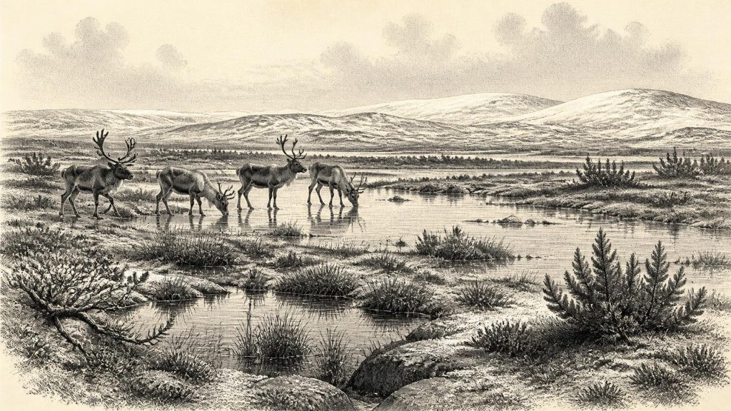
The fossil material from the organic beds indicates an open, treeless landscape rather than forest. Pollen and plant remains include grasses, sedges, juniper and herbs; mosses and aquatic species point to wet ground, shallow pools and plant-rich water. Insect evidence was interpreted as consistent with a muskeg-like environment: saturated terrain, mossy margins and open water under a harsh climate. This was not a settled lakeside village. It was a cold freshwater landscape in which seasonal thaw, standing water and frozen ground could coexist.
A conventional radiocarbon determination from Derryvree, BIRM-166, produced an age of 30,500 radiocarbon years BP, with a wide stated error margin. That result is important, but it is not equivalent to 30,435 BCE and cannot responsibly be used to date a particular year. It derives from a legacy sample of organic material and must be read alongside its stratigraphic context and the limitations of older radiocarbon methods. Irish Quaternary researchers use the term “Derryvree Cold Phase” as a practical label for this evidence, while recognising that it denotes a broad and complex interval rather than one perfectly dated climatic episode.
Derryvree nevertheless offers a rare glimpse of what Ireland could contain before the greatest late-glacial ice expansion transformed so much of its surface. Later erosion and deposition preserved this wetland almost accidentally, while also destroying or concealing many other landscapes of comparable age. Its value lies precisely in its modesty: a small, buried record that demonstrates that life persisted in particular ice-free or lightly glaciated settings.
Animals in the Cork Caves
Animal remains from limestone caves in southern Ireland provide another, more dramatic line of evidence. Castlepook Cave, also called Mammoth Cave, near Doneraile in County Cork is the principal Irish archive for pre-Last Glacial Maximum vertebrate fauna. Its collections include remains attributed to woolly mammoth, reindeer, giant deer, brown bear, wolf, foxes, hares, lemmings and spotted hyena. Taken together, these animals evoke an open, cold landscape with large herbivores, scavengers and predators rather than the dense woodland associated with later post-glacial Ireland.
Yet the cave must not be treated as a single frozen snapshot of 30,435 BCE. Many bones came from antiquarian excavations, cave deposits were disturbed by water and excavation, and some specimens may have been mixed with material of different ages. Modern reassessment and radiocarbon dating have strengthened the case for an important Marine Isotope Stage 3 fauna in southern Ireland, but they have also underlined the need for caution about individual associations. A mammoth bone or hyena tooth establishes that such animals reached Ireland during the broader period; it does not establish that they stood together outside the cave in one named year.
These faunal records matter because they show that the island was not biologically empty before the final great glaciation. Reindeer and mammoth imply available grazing over open ground, while carnivores indicate food webs sufficiently productive to support them. Cave hyenas may also have accumulated some of the bones, meaning that a cave assemblage can document animal behaviour and predation as well as simple mortality. The evidence supports a changing Pleistocene ecosystem, not a neatly bounded “mammoth steppe” reproduced intact in every Irish region.
People: Possibility Is Not Proof
The presence of large mammals raises an inevitable question: were people in Ireland too? For 30,435 BCE, the answer must remain that no securely excavated Irish camp, hearth, dwelling, burial, stone-tool assemblage or occupation surface is known. The National Museum of Ireland accordingly notes that no clear evidence has yet emerged for human presence in Ireland during the Palaeolithic. This absence does not prove that no person ever reached the island during the wider Late Pleistocene. It does mean that historians cannot convert environmental opportunity into a documented population.
Later work has pushed the firmly dated human story of Ireland farther back than the once-standard Mesolithic starting point. A butchered brown-bear bone from Alice and Gwendoline Cave in County Clare has been dated to the closing stages of the last glacial period, around 12,500 calibrated years BP. That find is enormously significant, but it is about twenty millennia later than the date considered here. It cannot be used as evidence for a population, economy or migration route at 30,435 BCE.
There is likewise no evidence on which to describe political affairs, warfare, diplomacy, religion, language, learning, art or trade in Ireland at this point. There were no known farms, fields, metalwork, monuments, ships or exchange networks. If transient hunter-gatherers did visit during a favourable interval, their technologies, beliefs and social relations remain unknown in Ireland’s present archaeological record. Comparisons with Upper Palaeolithic communities in Britain or continental Europe may suggest possibilities, but they are interpretations, not Irish evidence.
An Unsettled Island
Settlement, in the normal archaeological sense, is therefore absent from the record. The best-supported “inhabitants” are plants and animals: sedges at wet margins, mosses in saturated ground, juniper and herbs on open terrain, and mobile mammals able to exploit shifting habitats. Their movements would have depended on coastlines, sea levels and ice margins that differed greatly from those of modern Ireland. Lower global sea level exposed additional shelf land, but the exact configuration of routes across the Irish Sea and around the island remains uncertain for this date.
The strongest historical development around 30,435 BCE was not a human political change but environmental instability. Ireland occupied the western edge of a North Atlantic climatic system capable of abrupt warming and cooling. The buried Fermanagh wetland and the southern cave fauna reveal that cold, life-supporting landscapes existed before later ice expansion. Their survival also explains the limits of knowledge: the same glaciers that shaped Ireland’s drumlins and valleys stripped away much of the evidence needed to tell a fuller human story.
For this year, then, Ireland is best understood as a contested physical landscape rather than a nation with institutions or an archive with events. Derryvree’s silts and Castlepook’s bones offer rare witnesses to that landscape. They illuminate open wetlands, cold-adapted vegetation and Pleistocene animals, while insisting on an essential discipline: evidence can show that ancient environments existed, but it cannot manufacture a calendar-year history where none survives.
Primary Sources
- A Middle Midlandian Freshwater Series at Derryvree, Maguiresbridge, County Fermanagh, Northern Ireland
- Figure 6.— The Subdivision of the Quaternary Period in Ireland
- The Quaternary of South Fermanagh
- The Colonization of Ireland: A Human Ecology Perspective
- First Evidence of a Late Upper Palaeolithic Human Presence in Ireland
- The Irish Quaternary Fauna Project
- A Reconsideration of the Radiocarbon Dating of the Marine Isotope Stage 3 Fauna from Southern Ireland
- Castlepook Cave, County Cork: County Geological Site Report
- New Insights on the Fauna of Ireland's Younger Dryas and Early Holocene from Alice & Gwendoline Cave
- Pattern and Timing of Retreat of the Last British-Irish Ice Sheet
- New Data for the Last Glacial Maximum in Great Britain and Ireland
- Radiocarbon Constraints on the Age of the Maximum Advance of the British–Irish Ice Sheet in the Celtic Sea
- The Greenland Ice Core Chronology 2005, 15–42 ka: Part 1, Constructing the Time Scale
- A Stratigraphic Framework for Abrupt Climatic Changes During the Last Glacial Period Based on Three Synchronized Greenland Ice-Core Records
- Consistently Dated Atlantic Sediment Cores Over the Last 40 Thousand Years
- Independent Tephrochronological Evidence for Rapid and Synchronous Oceanic and Atmospheric Temperature Rises Over the Greenland Stadial-Interstadial Transitions Between ca. 32 and 40 ka b2k
- The IntCal20 Northern Hemisphere Radiocarbon Age Calibration Curve (0–55 cal kBP)
- The IntCal20 Northern Hemisphere Radiocarbon Age Calibration Curve (0–55 cal kBP) PDF
- Prehistoric Details: Stone Age Collections
- Archaeological Survey
- Ireland: Submerged Prehistoric Sites and Landscapes
- Seabed Prehistory Baseline
