BIRM-166’s Sheltered Water30418 BCE
Around 30,418 BCE, Ireland has no recorded human history, only fragmentary Late Pleistocene environmental evidence. At Derryvree, County Fermanagh, the BIRM-166 organic horizon, dated broadly to 34,950–29,750 BCE, preserves freshwater silts between glacial tills, demonstrating a local ice-free interval. Plant, moss and insect remains indicate cold, treeless tundra wetland, not a mild or wholly ice-free island. Cave finds at Castlepook, County Cork, document cold-adapted fauna, though remains derive from different periods. A possibly cut-marked reindeer bone offers uncertain evidence of human activity. Ireland formed a climatically unstable landscape of shifting ice, water and mobile animals, without demonstrable settlements or polities.

Dateline
The label 30,418 BCE gives a useful place in a modern chronology, but it cannot identify an Irish event in a single calendar year. At this depth of time, no annual historical record exists, and even scientific dates carry ranges rather than pinpoint moments. The year falls broadly within Marine Isotope Stage 3, a long and climatically unstable part of the Late Pleistocene. Ireland’s best evidence is not a chronicle of people or governments, but a small number of deposits, animal bones, cave sediments and landforms that survived later glaciation.
The nearest especially informative Irish archive is the organic sediment horizon known as BIRM-166 at Derryvree, near Maguiresbridge in present-day County Fermanagh. It is relevant because its calibrated age range encompasses this broad chronological neighbourhood, not because it can be assigned to 30,418 BCE itself. The task, therefore, is to reconstruct a cautiously bounded Ice Age landscape: one in which cold, water, plants, animals and moving ice shaped the possibilities of life, while evidence for humans remains exceptionally slight.
A Range, Not a Recorded Year
Derryvree was exposed in 1969 when roadworks cut through a drumlin. Beneath and above the organic layer lay till: unsorted clay, stones and debris deposited by glacier ice. Between those two tills were fine sands and freshwater organic silts. The sequence establishes a relative order with unusual clarity. Ice had occupied the locality; an interval followed in which fresh water, vegetation and organic matter accumulated; then later glacial activity covered and protected the deposit.
A conventional radiocarbon determination from the Derryvree organic material, BIRM-166, was reported as 30,500 radiocarbon years before present, with a large uncertainty. “Before present” conventionally means before 1950. Radiocarbon years are not calendar years, since atmospheric carbon-14 has varied over time. Calibration is therefore essential. Published discussion places the Derryvree deposit broadly at about 36,900–31,700 calibrated years before present, approximately 34,950–29,750 BCE. The requested year lies within that wide span, but it cannot be tied to a particular seed, insect, season, animal or human visit.
This distinction matters. A date such as 30,418 BCE is a retrospective modern label, not an ancient Irish date. It should not produce a fictional ruler, battle, migration or settlement. Nor should a radiocarbon determination from a mixed organic horizon be treated as a precise timestamp. At most, it places the Derryvree freshwater episode within a large Late Pleistocene interval, during which climate and ice margins shifted repeatedly across north-west Europe.
Fresh Water Between Glacial Advances
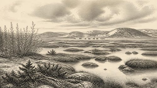
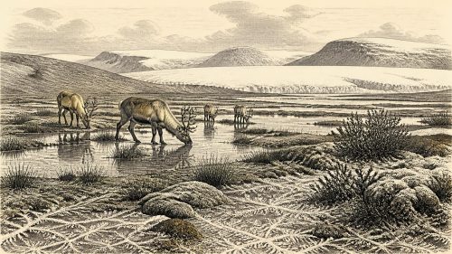
The Derryvree deposit is important precisely because it challenges the simple image of an Ireland permanently buried beneath ice. While the organic bed formed, this part of Fermanagh was not overridden by a glacier. Liquid water lay in a shallow pool, marsh or wetland margin; fine mineral sediment settled; plants grew and decayed. Yet the deposits do not describe a mild, wooded Ireland. Their biological remains point instead to an open, severe, periglacial environment: ground affected by frost and seasonal thaw, with short growing seasons and local wetness amid generally cold conditions.
Older classifications called this setting a muskeg, meaning mossy, waterlogged ground with standing water or sluggish channels. The term is useful as a description of wet terrain, provided it is not mistaken for an exact modern ecological equivalent. The evidence supports a local freshwater habitat rather than a map of the whole island. Conditions in a Fermanagh hollow could differ sharply from those on exposed uplands, in the south-western limestone country or near a changing coast.
At the larger scale, the British–Irish Ice Sheet was not a static mass. Recent syntheses identify dynamic advance and retreat during MIS 3, although the extent and timing of its pre-Last Glacial Maximum phases remain less securely resolved than the later ice sheet. Later glaciation eroded or buried much earlier evidence, making every surviving intertill deposit disproportionately valuable. Derryvree demonstrates an ice-free interval at one locality; it does not prove that all Ireland was ice-free, nor that the island’s ice margin stood still.
Open Tundra and Wet Ground
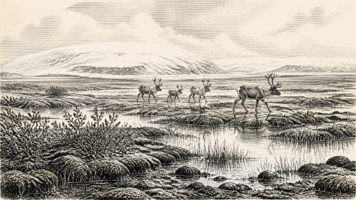
The most direct environmental evidence from Derryvree comes from plant remains, pollen, mosses and insects. These indicate treeless or almost treeless vegetation, with sedges, grasses, herbs, low shrubs and mosses around wet ground. Macrofossil evidence includes hardy cold-climate plants such as mountain avens, dwarf willow, lesser clubmoss and bogbean; aquatic water-milfoil helps confirm the presence of fresh water. Such remains are stronger evidence for local surroundings than isolated grains of tree pollen, which can travel long distances or be redeposited from older sediment.
This was not a featureless frozen waste. During the productive part of the year, plants flowered, shallow pools supported aquatic life, and insects inhabited waterlogged margins. But it was an exacting place. Frost could heave and fracture the ground; thaw could turn surfaces soft and unstable; wind and sparse vegetation could expose sediment. The vegetation was insufficient for woodland, agriculture or the settled rural life familiar from later prehistory. There were no fields, livestock, cereal crops, pottery villages, tombs or monuments.
Evidence from Crag Cave in County Kerry reinforces the wider point that Late Pleistocene Ireland experienced oscillation rather than uniform cold. Uranium-thorium dates show that speleothem growth in the cave occurred episodically through the last glacial period, broadly in step with Greenland interstadials. Calcite formation requires water moving through the cave system, so these episodes register intervals when local hydrological conditions permitted it. They do not make Crag Cave and Derryvree identical climates, but they support a picture of sharp environmental variability across Ireland.
Animals in the Southern Caves
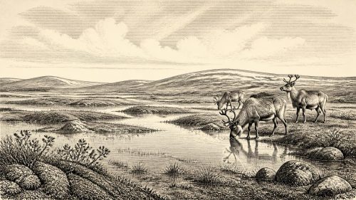
County Cork supplies a second, very different archive. Castlepook Cave near Doneraile has yielded one of Ireland’s most important Pleistocene faunal collections. Material attributed to the cave includes woolly mammoth, reindeer, giant deer, brown bear, wolf, fox, mountain hare, Arctic fox, spotted hyaena and lemmings. Taken together, those remains show that cold-adapted animal communities reached Ireland during parts of the Late Pleistocene. Reindeer, lemmings and open-country herbivores fit the wider reconstruction of grass-herb and tundra-like habitats, while hyaena, wolf and bear remind us that carcasses and cave spaces were also part of carnivore ecologies.
However, the Castlepook assemblage must not be compressed into one imagined scene. The cave was explored mainly in the late nineteenth and early twentieth centuries, before modern excavation and recording standards. Some deposits were disturbed, remains accumulated at different times, and natural processes could move bones into or within caves. Accelerator radiocarbon dating has shown that specimens from the same general cave system may belong to very different periods. A cave bone can establish that an animal lived in Ireland at some point; it does not automatically show a single contemporaneous herd, hunting episode or community.
The environment around 30,418 BCE was therefore probably regionally varied and changing. Fermanagh preserves wet ground and freshwater sediments; the Cork caves preserve evidence of animals associated with colder open landscapes. Neither archive permits a precise reconstruction of coastline, vegetation cover or animal numbers for the entire island in one year. The later Last Glacial Maximum would dramatically remodel much of that landscape and destroy many of its earlier surfaces.
People: A Possibility, Not a Population History
Human presence is the central uncertainty. A reindeer femur from Castlepook has been publicised as bearing a deep incision interpreted by zooarchaeologist Ruth Carden as a mark made by a stone tool during carcass processing. If that interpretation is confirmed, it would be exceptionally early evidence that people handled an animal in Ireland during the Upper Palaeolithic. It would suggest a brief encounter with a carcass, not a settled population, village or named culture. The bone’s age, the formation history of the cave deposits and the origin of the mark must all be assessed independently.
No securely associated hearth, stone-tool assemblage, dwelling floor, burial, artwork, human skeleton or occupation layer is known in Ireland for this broad period. Consequently, it is not responsible to describe a human economy, kinship system, language, religion, trade route, political authority, conflict or diplomacy for 30,418 BCE. If people did enter Ireland, the available evidence would be compatible only with small, mobile groups moving through a difficult northern landscape, perhaps following animal resources or exploiting a chance carcass. That is an inference from the wider European Upper Palaeolithic world, not a demonstrated Irish social history.
No Polities, but a Deep Environmental History
Political affairs, warfare and diplomacy leave no trace here because there is no evidence for organised polities in Ireland at this date. Religion and learning are likewise beyond recovery: there are no shrines, burials, images, inscriptions or artefacts that could support claims about belief or knowledge. Trade cannot be demonstrated. The island’s connections with Britain and continental Europe were controlled by changing ice, sea level, exposed shelves and animal movements, but no imported object or exchange network has been identified for this Irish interval.
That silence is not emptiness. The real history is environmental and archaeological. In a buried Fermanagh wetland, seeds, mosses, insects and silt recorded a period when fresh water endured between glacial episodes. In Cork caves, bones retained evidence for animals that lived across an Ice Age landscape later transformed by ice. These fragments show Ireland as part of a wider north-west European world of abrupt climatic change, mobile fauna and unstable habitable zones. They also set a firm limit on storytelling: around 30,418 BCE, Ireland can be studied as a changing landscape, but not yet narrated as a country of documented peoples and events.
Primary Sources
- The Stratigraphic Position and Age of the Gortian
- Figure 6.— The Subdivision of the Quaternary Period in Ireland
- The Irish Quaternary Fauna Project
- Occurrence of Mammalia Relicts at Site Castlepook Cave
- Pleistocene Vertebrates in the British Isles
- Preliminary Assessment of the Archive of Faunal Remains from Excavated Irish Cave Sites
- Heritage Artefacts of County Cork
- New Insights on the Fauna of Ireland’s Younger Dryas
- The IntCal20 Northern Hemisphere Radiocarbon Age Calibration Curve (0–55 cal kBP)
- Growth and Retreat of the Last British–Irish Ice Sheet, 31,000 to 15,000 Years Ago: The BRITICE-CHRONO Reconstruction
- BRITICE-CHRONO Maps and GIS Data of the Last British-Irish Ice Sheet 31 to 15 ka
- The Timing and Magnitude of the British–Irish Ice Sheet Between Marine Isotope Stages 5d and 2
- Deglaciation Chronology of the Donegal Ice Centre, North-West Ireland
- Marine Geophysical Evidence for Late Pleistocene Ice Sheet Extent and Recession off Northwest Ireland
- Sedimentary and Foraminiferal Records of Late Quaternary Environmental Change West of Ireland and Implications for the Last British–Irish Ice Sheet
- Episodic Speleothem Deposition Tracks the Terrestrial Impact of Millennial-Scale Last Glacial Climate Variability in SW Ireland
- Consistently Dated Atlantic Sediment Cores Over the Last 40 Thousand Years
- Menyanthes trifoliata L.
- Dryas octopetala L.
- Pleistocene Glaciations in Ireland