Maguiresbridge Climate31402 BCE
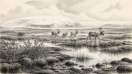
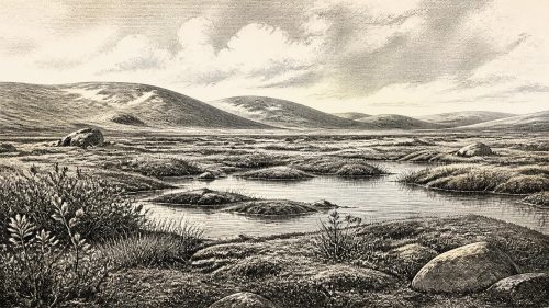
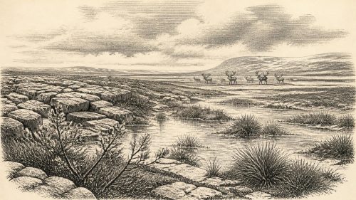
The notional date 31,402 BCE denotes an uncertain interval in later Marine Isotope Stage 3, not a recorded event. At Derryvree near Maguiresbridge, freshwater silts between glacial deposits preserve evidence of a cold, largely treeless tundra-like wetland with mosses, sedges, grasses and pools. Radiocarbon calibration places it broadly between 36,900 and 31,700 years BP. Climatic fluctuations brought alternating milder and colder conditions before later ice-sheet expansion. Cave fossils document reindeer and other Ice-Age animals. A contested cut mark on a Castlepook reindeer bone may indicate brief human activity, but proves neither settlement nor social organisation. It records only environmental change.
Dateline
31,402 BCE is a modern, backwards-counted calendar label, not a date that can be recovered from Ireland’s archaeological record. Nobody on the island recorded a year, season or political event in such terms. In archaeological conversion it lies roughly 33,350 years before AD 1950, but that apparent precision should not mislead: radiocarbon dates carry statistical uncertainty, and their calibration produces ranges rather than a single historical day. The responsible view is therefore of an interval within the later part of Marine Isotope Stage 3 (MIS 3), a long, climatically volatile phase of the last Ice Age, rather than an entry in a conventional annual chronicle.
An Ice-Age Interval, Not a Dated Event
The most relevant evidence comes from Derryvree, near Maguiresbridge in County Fermanagh. Roadworks in 1969 cut through a drumlin and exposed a remarkable sequence: thick glacial deposits, organic freshwater silts and fine sands, then further glacial deposits. The organic layer was therefore formed during a period when this part of the north of Ireland was not covered by ice, before renewed glacial activity sealed the deposit beneath till. Its conventional radiocarbon determination, Birm-166, was 30,500 years BP with a large uncertainty. Published recalibrations place it broadly at about 36,900–31,700 calibrated years BP. The notional year 31,402 BCE falls within that wide range, but cannot be pinned to a particular layer, plant, animal or episode of sediment deposition.
This is important because Derryvree gives Ireland one of its clearest surviving windows on conditions before the major expansion of the last British–Irish Ice Sheet. It does not establish that the whole island was ice-free at one moment, still less that every region shared the same climate. It does show that a freshwater environment existed in the Fermanagh interior during part of this broad span. The silts are not a diary, but they are physical evidence: water lay or moved through the hollow; plants grew nearby; small organisms lived, died and were preserved; and later ice overrode or buried the landscape.
A Treeless Wetland Landscape
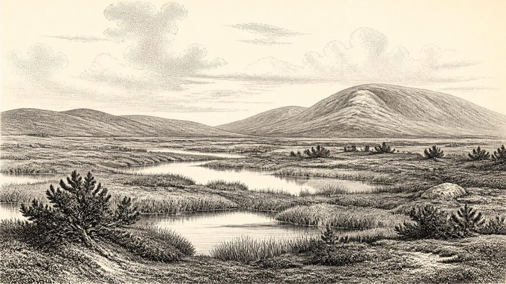
The Derryvree fossils indicate an open, cold and periglacial setting. Pollen was poorly preserved, which limits species-by-species certainty, but it was predominantly from herbaceous plants. Moss macrofossils were especially informative. Together with the sedimentology, they point to tundra-like vegetation and muskeg: wet, peaty or silty ground, sedges and grasses, low herbs, mossy hollows and pools, with dry ground that was probably patchy rather than densely carpeted. Juniper is among the plants associated with the reconstructed vegetation. A seed of bogbean, Menyanthes trifoliata, is particularly evocative evidence for freshwater or very wet ground.
This was emphatically not the wooded Ireland familiar from later prehistory. Isolated grains of tree pollen cannot securely prove nearby woodland, because pollen can travel long distances or be redeposited from older material. The better-supported interpretation is one of generally treeless country. Wind, frost action, seasonal saturation and a short growing season shaped the terrain. Even where liquid water persisted in pools and channels, winters could have been severe. The landscape was biologically active, yet vulnerable to abrupt change.
That instability is crucial. MIS 3 was marked by sharp climatic swings known from Greenland ice cores as interstadials and stadials. These were not gentle, uniform changes. In south-west Ireland, uranium-thorium dates from calcite formations in Crag Cave, County Kerry, show repeated episodes of speleothem growth during the last glacial period. Since calcite growth in such a shallow cave requires percolating liquid water and conditions above persistent freezing, the record independently indicates intervals of relative amelioration. It cannot tell us the weather in a particular Fermanagh valley in 31,402 BCE, but it supports the larger conclusion that Ireland’s climate alternated dramatically between colder and less severe phases.
Animals at the Edge of the Ice
Irish cave collections and fossil deposits show that the island supported an Ice-Age fauna at various times during MIS 3. The evidence includes reindeer, brown bear, hare, fox and spotted hyaena, while recent work at Castlepook Cave near Doneraile, County Cork, has also identified remains of lemming and woolly mammoth in the cave system. Such finds must be dated and interpreted individually: a cave bone proves the presence of an animal, not necessarily a living community occupying the immediate cave entrance, because hyaenas, water, collapse and earlier excavators could all move remains.
Reindeer are the animals most directly relevant to this broad period. Their grazing habits and mobility suited open northern landscapes, and reindeer bones from Castlepook have long figured in discussions of Ireland’s Middle Midlandian, or MIS 3, fauna. A reindeer femur from the old Castlepook collection has been reported as approximately 33,000 years old and bears a deep incision that zooarchaeologist Ruth Carden has interpreted as a sharp-tool cut made during carcass processing. If that diagnosis and its chronological relationship to the animal’s death are confirmed, it would be extraordinarily early evidence of human action in Ireland.
Yet it is essential not to turn a single disputed trace into a population history. The specimen was recovered from a cave excavated long ago, without a modernly excavated occupation surface linking it to a hearth, stone-tool assemblage, dwelling, human remains or a larger scatter of butchered bones of the same date. Natural damage can sometimes resemble cut marks, and a date on bone does not itself date the making of every mark on its surface. At present, Castlepook allows the possibility of a brief human encounter with a reindeer during the wider period; it does not demonstrate a permanent settlement, a named hunting group or an uninterrupted ancestry in Ireland.
No Polities, No Proven Trade
There is no evidence from this time for political institutions, chiefs, territories, warfare, diplomacy or formal alliances in Ireland. There are likewise no securely dated settlements, graves, houses, hearths, storage pits, ornaments or artworks from around 31,402 BCE. It would be misleading to fill the silence with imagined clans, rituals or Ice-Age kingdoms. The absence is not proof that no people ever entered the island during MIS 3; it is a statement about what the present record can substantiate.
The same caution applies to everyday life, economy and religion. If people did reach Ireland in this broad interval, the most defensible inference is that they would have been highly mobile foragers operating in a cold, resource-variable landscape, potentially interested in large game such as reindeer. Such a visit might have involved cutting meat or separating a limb from a carcass, which is the interpretation proposed for the Castlepook femur. It does not prove organised hunting territories, regular seasonal migration, trade routes, boat technology or exchange with Britain and continental Europe. Lower sea levels and changing ice margins greatly altered the geography around Ireland, but the precise availability of dry, icy or marine routes at any one moment remains a specialist problem in palaeogeography.
Nor is there material evidence for religious practice or formal learning. Knowledge, of course, need not leave monuments: people capable of travelling through northern Europe possessed practical understanding of weather, animals, stone and route-finding. But assigning such knowledge to Ireland at this date would exceed the evidence. Culture is visible here chiefly in the methods of modern investigation: pollen analysis, plant macrofossils, insect remains, bone study, radiocarbon measurement, cave survey and the dating of calcite.
Approaching the Glacial Maximum
The Derryvree wetland belonged to a changing world rather than a stable refuge. Its position between tills records more than an attractive tundra pond: it marks the alternation of locally ice-free conditions and glacial advance. Later, the British–Irish Ice Sheet expanded on a far greater scale. Reconstructions differ in detail, but place its maximum volume around 23,000 years ago, well after the interval represented by 31,402 BCE. During the intervening millennia, expanding ice progressively transformed routes, drainage systems, habitats and the survival prospects of plants and animals.
For Ireland, then, the most important development around this notional year was environmental possibility under pressure. In Fermanagh, freshwater silts preserve a cold open wetland in an interval before later ice. In Kerry, cave calcite records episodes when liquid water again moved underground. In north Cork, cave faunas and one contested marked reindeer bone raise the prospect of very early human contact without yet proving lasting occupation. These fragments do not yield a conventional national history. They offer something rarer: a carefully bounded glimpse of an Ice-Age Ireland where mosses, sedges, shallow water, grazing animals and encroaching ice defined the terms on which life—and perhaps occasional human movement—was possible.
Source References
Hover over a number to see the source. Select it to open the source.

- [1] A Middle Midlandian Freshwater Series at Derryvree, Maguiresbridge, County Fermanagh, Northern Ireland
- [2] Palaeoecology: Irish Quaternary Association Field Guide
- [3] The Subdivision of the Quaternary Period in Ireland
- [4] The Irish Quaternary Fauna Project
- [5] Episodic Speleothem Deposition Tracks the Terrestrial Impact of Millennial-Scale Last Glacial Climate Variability in SW Ireland
- [6] Trimlines, Blockfields and the Vertical Extent of the Last Ice Sheet in Southern Ireland
- [7] Exploring the Celtic Sea Ice Stream and Associated Deglacial Systems of the British–Irish Ice Sheet
- [8] Growth and Retreat of the Last British–Irish Ice Sheet, 31,000 to 15,000 Years Ago: the BRITICE-CHRONO Reconstruction
- [9] Pattern and Timing of Retreat of the Last British-Irish Ice Sheet
- [10] The Island of Ireland: Drowning the Myth of an Irish Land-Bridge?
- [11] The Problem of a Late Quaternary Landbridge Between Britain and Ireland
- [12] New Insights on the Fauna of Ireland’s Younger Dryas and Early Holocene from Alice & Gwendoline Cave
- [13] New Insights on the Fauna of Ireland’s Younger Dryas and Early Holocene from Alice & Gwendoline Cave (open-access PDF)
- [14] Heritage Artefacts of County Cork
- [15] Ireland’s Palaeolithic Archaeology: Fleeting Footprints in a Frozen Land
- [16] Scientific Dating of Pleistocene Sites: Introduction
- [17] Historic England’s Research into Submerged Prehistoric Landscapes
- [18] Hydrographic Survey Data Uncovers Preserved Glacial Landscape
- [19] The IntCal20 Northern Hemisphere Radiocarbon Age Calibration Curve (0–55 cal kBP)
- [20] A Stratigraphic Framework for Abrupt Climatic Changes During the Last Glacial Period Based on Three Synchronized Greenland Ice-Core Records
Primary Sources
- A Middle Midlandian Freshwater Series at Derryvree, Maguiresbridge, County Fermanagh, Northern Ireland
- Palaeoecology: Irish Quaternary Association Field Guide
- The Subdivision of the Quaternary Period in Ireland
- The Irish Quaternary Fauna Project
- Episodic Speleothem Deposition Tracks the Terrestrial Impact of Millennial-Scale Last Glacial Climate Variability in SW Ireland
- Trimlines, Blockfields and the Vertical Extent of the Last Ice Sheet in Southern Ireland
- Exploring the Celtic Sea Ice Stream and Associated Deglacial Systems of the British–Irish Ice Sheet
- Growth and Retreat of the Last British–Irish Ice Sheet, 31,000 to 15,000 Years Ago: the BRITICE-CHRONO Reconstruction
- Pattern and Timing of Retreat of the Last British-Irish Ice Sheet
- The Island of Ireland: Drowning the Myth of an Irish Land-Bridge?
- The Problem of a Late Quaternary Landbridge Between Britain and Ireland
- New Insights on the Fauna of Ireland’s Younger Dryas and Early Holocene from Alice & Gwendoline Cave
- New Insights on the Fauna of Ireland’s Younger Dryas and Early Holocene from Alice & Gwendoline Cave (open-access PDF)
- Heritage Artefacts of County Cork
- Ireland’s Palaeolithic Archaeology: Fleeting Footprints in a Frozen Land
- Scientific Dating of Pleistocene Sites: Introduction
- Historic England’s Research into Submerged Prehistoric Landscapes
- Hydrographic Survey Data Uncovers Preserved Glacial Landscape
- The IntCal20 Northern Hemisphere Radiocarbon Age Calibration Curve (0–55 cal kBP)
- A Stratigraphic Framework for Abrupt Climatic Changes During the Last Glacial Period Based on Three Synchronized Greenland Ice-Core Records