Bogbean Before the Ice Return30759 BCE
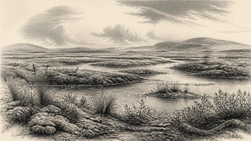
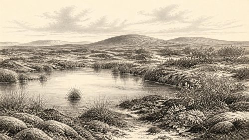
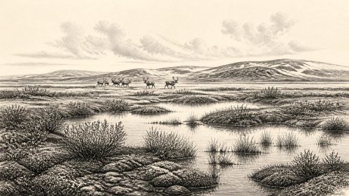
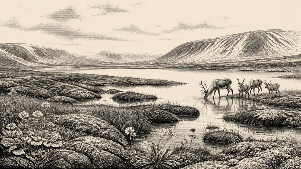
At 30,759 BCE, Ireland cannot be described through precise annual history, but evidence places it within a cold, unstable MIS 3 landscape. Derryvree, County Fermanagh, preserves freshwater sediments between glacial tills, dated broadly to 34,950–29,750 BCE. Its mosses, sedges, bogbean and other fossils indicate treeless, periglacial wetland conditions with seasonal thaw, rather than continuous ice cover. Castlepook Cave, County Cork, preserves remains of cold-adapted animals, including reindeer, mammoth and predators, accumulated across several periods. A marked reindeer femur may indicate human butchery around 33,000 years ago, but cannot demonstrate permanent settlement. Ireland’s history then is ecological, with human presence uncertain.
Dateline
The label 30,759 BCE cannot describe a recoverable Irish year in the manner of a medieval annal or a modern historical timeline. Nobody in Ireland then used a calendar, and no written account, named individual, settlement layer or dated event can be fixed to that precise point. In simple arithmetic it lies about 32,700 years before the radiocarbon reference year of AD 1950, but that conversion is not a scientific date. The responsible approach is to place it within the Late Pleistocene, broadly Marine Isotope Stage 3 (MIS 3), and to use calibrated ranges rather than pretend that archaeological evidence has annual precision.
The closest important Irish chronological anchor is a buried freshwater deposit at Derryvree, near Maguiresbridge in County Fermanagh. Organic material there returned the radiocarbon determination Birm-166, 30,500 +1,170/−1,030 radiocarbon years before present. Published calibration places it broadly at about 36,900–31,700 calibrated years BP, approximately 34,950–29,750 BCE. The requested year falls within that wide range. It does not date a single season at Derryvree, still less establish identical conditions across the whole island. Yet it provides an unusually valuable window on an Ireland that was cold, largely treeless and environmentally unstable, but not uniformly sealed beneath ice.
A Wetland Between Glaciers
Derryvree was revealed when roadworks cut through a drumlin in 1969. Beneath the familiar smooth glacial hill lay a remarkable sequence: glacier-laid till at the bottom, freshwater silts and fine sands containing organic material in the middle, and a further till above. Till is the unsorted mixture of clay, stones and debris deposited by ice. The order of these layers establishes a basic history. Glacier ice had occupied the locality; an interval followed in which ice no longer covered it and fresh water, vegetation and sediment accumulated; then ice returned or advanced across the site, burying the wetland.
That sequence is evidence, not a complete map of Ireland. It proves an ice-free freshwater environment at this part of Fermanagh during part of the dated interval. It does not prove that all Irish lowlands were simultaneously hospitable, that the island had one stable climate, or that the Derryvree pool survived unchanged for five millennia. Later ice sheets eroded, moved and buried older landscapes across much of Ireland. The very survival of organic silts between tills is therefore exceptional, and helps explain why the evidence is so local and discontinuous.
Modern reconstruction of the British–Irish Ice Sheet also cautions against simple images of an island either wholly frozen or wholly open. The principal late-glacial expansion was still developing around this broader period, and its margins changed at different speeds in different regions. Upland ice, local glaciers, exposed ground, shallow seas and lowland basins could coexist within a comparatively small area. Around the nominal date, Ireland should be envisaged as a changing northern Atlantic landscape, shaped by severe cold and advancing ice but containing refuges of liquid water and life.
Mosses, Sedges and Cold Water
The Derryvree fossils give substance to that picture. Pollen, plant macrofossils and insect evidence point to open, treeless vegetation rather than the oak, hazel and elm woods of much later prehistory. Mosses were especially abundant. Sedges, grasses and low herbs occupied wet ground and nearby open country. The deposit included mountain avens, a plant associated with cold, open calcareous terrain, and a seed of bogbean, an aquatic plant of marshes and shallow freshwater margins. Such finds show that meltwater or other standing fresh water persisted long enough for a wetland community to form.
This was not a green pastoral Ireland, and no crops, hedges or managed fields existed. The strongest interpretation is a periglacial tundra or muskeg-like mosaic: frost-affected ground, shallow pools, sedgy margins, mossy hollows and sparse vegetation on better-drained surfaces. Seasonal thaw was essential. Without it there would have been neither the aquatic plants nor the organic mud now preserved at Derryvree. But the fossils cannot supply a daily weather report. They record accumulated local environments and should not be used to specify the temperature, snowfall or water level in 30,759 BCE itself.
Environment governed every possibility of animal and human movement. Productive patches around water could support insects, grazing animals and scavengers during favourable seasons, while long winters, deep frost and expanding ice greatly restricted food and travel. Rivers and meltwater channels were liable to shift; exposed surfaces were vulnerable to wind and frost action. Even the landscapes that appear permanent today were not. Drumlins, valleys and bog basins are products of long histories of glaciation, erosion and deposition, not fixed landmarks whose appearance can be projected unchanged into this distant period.
Castlepook’s Animal Archive
County Cork supplies the other major body of evidence relevant to this time. Castlepook Cave, near Doneraile in the Awbeg valley, has yielded one of Ireland’s most important Late Pleistocene faunal collections. Its caves preserved bones where most open-air organic evidence was later destroyed. Reassessment of the material has shown that the assemblage includes remains from more than one phase of the Ice Age, rather than one moment or one neatly bounded ecosystem.
The fauna known from Castlepook and related Irish cave records includes reindeer, woolly mammoth, giant deer, brown bear, wolf, fox, Arctic fox, lemming and spotted hyaena. These animals should not all be imagined standing together on a single hillside in 30,759 BCE. Cave deposits accumulate over long spans, and bones may arrive through predation, scavenging, natural death, water movement and the actions of people. Nevertheless, they establish an important point: during favourable Late Pleistocene intervals, Ireland supported or received animals characteristic of cold, open environments. Reindeer and other grazers imply usable vegetation somewhere in the wider landscape; predators and hyaenas indicate food webs more complex than a lifeless ice desert.
Castlepook was also a natural trap, carnivore den and sediment archive, not a purpose-built human site. Early twentieth-century excavation removed much material before the recording standards now expected in archaeology. This makes the cave invaluable but difficult. Individual specimens can be directly dated and re-examined, yet their original position, association and route into the cave may be uncertain. Current excavation and post-excavation work at Castlepook is important precisely because intact deposits could test the older collection and distinguish animal activity from possible human activity more securely.
The Reindeer Femur Question
A reindeer femur from Castlepook has made this period exceptionally significant for Irish prehistory. The bone has been publicly reported as roughly 33,000 years old and bears a deep mark interpreted by zooarchaeologist Ruth Carden as damage made by a sharp stone tool while fresh bone was being processed. If that interpretation is confirmed, it would be evidence that a person handled a reindeer carcass in Ireland during the Upper Palaeolithic, far earlier than the formerly accepted terminal-Pleistocene evidence from County Clare.
The distinction between evidence and interpretation matters. The femur itself is evidence; its direct date concerns the death of the animal; the identification of the mark as a cut or chop is a specialist interpretation. The bone derives from an old cave collection, not a newly excavated occupation floor with a secure suite of tools and hearths. No associated stone-tool assemblage, dwelling, burial, human bone, camp floor or repeated food-processing area has yet demonstrated a settled community in Ireland at this antiquity. Nor can a single modified bone show whether people killed the reindeer, found a carcass, removed a portion elsewhere, or how long any visit lasted.
Accordingly, it is possible to discuss a brief human incursion, perhaps by mobile hunter-gatherers familiar with large game in north-west Europe; it is not responsible to announce an established Palaeolithic population, a named people or an ancestral Irish nation. The apparent proximity between the reported Castlepook date and 30,759 BCE makes the bone central to this article, but it does not make it evidence for an event in that exact year. Future work may strengthen, qualify or overturn the current reading.
Society Beyond the Record
There is no Irish evidence around this point for rulers, kingdoms, diplomacy, warfare between political communities, law, tribute, markets, agriculture or permanent villages. Nor are there securely dated Irish monuments, graves, art, ritual deposits or inscriptions from which religion, language, formal learning or collective identities can be reconstructed. Calling any possible visitors “Irish”, Celtic or tribal would impose much later identities upon a record that cannot bear them.
If people did enter the island, their probable economy would have depended on movement, hunting, scavenging and the careful use of animal materials, rather than farming or trade in the later sense. Reindeer could provide meat, fat, marrow, hide, sinew, antler and bone, but Castlepook does not reveal which resources were taken. Sea level was lower than today and the geography of waters, coasts and possible approaches differed markedly, yet neither a precise route nor the frequency of crossings is known. Animal dispersal demonstrates that movements into Ireland happened in parts of the wider period; it does not identify a land bridge, a boat journey or a particular season for people.
The most meaningful history of Ireland around 30,759 BCE is therefore ecological and evidential. At Derryvree, a freshwater wetland briefly flourished between episodes of glaciation, preserving mosses, sedges, bogbean and signs of cold-water life. At Castlepook, caves retained the fragmentary remains of a northern animal world and perhaps a trace of human butchery. Together they replace an outdated image of permanent, empty ice with a more compelling but more cautious one: a severe, changing land in which life persisted unevenly, and where any human presence remains a major possibility rather than a settled historical fact.
Primary Sources
- A Middle Midlandian Freshwater Series at Derryvree, Maguiresbridge, County Fermanagh, Northern Ireland
- Trimlines, blockfields and the vertical extent of the last ice sheet in southern Ireland
- Growth and retreat of the last British–Irish Ice Sheet, 31,000 to 15,000 years ago: the BRITICE-CHRONO reconstruction
- BRITICE-CHRONO maps and GIS data of the last British-Irish Ice Sheet 31 to 15 ka
- The IntCal20 Northern Hemisphere radiocarbon age calibration curve (0–55 cal kBP)
- A reconsideration of the radiocarbon dating of the Marine Isotope Stage 3 fauna from southern Ireland
- Heritage Artefacts of County Cork
- Archaeology Research Excavation Grant Report: Castlepook Cave Project
- 2022:564 – Castlepook Cave, Castlepook South, Cork
- New insights on the fauna of Ireland’s Younger Dryas and Early Holocene from Alice & Gwendoline Cave
- First evidence of a Late Upper Palaeolithic human presence in Ireland
- BSBI: Menyanthes trifoliata
- BSBI: Dryas octopetala
- The Geological Heritage of County Leitrim
- Figure 6.— The subdivision of the Quaternary Period in Ireland
- References and Recommended Reading
- The Late Quaternary history of east-central Ireland
- Sedimentology and chronology of the advance and retreat of the last British-Irish ice sheet on the continental shelf west of Ireland
- Ireland: Submerged Prehistoric Sites and Landscapes
- Pleistocene vertebrates in the British Isles
- The origins and diversification of Holarctic brown bear populations inferred from genomes of past and present populations
- Timing, pace and controls on ice sheet retreat: an introduction to the BRITICE-CHRONO transect reconstructions of the British-Irish Ice Sheet
- The stratigraphic position and age of the Gortian
- Quaternary Science Reviews 339 (2024) 108827