Derryvree’s Arctic-Alpine Flora30687 BCE
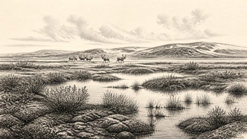
Around 30,687 BCE, Ireland was experiencing unstable Late Pleistocene conditions rather than a recordable historical year. At Derryvree, County Fermanagh, freshwater sediments preserved between glacial tills show an ice-free interval with cold, wet, treeless tundra vegetation. Mosses, sedges, aquatic plants, mountain avens, dwarf willow and other Arctic-alpine species indicate shallow water, saturated ground and brief growing seasons. Cave finds elsewhere confirm that reindeer, mammoth, hyaena and giant deer inhabited Ireland during broadly comparable periods, though not necessarily locally together. No secure evidence establishes human settlement then. Derryvree therefore records a local, changing ecosystem between glacier advances, not an inhabited society.
Dateline
30,687 BCE is a modern calendar label, not a date at which Ireland can be described year by year. No written record, settlement sequence, historical person or securely dated event allows that precision. In archaeological terms, this point falls around 32,637 calibrated years before present (where “present” is conventionally 1950), within the Late Pleistocene and the climatically unstable Marine Isotope Stage 3 (MIS 3). The most responsible account is therefore a reconstruction from dated sediment, fossil plants and insects, glacial deposits and cave fauna, rather than a narrative of a single year.
The strongest Irish evidence relevant to this horizon is the Derryvree freshwater deposit near Maguiresbridge, County Fermanagh. Its conventional radiocarbon determination, BIRM-166, was 30,500 radiocarbon years before present, with a sizeable uncertainty of +1,170/−1,030 years. Calibration produces a broad range rather than an anniversary: published treatments place the deposit broadly in the later part of MIS 3, with estimates extending across roughly 36,900–31,700 calibrated years before present. Thus 30,687 BCE can reasonably be discussed within Derryvree’s environmental interval, but it cannot be assigned to a particular layer, season, animal or human action.
A Wetland Between Ice Advances
Derryvree was exposed in 1969 when roadworks cut through a drumlin, one of the streamlined hills formed beneath moving glacier ice. The section was remarkable because freshwater silts, fine sands and organic mud lay between two tills: unsorted stony sediments deposited by glaciers. The lower till records an earlier episode of ice cover; the upper till records a later advance. In between came a period when ice had withdrawn from that locality sufficiently for water, sediment, plants and small animals to establish themselves. Later ice buried and preserved that short-lived archive.
This sequence is evidence for major environmental change, not proof that all of Ireland was simultaneously ice-free. Derryvree documents one basin in south Fermanagh. Other Irish regions may have had different conditions according to altitude, distance from ice margins, exposure to the Atlantic and the shifting configuration of the British-Irish Ice Sheet. Nevertheless, related inter-till organic deposits at Hollymount and Greenagho in Fermanagh show that the island’s glacial history was not a simple progression from ice to thaw. During the Midlandian cold stage, glaciers advanced and retreated, while non-glacial but severe landscapes could persist between them.
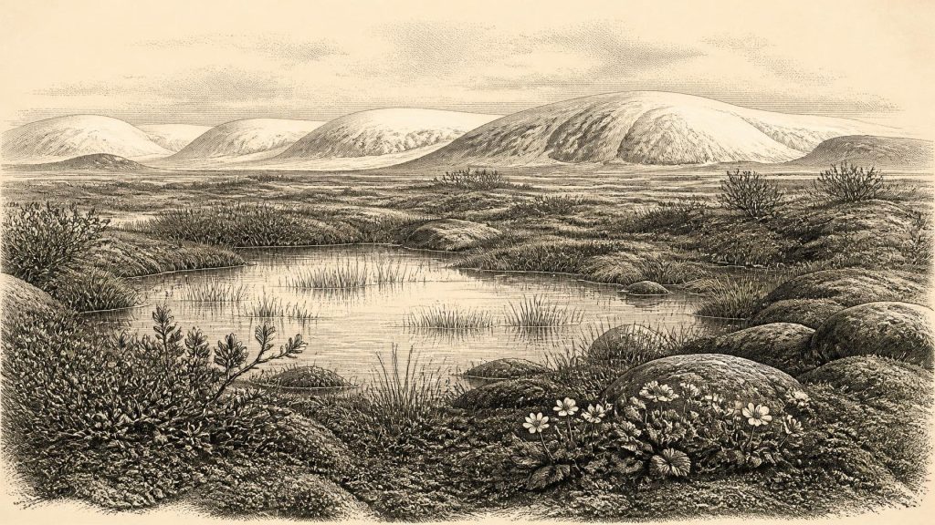
At Derryvree, the freshwater sediments demonstrate open water and saturated ground in a cold environment. This was not a later Irish bog, a wooded lakeshore or a settled rural landscape. It was a periglacial setting: ground affected by frost, seasonal thaw and short growing seasons. The term “muskeg”, sometimes used for the environment, usefully conveys waterlogged vegetation and pools, but should not suggest an exact modern counterpart. The deposit preserves a local ecological community, not an unchanging biome spread across the entire island.
Plants at the Edge of Ice
The fossil flora gives this otherwise remote period unusual clarity. Pollen was poorly preserved, yet plant macrofossils and mosses survived. Their combined signal indicates treeless, open vegetation. Sedges and freshwater mosses belonged near wet margins; water-milfoil points directly to standing or slow-moving fresh water. Bogbean, a plant associated with wet ground and shallow water, adds to the case for a vegetated basin rather than bare glacial debris.
The surrounding ground supported plants now strongly associated with cold or upland settings. Mountain avens (Dryas octopetala), dwarf willow (Salix herbacea), Arctic-alpine clubmoss and rosy saxifrage are among the significant elements reported from the Derryvree assemblage. They do not mean every hillside was covered by the same plants, nor do they provide a precise temperature reading. They do show that the locality offered exposed, low-growing tundra-like vegetation alongside wet hollows and freshwater. Dense forest is not supported by the main evidence. Isolated pollen grains of trees must be treated carefully: they may have travelled far, been redeposited, or represent sparse vegetation rather than local woodland.
In practical terms, the landscape around the pool was likely visually open. Mosses, sedges, herbs and diminutive shrubs could take advantage of brief summers; winter frost and wind would have imposed hard limits. The vegetation also helps explain why the distinction between permanent ice and non-glacial cold country matters. Even amid an ice-age climate, an ice-free locality could sustain a functioning food web, with aquatic plants in the water, wet-ground vegetation at its edge and sparse terrestrial cover beyond.
Animals and the Wider Faunal World
Derryvree itself is principally a botanical and small-faunal record, so it should not be used to place large mammals at its pool. For the wider Irish picture, limestone caves in the south are essential. Castlepook Cave near Doneraile, County Cork, has produced an important collection of Late Pleistocene animal remains, including reindeer, woolly mammoth, spotted hyaena and giant deer. Improved radiocarbon pretreatment has revised the chronology of several cave specimens, demonstrating that some mammals were present in Ireland during MIS 3 substantially earlier than older dates had indicated. The cave evidence establishes that Ireland was connected to a north-west European cold-stage faunal world before the Last Glacial Maximum.
It does not, however, demonstrate that every listed species lived together at Derryvree in 30,687 BCE. Cave deposits may contain material accumulated over long spans, often by carnivores, water movement or older excavations with limited stratigraphic recording. The safest conclusion is that animal populations, including cold-adapted herbivores and predators, reached parts of Ireland during this broad period. Reindeer are especially relevant to interpretations of open country, but their presence in a Cork cave cannot be converted into a precise migration route across Fermanagh.
These animals also illuminate regional change. At lower sea levels, the coastlines and shallow seas around Ireland were very different from those of today. Exposed shelf landscapes and periodically altered passages between Ireland, Britain and continental north-west Europe could have affected the dispersal of plants and animals. Yet physical accessibility was not a permanent land bridge guaranteed to be open at all times. Ice, water, terrain and climate changed repeatedly. Ireland was a western edge of a larger Pleistocene world, but not a uniform extension of Britain or the continent.
People: Possibility Without a Population History
There is no securely excavated camp, hearth, dwelling, burial, tool scatter or human bone dated to this Irish horizon. Accordingly, there can be no responsible account of Irish rulers, diplomacy, warfare, law, language, religion, artistic practice or formal learning in 30,687 BCE. Nor is there evidence for farming, herding, permanent villages, trade networks or a political territory called Ireland. These categories belong to much later periods and should not be projected backwards merely because humans elsewhere in Europe made sophisticated Upper Palaeolithic technologies and art.
A reindeer femur from Castlepook has been reported as bearing marks interpreted as stone-tool butchery and as dating to about 33,000 years ago. If that interpretation is confirmed through full publication and scrutiny, it would be exceptionally important: evidence for a brief human presence in Ireland before the Last Glacial Maximum. It would still represent an episode, not proof of continuous occupation. At present, the better-established direct evidence for human activity in Ireland remains much later, notably cut-marked brown-bear bone from Alice and Gwendoline Cave in County Clare, dated to the terminal Pleistocene.
The distinction is consequential. It is reasonable to infer that any people who reached Ireland in MIS 3 would have been highly mobile hunter-gatherers, equipped for a seasonal and demanding landscape, perhaps following animal resources as comparable groups did elsewhere in north-west Europe. That is an inference from regional comparison, not a demonstrated Irish society. The archaeological silence may partly reflect real rarity of visits, but it also reflects preservation: later ice scoured landscapes, sea-level change drowned former coastal terrain, and early excavations disturbed many cave deposits.
An Environmental History, Not an Annal
The chief development around this date was environmental volatility. Derryvree shows that a freshwater wetland and low tundra flora existed between phases of glaciation in Fermanagh. Castlepook and other cave collections show that Ireland supported elements of the Pleistocene mammal fauna over broadly comparable millennia. Together, they overturn any picture of an island that was either continuously ice-covered or ecologically empty. At the same time, they impose limits: the evidence is patchy, local and usually dated in ranges.
For Ireland around 30,687 BCE, there are no political affairs to chronicle and no named communities to follow. There is instead a buried pool beneath a later drumlin, its mosses, sedges, aquatic plants and Arctic-alpine flora preserving the most vivid testimony. It records a living but exposed Irish landscape: cold, wet, treeless and changeable, poised between ice advances and long before the island’s first securely documented settlements.
Primary Sources
- A Middle Midlandian Freshwater Series at Derryvree, Maguiresbridge, County Fermanagh, Northern Ireland
- Early Midlandian–Middle Midlandian, Pleistocene, Northern Ireland
- Palaeoecology: The Middle Midlandian Palaeoenvironment of South Fermanagh
- Introduction to the Late Quaternary and Holocene of Northern Ireland
- Dryas octopetala L.
- Myriophyllum alterniflorum DC.
- A Reconsideration of the Radiocarbon Dating of the Marine Isotope Stage 3 Fauna from Southern Ireland
- The Irish Quaternary Fauna Project
- First Evidence of a Late Upper Palaeolithic Human Presence in Ireland
- First Evidence of a Late Upper Palaeolithic Human Presence in Ireland (PDF)
- New Insights on the Fauna of Ireland’s Younger Dryas and Early Holocene from Alice & Gwendoline Cave
- New Insights on the Fauna of Ireland’s Younger Dryas and Early Holocene from Alice & Gwendoline Cave (PDF)
- Ireland: Submerged Prehistoric Sites and Landscapes
- Landscapes and Environments of the Last Glacial-Interglacial Transition: A Time of Amazingly Rapid Change in Ireland
- Irish Pleistocene Biostratigraphy
- The Geological Heritage of County Leitrim
- Palaeogeographical Investigation: Environmental Impact Assessment Report Appendix 18.1
- The Mesolithic in Ireland: When Was It?
- The Antiquity of Man in Ireland
- Ireland’s Palaeolithic Archaeology – Fleeting Footprints in a Frozen Land