

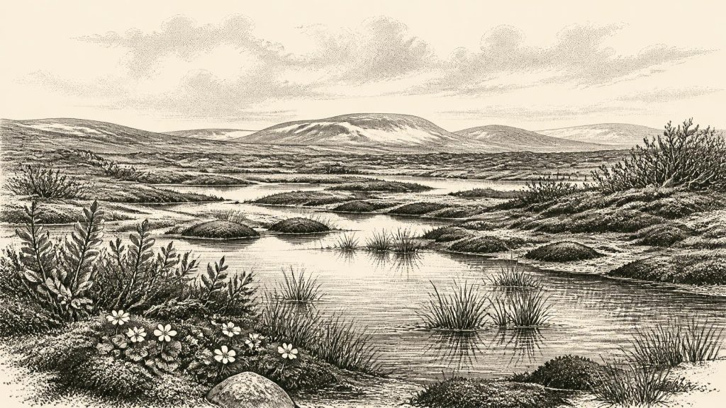
Derryvree’s Periglacial Muskeg30317 BCE
Thirty thousand years BCE is best understood as a modern label within a broad Late Pleistocene timeframe. At Derryvree, County Fermanagh, freshwater silts between glacial tills record an ice-free interval, producing a cold, treeless periglacial wetland of pools, sedges, mosses, insects and frost-affected ground. Ireland’s ice margins, sea levels and landscapes changed repeatedly during Marine Isotope Stage 3, while Kerry stalagmites indicate climatic fluctuations. Cave remains show that cold-adapted mammals, including reindeer, mammoth and hyaena, intermittently reached Ireland. Evidence for people is inconclusive: a possible butchery mark is isolated. These fragmentary deposits reveal primarily environmental change, not documented human events.
Dateline
30,317 BCE is a modern chronological label, not a year that anyone in prehistoric Ireland could have named or recorded. At this depth of time, calendar-year precision is unavailable. The responsible evidence consists of sediments, fossils, landforms and scientific dates with substantial uncertainties. The closest local guide is a buried freshwater deposit at Derryvree, near Maguiresbridge in County Fermanagh: its radiocarbon measurement of 30,500 +1,170/−1,030 radiocarbon years BP calibrates broadly to about 36,900–31,700 years before present (where “present” is AD 1950). The modern date 30,317 BCE, roughly 32,266 years before 1950, falls within that wide range. It cannot, however, be attached to a particular season, animal, journey or human act.
A Late Pleistocene Interval
This was the Late Pleistocene, in the later part of Marine Isotope Stage 3, during the last glacial cycle. Ireland was not yet simply the uniformly ice-covered island often imagined from pictures of the Last Glacial Maximum. The full maximum of the last British–Irish Ice Sheet came later, broadly during Marine Isotope Stage 2. Yet neither was Ireland a benign refuge. Ice sheets had already grown and fluctuated around the country; their margins advanced, retreated and reorganised in response to abrupt North Atlantic climatic changes. Different regions could therefore have experienced very different conditions over comparatively short geological intervals.
Derryvree is valuable precisely because it preserves a break in that long story of ice. Roadworks in 1969 cut through a drumlin and revealed two thick sheets of till – unsorted debris left directly by glacier ice – separated by fine sands and organic-rich freshwater silts. The sequence demonstrates, at this one Fermanagh locality, an earlier glacial phase, then an ice-free interval long enough for standing or slow-moving freshwater, plants and small animals to leave a record, followed by renewed overriding or ice expansion. It does not prove that all Ireland was ice-free at once. It does show that the north-western interior contained an exposed landscape at some point within the date range of the deposit.
Water Between the Tills
The buried sediments describe a cold, treeless wetland rather than a forest, farm or village. Plant remains include sedges, mosses and aquatic or waterside species such as bogbean (Menyanthes trifoliata), water-milfoil and dwarf willow. Mountain avens and other cold-adapted plants point towards open ground and a short growing season. Insects, including beetles associated with wet organic ground, support the picture of a muskeg-like mosaic: shallow pools and saturated margins, patches of vegetation, exposed mineral ground and seasonally frozen soils.
“Muskeg” should not suggest a lush modern bog. The term is an ecological comparison, useful for conveying waterlogged, peaty ground under severe climatic conditions. The original investigators concluded that open tundra vegetation and a periglacial regime prevailed. Periglacial means a landscape strongly shaped by frost, thaw, frozen ground and sparse cover, whether or not glacier ice stood immediately beside it. Winters were likely long and hard; summers were brief but sufficient for plants to flower, insects to breed and sediment to accumulate in quiet water. The precise air temperatures remain an interpretation, not a measurement from Derryvree itself.
Evidence from Crag Cave in County Kerry adds a complementary, but not identical, climatic record. There, uranium-thorium dates show that stalagmites formed episodically during Marine Isotope Stage 3. Because dripstone requires liquid water moving through the cave, phases of growth indicate episodes when mean annual conditions were less persistently frozen than during the harshest stadials. The cave record and Derryvree deposits together suggest an Irish climate that changed sharply on millennial scales. They do not license the claim that conditions in Fermanagh and Kerry were identical in 30,317 BCE; rather, they demonstrate that the island lay within a climate system capable of rapid swings between relatively milder interstadials and severe cold phases.
Ice, Coast and Changing Ground
At this time sea level was much lower than today because vast quantities of water were held in northern ice sheets. Ireland’s shores and surrounding seas were consequently configured very differently, though their exact local outlines changed with sea level, ice loading and crustal movement. Research on raised marine deposits and offshore sediments shows that the Irish ice sheet had already been substantial before the later Last Glacial Maximum. In western Ireland, some evidence indicates major pre-maximum advances and high relative sea levels produced by the weight of ice depressing the land. This is a warning against a simple map of a steadily growing ice cap: the Irish Ice Sheet was dynamic, and its margins did not all reach their greatest extent at the same time.
The land itself was being repeatedly made and remade. Glaciers quarried bedrock, transported boulders and laid down tills; meltwater sorted sand and gravel; frost fractured exposed surfaces; ponds and wetlands formed in local hollows. The drumlin at Derryvree eventually incorporated the freshwater deposits within its body, preserving the evidence while also concealing it for tens of thousands of years. Much of what can be said about Ireland around 30,317 BCE comes from such accidental archives, exposed by quarrying, road construction, cave excavation or coastal erosion rather than from recognisable prehistoric sites.
Animals in a Sparse Archive
The best-known Irish assemblage relevant to this wider period comes from Castlepook Cave, near Doneraile in County Cork. Its old excavated collections include remains attributed to woolly mammoth, reindeer, giant deer, brown bear, wolf, foxes, mountain hare, lemmings and spotted hyaena. Revised radiocarbon work has shown that some Castlepook material is considerably older than once thought and belongs to Marine Isotope Stage 3. This establishes that cold-stage mammals reached Ireland during the broad interval before the Last Glacial Maximum.
But Castlepook must not be turned into a snapshot of one day, or even one century. Cave deposits accumulated over long spans, were excavated in stages, and include material of differing ages and contexts. Not every listed species necessarily shared the cave or surrounding ground at the same moment. The cave is stronger evidence for changing faunal possibilities in Pleistocene Ireland than for a stable, complete “mammoth-steppe” community at the exact year in question. Its predators also matter: hyaenas may have carried bones into caves, while carnivores, scavenging and geological disturbance can complicate how faunal deposits formed.
Still, the combined evidence allows a careful reconstruction of the living landscape. Open vegetation could support grazing and browsing herbivores, while wet margins supplied summer forage and shelter. Reindeer are especially compatible with cold, open terrain, though their bones alone do not establish migration routes or herd sizes. Mammoth and giant deer remains show that very large mammals could at times reach Ireland. Lemmings and Arctic fox point to colder ecological connections with Britain and continental north-west Europe. The island was not biologically isolated in the modern sense, but routes of movement varied as ice, sea, shorelines and habitable ground changed.
People: A Necessary Silence
No securely excavated house, hearth, tool-making floor, burial, art site or enduring settlement in Ireland can be assigned to around 30,317 BCE. There were no Irish kingdoms, political institutions, diplomatic relationships, written traditions, formal religions or trade networks that the evidence allows us to describe. Terms such as “society”, “conflict” and “economy” therefore have to be used with restraint. Hunting, scavenging and the movement of small groups are conceivable in an Upper Palaeolithic north-west European setting, but analogy with France, Britain or continental Europe is not evidence that equivalent communities lived in Ireland at this particular time.
A reindeer femur from Castlepook has been reported as bearing a deep mark interpreted by some researchers as stone-tool butchery and dated broadly to about 33,000 years ago. If that interpretation and its chronological association are sustained, it would indicate a brief human intervention in an animal carcass during the wider period. It would not demonstrate permanent occupation, a named population, a settlement or a hunting territory. The claim remains isolated, and scholars have rightly stressed the need to distinguish human cut marks from damage caused by carnivores, excavation, weathering or other processes. National Museum of Ireland guidance still reflects the long-standing caution that clear Palaeolithic human presence on the island has not been firmly demonstrated.
What This Date Can Mean
The year-label 30,317 BCE is best treated as a point within a broad environmental window, not an entry in an annal. Around this point in the calibrated range represented at Derryvree, part of Ireland had, at least at some stage, become an open periglacial wetland between glacial episodes. Its shallow waters supported cold-adapted plants, mosses and insects; its wider landscapes could intermittently sustain Ice Age mammals; and its ground lay within reach of a fluctuating ice-sheet system. The great developments were environmental: ice advance and retreat, altered sea levels, changing drainage and the survival of life in a demanding climate.
There is no responsible basis for inventing an Irish chieftain, battle, migration, ritual or settlement for 30,317 BCE. The real history is more fragmentary but no less remarkable. A layer of silt beneath a Fermanagh drumlin, cave bones from north Cork and dripstone from Kerry preserve evidence of an Ireland that would later be almost erased by ice. They give not a calendar of events, but a scientifically recoverable world of tundra water, frost-bound ground and repeated climatic change.
Primary Sources
- A Middle Midlandian Freshwater Series at Derryvree, Maguiresbridge, County Fermanagh, Northern Ireland
- The Last British-Irish Ice Sheet: A Reconstruction of Its Extent and Dynamics
- Extent and Timing of the Last Glacial Maximum in Britain and Ireland: A Review
- The Timing and Magnitude of the British–Irish Ice Sheet Between Marine Isotope Stages 5d and 2
- Radiocarbon Constraints on the History of the Western Irish Ice Sheet Prior to the Last Glacial Maximum
- Timing and Pace of Ice-Sheet Withdrawal Across the Marine–Terrestrial Transition West of Ireland During the Last Glaciation
- Early Deglaciation of the British-Irish Ice Sheet on the Atlantic Shelf Northwest of Ireland Driven by Glacioisostatic Depression and High Relative Sea Level
- Deglaciation Chronology of the Donegal Ice Centre, North-West Ireland
- Late Pleistocene Chronostratigraphy and Ice Sheet Limits, Southern Ireland
- New Data for the Last Glacial Maximum in Great Britain and Ireland
- Episodic Speleothem Deposition Tracks the Terrestrial Impact of Millennial-Scale Last Glacial Climate Variability in SW Ireland
- A Reconsideration of the Radiocarbon Dating of the Marine Isotope Stage 3 Fauna from Southern Ireland
- The Irish Quaternary Fauna Project
- Occurrence of Mammalia Relicts at Site Castlepook Cave
- New Insights on the Fauna of Ireland's Younger Dryas and Early Holocene from Alice & Gwendoline Cave
- The IntCal20 Northern Hemisphere Radiocarbon Age Calibration Curve (0–55 cal kBP)
- IntCal: International Radiocarbon Calibration
- Prehistoric Details: Stone Age Collections
- The Subdivision of the Quaternary Period in Ireland
- Proceedings: Postglacial Colonisation Conference







