Mammoth Cave, Derryvree Silts31862 BCE
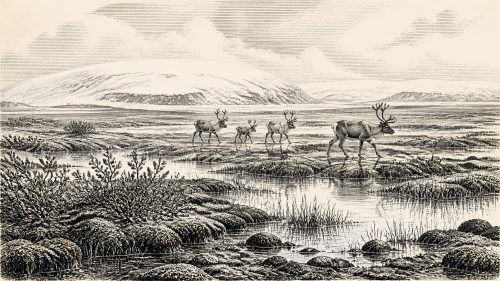
About 31,862 BCE, Ireland lay within the volatile MIS 3 phase of the Late Pleistocene, before the Last Glacial Maximum. Derryvree sediments in Fermanagh indicate an ice-free but severe tundra wetland, supporting mosses, insects and freshwater life between roughly 36,900 and 31,700 years ago. Castlepook Cave in Cork preserves bones of mammoth, reindeer, giant deer, hyaena and other cold-adapted animals, although its deposits span millennia and do not represent one community. A possibly cut-marked reindeer bone suggests brief human activity, not settlement. Ireland was a changing landscape of wetlands, grazing animals, predators, caves and fluctuating ice during this remote period.
Dateline
The label 31,862 BCE is useful only as a modern point of reference. No community in prehistoric Ireland marked years in a calendar, and archaeology cannot resolve an event to this particular year. In calendar terms it lies about 33,800 years before 1950, within the Late Pleistocene and Marine Isotope Stage 3 (MIS 3), an unsettled interval of the last Ice Age. The responsible history of this moment is therefore a history of dated ranges, deposits and probabilities rather than named individuals or single-year happenings.
For Ireland, the best evidence comes from two rather different archives. In north County Fermanagh, freshwater sediments at Derryvree near Maguiresbridge record an ice-free, treeless landscape within a broad calibrated range of about 36,900–31,700 years before present. In north County Cork, Castlepook Cave near Doneraile preserves the island’s richest known collection of middle-to-late Ice Age animal remains. Neither archive is a diary of 31,862 BCE. Together, however, they show what parts of Ireland could have been like around the notional date: cold, open, ecologically varied in places, and subject to dramatic environmental change.
A Moving Ice-Age Landscape
This was long before the Last Glacial Maximum, when the British–Irish Ice Sheet reached its greatest known extent, broadly around 27,000–23,000 years ago. Around 33,800 years ago, ice did not simply cover all of Ireland in one uniform mass. The extent, thickness and timing of ice changed across the island and through time. Geological evidence indicates that north-central Ireland was ice-free until at least roughly 34,000 years ago, while other evidence points to glacier growth and fluctuating ice margins in the wider Irish and British region. That distinction matters: an ice-free district was not a mild refuge, but a severe periglacial environment beyond or between advancing ice.
Sea level was much lower than today because vast quantities of water were stored in continental ice sheets. Ireland’s coastlines were correspondingly far from their modern positions, and the Irish Sea and Celtic Sea landscapes were altered by exposed shelves, channels, ice and shifting shorelines. It would be careless, however, to draw a single assured route across a dry “land bridge”. The practical connections among Ireland, Britain and continental Europe depended on local topography, sea level and glacier position, all of which varied. Animals certainly reached Ireland during this part of the Ice Age; exactly how, and at which moments, remains a question for reconstruction rather than certainty.
MIS 3 was not a single climate. Greenland ice-core records and Irish cave deposits indicate abrupt millennial-scale swings between relatively milder interstadial episodes and colder stadials. Calcite formations in Crag Cave, County Kerry, grew episodically during favourable intervals and ceased during colder conditions, providing an important regional signal of these changes. Thus a date around 31,862 BCE should not be imagined as a fixed climate regime. It falls within a long, volatile sequence in which vegetation, animal ranges, watercourses and the limits of ice could shift substantially over generations.
Derryvree’s Open Tundra
Derryvree is especially valuable because road works exposed organic-rich freshwater silts and fine sands between two thick layers of glacial till. The deposits were later buried by ice-derived material, but their mosses, plant remains and insects preserve a glimpse of conditions during an earlier ice-free interval. A conventional radiocarbon determination of about 30,500 radiocarbon years before present has been calibrated in published discussion to approximately 36,900–31,700 calendar years before present. The range overlaps the modern calendar label used here, but cannot identify one precise year within it.
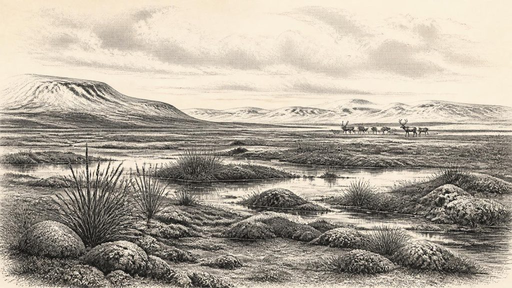
The evidence indicates a full-glacial, open tundra or muskeg environment: wet ground, shallow pools, plant-rich muds and mossy vegetation rather than closed forest. Insect remains are particularly informative because many species have narrow environmental tolerances. They support an interpretation of cold conditions with severe winters, yet also of freshwater habitats able to sustain vegetation and invertebrate life during the growing season. This was not an empty white wilderness. It was a patchwork of marsh, sedge- and moss-rich ground, exposed mineral soil and water, shaped by frost, runoff and the proximity of ice.
Such evidence cannot be extended mechanically to every district of Ireland. Derryvree describes one local basin in what is now County Fermanagh, not the entire island. Nevertheless, it offers a better-founded picture of everyday ecological conditions than later romantic images of an unbroken frozen land. Plants, insects and small animals could occupy productive microhabitats even where the wider climate was harsh. Larger herbivores and their predators, in turn, could exploit suitable corridors and seasonal grazing country.
Castlepook’s Animal Archive
Castlepook Cave provides the clearest evidence for the larger animals of Ice-Age Ireland. The limestone maze cave contains more than 2,000 recovered bones and has yielded woolly mammoth, giant deer, reindeer, brown bear and spotted hyaena, as well as Arctic fox, wolf, mountain hare, Norwegian lemming and collared lemming. The assemblage demonstrates that animals now associated with very different modern environments could overlap in prehistoric Ireland during separate phases of the Pleistocene.
It must not be treated as a photograph of one herd or one season. Individual bones from Castlepook have produced dates spread broadly from about 45,700 to 19,950 years before present. The cave acted as a repository over a very long period. Water movement, carnivore activity, antiquarian excavation and disturbed sediment have complicated the original positions of many finds. Recent re-dating has also shown that some older radiocarbon determinations from Castlepook were substantially too young because earlier methods of bone preparation were less effective at removing contamination. The scientific lesson is plain: species lists establish presence, but they do not automatically prove that every listed species lived together or that all bones were deposited by the same process.
Even so, the older part of the Castlepook record makes an open, cold-adapted animal world credible for southern Ireland around the broader period. Reindeer point to extensive grazing landscapes; lemmings and Arctic fox reinforce the case for cold conditions. Mammoth and giant deer reveal that sizeable herbivores reached the island during MIS 3. Spotted hyaena is especially striking. Castlepook is Ireland’s principal evidence for the species, and its presence helps explain why a cave might contain accumulated large-animal bones: carnivores can carry in prey remains, scavenge carcasses and repeatedly use sheltered places. A mammoth bone is therefore evidence of mammoth, not proof that people hunted mammoth there.
People: A Possibility, Not a Population
No settlement, hearth, house floor, tool-making site, burial or securely associated stone-tool assemblage is known from Ireland for 31,862 BCE. There are no grounds for describing a settled population, a language, an ethnic identity, a tribe or a political territory. Terms such as Gaelic, Celtic and Irish in their later cultural senses have no place in this period. There were no states, kings, churches, written laws, diplomatic missions or recorded conflicts on the island.
The most tantalising relevant claim is a reindeer femur from Castlepook reported to bear a cut mark consistent with the use of a sharp stone tool during butchery. The bone has been presented by its researchers and County Cork heritage publications as possible evidence of human activity roughly 33,000 years ago. If that interpretation and dating are sustained, it would push human presence in Ireland far back into the Upper Palaeolithic. Yet one modified bone would demonstrate only a brief encounter or visit, not colonisation. It cannot tell us how many people were involved, where they came from, how long they stayed, whether they returned, or what tools and social traditions they carried.
This uncertainty should be treated as historically significant, not as a defect to be concealed. The evidence permits a restrained scenario: mobile hunter-gatherers may have entered parts of Ireland during an ice-free phase and processed at least one animal. It does not permit a narrative of villages, regular trade, hunting territories or enduring occupation. The possibility is compelling precisely because the surviving trace is so slight.
Life Without Institutions
If people did reach Ireland in this period, their economy would have depended on immediate knowledge of animals, weather, fuel, shelter and routes through a demanding landscape. Hunting, scavenging and the careful processing of carcasses are plausible activities; farming, herding, metalworking, pottery and permanent monument building are not. Any possessions were likely perishable or portable, while later glaciation has removed or buried much of the contemporary land surface on which camps might once have stood.
There is likewise no direct evidence for religion, art, formal learning or exchange networks within Ireland at this date. It is reasonable to say that Upper Palaeolithic groups elsewhere in Europe possessed complex skills, social ties and symbolic practices, but it would be an interpretation, not Irish evidence, to assign comparable practices to an undocumented Irish visit. Nor can the movements of mammoth, reindeer or hyaena be converted into proof of human trade routes. Faunal dispersal shows ecological connectivity, not human diplomacy.
What This Date Can Mean
31,862 BCE therefore belongs to Ireland’s deep environmental history before its documented human history. Derryvree shows that tundra wetlands and freshwater life existed in an ice-free Fermanagh interval overlapping this broad time. Castlepook shows that a remarkable Pleistocene fauna entered southern Ireland over a long span, and it preserves a debated but potentially momentous sign of butchery. Ice-sheet research places both archives within a changing pre-maximum landscape rather than a static frozen island.
The most accurate conclusion is modest but vivid. Around this modern calendar marker, Ireland was not yet a country of communities known by name. It was a changing northern landscape of cold wetlands, grazing animals, predators, caves and advancing ice. Its history survives in silt, bone, calcite and calibrated probabilities. Those fragmentary records do not yield a year-by-year chronicle; they make it possible, with care, to recover the conditions from which Ireland’s much later human story eventually emerged.
Primary Sources
- A reconsideration of the radiocarbon dating of the Marine Isotope Stage 3 fauna from southern Ireland
- The Irish Quaternary Fauna Project
- A Middle Midlandian Freshwater Series at Derryvree, Maguiresbridge, County Fermanagh, Northern Ireland
- Middle Midlandian Interstadial Deposits at Greenagho, Near Belcoo, County Fermanagh, Northern Ireland
- Castlepook Cave: Cork County Geological Site Report
- Heritage Artefacts of County Cork
- Archaeological Heritage of County Cork
- Episodic speleothem deposition tracks the terrestrial impact of millennial-scale last glacial climate variability in SW Ireland
- Growth and retreat of the last British–Irish Ice Sheet, 31,000 to 15,000 years ago: the BRITICE-CHRONO reconstruction
- Trimlines, blockfields and the vertical extent of the last ice sheet in southern Ireland
- Late Pleistocene chronostratigraphy and ice sheet limits, southern Ireland
- The timing and magnitude of the British–Irish Ice Sheet between Marine Isotope Stages 5d and 2: implications for glacio-isostatic adjustment, high relative sea levels and ‘giant erratic’ emplacement
- New insights on the fauna of Ireland's Younger Dryas and Early Holocene from Alice & Gwendoline Cave
- Quaternary Site Descriptions
- The Subdivision of the Quaternary Period in Ireland
- Castlepook Cave, Castlepook South, Cork: Excavation Report 2022
- Areas of Scientific Interest in County Cork
- The IntCal20 Northern Hemisphere Radiocarbon Age Calibration Curve (0–55 cal kBP)
- The IntCal20 Approach to Radiocarbon Calibration Curve Construction: A New Methodology Using Bayesian Splines and Errors-in-Variables
- New Data for the Last Glacial Maximum in Great Britain and Ireland
- Pattern and Timing of Retreat of the Last British-Irish Ice Sheet
- Dimensions and Chronology of the Last Ice Sheet in Western Ireland
- Timing and Pace of Ice-Sheet Withdrawal Across the Marine–Terrestrial Transition West of Ireland During the Last Glaciation
- Advance and Retreat of the Marine-Terminating Irish Sea Ice Stream into the Celtic Sea During the Last Glacial: Timing and Maximum Extent