Derryvree’s Muskeg Window31805 BCE
31,805 BCE is a modern label within late Marine Isotope Stage 3, not a date for recoverable Irish events. Ireland experienced unstable glacial conditions, with ice-free areas varying regionally before later ice reshaped evidence. Derryvree’s freshwater sediments, preserved between tills, reveal cold, treeless tundra-like wetlands supporting insects and pools. Southern caves preserve fauna including mammoth, reindeer, giant deer, bear and hyaena, indicating open habitats but complex depositional histories. A possibly cut-marked reindeer bone from Castlepook raises prospects of transient Upper Palaeolithic visitors, yet no settlement or secure human occupation is known. These fragmentary archives demonstrate environmental change, not social history.
Dateline
31,805 BCE is a modern chronological label, not a recoverable Irish year. No calendar, inscription, settlement sequence or environmental archive can tell us what happened in Ireland in that particular twelve-month span. Converted approximately into the archaeological convention of years before AD 1950, it falls around 33,750 calibrated years before present (cal BP). The appropriate setting is the later part of Marine Isotope Stage 3 (MIS 3), a climatically unstable interval of the Late Pleistocene. Evidence can illuminate broad ranges of centuries or millennia around this point; it cannot support an invented event, named leader or exact seasonal narrative.
A Landscape in Transition
Ireland at this depth of time was not a country in the later political or cultural sense. There were no known kingdoms, borders, diplomatic relations, institutions or communities whose affairs can be reconstructed. Nor is there evidence for farming, permanent villages, trade networks, formal religious monuments, literacy or artistic traditions in Ireland at c. 33,750 cal BP. The historical subject is therefore a changing physical landscape, its animal life and the difficult question of whether people ever entered it during this early phase of the last glacial cycle.
The island lay on Europe’s north-western fringe, exposed to major shifts in temperature, precipitation, sea level and ice extent. The British–Irish Ice Sheet was growing, but its development was neither simple nor simultaneous across all regions. Modern reconstructions show rapid expansion in the wider British–Irish system from about 32,000–31,000 years ago, while its greatest total volume came later, around 23,000 years ago. Around the notional date represented by 31,805 BCE, some parts of Ireland may still have contained ice-free or seasonally ice-free ground, while other areas were increasingly affected by glacier growth and severe periglacial conditions.
This distinction matters. It would be misleading to picture the whole island either as a continuous white ice cap or as a hospitable open plain. Ice sheets and their margins moved; local topography, elevation, coastal exposure and changing climate produced contrasting environments. Much of the evidence that might once have recorded those environments was subsequently scraped away, buried or redeposited by later glaciation. What survives is necessarily patchy: cave deposits, bones, sediments protected beneath till, and mineral formations in caves.
Freshwater Beneath the Drumlins
The most revealing Irish environmental archive relevant to this broad interval is at Derryvree, near Maguiresbridge in County Fermanagh. Roadworks exposed organic freshwater silts and fine sands sandwiched between two glacial tills. The deposit was laid down during an earlier non-glacial interval and then sealed below a later ice deposit, preserving a rare fragment of an older landscape that would otherwise have been lost.
A radiocarbon determination from Derryvree, 30,500 ± 1,170 radiocarbon years BP, does not translate directly into a single calendar date. When calibrated, it corresponds to a broad range commonly cited at roughly 36,900–31,700 cal BP. The notional date of 31,805 BCE falls near the younger end of that window, but this does not mean the Derryvree deposit records that particular year. Sediments accumulated over time, and the age range expresses both the nature of radiocarbon dating and the uncertainty inherent in such ancient material.
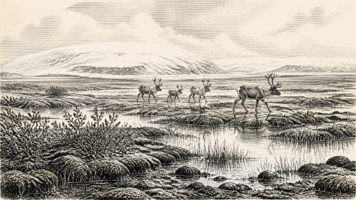
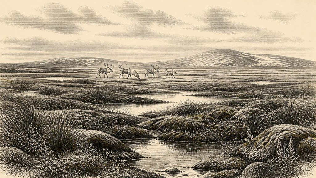
Its biological remains indicate an open, cold and treeless environment. Pollen, plant macrofossils, mosses and insects point towards tundra-like or muskeg conditions: wet ground, sedges, herbs, grasses, mossy vegetation and pools or slow-moving freshwater. Plant evidence includes taxa suited to cold and exposed settings, rather than familiar Irish woodland. The implication is not a lifeless frozen desert. During favourable summer months, wet hollows and watersides could be biologically productive, though the wider landscape endured long winters, frozen ground and a short growing season.
Derryvree must not be stretched into a complete portrait of Ireland. It describes one Fermanagh basin, not every coastal lowland, upland valley or southern limestone district. Yet it decisively complicates the popular image of an Ice Age Ireland as uniformly entombed beneath ice. At least during the broader interval represented by the deposit, a freshwater habitat and an open plant community existed in north-central Ireland before later glacier ice sealed its traces away.
Caves and Cold-Stage Animals
In southern Ireland, caves provide another incomplete but important line of evidence. Castlepook Cave, near Doneraile in north County Cork, has yielded an exceptional assemblage of Late Pleistocene animal remains. Mammoth, reindeer, giant deer, brown bear and spotted hyaena are among the species associated with the wider Irish cave record, with Castlepook especially significant for cold-stage fauna. Such animals did not necessarily coexist in one moment, nor do their bones prove the precise composition of one local herd. Cave deposits can be disturbed by scavengers, water, collapse and early excavation, and individual bones can have markedly different ages.
Nevertheless, revised accelerator radiocarbon dating has strengthened the conclusion that important parts of the Castlepook, Shandon and Foley Cave faunas belong to MIS 3. Earlier radiocarbon determinations were sometimes too young because older methods and pretreatments were more vulnerable to contamination. The reassessment places some Irish mammal evidence substantially further back in time and suggests that species including giant deer and spotted hyaena had disappeared locally before the Last Glacial Maximum. This is a reminder that Ireland’s Pleistocene fauna changed repeatedly before the great ice advance reached its later maximum.
The animals themselves suggest an open landscape offering forage and carrion, not closed forest. Reindeer were adapted to cold, seasonal country; mammoths and giant deer signal extensive herbivore habitat; and spotted hyaenas indicate a large-carnivore presence capable of transporting and modifying bones. Their remains are evidence of animal lives and natural processes, not automatically of human hunting. A cave can be a den, a trap, a place where floodwater collects remains, or a mixture of all three over thousands of years.
The Human Question
One Castlepook find has given this period unusual importance. A reindeer femur has been publicly presented as bearing a mark consistent with cutting by a sharp stone tool, and the bone has been reported as roughly 33,000 years old. If that interpretation is sustained by continuing research, it may indicate that one or more Upper Palaeolithic people processed a reindeer in Ireland during MIS 3—many millennia earlier than the formerly accepted evidence for human presence.
That possibility must be stated cautiously. A single modified bone is not a settlement. No securely associated hearth, stone-tool assemblage, dwelling floor, burial, human bone, artwork or occupation layer of comparable antiquity has yet established a resident human population in Ireland around 31,805 BCE. Natural abrasion, trampling, carnivore damage and excavation history can complicate the identification of marks on ancient bone. Recent excavations at Castlepook are therefore important not because they confirm a dramatic story already known, but because they seek stratified evidence that can test it.
The responsible conclusion is that a brief human visit is possible, rather than that Ireland was certainly inhabited. If people did arrive, they may have followed mobile game across a landscape whose shorelines were unlike those of today, when lower global sea levels exposed far more of the continental shelf. But routes, water crossings and the extent of any land connection remain uncertain. It is equally possible that the relevant activity was fleeting: a small hunting party, a single carcass-processing episode, or an event not yet represented by a recognisable archaeological site.
Life Without a Social Record
There is no direct Irish evidence from this period for households, kin groups, gender roles, language, ritual practice or systems of authority. Any detailed account of clothing, shelters, weapons or belief would be imported from better-preserved Upper Palaeolithic sites elsewhere in Europe, not recovered from Ireland itself. Comparisons can suggest what was possible for cold-climate hunter-gatherers, but they must not be mistaken for observations of Irish daily life.
For the same reason, there is no demonstrated Irish economy or trade in the usual historical sense. Wild animals and local plant resources were the potential basis for subsistence in any temporary human presence, while stone suitable for cutting tools would have been a practical resource. Yet no dated lithic assemblage links these possibilities to a community on the island at this time. There is also no evidence for conflict, diplomacy or political control. The strongest story is ecological: animal movements, watery ground, open vegetation, advancing ice and perhaps transient human contact.
An Archive of Limits
The importance of Ireland around 31,805 BCE lies partly in the limits of the record. Derryvree preserves a cold freshwater world beneath later till. Castlepook preserves animals whose bones survived cave processes and antiquarian excavation. Crag Cave in County Kerry preserves speleothems whose episodic growth shows that liquid water could enter caves during ameliorated phases of the last glacial. Together, these records demonstrate environmental fluctuation rather than a single, uniform “Ice Age”.
They also show why cautious language is a strength, not an evasion. Around this date, Ireland was approaching a profound transformation as the British–Irish Ice Sheet expanded and later reshaped much of the land. The evidence securely supports a severe, open and changing Late Pleistocene environment with varied animal life and local freshwater habitats. It raises, but does not yet settle, the prospect of very early people. That small but significant distinction is the most accurate year-by-year account possible for Ireland at this remote point in time.
Primary Sources
- A Middle Midlandian Freshwater Series at Derryvree, Maguiresbridge, County Fermanagh, Northern Ireland
- Irish Pleistocene Biostratigraphy
- The Irish Quaternary Fauna Project
- A Reconsideration of the Radiocarbon Dating of the Marine Isotope Stage 3 Fauna from Southern Ireland
- Growth and Retreat of the Last British–Irish Ice Sheet, 31,000 to 15,000 Years Ago: The BRITICE-CHRONO Reconstruction
- Dimensions and Chronology of the Last Ice Sheet in Western Ireland
- Oscillating Retreat of the Last British-Irish Ice Sheet on the Continental Shelf Offshore Galway Bay, Western Ireland
- Episodic Speleothem Deposition Tracks the Terrestrial Impact of Millennial-Scale Last Glacial Climate Variability in SW Ireland
- Spatio-Temporal Dynamics of Speleothem Growth and Glaciation in the British Isles
- The Colonization of Ireland: A Human Ecology Perspective
- The IntCal20 Northern Hemisphere Radiocarbon Age Calibration Curve (0–55 cal kBP)
- IntCal Publications
- IntCal History
- First Evidence of a Late Upper Palaeolithic Human Presence in Ireland
- New Insights on the Fauna of Ireland’s Younger Dryas and Early Holocene from Alice & Gwendoline Cave
- 2022:564 – Castlepook Cave, Castlepook South, Cork
- Heritage Artefacts of County Cork
- Ireland’s Palaeolithic Archaeology – Fleeting Footprints in a Frozen Land
- Quaternary Geological Mapping
- Geological Mapping Programme