
Aghnadarragh’s Treeless Plain31703 BCE
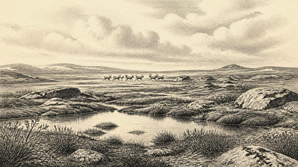
Around 31,703 BCE, Ireland lay within the climatically unstable Late Pleistocene, as ice expanded before its later maximum. Later glaciation destroyed much evidence, but northern buried sediments preserve pollen, plants and beetles indicating treeless, cold grass-sedge tundra, wet hollows and Arctic-like conditions. Southern caves contain reindeer, giant deer, mammoth, bears, wolves and hyaenas, demonstrating changing habitats and animal movement. A cut-marked Castlepook reindeer bone may suggest transient human activity, but cannot prove settlement or occupation. Shifting seas and ice complicated access to Ireland. No evidence supports societies, trade or institutions. This period is understood through fragmentary deposits and radiocarbon ranges.
Dateline
The label 31,703 BCE gives a seductive impression of precision. It should not be read as the date of a recorded occurrence in Ireland: no settlement, journey, battle, ruler or ritual can be assigned to that calendar year. In archaeological terms it lies roughly 33,650 years before the conventional radiocarbon “present” of AD 1950, during the Late Pleistocene and Marine Isotope Stage 3 (MIS 3). For this depth of time, evidence is dated in radiocarbon years and calibrated ranges, not annual anniversaries. The responsible question is therefore what the surviving evidence can say about Ireland in the broad millennia around this point, and where its limits lie.
A Landscape Before the Ice Peak
This was an age of pronounced climatic instability, long before the last Irish ice sheet reached its fullest extent. A widely used reconstruction places the major build-up of the British–Irish Ice Sheet after about 35,000–32,000 years ago, with maximum ice extent later, broadly between 27,000 and 21,000 years ago. That framework does not mean that every part of Ireland followed one timetable. Ice masses, margins, rivers, lakes and coastal environments altered at different times in different regions. Around the modern calendar label of 31,703 BCE, Ireland was entering a colder phase in which glaciation was becoming increasingly important, but its precise local reach remains debated.
Much of the physical evidence has itself been damaged by later ice. Glaciers eroded older soils, redistributed sediments and buried fragments of former ground surfaces beneath till. The island’s Pleistocene archive is consequently uneven. It survives most clearly in protected or accidental repositories: caves in the limestone country of Cork and Waterford, organic beds trapped beneath later glacial deposits in Fermanagh and Antrim, and scattered bones recovered from old excavations. These sources illuminate episodes rather than offer a continuous national picture. They are enough to show a changing cold-country environment; they are not enough to draw a precise map of Ireland in one nominal year.
Cold Ground in Ulster
The most direct environmental clues come from buried sediments in the north. At Aghnadarragh, Hollymount, Greenagho and Derryvree, deposits enclosed between till sheets have preserved pollen, plant remains and beetles from parts of the Midlandian glaciation. Their individual dates and correlations are complicated, and they should not simply be treated as a diary for 31,703 BCE. Taken together, however, they establish that intervals of open, cold terrain existed in northern Ireland during MIS 3 before later ice covered or reworked the landscape.
Pollen from the older Fermanagh and Antrim sequences points towards sparse vegetation dominated by grasses and sedges, with dwarf birch, heaths, crowberry, willow, herbs and clubmosses. Insects from Aghnadarragh include species now characteristic of Arctic Fennoscandia, supporting the interpretation of exposed ground with little sheltering woodland. Reconstructions based on those beetles suggest cool summers and very cold winters, though such figures describe the deposit’s climatic setting rather than a measurement for all Ireland. At Derryvree, younger organic muds indicate treeless tundra or muskeg: wet, mossy ground with pools, sedges, juniper and herbaceous plants.
These records correct a common mental picture of an Ireland that was either entirely ice-covered or uniformly empty. Parts of the land could support vegetation, freshwater habitats and grazing animals during favourable intervals, even while the wider climate was severe and ice was advancing elsewhere. Open country did not mean an easy landscape. Seasonal snow, frozen ground, powerful winds, shallow soils and abrupt climatic shifts would have constrained plants and animals alike. The evidence supports mosaic environments, not a stable northern wilderness of the modern kind.
Caves and the Animal Record
Southern cave collections provide the clearest indication that mammals reached Ireland before the Last Glacial Maximum. Castlepook Cave near Doneraile in County Cork is especially important, alongside Foley Cave in Cork and Shandon and Ballynamintra in County Waterford. Reassessment of their animal bones has identified a cold-stage fauna that included reindeer, giant deer, brown bear, wolf, fox, hare, spotted hyaena and, in the wider cave record, woolly mammoth. These were not necessarily animals living together at one moment, nor proof that every species occupied every county. Each directly dated bone records the death of one animal, while cave accumulation may span many centuries or millennia.
Nevertheless, the fauna has large historical significance. Reindeer and mammoth point to open habitats and connections with the wider north-west European world. Giant deer required substantial forage, while predators and scavengers such as wolves and spotted hyaenas reveal functioning food webs rather than isolated animal arrivals. Caves may have served as dens, shelters, traps or places where bones accumulated after scavenging and water movement. They were not automatically human camps. A concentration of bones is evidence of animal history and geological process before it is evidence of settlement.
Chronology has changed markedly as dating techniques have improved. The Irish Quaternary Fauna Project showed that many mammals had reached Ireland during the broad interval from at least about 45,000 to 20,000 radiocarbon years ago. More recent work using improved collagen pretreatment and ultrafiltration redated several Castlepook specimens substantially older than measurements obtained in the 1990s. This matters greatly at the edge of radiocarbon’s useful range. A radiocarbon result is not a calendar date; calibration against changing atmospheric carbon-14 levels produces a probability range, often broad at this antiquity. Modern calendar precision is therefore unavailable.
The Castlepook Human Question
One Castlepook reindeer femur has attracted exceptional attention because a deep incision has been interpreted by zooarchaeologist Ruth Carden as consistent with cutting by a sharp stone tool during carcass processing. The bone has been reported as dating to roughly 33,000 radiocarbon years before present. If both the identification of the mark and its association with the animal’s death were confirmed, it could indicate a very early, brief human visit to Ireland during MIS 3. It would be a striking revision to the long-standing view that secure evidence for people on the island belongs much later in the Late Pleistocene and early Holocene.
The claim must remain carefully bounded. The femur came from an historic cave collection rather than a newly excavated, securely stratified occupation floor. Its date establishes the age of the animal’s death within statistical uncertainty, not the exact moment when a mark was made, the place where it was killed, or the duration of any human presence. Natural abrasion, carnivore activity and breakage can complicate the interpretation of marks on old bone. No associated hearth, stone-tool assemblage, dwelling surface, human remains or repeated sequence of occupation securely demonstrates a community in Ireland around 31,703 BCE.
Accordingly, it would be wrong to populate this year with a named hunting band, a camp beside the Awbeg, or a routine of reindeer butchery. At most, the Castlepook specimen supports a carefully framed possibility of transient human activity in the broad period. It does not demonstrate permanent settlement, population continuity or a society with institutions that archaeology can identify. The distinction is important: the animal record is substantial, while the claimed human evidence remains singular and under scrutiny.
Connections Without a Known Society
Lower global sea levels altered the geography of the Irish Sea region, but a simple land-bridge story is not supported. Geological studies stress that insularity depended on shifting combinations of sea level, crustal movement, ice distribution and local topography. Any possible connections were short-lived and geographically complex. The presence of mammals proves that movement into Ireland occurred at various points in the Pleistocene; it does not reveal a single route, nor establish a dry, permanent corridor available in the year under discussion. Animals and, potentially, people may have moved through landscapes now drowned, eroded or sealed below later deposits.
This is as far as political and economic history can responsibly go. There is no evidence for polities, diplomacy, warfare, trade networks, farming, seafaring, built settlements, language, religion or art in Ireland at this date. Nor can social roles, learning or domestic routines be recovered from the known Irish record. If people did reach the island, comparable Upper Palaeolithic societies elsewhere in Europe were mobile hunter-gatherers using sophisticated stone, bone and organic technologies; that comparison supplies context, not evidence that such practices occurred in Ireland. Irish evidence must not be filled with borrowed continental detail.
What This Date Can Mean
Ireland around the broad horizon represented by 31,703 BCE was a place of ecological opportunity and risk on the north-western edge of Europe. Treeless grass-sedge landscapes, wet mossy hollows and pools are supported by pollen and insect records in the north. Caves in the south preserve tangible traces of large herbivores and carnivores that crossed changing regional landscapes. Growing ice, severe cold and later glacial erosion shaped both the lives that were possible and the fragmentary record left behind.
The most important fact is not an invented event but an evidential transformation. Ireland was not merely a blank interval before the last ice maximum: its sediments and cave bones show episodes of living tundra, animal movement and ecological change during MIS 3. Yet the archive is patchy, dates are ranges, and the human question is unresolved. The honest history of this nominal year is therefore one of deep time measured through calibrated probabilities, buried muds and carefully re-examined bones—not a calendar page on which a particular Irish event can be written.
Primary Sources
- A reconsideration of the radiocarbon dating of the Marine Isotope Stage 3 fauna from southern Ireland
- The Irish Quaternary Fauna Project
- New insights on the fauna of Ireland's Younger Dryas and Early Holocene from Alice & Gwendoline Cave
- New insights on the fauna of Ireland’s Younger Dryas and Early Holocene from Alice & Gwendoline Cave
- Extent and timing of the Last Glacial Maximum (LGM) in Britain and Ireland: a review
- Last Glacial Maximum cirque glaciation in Ireland and implications for reconstructions of the Irish Ice Sheet
- Early deglaciation of the British-Irish Ice Sheet on the Atlantic shelf northwest of Ireland driven by abridging ice stream retreat
- Dimensions and chronology of the last ice sheet in Western Ireland
- The problem of a late quaternary landbridge between Britain and Ireland
- Deglaciation, Earth crustal behaviour and sea-level changes in the determination of insularity: A perspective from Ireland
- The IntCal20 Northern Hemisphere Radiocarbon Age Calibration Curve (0–55 cal kBP)
- The IntCal20 Northern Hemisphere radiocarbon age calibration curve (0–55 cal kBP)
- Quaternary
- Geology of Ireland
- The subdivision of the Quaternary Period in Ireland
- Landscapes and environments of the last glacial-interglacial transition: a time of amazingly rapid change in Ireland
- The Dungarvan Valley Caves Project: Second interim report
- The Mesolithic in Ireland: when was it?
- Advice to the Public: Caves
- Archaeological excavations at Killuragh Cave, Co. Limerick: a persistent place in the landscape from the Early Mesolithic to the Late Bronze Age
