Maguirebridge’s Arctic Silts31864 BCE
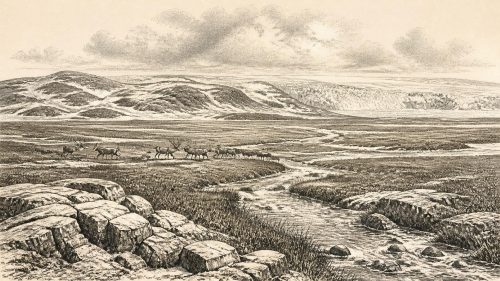
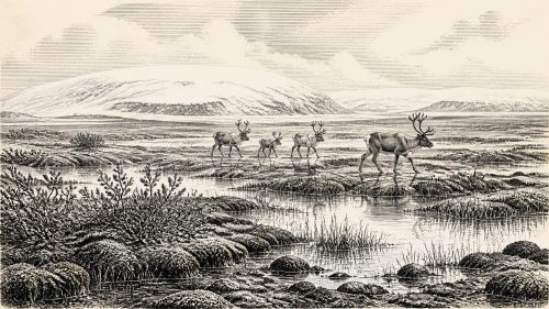
At the notional date of 31,864 BCE, Ireland lay in the unstable MIS 3 phase before the Last Glacial Maximum, not beneath uniform ice. Lower seas altered coasts, while glaciers advanced unevenly. Derryvree deposits near Maguiresbridge preserve evidence of open, treeless tundra, wet hollows and severe periglacial conditions; other records show intermittent climatic amelioration. Castlepook Cave documents diverse cold-adapted fauna, including mammoth, reindeer, giant deer and hyaena, accumulated over extended periods. A cut-mark-like incision on a dated reindeer bone may indicate Upper Palaeolithic visitors, but disturbed contexts preclude certainty. No contemporary settlement exists; later glaciation and early excavation obscured traces.

Dateline
“31,864 BCE” is a modern filing point, not a date that can be recovered from Irish evidence with calendar-year precision. In archaeological terms it corresponds very roughly to 33.8 thousand years before 1950, within the Late Pleistocene and Marine Isotope Stage 3 (MIS 3), a climatically unstable part of the last Ice Age. Radiocarbon results from so far back must be calibrated and are expressed as probability ranges, not as an anniversary. The closest substantial Irish environmental sequence, the freshwater deposits at Derryvree near Maguiresbridge in County Fermanagh, has been associated with calibrated ages of about 36.9–31.7 thousand years ago. It can illuminate conditions around this notional year, but cannot describe one particular season, community or event.
An Island Before the Ice Peak
This was Ireland before the Last Glacial Maximum, not Ireland at the maximum. The great British–Irish Ice Sheet would later expand over almost the entire island and its surrounding shelf, but reconstructions indicate a rapidly changing situation during the preceding millennia. A major synthesis of ice-sheet growth places the combined British–Irish Ice Sheet’s pronounced expansion at around 30,000 years ago, with further Irish growth by 29,000 years ago. That chronology makes it unsafe to imagine a single blanket of ice covering every part of Ireland at c. 33.8 thousand years ago. Equally, it would be wrong to picture a mild, wooded island: cold conditions, advancing glaciers and highly variable regional environments were already defining the future landscape.
Sea level was lower than today because vast quantities of water were stored in northern ice sheets. Modelled relative sea level at 31,000 years ago lay roughly 50–100 metres below the modern level across the wider British–Irish region, exposing areas now beneath the sea. The outline of Ireland was therefore different, and journeys between landmasses may have involved wider lowlands, changing channels, coasts or ice margins rather than the familiar Irish Sea. Yet lower sea level does not itself prove an easy, continuous walking route from continental Europe to Ireland at this earlier date. The routes available to animals and people depended on local topography, marine inundation and ice, all of which changed through time.
Derryvree’s Cold Landscape
The Derryvree evidence is especially valuable because organic silts and fine sands survived between two later sheets of glacial till. Their plant and animal remains indicate open tundra vegetation under a periglacial climate. Moss macrofossils and poorly preserved herb pollen suggest a sparse, treeless world rather than forest: vegetation able to endure cold, wind, short growing seasons and disturbed ground. This is direct evidence from south Fermanagh, not a map of every Irish county. Nevertheless, it provides the most responsible local comparison for the numbered year. It points to a landscape of exposed ground, wet hollows and freshwater sediments, with seasonal contrasts far more severe than those of modern Ireland.
Other Irish records reinforce the broader picture of instability rather than uniformity. Speleothems in Crag Cave, County Kerry, grew only during episodes when cave-water chemistry permitted it; researchers interpret repeated phases of growth during MIS 3 as evidence for climatic ameliorations interrupting colder conditions. Organic deposits at Greenagho and Derryvree likewise show that ice-free or non-glacial intervals existed in parts of Ireland before subsequent ice advances. Such evidence does not allow a weather report for 31,864 BCE. It does show why a single label such as “the Ice Age” conceals a sequence of sharp shifts, in which habitats could open, contract or disappear within the lifespan of animal populations.
Castlepook and the Animal Evidence
The most evocative evidence comes from Castlepook Cave, also called Mammoth Cave, in the Awbeg Valley north of Doneraile, County Cork. Excavations undertaken in the early twentieth century recovered a remarkable Pleistocene assemblage, including woolly mammoth, reindeer, giant deer, brown bear, Arctic fox, hare, wolf, lemmings and spotted hyaena. The cave is Ireland’s outstanding record of this earlier Ice Age fauna. Its very richness, however, demands care. Bones accumulated in a cave used and disturbed by carnivores, water, sediment movement and antiquarian excavation; they are not a neat snapshot of animals standing together on one day, nor proof that every recorded species was contemporary.
Modern redating has made the Castlepook material more significant and more complicated. Improved pretreatment of bone collagen produced dates substantially older than some earlier determinations, placing parts of the southern Irish fauna securely in MIS 3. The revised work suggests that animals such as giant deer and spotted hyaena may have vanished locally before the later ice maximum. A reindeer metatarsal from Castlepook produced an uncalibrated radiocarbon age of 33,630 ± 790 BP in the Irish Quaternary Fauna Project, while other dated specimens demonstrate that the cave’s record spans a long interval. Around the article’s approximate horizon, then, reindeer and other cold-adapted mammals are firmly part of the evidence, but their exact local abundance, seasonal movements and ecological relationships remain unknown.
Spotted hyaena matters because it changes the scale of the landscape. Its bones and tooth-marked prey remains indicate that Ireland was not a biologically empty frozen outpost. Carnivores, large herbivores and small mammals had reached suitable terrain at different times. Hyaenas could transport and gnaw carcasses, explaining why cave bone collections cannot automatically be treated as hunting debris. Mammoth and giant deer also should not be converted into claims of regular human hunting: their presence records fauna, not a human economy. The responsible conclusion is that parts of Ireland supported complex cold-stage animal communities before ice expansion transformed or erased many of their habitats.
A Possible Human Trace
There is no securely excavated settlement, hearth, human skeleton, stone-tool assemblage or rock art from Ireland dated to c. 31,864 BCE. Consequently, there is no basis for identifying a people, language, political unit, religious practice or enduring population on the island. The reported importance of this horizon rests chiefly on a reindeer femur from the old Castlepook collection, dated to roughly 33,000 years ago and described as bearing an incision consistent with cutting by a sharp stone edge. If that interpretation is confirmed, it would show that a person or a small party processed an animal in Ireland during the Upper Palaeolithic—an extraordinary extension of the island’s human record.
But “if” is essential. The bone lacks a securely excavated human occupation context, and the cave deposits have been heavily disturbed. Recent Castlepook fieldwork has recovered Pleistocene fauna and investigated surviving sediments, but the project’s own reporting stresses that no stone or bone tool can yet be assigned with certainty to Pleistocene human activity there. The later, much stronger evidence for a human presence is a cut-marked brown-bear patella from Alice and Gwendoline Cave in County Clare, independently dated to 12,810–12,590 calibrated years BP—over twenty millennia after this article’s notional date. That later discovery demonstrates that people did reach Late Glacial Ireland; it cannot fill the earlier evidential gap.
Society Beyond Recovery
If people did visit Ireland at this time, the Castlepook incision permits only the narrowest inference: somebody may have used a sharp implement on animal tissue or hide. It does not establish a camp, a family group, a hunting strategy, a seasonal round or permanent residence. Nor is there evidence for farming, herding, pottery, trade goods, monuments, burial, formal diplomacy, organised warfare or institutions. “Economy” can therefore mean only the possible short-term procurement and processing of wild resources; “settlement” only the possibility of fleeting movement through a demanding environment. The ordinary realities of shelter, clothing, fire, kinship and knowledge were surely vital to any travellers, but they are not recoverable from Ireland’s present record.
This silence is historically meaningful. Later ice advance scoured landscapes, redeposited sediments and helped destroy the shallow traces from which archaeologists normally recognise Palaeolithic activity. Caves have preserved animal bone more readily than open-air camps, yet early excavators often removed deposits before modern recording methods existed. Museum collections, radiocarbon redating, microscopic study of surface marks, sediment DNA and carefully controlled new excavation are therefore central to the story. At 31,864 BCE, Ireland is best understood not as a nation with a recoverable annual history, but as a changing northern landscape on the threshold of severe glaciation—one inhabited certainly by Ice Age animals and perhaps, briefly and still controversially, visited by people.
Primary Sources
- A reconsideration of the radiocarbon dating of the Marine Isotope Stage 3 fauna from southern Ireland
- The Irish Quaternary Fauna Project
- The exploration of Castlepook Cave, Co. Cork. With 3 plates
- Castlepook Caves Project: Archaeology Research Excavation Grant 2022 Final Report
- 2022:564 – Castlepook Cave, Castlepook South, Cork
- New insights on the fauna of Ireland's Younger Dryas and Early Holocene from Alice & Gwendoline Cave
- First evidence of a Late Upper Palaeolithic human presence in Ireland
- Middle Midlandian Freshwater Series at Derryvree, Maguiresbridge, County Fermanagh, Northern Ireland
- Growth and retreat of the last British-Irish Ice Sheet, 31,000 to 15,000 years ago: the BRITICE-CHRONO reconstruction
- Maximum extent and dynamic behaviour of the last British-Irish Ice Sheet west of Ireland
- Stratigraphic and palaeo-geomorphological evidence for the glacial-deglacial history of the last British-Irish Ice Sheet in the north-western Irish Sea
- Advance and retreat of the marine-terminating Irish Sea Ice Stream into the Celtic Sea during the Last Glacial: Timing and maximum extent
- Ireland: Submerged Prehistoric Sites and Landscapes
- Quaternary deposits and glacial stratigraphy in Ireland
- Episodic speleothem deposition tracks the terrestrial impact of millennial-scale climate variability during Marine Isotope Stage 3
- Palaeoecology: Irish Quaternary Association Field Guide 16
- The IntCal20 Northern Hemisphere Radiocarbon Age Calibration Curve (0-55 cal kBP)
- Castlepook Caves
- Occurrence of mammalia relicts at site Castlepook Cave
- BRITICE Glacial Map, version 2: a map and GIS database of glacial landforms of the last British-Irish Ice Sheet
- The Archaeological Heritage of County Cork
- Ireland's Palaeolithic Archaeology – Fleeting Footprints in a Frozen Land