Ecological Patchwork31230 BCE
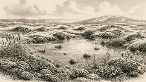
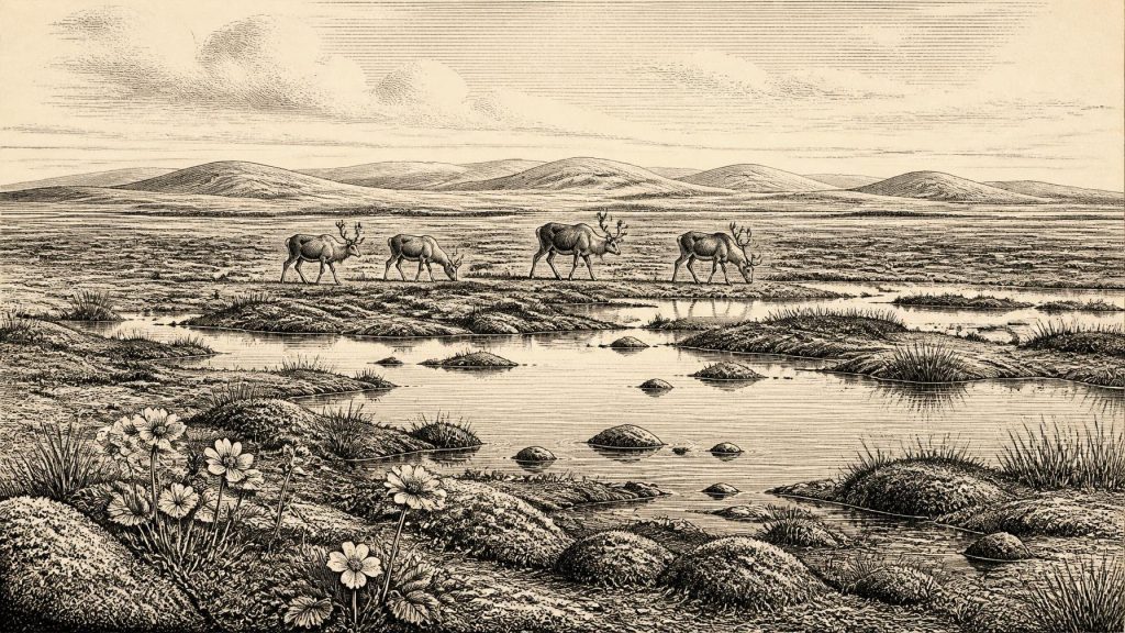
Circa 31,230 BCE, Ireland cannot be described through annual events or human history. At Derryvree near Maguiresbridge, Fermanagh, organic sediments between glacial tills, radiocarbon dated broadly to 36,900–31,700 calibrated BP, record an ice-free freshwater wetland during MIS 3. Plant and insect remains indicate cold, treeless, mossy tundra with pools, sedges, bogbean and mountain-avens. Elsewhere, deposits and cave calcite confirm varied conditions as ice advanced and retreated. Castlepook Cave fauna demonstrates Pleistocene mammals, although possible cut marks on reindeer provide only tentative evidence of people. The surviving record establishes ecological occupation, not human society, amid unstable ice, sea and land connections.
Dateline
Modern calendar-year precision is not available for Ireland in 31,230 BCE. The date is a retrospective label, roughly 33,180 calendar years before AD 1950, rather than a year that any contemporary person could have named or recorded. There are no annals, settlements, monuments or securely dated human occupations from which to construct an annual narrative. The responsible subject is instead a broad interval in the Late Pleistocene, within Marine Isotope Stage 3 (MIS 3), when Ireland’s climate, ice cover and animal populations changed repeatedly. Sediments, fossils, cave deposits and landforms can illuminate that world, but they reveal ranges and processes rather than a particular season, generation or event.
A Date Within a Wide Range
The closest chronological anchor is Derryvree, near Maguiresbridge in County Fermanagh. Roadworks in 1969 cut through a drumlin and exposed fine sands, freshwater silts and organic material enclosed between two substantial layers of till: the unsorted debris deposited by glacier ice. This sequence is valuable because its relative order is clear. Ice laid down the lower till; a period without local glacier cover allowed wetland and freshwater sediments to accumulate; then a later advance sealed them beneath the upper till.
An organic sample from the deposit, BIRM-166, produced a conventional radiocarbon age of 30,500 years BP, with a large uncertainty. Radiocarbon years are not calendar years: past atmospheric carbon-14 levels varied, so results must be calibrated against independently dated records. Modern calibration places the Derryvree material broadly at about 36,900–31,700 calibrated years BP, approximately 34,950–29,750 BCE. The nominal date of 31,230 BCE falls inside that extensive range. It cannot, however, be pinpointed to a particular sediment layer, nor does it identify the beginning or end of the wetland’s existence.
This is not merely a technical reservation. The uncertainty is the history. At this depth in time, an honest account must retain the distinction between what the deposits demonstrate and what archaeologists infer from them. Derryvree proves that an ice-free or at least locally ice-free freshwater environment existed at Maguiresbridge during part of late MIS 3. It does not prove that every part of Ireland shared the same conditions simultaneously, or that this particular modern calendar year saw a particular climatic turn.
Wet Ground Between Ice Advances
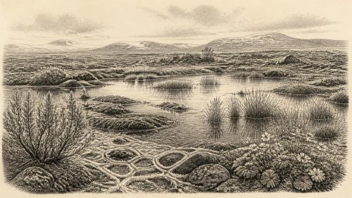
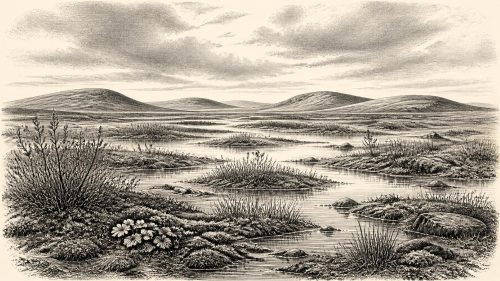
The plant and insect evidence from Derryvree gives the interval its distinctive character. The former drumlin hollow was not a familiar wooded Irish landscape. It was an open, treeless, cold wetland: a mosaic of shallow pools, sedge-rich ground, mosses and herbaceous tundra vegetation. Plant macrofossils include species associated with cold, wet and often calcareous ground, among them bogbean, mountain-avens and lesser clubmoss. Insect remains support the interpretation of a muskeg-like setting, with standing water, abundant plant matter and mossy margins.
Such evidence supports a picture of short summers, severe winters and a landscape in which frozen ground and seasonal thaw influenced drainage. It should not be converted into a precise weather report. The fossil assemblage records the accumulated life of a wetland over time, while individual species could occupy sheltered microhabitats. Nonetheless, it decisively counters an image of Ireland as either wholly buried under ice or reduced to bare rock. In at least this part of Fermanagh, freshwater, soils and specialised cold-climate vegetation sustained a functioning ecosystem.
Other Irish sequences reinforce the wider conclusion that MIS 3 was climatically uneven. Organic deposits beneath later glacial sediments at Greenagho and Hollymount in Fermanagh, and at Aghnadarragh in County Antrim, preserve fragments of earlier cold-stage environments. At Crag Cave in County Kerry, uranium-thorium dates show that calcite sometimes grew during MIS 3. Because speleothems require liquid water moving through cave systems, their episodic growth indicates intervals of relative amelioration. It does not mean that south-west Ireland was warm in a modern sense, nor that Crag Cave and Derryvree experienced identical conditions at the same moment.
A Changing Island Geography
By this stage the last British–Irish Ice Sheet was growing towards its later, much more extensive configuration. The main maximum lay ahead, but the expansion of ice was neither simple nor uniform. Ice margins moved in response to climate, topography and the surrounding seas; different sectors advanced and retreated on different timescales. The tills enclosing the Derryvree wetland are direct local evidence of more than one episode of glaciation, while Ireland’s drumlins, moraines, striations and offshore landforms preserve the much larger imprint of moving ice.
Lower global sea levels altered the geography around Ireland, exposing areas of continental shelf now drowned. Yet it would be misleading to draw a permanent, uncomplicated land bridge between Ireland and Britain for 31,230 BCE. Coasts, river valleys, ice margins and exposed ground all shifted through time. The arrival of large mammals demonstrates that routes existed during parts of the wider Late Pleistocene, but it does not identify a route open in this particular year. Later ice, erosion and rising seas have removed or submerged much of the evidence that might have clarified those connections.
The Cork Cave Fauna
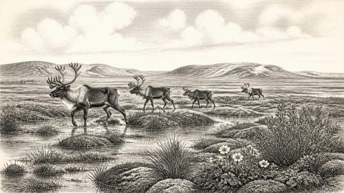
County Cork offers a different kind of archive. Castlepook Cave, near Doneraile, yielded a remarkable collection during early twentieth-century excavations and later investigations: remains attributed to woolly mammoth, reindeer, giant deer, brown bear, spotted hyaena, Arctic fox, wolf, hare and lemmings. Revised radiocarbon work has shown that several southern Irish cave bones are substantially older than earlier measurements suggested, strengthening the evidence for a diverse MIS 3 fauna on the island. Reindeer and hyaena, in particular, fit an open, cold landscape with substantial grazing resources and active predators or scavengers.
The cave collection must nevertheless be handled carefully. Much of it was excavated before modern recording standards, and cave deposits can mix material moved by animals, water, collapse and earlier digging. A list of species from Castlepook is not a census of one moment, still less proof that every species encountered one another beside the cave on the same day. The secure conclusion is broader but important: Ireland supported, at intervals during MIS 3, large mammals and carnivores more commonly associated with the Pleistocene environments of north-west Europe.
A reindeer femur from Castlepook has attracted special attention because a deep mark has been interpreted as a cut made by a stone tool, and the bone has been publicly reported as dating to about 33,000 years ago. If that interpretation is confirmed, it may indicate the butchery of a reindeer by people in Ireland far earlier than the previously accepted terminal Palaeolithic evidence. But one marked bone from an old, incompletely stratified collection is not a settlement. No associated hearth, stone-tool assemblage, dwelling, human burial or occupation surface has yet established a resident community in Ireland around 31,230 BCE. The cut-mark claim is therefore an important possibility, not a licence to invent an Ice Age population.
Society Without a Recoverable Society
Nothing presently supports discussion of Irish rulers, political institutions, diplomacy, territorial boundaries, organised warfare, religion or formal learning at this date. There are no known communities from which social ranks, kin groups, languages, ritual practices or artistic traditions can responsibly be reconstructed. Similarly, there is no evidence for farming, craft production, exchange networks or trade conducted from Ireland. Terms such as economy and settlement must be used with exceptional restraint.
If people did reach the island during this period, the most that can cautiously be inferred from the possible Castlepook modification is a small-scale foraging activity: the use of a sharp edge to process animal tissue or bone. Comparable Upper Palaeolithic communities elsewhere in north-west Europe were mobile hunter-gatherers whose survival depended on knowledge of animal movements, raw materials and seasonally changing terrain. That comparison provides context, not proof that the same social arrangements existed in Ireland. Ireland’s own record is too slight to tell whether visitors were transient, recurrent or absent for long intervals.
The Principal Development
The central development around this notional date was environmental, not political. In Fermanagh, a cold freshwater wetland accumulated organic sediment between episodes of glaciation. Across the island, ice, exposed land, water and vegetation formed an unstable regional patchwork. In Cork, cave remains attest to the capacity of that wider landscape to sustain Pleistocene mammals, including reindeer and mammoth, as well as formidable carnivores. The evidence preserves a living Irish environment before the last glacial maximum transformed it again.
Maguirebridge’s mountain-avens and bogbean are therefore more historically secure guides to 31,230 BCE than any imagined chieftain, camp or battle. Their buried remains show that even in a harsh phase of the Ice Age, Ireland contained local habitats with water, plants, insects and animal life. They also remind us how precarious the archive is: later ice protected some sediments while destroying or dispersing countless others. What survives is enough to establish an inhabited landscape in the ecological sense, but not yet enough to write a human history year by year.
Source References
Hover over a number to see the source. Select it to open the source.

- [1] A Middle Midlandian Freshwater Series at Derryvree, Maguiresbridge, County Fermanagh, Northern Ireland
- [2] A Reconsideration of the Radiocarbon Dating of the Marine Isotope Stage 3 Fauna from Southern Ireland
- [3] Episodic Speleothem Deposition Tracks the Terrestrial Impact of Millennial-Scale Last Glacial Climate Variability in SW Ireland
- [4] Quaternary Deposits and Glacial Stratigraphy in Ireland
- [5] Growth and Retreat of the Last British–Irish Ice Sheet, 31,000 to 15,000 Years Ago: the BRITICE-CHRONO Reconstruction
- [6] Pattern and Timing of Retreat of the Last British-Irish Ice Sheet
- [7] First Evidence of a Late Upper Palaeolithic Human Presence in Ireland
- [8] New Insights on the Fauna of Ireland’s Younger Dryas and Early Holocene from Alice & Gwendoline Cave
- [9] The Irish Quaternary Fauna Project
- [10] Irish Pleistocene Biostratigraphy
- [11] Castlepook Cave, Castlepook South, Cork: 2022 Excavation Report
- [12] Heritage Artefacts of County Cork 2021
- [13] The Mesolithic in Ireland: When Was It?
- [14] Deposits of the Last Glaciation, Environmental Science and Community Research Site
- [15] Figure 6: The Subdivision of the Quaternary Period in Ireland
- [16] Ireland Through Geological Time
- [17] Quaternary Geology and Geomorphology, Geological Survey Ireland
- [18] An All-Ireland Quaternary Map
- [19] The IntCal20 Northern Hemisphere Radiocarbon Age Calibration Curve (0–55 cal kBP)
- [20] OxCal: Radiocarbon Calibration and Analysis
- [21] Radiocarbon Calibration, Oxford Radiocarbon Accelerator Unit
- [22] Occurrence of Mammalia Relicts at Site Castlepook Cave
Primary Sources
- A Middle Midlandian Freshwater Series at Derryvree, Maguiresbridge, County Fermanagh, Northern Ireland
- A Reconsideration of the Radiocarbon Dating of the Marine Isotope Stage 3 Fauna from Southern Ireland
- Episodic Speleothem Deposition Tracks the Terrestrial Impact of Millennial-Scale Last Glacial Climate Variability in SW Ireland
- Quaternary Deposits and Glacial Stratigraphy in Ireland
- Growth and Retreat of the Last British–Irish Ice Sheet, 31,000 to 15,000 Years Ago: the BRITICE-CHRONO Reconstruction
- Pattern and Timing of Retreat of the Last British-Irish Ice Sheet
- First Evidence of a Late Upper Palaeolithic Human Presence in Ireland
- New Insights on the Fauna of Ireland’s Younger Dryas and Early Holocene from Alice & Gwendoline Cave
- The Irish Quaternary Fauna Project
- Irish Pleistocene Biostratigraphy
- Castlepook Cave, Castlepook South, Cork: 2022 Excavation Report
- Heritage Artefacts of County Cork 2021
- The Mesolithic in Ireland: When Was It?
- Deposits of the Last Glaciation, Environmental Science and Community Research Site
- Figure 6: The Subdivision of the Quaternary Period in Ireland
- Ireland Through Geological Time
- Quaternary Geology and Geomorphology, Geological Survey Ireland
- An All-Ireland Quaternary Map
- The IntCal20 Northern Hemisphere Radiocarbon Age Calibration Curve (0–55 cal kBP)
- OxCal: Radiocarbon Calibration and Analysis
- Radiocarbon Calibration, Oxford Radiocarbon Accelerator Unit
- Occurrence of Mammalia Relicts at Site Castlepook Cave