The Birm-166 Horizon31690 BCE
Dateline
“31,690 BCE” is a modern chronological label, not a year that anyone in prehistoric Ireland could have counted, named or remembered. It corresponds arithmetically to about 33,640 calendar years before 1950, the conventional ‘present’ of radiocarbon dating, but the evidence cannot identify an event in that single year. The responsible subject is therefore Ireland during a broad late-Pleistocene interval: Marine Isotope Stage 3, within the last Ice Age and before the fuller expansion of the Last Glacial Maximum.
The best Irish evidence nearest this nominal point is not a settlement, ruler or battle, but a layer of organic sediment labelled Birm-166. Exposed during roadworks at Derryvree, near Maguiresbridge in County Fermanagh, it preserves a fleeting geological and ecological archive from a landscape later buried beneath glacial deposits. Alongside it, the cave-bone assemblage at Castlepook near Doneraile, County Cork, offers striking but complicated evidence for the animals that ranged through Ireland and for the possibility of very early human visits.
Dating a Landscape
Radiocarbon results of this antiquity are not calendar dates. Birm-166, taken from Derryvree organic silts, produced a determination of 30,500 radiocarbon years before present, with a substantial uncertainty of +1,170 and −1,030 years. Calibration is necessary because atmospheric carbon-14 has varied through time. Later scholarship places the result broadly within c. 36,900–31,700 calibrated years before present. That broad span includes the modern reference-point of 31,690 BCE, but it emphatically does not turn the Derryvree deposits into a record of one year, one generation, or even one unbroken century.
This distinction matters because the older language of ‘stages’ and ‘interstadials’ can sound sharper than the evidence allows. The Derryvree horizon has been associated with a cold, non-glacial interval within the Irish Midlandian sequence and, more widely, with the fluctuating climates of MIS 3. Its sediments accumulated over time; plant remains, insect fragments and pollen are environmental samples rather than a dated historical document. The calibrated range is the proper measure of confidence.
Silts Between the Tills
Derryvree was revealed when a road cutting sliced through a drumlin, one of the elongated hills characteristic of glaciated ground. Beneath the surface lay two thick and distinct tills: unsorted sediment deposited by glacier ice. Between them were freshwater silts and fine sands, enriched with organic material. The sequence is powerful evidence. Ice had affected the site before the organic bed formed, while a later ice advance sealed it beneath another till. In the intervening interval, the locality supported standing or slow-moving freshwater, wet ground and plants.
That does not mean the whole island was comfortably ice-free. Ireland’s ice cover was changing on regional and millennial scales. Recent reconstructions suggest that the British–Irish Ice Sheet was beginning a major phase of growth around 31,000 years ago, with upland and northern ice centres developing before much wider expansion. Other dated deposits indicate that parts of north-central Ireland had remained ice-free until at least roughly 34,000 years ago. Around the nominal date in question, it is therefore safer to picture a geographically uneven, changing world than a single all-Ireland map: periglacial lowlands and wetlands in some places, ice and accumulating snowfields in others, and advancing ice margins as an approaching long-term threat.
The coming transformation was immense. By the Last Glacial Maximum, broadly c. 26,000–20,000 years ago, ice would cover almost all of Ireland and extend across adjoining shelves. Yet that lies thousands of years after the Derryvree deposit’s central age. The Birm-166 horizon captures not an island already smothered by the maximum ice sheet, but an earlier cold phase in which water, vegetation and animal life still left recoverable traces on exposed ground.
A Treeless Wetland World
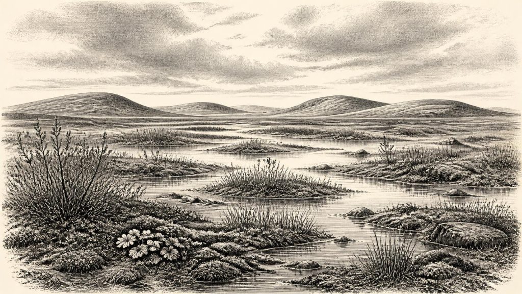
The Derryvree fossils indicate open tundra vegetation and a periglacial climate. Herbaceous pollen was poorly preserved but significant; plant macrofossils included mosses and sedges, while the broader flora points towards wet, cold ground rather than woodland. Mountain avens, dwarf willow and other northern or Arctic-alpine elements have been associated with this kind of Irish Pleistocene environment. The term ‘tundra’ should not conjure a featureless sheet of snow. In summer, shallow pools, sedge-rich margins, mossy ground and low-growing herbs could create a patchwork of colour and food. The ground was nevertheless treeless, exposed and subject to a brief growing season and severe winters.
Insect evidence reinforces the interpretation. Cold-adapted beetles and other small remains are more useful than their size suggests: many have narrow environmental tolerances, allowing palaeoecologists to identify conditions that no longer prevail locally. Together, the insects, pollen and plant remains support a landscape of seasonally frozen soils, freshwater hollows and sparse to open vegetation. They do not provide a weather report for 31,690 BCE, but they establish the character of the wider climatic regime.
South-west Ireland offers another, different sort of evidence. Broken calcite formations in Crag Cave, County Kerry, have been uranium-thorium dated to episodes of growth during MIS 3. Because shallow-cave speleothems require water moving through unfrozen ground, their intermittent formation indicates climatic ameliorations within an overall cold period. This does not make Kerry temperate woodland, nor does it date Derryvree precisely. It shows why Ireland’s climate at this depth of time should be understood as unstable: colder and less cold phases, varying moisture and local ice conditions succeeded one another across many millennia.
Animals at Castlepook
Castlepook Cave in north Cork is the principal Irish archive for large mammals before the Last Glacial Maximum. Excavations from 1904 onwards recovered more than 2,000 bones from its limestone galleries. The assemblage includes woolly mammoth, giant deer, reindeer, brown bear, wolf, Arctic fox, collared and Norwegian lemmings, and spotted hyena. Not every specimen necessarily belongs to the same moment: cave deposits can be disturbed by water, animals, excavation and later intrusion. Still, the fauna demonstrates that Ireland supported, or was visited by, a remarkable cold-stage animal community during this broad period.
The cave was not a simple snapshot of animals grazing outside its entrance. Spotted hyenas were likely among the agents that accumulated bone, carrying carcass parts into their den. A cave can be a shelter, trap, carnivore lair, drainage route and sediment storehouse in successive periods. Thus, mammoth or reindeer remains prove the presence of those species in the wider regional environment, but a bone’s final resting-place does not automatically identify where an animal died or how it arrived. Castlepook’s old excavations are indispensable, but their recording standards cannot meet those of a modern, fully stratified excavation.
Even so, the animal evidence has important implications for regional change. The presence of reindeer and lemmings accords with cold, open habitats; mammoth and giant deer indicate that enough forage was available somewhere within the wider landscape mosaic. Carnivores such as wolves and hyenas point to a functioning food web rather than a sterile ice margin. Ireland was not yet the historically familiar wooded island of later millennia. It was a north-west European Ice-Age landscape, environmentally connected to changing habitats around Britain and the exposed or altered seas, although the precise routes by which particular animals arrived remain uncertain.
The Marked Reindeer Bone
One Castlepook object bears directly on the question of people. A reindeer femur has a deep incision interpreted by zooarchaeologist Ruth Carden as a mark made with a sharp stone implement during the processing of a carcass. County Cork heritage material has presented the specimen as dating to around 31,000 BCE. If the mark is anthropogenic and contemporary with the animal’s death, it is potentially the earliest evidence for human activity in Ireland by a very large margin.
That possibility deserves attention, but not exaggeration. The bone derives from an old cave collection, not from a modernly excavated occupation floor with securely associated tools. The date concerns the animal bone, rather than directly dating the making of the mark. A single modified bone cannot establish whether people killed the reindeer, scavenged it, removed meat, hide, sinew or marrow, or processed the carcass elsewhere. It cannot identify their number, language, ancestry, season of travel or relationship to later Irish populations.
Nor has an Upper Palaeolithic settlement of comparable age been securely demonstrated in Ireland. The renewed 2022 excavation at Castlepook located surviving cave sediments and recovered animal remains, but reported no cultural artefacts. There are no published hearths, dwelling floors, burials, art assemblages or stone-tool concentrations that could demonstrate permanent settlement around this date. The most cautious conclusion is also the most significant: brief human incursions into Ireland during MIS 3 are possible, and the marked femur may preserve evidence of one; continuous occupation remains unproven.
Society Beyond Recovery
For that reason, ordinary historical categories reach their limit. There is no evidence for political institutions, named communities, diplomacy, warfare, territorial rule, religion, formal learning, monuments or exchange networks in Ireland at this point. To invent them would turn a sparse archaeological question into fiction. There is likewise no basis for assigning the Castlepook mark to a particular archaeological culture known from mainland Europe or Britain.
A restrained inference is possible if people did enter the island. Upper Palaeolithic hunter-gatherers elsewhere in north-west Europe relied on practical knowledge of animal movement, seasonality, stone-working and the uses of carcasses. Reindeer could provide meat, fat, marrow, hide, sinew and bone. Such knowledge would be an adaptive economy, not ‘trade’ in the later historical sense. It should be described as a comparative possibility, not as a documented Irish society.
The clearest story for this point in deep time is therefore one of environment, mobility and survival. At Derryvree, freshwater silts trapped between tills preserve evidence for treeless tundra and cold wetland. At Castlepook, bones preserve a diverse Ice-Age fauna and a single, debated clue to human action. Both records are fragile survivors of later glaciation. Their value lies not in supplying an imagined annual chronicle, but in showing that Ireland around the calibrated range relevant to 31,690 BCE was a changing frontier of water, tundra, animals and encroaching ice.
Primary Sources
- A Middle Midlandian Freshwater Series at Derryvree, Maguiresbridge, County Fermanagh, Northern Ireland
- Early Midlandian–Middle Midlandian, Pleistocene, Northern Ireland
- Palaeoecology
- The Subdivision of the Quaternary Period in Ireland
- Trimlines, Blockfields and the Vertical Extent of the Last Ice Sheet in Southern Ireland
- Quaternary Deposits and Glacial Stratigraphy in Ireland
- Growth and Retreat of the Last British–Irish Ice Sheet, 31,000 to 15,000 Years Ago: the BRITICE-CHRONO Reconstruction
- The Deglaciation of the Western Sector of the Irish Ice Sheet from the Inner Continental Shelf to its Terrestrial Margin
- Castlepook Cave
- Spotted Hyena Skull
- 32564: Castlepook Cave, Ballyhooly, Cork
- Heritage Artefacts of County Cork
- Episodic Speleothem Deposition Tracks the Terrestrial Impact of Millennial-Scale Last Glacial Climate Variability in SW Ireland
- The IntCal20 Northern Hemisphere Radiocarbon Age Calibration Curve (0–55 cal kBP)
- IntCal Publications
- Ireland Through Geological Time
- Quaternary
- Occurrence of Mammalia Relicts at Site Castlepook Cave
- Pleistocene Vertebrates in the British Isles
- The Irish Quaternary Fauna Project
- Middle Midlandian Interstadial Deposits at Greenagho, Near Belcoo, County Fermanagh, Northern Ireland
- Freshwater Organic Deposits and Stratified Sediments Between Early and Late Midlandian (Devensian) Till Sheets, at Aghnadarragh, County Antrim, Northern Ireland
- Clogher Valley
