Derryvree’s Permafrost Wetland30942 BCE
At the notional date of 30,942 BCE, Ireland lay within the climatically unstable Late Pleistocene, not a precisely documented year. Derryvree, County Fermanagh, preserves freshwater sediments dated broadly to this period between glacial tills, proving local ice-free conditions but not island-wide deglaciation. Its plants, insects and sediments indicate a treeless, tundra-like wetland shaped by permafrost, meltwater and seasonal thaw. Crag Cave records milder intervals through stalagmite growth. Cave fauna, including mammoth, reindeer and hyaena, demonstrates intermittently viable open habitats. A possibly cut-marked reindeer bone suggests fleeting human presence, but neither settlement nor permanent occupation is established. Later ice obscured evidence.
Dateline
Modern calendar-year precision is not available for Ireland in 30,942 BCE. This is a retrospective date in a modern numbering system, not a year that any person in Ice Age Ireland recorded or recognised. It corresponds roughly to 32,892 years before AD 1950, the conventional reference point for “before present” chronology, but that conversion does not turn the evidence into an annual record. The responsible historical setting is the later part of Marine Isotope Stage 3 (MIS 3), a cold and highly variable interval of the Late Pleistocene, before the fullest expansion of the last British–Irish Ice Sheet.
The closest Irish evidence is measured in sediment layers, animal bones, pollen, plant fragments and cave minerals, and is dated in broad ranges. A particularly useful range comes from Derryvree, near Maguiresbridge in County Fermanagh: organic freshwater sediments there produced the legacy radiocarbon determination Birm-166, 30,500 +1,170/−1,030 radiocarbon years BP. Using modern calibration, this is generally treated as a wide interval of roughly 36,900–31,700 calibrated years BP, or about 34,950–29,750 BCE. The requested year falls within that span, but cannot be placed at a particular point in the deposit. It would be misleading to invent a dated event, a leader, a settlement or a journey for it.
An Island in a Changing Ice Age
Ireland at this time was neither a familiar green island nor necessarily a single, uniform sheet of ice. The last glacial cycle produced sharp climatic shifts, changing ice margins and major differences between regions. The later Last Glacial Maximum, broadly centred on the interval after about 27,000 calibrated years BP, would bring far more extensive ice across much of Ireland and its surrounding shelf. Around the notional date considered here, however, the surviving evidence instead points to a shifting mosaic: local glacier ice in some places and times; exposed, frost-shattered ground in others; meltwater channels, lakes and wetlands where conditions permitted.
That distinction matters. The sediments at Derryvree demonstrate that one locality in south Fermanagh was ice-free long enough for freshwater deposits and organic material to accumulate between two separate layers of till, the unsorted debris left by glacier ice. They do not prove that all Ireland was simultaneously free of ice, nor do they supply a map for one specific century. Equally, evidence from caves in Cork or Kerry cannot simply be projected across the island. Late Pleistocene Ireland must be understood as a changing landscape whose records are scattered and often damaged by later glaciation.
Crag Cave near Castleisland, County Kerry supplies another, different kind of clue. Uranium-thorium dates show episodes of stalagmite growth during the last glacial period. Such growth requires water to percolate through the limestone and, in this shallow cave system, is associated with intervals when average annual temperatures were sufficiently mild for liquid water. The record reinforces the conclusion that climatic conditions were not static. Yet it is not a weather diary: cave-calcite episodes constrain broad environmental phases, not the conditions on one day in 30,942 BCE.
Fresh Water Beneath a Drumlin
Derryvree is the clearest environmental window onto this part of Irish deep time. Road excavations in 1969 cut through a drumlin and revealed silts and fine sands between lower and upper tills. The sequence gives a secure relative story. First, glacier ice deposited the lower till. Later, at least locally, ice was absent and a freshwater environment formed. Finally, renewed glacial action overrode and sealed that environment under the upper till. Much of the landscape visible in Ireland today was subsequently shaped or obscured by these and later movements of ice.
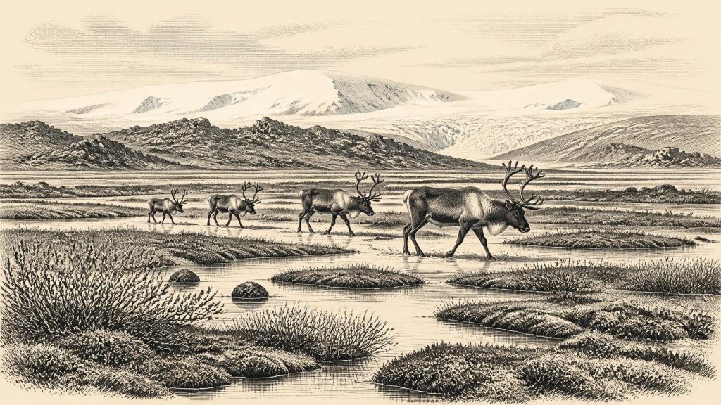
The plants and animals preserved in the intervening freshwater series indicate an open tundra or tundra-like setting and a severe periglacial regime. Pollen preservation was poor, but the identifiable pollen was principally herbaceous. Macrofossils included mosses, while aquatic and wetland plants included water-milfoil, bogbean, sedges, mountain-avens, dwarf willow and lesser clubmoss. This was not forest: there is no evidence here for oak, hazel woodland, farms or meadow pasture. The better comparison is with a cold, treeless wetland of shallow water, mossy ground, sedge-rich margins and sparse vegetation on drier exposed surfaces.
In practical terms, seasonal thaw was as important as winter cold. Water could pond above frozen or impermeable ground; meltwater could sort sand and silt; and short summers allowed hardy plants and invertebrates to complete their life cycles. Fossil beetles and other insects are consistent with a northern, open-country environment. The phrase “muskeg” has been used as an analogy for the wet, mossy terrain, but it should not conceal uncertainty. The deposit documents a local wetland community, rather than a complete reconstruction of every hill, shore and valley in Ireland.
Animals, Caves and Missing Landscapes
Animal bones from Irish caves show that large mammals entered and used Ireland during favourable phases of the Late Pleistocene. Castlepook Cave, also known historically as Mammoth Cave, in the Awbeg Valley near Doneraile in north County Cork is especially important. Its old collections include woolly mammoth, reindeer, giant deer, brown bear, wolf, fox, hare and spotted hyaena, alongside smaller mammals. Direct dates on some material place elements of the fauna before the Last Glacial Maximum, broadly within the wider time horizon relevant here.
These creatures should not be assembled into an imagined single herd passing Castlepook in one season. Cave deposits commonly form over long periods through carnivore denning, animals dying in or near cavities, water movement, scavenging and sediment disturbance. Much of Castlepook was excavated in the early twentieth century, before present-day standards of stratigraphic recovery and recording. The fauna therefore establishes that cold-adapted and open-country mammals occurred in Ireland at different times, but it cannot reliably specify which species met each other, or precisely when.
Nevertheless, the combined evidence suggests productive, if harsh, habitats. Reindeer could exploit lichens, sedges and other open-country forage; hyaenas and wolves followed prey or scavenged carcasses; mammoths and giant deer required extensive landscapes rather than isolated pockets of ground. Their presence implies routes into Ireland when geographical and climatic circumstances allowed, though the exact routes remain uncertain. Lower global sea levels altered the form of the Irish Sea basin, but ice loading, relative sea level, coastlines and water crossings changed through time. No simple claim that Ireland was joined to Britain by a permanent land bridge is justified for this particular date.
A Possible Human Trace
The question of people in Ireland is more contentious still. A reindeer femur from Castlepook has been publicised as approximately 33,000 years old and bears a deep mark that zooarchaeologist Ruth Carden has interpreted as damage made by a sharp stone tool during butchery. If that diagnosis is upheld, it may represent the earliest known indication of human activity in Ireland and would show that a person or small party handled a reindeer during the Upper Palaeolithic.
Its significance is real, but narrow. The bone comes from an old collection rather than a securely excavated occupation surface. Its radiocarbon age dates the animal, not necessarily the moment at which the mark was made. No associated stone-tool assemblage, hearth, dwelling floor, burial, food store or repeated sequence of butchered bones has established a camp of this age. The sound conclusion is therefore possibility, not a settled colonisation: Ireland may have received a brief human visit or visits during this broad period, but permanent occupation cannot be demonstrated around 30,942 BCE.
If people did arrive, their social and economic world would have been that of highly mobile hunter-gatherers, equipped with perishable gear and stone cutting tools, moving through a risky cold environment where animal migrations, shelter and seasonal access mattered greatly. This is an inference from the possible cut-mark and wider European Upper Palaeolithic context, not direct evidence for a named Irish community. There is no basis for discussing tribes, rulers, diplomacy, organised warfare, territorial states, formal religion, monuments, trade networks or learned traditions in Ireland at this date. None is attested.
History Without a Chronicle
For this point in the Irish past, environmental change is not merely background to history: it is the surviving history. Political affairs and conflict cannot be reconstructed because no evidence identifies political communities. Religion and culture leave no secure artefacts or ceremonial places. Economy is visible only in the most limited sense: cold-adapted plants and animals used a landscape of seasonal water, exposed ground and shifting ice, while the Castlepook bone raises the prospect of human use of animal resources. Exchange and diplomacy are unknown.
The essential development was instability. At Derryvree, freshwater life occupied a brief space between glacial episodes; at Crag Cave, mineral growth registers intervals of thaw; at Castlepook, bones preserve fragments of a mobile Ice Age fauna, perhaps with one tantalising human intervention. Later ice advance buried, eroded and rearranged much of this world. What remains is necessarily incomplete, but it is enough to replace the old image of an entirely empty, permanently frozen Ireland with a more careful one: a cold, regionally varied and repeatedly transformed country, intermittently capable of sustaining wetlands, animals and perhaps fleeting human passage.
Primary Sources
- A Middle Midlandian Freshwater Series at Derryvree, Maguiresbridge, County Fermanagh, Northern Ireland
- Palaeoecology: The Middle Midlandian Palaeoenvironment of South Fermanagh
- Figure 6.—The Subdivision of the Quaternary Period in Ireland
- Cenozoic: Tertiary and Quaternary
- The IntCal20 Northern Hemisphere Radiocarbon Age Calibration Curve (0–55 cal kBP)
- IntCal Publications
- The IntCal20 Approach to Radiocarbon Calibration Curve Construction: A New Methodology Using Bayesian Splines and Errors-in-Variables
- Episodic Speleothem Deposition Tracks the Terrestrial Impact of Millennial-Scale Last Glacial Climate Variability in SW Ireland
- Spatio-Temporal Dynamics of Speleothem Growth and Glaciation in the British Isles
- Growth and Retreat of the Last British–Irish Ice Sheet, 31,000 to 15,000 Years Ago: the BRITICE-CHRONO Reconstruction
- The Deglaciation of the Western Sector of the Irish Ice Sheet from the Inner Continental Shelf to its Terrestrial Margin
- New Insights on the Fauna of Ireland's Younger Dryas and Early Holocene from Alice & Gwendoline Cave
- New Insights on the Fauna of Ireland's Younger Dryas and Early Holocene from Alice & Gwendoline Cave
- The Irish Quaternary Fauna Project
- Pleistocene Vertebrates in the British Isles
- Heritage Artefacts of County Cork
- 2022:564 — Castlepook Cave, Castlepook South, Cork
- County Cork Heritage Grant Scheme 2023
- Last Glacial Maximum Cirque Glaciation in Ireland and Implications for Reconstructions of the Irish Ice Sheet
- Reindeer Bone Found in Cork Cave Shows Human Activity in Ireland 33,000 Years Ago
