
The Maguiresbridge Drumlin Fen30838 BCE
Around 30,838 BCE, Ireland had no recorded history, but Derryvree near Maguiresbridge preserves evidence of an ice-free Middle Midlandian interval. Freshwater silts between glacial tills indicate a cold, periglacial fen with tundra plants, pools, mosses and seasonal growth. Climatic conditions fluctuated during Marine Isotope Stage 3. Cave deposits, especially at Castlepook, show that open landscapes supported mammoth, reindeer, giant deer, predators and smaller cold-adapted animals. A possibly cut-marked reindeer bone offers tentative evidence of transient human activity, not settlement. Later ice advances buried or erased much evidence. These fragmentary archives portray ecologically active, severe landscapes preceding the Last Glacial Maximum.
Dateline
A modern date such as 30,838 BCE gives a useful point at which to pause, but it cannot identify a recorded Irish “year”. No writing, named people, political units or calendar existed in Ireland at this depth of time, and archaeological dating cannot ordinarily distinguish one year from the next. In radiocarbon terms, this date is approximately 32,787 calendar years before AD 1950. The most relevant Irish evidence belongs to a much broader Late Pleistocene interval: the Middle Midlandian, within Marine Isotope Stage 3, before the Last Glacial Maximum. It is best approached through calibrated ranges, sediments and fossil assemblages rather than through a year-by-year narrative.
A Date Within a Broad Window
The strongest evidence for conditions in or near this period comes from Derryvree, beside Maguiresbridge in County Fermanagh. Road works in 1969 cut through a drumlin and revealed organic freshwater silts and fine sands trapped between two thick tills: deposits left by ice before and after the wetland existed. Organic material from the layer produced the conventional radiocarbon result Birm-166, 30,500 years BP, with a large uncertainty of +1,170/−1,030 years. Later work has expressed the possible calibrated age span broadly as c. 36,900–31,700 cal BP. The modern label 30,838 BCE falls within that range, but it is not possible to say that the Derryvree sediments accumulated in that particular calendar year.
This distinction matters. The lower till demonstrates an earlier ice advance; the freshwater deposit records an interval in which this particular part of Fermanagh was ice-free; and the upper till shows that a subsequent advance buried and preserved the evidence. It does not prove that all Ireland was simultaneously free of ice, nor does it yield a continuous diary of weather or life. Nevertheless, the road section is exceptionally important because later glaciation erased or disturbed so much of Ireland’s older Pleistocene landscape. Derryvree is a rare local window into a cold, living environment before the greatest expansion of the last British–Irish Ice Sheet.
A Tundra Wetland, Not a Frozen Desert
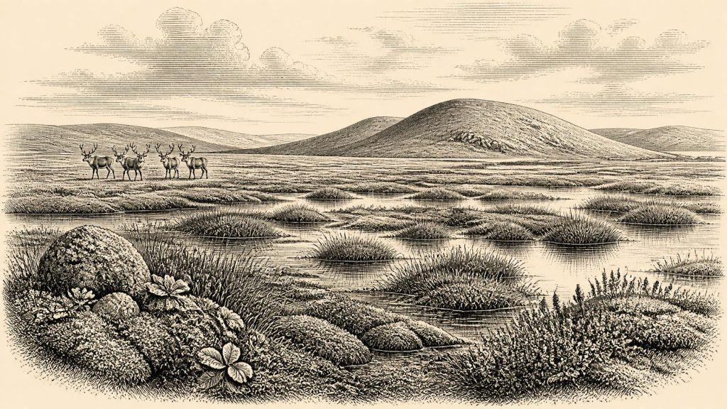
The organisms preserved at Derryvree indicate open tundra vegetation and a periglacial climate. That means ground affected by severe seasonal freezing around ice masses, not necessarily permanent glacier ice at the site. Plant remains, pollen and insects point to a wet, mossy landscape with shallow pools and plant-rich mud: a muskeg-like fen embedded in an otherwise exposed, treeless terrain. The record includes cold-adapted plants such as mountain avens and fringed sandwort, while a fossil seed of bogbean is especially eloquent evidence for freshwater conditions. Such plants require particular habitats; their remains show that the landscape contained damp hollows, water and summer growth, even under hard winters.
This was therefore no uniform white wilderness. Low vegetation would have lain close to the ground, with sedges, mosses, herbs and dwarf shrubs exploiting wetter and better-sheltered spots. Exposed slopes and stony surfaces may have supported sparse tundra plants; frost action, solifluction and seasonal meltwater reshaped soils and channels. The reconstructed scene is one of ecological patchiness. A pool or sedge-rich hollow could sustain far more life than nearby wind-scoured ground. Yet the overall setting was far colder, less wooded and more unstable than modern Fermanagh.
Evidence from Crag Cave in County Kerry adds a valuable regional qualification. Uranium-series dates on broken speleothems show that, during Marine Isotope Stage 3, episodes of calcite growth occurred when liquid water could percolate through shallow cave systems. This supports the wider conclusion that the Irish climate fluctuated markedly during the long glacial period. Around the date represented by Derryvree, Ireland should not be imagined as having one fixed climate. More favourable interstadial episodes and sharp cold reversals followed one another on millennial scales, while local topography strongly affected where water, plants and animals could survive.
Animals at the Edge of Ice
The cave deposits of southern Ireland provide a separate, imperfect view of the country’s fauna before the Last Glacial Maximum. Castlepook Cave, near Doneraile in County Cork, is the richest such archive. Its finds include woolly mammoth, reindeer, giant deer, brown bear, spotted hyena, Arctic fox, wolf, lemmings and mountain hare. These are not a single, neatly contemporary herd list. Many bones were excavated long ago, cave deposits were disturbed or reworked, and carnivores, water movement and natural deaths all helped to accumulate remains. Individual specimens also have dates spread across thousands of years.
Even so, the assemblage establishes an important point: parts of pre-maximum Ireland were capable of supporting substantial mammals and their predators. Reindeer, mammoth and hyena imply open country with adequate grazing and prey, rather than dense forest. Cave bones can exaggerate the presence of denning or scavenging carnivores, especially bears and hyenas, and cannot measure animal numbers across the island. They do, however, make the Derryvree wetland easier to place within a larger mosaic of tundra, grass-herb plains, rocky shelter and seasonal watercourses.
The fauna also cautions against treating the modern island as a ready-made ecological unit. Sea level was much lower during the glacial period, coastlines differed greatly, and the extent of land, shallow sea and ice changed repeatedly. Animal movements into Ireland evidently occurred in favourable phases, but the exact pathways and duration of individual populations remain uncertain. There is no basis for describing fixed territories, managed herds or an Irish animal economy at 30,838 BCE.
The Human Question
There is no securely excavated settlement, hearth, dwelling, burial, stone-tool assemblage or human skeleton from Ireland that can be assigned to this date. Consequently, everyday life cannot responsibly be reconstructed as if an established community occupied Derryvree. There were no demonstrable Irish chiefs, laws, alliances, diplomacy, warfare, religious institutions or systems of trade. Nor is there evidence for farming, pottery, metalworking, monuments, formal learning or long-term village life. These absences are historically significant: they define the limits of what the record allows.
One object nonetheless makes the possibility of human activity a serious question. A reindeer femur from Castlepook Cave has been interpreted by palaeozoologist Ruth Carden as bearing a deep stone-tool cut made during butchery. County Cork’s heritage publication presents it as Palaeolithic and approximately 31,000 BC, while the older cave-fauna project produced radiocarbon ages from the site showing that reindeer and other cold-adapted mammals were present in the wider pre-maximum era. If the mark is anthropogenic, it would be evidence that people handled a reindeer in Ireland far earlier than the traditionally recognised terminal-Pleistocene traces.
But the correct conclusion is deliberately modest. A modified bone records, at most, an encounter with an animal; it does not establish a resident population, the size of a party, the season of a visit, the location of butchery or a settled hunting camp. The animal may have been butchered elsewhere and part of its remains later carried to the cave by scavengers. No associated tools have yet been recovered. The femur is therefore best treated as important proposed evidence for transient human presence, not proof that Ireland possessed a continuous Upper Palaeolithic population in this period.
What Society Can Be Inferred?
If people did enter Ireland during a milder interval of Marine Isotope Stage 3, comparison with Upper Palaeolithic groups elsewhere in north-west Europe suggests that mobility, close knowledge of animal movements, weather and shelter, and portable stone technology would have been essential. That is an interpretation from neighbouring archaeological contexts, not an observed fact about Ireland. The Irish evidence itself does not identify a language, kin group, ritual, artistic tradition or route of arrival. Even the inference of hunting should remain tied to the single disputed or provisional butchery indication rather than enlarged into a detailed social portrait.
What can be stated more firmly is that survival, for any human visitors, would have depended on the same varied environment visible in the natural record: water in unfrozen seasons, fuel and shelter where available, and access to migrating or locally present animals. A wetland such as Derryvree was not a settlement site merely because it supported life. Yet it demonstrates that the cold-stage landscape contained usable ecological niches, rather than being wholly sterile beneath permanent ice.
Approaching the Ice Maximum
The larger trajectory was towards a much more extensive ice sheet. Research on the British–Irish Ice Sheet places its maximum overall reach at about 27,000 years BP, several millennia after the Derryvree window. The later advance that sealed the Fermanagh freshwater deposits forms a material reminder of that change. Ice did not simply arrive everywhere at once: its margins, flow directions and timing varied around Ireland and across the adjoining seas. Still, the long-term consequence was devastating for earlier landscapes. Glacial erosion, burial and reworking explain why a road-cut wetland, a cave bone and a few fragments of calcite carry so much interpretative weight.
For 30,838 BCE, then, Ireland is known not through a historical event but through a fragile set of natural archives. Derryvree supplies the clearest local evidence: a cold freshwater fen, open tundra vegetation and periglacial conditions during an ice-free interval bracketed by glacial advances. Castlepook supplies the wider animal world and a tantalising, unconfirmed-scale sign of human action. Together they reveal a changing Ice Age country—ecologically active, climatically severe and historically elusive—on the threshold of deeper glaciation.
Primary Sources
- A Middle Midlandian Freshwater Series at Derryvree, Maguiresbridge, County Fermanagh, Northern Ireland
- The Irish Quaternary Fauna Project
- Red deer (Cervus elaphus) in Ireland: a 7000-year history of population expansion, contraction and re-colonization
- New insights on the fauna of Ireland’s Younger Dryas and their implications for human survival during the Pleistocene-Holocene transition
- Episodic speleothem deposition tracks the terrestrial impact of millennial-scale last glacial climate variability in SW Ireland
- Pattern and timing of retreat of the last British-Irish Ice Sheet
- Timing and pace of ice-sheet withdrawal across the marine–terrestrial transition west of Ireland during the last glaciation
- Exploring controls of the early and stepped deglaciation on the western margin of the British-Irish Ice Sheet
- Dimensions and chronology of the last ice sheet in Western Ireland
- Trimlines, blockfields and the vertical extent of the last ice sheet in southern Ireland
- The IntCal20 Northern Hemisphere radiocarbon age calibration curve (0–55 cal kBP)
- IntCal Publications
- A stratigraphic framework for abrupt climatic changes during the Last Glacial period based on three synchronized Greenland ice-core records
- Castlepook Cave: County Geological Site Report
- Heritage Artefacts of County Cork
- Spotted Hyena Skull
- 2022:564 – Castlepook Cave, Castlepook South, Cork
- Menyanthes trifoliata
- Environmental Change in Northern Ireland: Site Summary
- The Subdivision of the Quaternary Period in Ireland
