
c.1840s
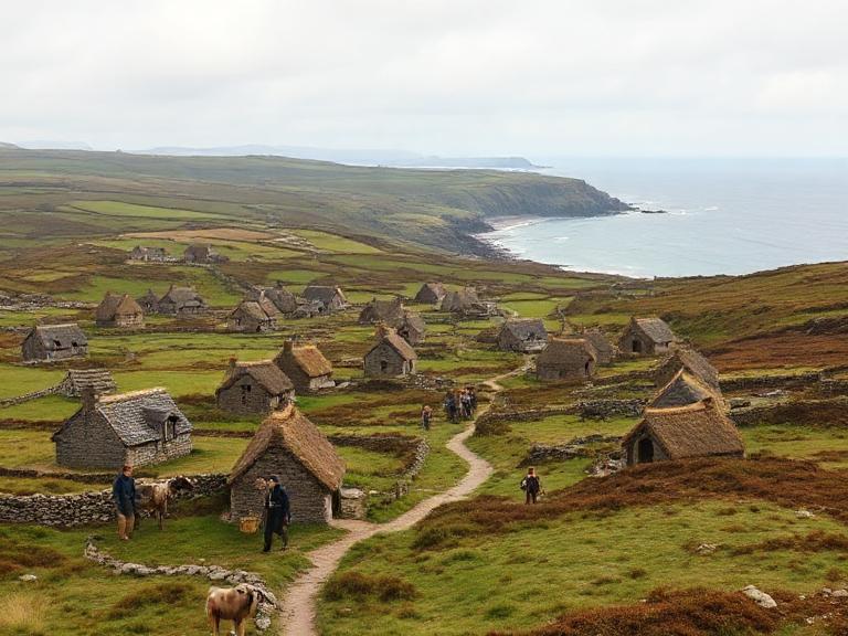
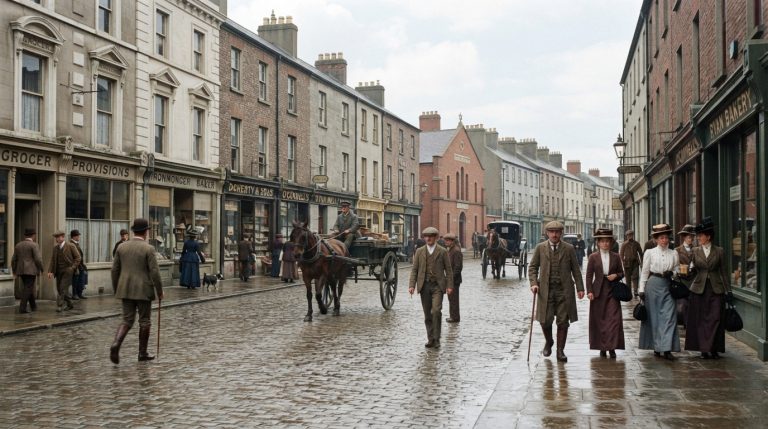
The 1840s brought catastrophe to Limerick as the Great Famine destroyed livelihoods across city and county. Potato failure caused hunger, disease, eviction and mass dependence upon relief works, soup kitchens and workhouses. Rural labourers and small tenants suffered most, while urban streets received families seeking food, employment and shelter. Death and emigration emptied townlands and permanently altered communities. The Shannon remained a route for trade and departure, linking local suffering with wider imperial markets and migration. Political debate over relief, land and government intensified. Ordinary people endured loss on an immense scale, relying upon family, charity, faith and survival daily.
1840 109 items
Cornmarket Row
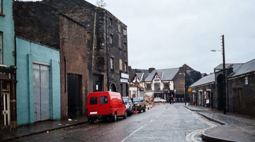
This 1975 view captures the junction of Lower Henry Street and Sarsfield Street before the creation of Liddy Street transformed the surrounding cityscape. The photograph preserves a moment when traffic, shopfronts and older buildings still defined this busy corner of central Limerick. Lower Henry Street connected the commercial heart of the city with the Shannon quays, while Sarsfield Street formed an important route towards Sarsfield Bridge. The later development of Liddy Street altered movement through the area and removed part of the earlier streetscape. Today, the image offers a valuable record of a vanished junction and changing daily urban life.
View Image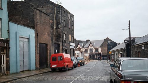
Cornmarket Row
Cornmarket Row is a historic street in the heart of Limerick City, best known as the home of the celebrated Milk Market. Established in 1852, the market remains a lively centre for fresh produce, artisan foods, crafts, antiques, hot meals and live entertainment. Friday hosts a popular flea market, Saturday brings the famous food market, and Sunday offers a relaxed variety market. Nearby Cornmarket Square Car Park provides convenient access for visitors. Situated within the Irishtown area, Cornmarket Row is also close to shops, offices, restaurants, bus routes and Colbert Station, making it an accessible and enduring city landmark today.
View Image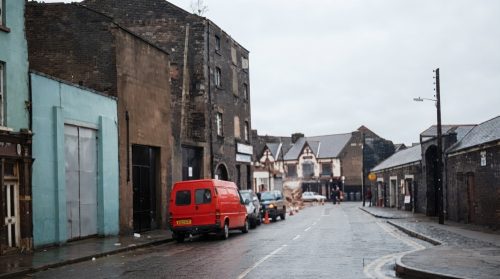
Cornmarket Row
Cornmarket Row is a historic street in the heart of Limerick City, best known as the home of the celebrated Milk Market. Established in 1852, the market remains a lively centre for fresh produce, artisan foods, crafts, antiques, hot meals and live entertainment. Friday hosts a popular flea market, Saturday brings the famous food market, and Sunday offers a relaxed variety market. Nearby Cornmarket Square Car Park provides convenient access for visitors. Situated within the Irishtown area, Cornmarket Row is also close to shops, offices, restaurants, bus routes and Colbert Station, making it an accessible and enduring city landmark today.
View Image
Cornmarket Row
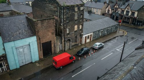
This 1975 view captures the junction of Lower Henry Street and Sarsfield Street before the creation of Liddy Street transformed the surrounding cityscape. The photograph preserves a moment when traffic, shopfronts and older buildings still defined this busy corner of central Limerick. Lower Henry Street connected the commercial heart of the city with the Shannon quays, while Sarsfield Street formed an important route towards Sarsfield Bridge. The later development of Liddy Street altered movement through the area and removed part of the earlier streetscape. Today, the image offers a valuable record of a vanished junction and changing daily urban life.
View Image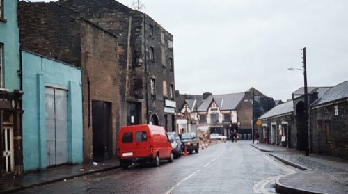
Cornmarket Row
Cornmarket Row is a historic street in the heart of Limerick City, best known as the home of the celebrated Milk Market. Established in 1852, the market remains a lively centre for fresh produce, artisan foods, crafts, antiques, hot meals and live entertainment. Friday hosts a popular flea market, Saturday brings the famous food market, and Sunday offers a relaxed variety market. Nearby Cornmarket Square Car Park provides convenient access for visitors. Situated within the Irishtown area, Cornmarket Row is also close to shops, offices, restaurants, bus routes and Colbert Station, making it an accessible and enduring city landmark today.
View Image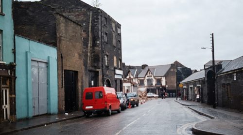
Cornmarket Row
This 1975 view captures the junction of Lower Henry Street and Sarsfield Street before the creation of Liddy Street transformed the surrounding cityscape. The photograph preserves a moment when traffic, shopfronts and older buildings still defined this busy corner of central Limerick. Lower Henry Street connected the commercial heart of the city with the Shannon quays, while Sarsfield Street formed an important route towards Sarsfield Bridge. The later development of Liddy Street altered movement through the area and removed part of the earlier streetscape. Today, the image offers a valuable record of a vanished junction and changing daily urban life.
View Image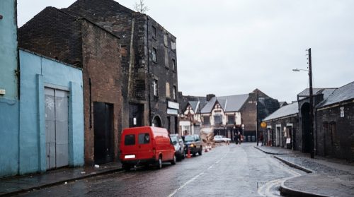
Cornmarket Row
This 1975 view captures the junction of Lower Henry Street and Sarsfield Street before the creation of Liddy Street transformed the surrounding cityscape. The photograph preserves a moment when traffic, shopfronts and older buildings still defined this busy corner of central Limerick. Lower Henry Street connected the commercial heart of the city with the Shannon quays, while Sarsfield Street formed an important route towards Sarsfield Bridge. The later development of Liddy Street altered movement through the area and removed part of the earlier streetscape. Today, the image offers a valuable record of a vanished junction and changing daily urban life.
View Image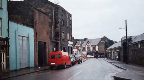
Cornmarket Row
Cornmarket Row is a historic street in the heart of Limerick City, best known as the home of the celebrated Milk Market. Established in 1852, the market remains a lively centre for fresh produce, artisan foods, crafts, antiques, hot meals and live entertainment. Friday hosts a popular flea market, Saturday brings the famous food market, and Sunday offers a relaxed variety market. Nearby Cornmarket Square Car Park provides convenient access for visitors. Situated within the Irishtown area, Cornmarket Row is also close to shops, offices, restaurants, bus routes and Colbert Station, making it an accessible and enduring city landmark today.
View Image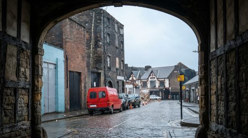
Cornmarket Row
Cornmarket Row is a historic street in the heart of Limerick City, best known as the home of the celebrated Milk Market. Established in 1852, the market remains a lively centre for fresh produce, artisan foods, crafts, antiques, hot meals and live entertainment. Friday hosts a popular flea market, Saturday brings the famous food market, and Sunday offers a relaxed variety market. Nearby Cornmarket Square Car Park provides convenient access for visitors. Situated within the Irishtown area, Cornmarket Row is also close to shops, offices, restaurants, bus routes and Colbert Station, making it an accessible and enduring city landmark today.
View Image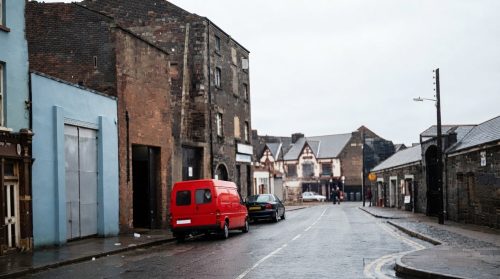
Cornmarket Row
Cornmarket Row is a historic street in the heart of Limerick City, best known as the home of the celebrated Milk Market. Established in 1852, the market remains a lively centre for fresh produce, artisan foods, crafts, antiques, hot meals and live entertainment. Friday hosts a popular flea market, Saturday brings the famous food market, and Sunday offers a relaxed variety market. Nearby Cornmarket Square Car Park provides convenient access for visitors. Situated within the Irishtown area, Cornmarket Row is also close to shops, offices, restaurants, bus routes and Colbert Station, making it an accessible and enduring city landmark today.
View Image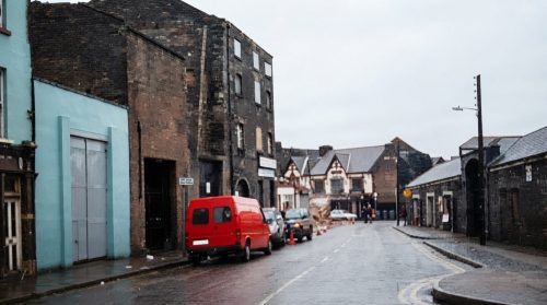
Cornmarket Row
Cornmarket Row is a historic street in the heart of Limerick City, best known as the home of the celebrated Milk Market. Established in 1852, the market remains a lively centre for fresh produce, artisan foods, crafts, antiques, hot meals and live entertainment. Friday hosts a popular flea market, Saturday brings the famous food market, and Sunday offers a relaxed variety market. Nearby Cornmarket Square Car Park provides convenient access for visitors. Situated within the Irishtown area, Cornmarket Row is also close to shops, offices, restaurants, bus routes and Colbert Station, making it an accessible and enduring city landmark today.
View Image
Cornmarket Row
This 1975 view captures the junction of Lower Henry Street and Sarsfield Street before the creation of Liddy Street transformed the surrounding cityscape. The photograph preserves a moment when traffic, shopfronts and older buildings still defined this busy corner of central Limerick. Lower Henry Street connected the commercial heart of the city with the Shannon quays, while Sarsfield Street formed an important route towards Sarsfield Bridge. The later development of Liddy Street altered movement through the area and removed part of the earlier streetscape. Today, the image offers a valuable record of a vanished junction and changing daily urban life.
View Image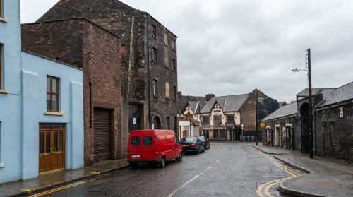
Cornmarket Row
Cornmarket Row is a historic street in the heart of Limerick City, best known as the home of the celebrated Milk Market. Established in 1852, the market remains a lively centre for fresh produce, artisan foods, crafts, antiques, hot meals and live entertainment. Friday hosts a popular flea market, Saturday brings the famous food market, and Sunday offers a relaxed variety market. Nearby Cornmarket Square Car Park provides convenient access for visitors. Situated within the Irishtown area, Cornmarket Row is also close to shops, offices, restaurants, bus routes and Colbert Station, making it an accessible and enduring city landmark today.
View Image
Cornmarket Row
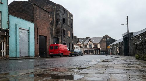
This 1975 view captures the junction of Lower Henry Street and Sarsfield Street before the creation of Liddy Street transformed the surrounding cityscape. The photograph preserves a moment when traffic, shopfronts and older buildings still defined this busy corner of central Limerick. Lower Henry Street connected the commercial heart of the city with the Shannon quays, while Sarsfield Street formed an important route towards Sarsfield Bridge. The later development of Liddy Street altered movement through the area and removed part of the earlier streetscape. Today, the image offers a valuable record of a vanished junction and changing daily urban life.
View Image
Cornmarket Row
Cornmarket Row is a historic street in the heart of Limerick City, best known as the home of the celebrated Milk Market. Established in 1852, the market remains a lively centre for fresh produce, artisan foods, crafts, antiques, hot meals and live entertainment. Friday hosts a popular flea market, Saturday brings the famous food market, and Sunday offers a relaxed variety market. Nearby Cornmarket Square Car Park provides convenient access for visitors. Situated within the Irishtown area, Cornmarket Row is also close to shops, offices, restaurants, bus routes and Colbert Station, making it an accessible and enduring city landmark today.
View Image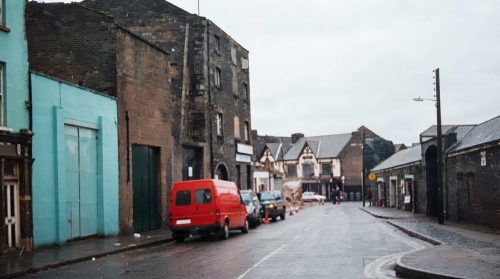
Cornmarket Row
Cornmarket Row is a historic street in the heart of Limerick City, best known as the home of the celebrated Milk Market. Established in 1852, the market remains a lively centre for fresh produce, artisan foods, crafts, antiques, hot meals and live entertainment. Friday hosts a popular flea market, Saturday brings the famous food market, and Sunday offers a relaxed variety market. Nearby Cornmarket Square Car Park provides convenient access for visitors. Situated within the Irishtown area, Cornmarket Row is also close to shops, offices, restaurants, bus routes and Colbert Station, making it an accessible and enduring city landmark today.
View Image
Cornmarket Row
This 1975 view captures the junction of Lower Henry Street and Sarsfield Street before the creation of Liddy Street transformed the surrounding cityscape. The photograph preserves a moment when traffic, shopfronts and older buildings still defined this busy corner of central Limerick. Lower Henry Street connected the commercial heart of the city with the Shannon quays, while Sarsfield Street formed an important route towards Sarsfield Bridge. The later development of Liddy Street altered movement through the area and removed part of the earlier streetscape. Today, the image offers a valuable record of a vanished junction and changing daily urban life.
View Image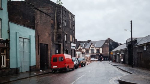
Cornmarket Row
This 1975 view captures the junction of Lower Henry Street and Sarsfield Street before the creation of Liddy Street transformed the surrounding cityscape. The photograph preserves a moment when traffic, shopfronts and older buildings still defined this busy corner of central Limerick. Lower Henry Street connected the commercial heart of the city with the Shannon quays, while Sarsfield Street formed an important route towards Sarsfield Bridge. The later development of Liddy Street altered movement through the area and removed part of the earlier streetscape. Today, the image offers a valuable record of a vanished junction and changing daily urban life.
View Image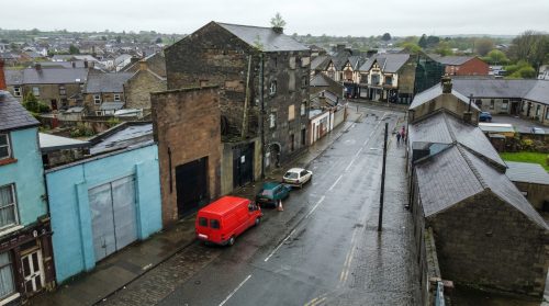
Cornmarket Row
Cornmarket Row is a historic street in the heart of Limerick City, best known as the home of the celebrated Milk Market. Established in 1852, the market remains a lively centre for fresh produce, artisan foods, crafts, antiques, hot meals and live entertainment. Friday hosts a popular flea market, Saturday brings the famous food market, and Sunday offers a relaxed variety market. Nearby Cornmarket Square Car Park provides convenient access for visitors. Situated within the Irishtown area, Cornmarket Row is also close to shops, offices, restaurants, bus routes and Colbert Station, making it an accessible and enduring city landmark today.
View Image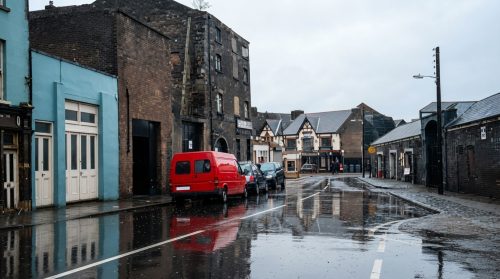
Cornmarket Row
Cornmarket Row is a historic street in the heart of Limerick City, best known as the home of the celebrated Milk Market. Established in 1852, the market remains a lively centre for fresh produce, artisan foods, crafts, antiques, hot meals and live entertainment. Friday hosts a popular flea market, Saturday brings the famous food market, and Sunday offers a relaxed variety market. Nearby Cornmarket Square Car Park provides convenient access for visitors. Situated within the Irishtown area, Cornmarket Row is also close to shops, offices, restaurants, bus routes and Colbert Station, making it an accessible and enduring city landmark today.
View Image1841 0 items
No published items are currently assigned to this period.
1842 2 items
Civic Ledgers
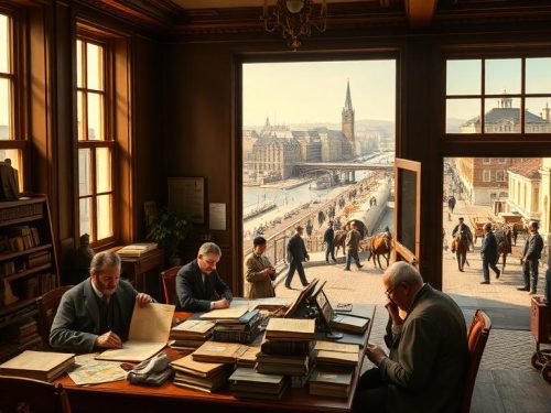
Limerick’s nineteenth-century transformation can be followed through the surviving financial records of its Corporation, which reveal how civic ambition was translated into rates, loans, wages and public works. After the Municipal Corporations Act 1840, the city gained authority to levy a borough rate using the poor-law rating system. For more than a decade, municipal income and expenditure flowed through a single Borough Fund. From 1853, however, the Limerick Improvement Act created new financial structures, separating ordinary civic obligations from improvement projects and establishing a Sinking Fund to reduce corporate debt. These changes reshaped how Limerick governed, maintained and modernised itself.
View Article
Civic Accounts
Limerick’s municipal development between 1842 and 1934 can be traced through the financial records of its Corporation. These surviving abstracts, ledgers, registers and committee papers show how local government raised money, paid employees, supported institutions and maintained public services. After the Municipal Corporations Act 1840, the Corporation could levy a borough rate through the poor-law rating system. Initially, income and expenditure were managed through one Borough Fund. The Limerick Improvement Act 1853 then introduced separate General Purposes and Improvement funds, alongside a Sinking Fund intended to assist with repayment of the city’s corporate debt over time with increasing administrative precision.
View Article1843 0 items
No published items are currently assigned to this period.
1844 30 items
Bridge Limerick
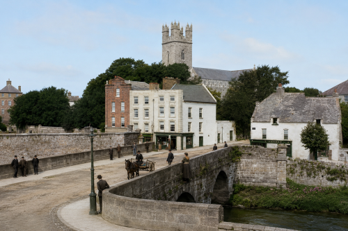
Mathew Bridge, completed between 1844 and 1846, forms an important crossing over the Abbey River in Limerick City. Designed by William Henshaw Owen, the triple-span ashlar limestone structure features segmental arches, rounded breakwaters and a broad flat roadway. It linked Rutland Street and Bank Place with Bridge Street and Merchant’s Quay, connecting the Georgian commercial quarter of Newtown Pery with medieval Englishtown. The bridge replaced the inadequate New Bridge of 1762 and accommodated the city’s growing Victorian traffic. Named for Father Theobald Mathew, the celebrated temperance reformer, it remains a notable example of nineteenth-century Irish civic engineering and urban development.
View Image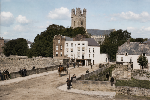
Bridge Limerick
Mathew Bridge, completed between 1844 and 1846, forms an important crossing over the Abbey River in Limerick City. Designed by William Henshaw Owen, the triple-span ashlar limestone structure features segmental arches, rounded breakwaters and a broad flat roadway. It linked Rutland Street and Bank Place with Bridge Street and Merchant’s Quay, connecting the Georgian commercial quarter of Newtown Pery with medieval Englishtown. The bridge replaced the inadequate New Bridge of 1762 and accommodated the city’s growing Victorian traffic. Named for Father Theobald Mathew, the celebrated temperance reformer, it remains a notable example of nineteenth-century Irish civic engineering and urban development.
View Image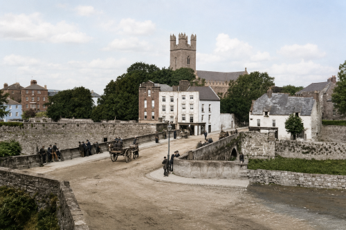
Bridge Limerick
Mathew Bridge, completed between 1844 and 1846, forms an important crossing over the Abbey River in Limerick City. Designed by William Henshaw Owen, the triple-span ashlar limestone structure features segmental arches, rounded breakwaters and a broad flat roadway. It linked Rutland Street and Bank Place with Bridge Street and Merchant’s Quay, connecting the Georgian commercial quarter of Newtown Pery with medieval Englishtown. The bridge replaced the inadequate New Bridge of 1762 and accommodated the city’s growing Victorian traffic. Named for Father Theobald Mathew, the celebrated temperance reformer, it remains a notable example of nineteenth-century Irish civic engineering and urban development.
View Image
Bridge Limerick
Mathew Bridge, completed between 1844 and 1846, forms an important crossing over the Abbey River in Limerick City. Designed by William Henshaw Owen, the triple-span ashlar limestone structure features segmental arches, rounded breakwaters and a broad flat roadway. It linked Rutland Street and Bank Place with Bridge Street and Merchant’s Quay, connecting the Georgian commercial quarter of Newtown Pery with medieval Englishtown. The bridge replaced the inadequate New Bridge of 1762 and accommodated the city’s growing Victorian traffic. Named for Father Theobald Mathew, the celebrated temperance reformer, it remains a notable example of nineteenth-century Irish civic engineering and urban development.
View Image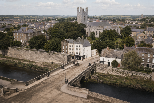
Bridge Limerick
Mathew Bridge, completed between 1844 and 1846, forms an important crossing over the Abbey River in Limerick City. Designed by William Henshaw Owen, the triple-span ashlar limestone structure features segmental arches, rounded breakwaters and a broad flat roadway. It linked Rutland Street and Bank Place with Bridge Street and Merchant’s Quay, connecting the Georgian commercial quarter of Newtown Pery with medieval Englishtown. The bridge replaced the inadequate New Bridge of 1762 and accommodated the city’s growing Victorian traffic. Named for Father Theobald Mathew, the celebrated temperance reformer, it remains a notable example of nineteenth-century Irish civic engineering and urban development.
View Image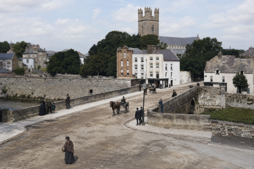
Bridge Limerick
Mathew Bridge, completed between 1844 and 1846, forms an important crossing over the Abbey River in Limerick City. Designed by William Henshaw Owen, the triple-span ashlar limestone structure features segmental arches, rounded breakwaters and a broad flat roadway. It linked Rutland Street and Bank Place with Bridge Street and Merchant’s Quay, connecting the Georgian commercial quarter of Newtown Pery with medieval Englishtown. The bridge replaced the inadequate New Bridge of 1762 and accommodated the city’s growing Victorian traffic. Named for Father Theobald Mathew, the celebrated temperance reformer, it remains a notable example of nineteenth-century Irish civic engineering and urban development.
View Image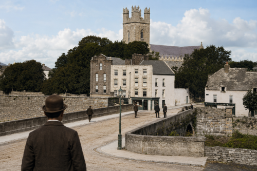
Bridge Limerick
Mathew Bridge, completed between 1844 and 1846, forms an important crossing over the Abbey River in Limerick City. Designed by William Henshaw Owen, the triple-span ashlar limestone structure features segmental arches, rounded breakwaters and a broad flat roadway. It linked Rutland Street and Bank Place with Bridge Street and Merchant’s Quay, connecting the Georgian commercial quarter of Newtown Pery with medieval Englishtown. The bridge replaced the inadequate New Bridge of 1762 and accommodated the city’s growing Victorian traffic. Named for Father Theobald Mathew, the celebrated temperance reformer, it remains a notable example of nineteenth-century Irish civic engineering and urban development.
View Image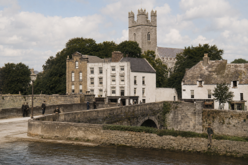
Bridge Limerick
Mathew Bridge, completed between 1844 and 1846, forms an important crossing over the Abbey River in Limerick City. Designed by William Henshaw Owen, the triple-span ashlar limestone structure features segmental arches, rounded breakwaters and a broad flat roadway. It linked Rutland Street and Bank Place with Bridge Street and Merchant’s Quay, connecting the Georgian commercial quarter of Newtown Pery with medieval Englishtown. The bridge replaced the inadequate New Bridge of 1762 and accommodated the city’s growing Victorian traffic. Named for Father Theobald Mathew, the celebrated temperance reformer, it remains a notable example of nineteenth-century Irish civic engineering and urban development.
View Image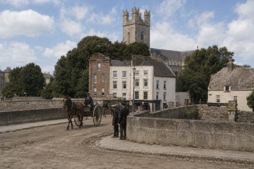
Bridge Limerick
Mathew Bridge, completed between 1844 and 1846, forms an important crossing over the Abbey River in Limerick City. Designed by William Henshaw Owen, the triple-span ashlar limestone structure features segmental arches, rounded breakwaters and a broad flat roadway. It linked Rutland Street and Bank Place with Bridge Street and Merchant’s Quay, connecting the Georgian commercial quarter of Newtown Pery with medieval Englishtown. The bridge replaced the inadequate New Bridge of 1762 and accommodated the city’s growing Victorian traffic. Named for Father Theobald Mathew, the celebrated temperance reformer, it remains a notable example of nineteenth-century Irish civic engineering and urban development.
View Image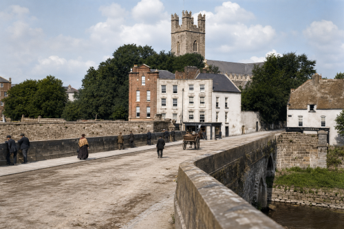
Bridge Limerick
Mathew Bridge, completed between 1844 and 1846, forms an important crossing over the Abbey River in Limerick City. Designed by William Henshaw Owen, the triple-span ashlar limestone structure features segmental arches, rounded breakwaters and a broad flat roadway. It linked Rutland Street and Bank Place with Bridge Street and Merchant’s Quay, connecting the Georgian commercial quarter of Newtown Pery with medieval Englishtown. The bridge replaced the inadequate New Bridge of 1762 and accommodated the city’s growing Victorian traffic. Named for Father Theobald Mathew, the celebrated temperance reformer, it remains a notable example of nineteenth-century Irish civic engineering and urban development.
View Image1845 29 items
1846 0 items
No published items are currently assigned to this period.
1847 0 items
No published items are currently assigned to this period.
1848 8 items

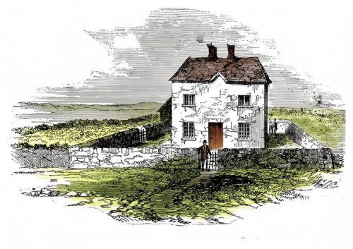
Cabbage Patch Siege
Margaret McCormack, known to history as the Widow McCormack, found herself and her family at the centre of one of the most curious and poignant episodes of Irish revolutionary history—the so-called “Battle of Widow McCormack’s Cabbage Patch.” Her two-storey farmhouse near Ballingarry, County Tipperary, stands just beyond the Limerick and Kilkenny borders, in a landscape long shaped by mining, rural hardship, and the turbulent years of the Great Famine.
View Article1849 0 items
No published items are currently assigned to this period.