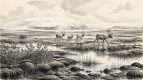
Maguirebridge Sedge Basin31890 BCE
At roughly 31,890 BCE, Ireland was a climatically unstable Late Pleistocene landscape rather than a documented society. Derryvree sediments near Maguiresbridge, Fermanagh, dated broadly to 36,900–31,700 calibrated years BP, show ice-free freshwater habitats with sedges, mosses, herbs, beetles and periglacial tundra conditions. Other deposits and Crag Cave indicate alternating non-glacial and milder phases amid advancing ice. Castlepook Cave preserves time-mixed remains of cold-adapted and other mammals, demonstrating intermittent faunal connections with Eurasia. A marked reindeer bone may record early human butchery, but remains disputed and cannot prove settlement. Subsequent ice-sheet expansion transformed, buried and destroyed much of this fragile landscape.
Dateline
The label 31,890 BCE gives a useful point of reference, but it cannot identify an Irish event in the way that a medieval annal or modern archive can. There were no written calendars, named polities or dated records on the island. Archaeology cannot isolate a hunt, a season or a settlement to that single year. In scientific terms, it falls at roughly 33,840 years before present (where “present” conventionally means 1950), during the Late Pleistocene and Marine Isotope Stage 3, a long and highly variable part of the last Ice Age. The responsible history of Ireland at this point is therefore a history of ranges, deposits and probabilities rather than of individuals or happenings.
The closest securely relevant chronological anchor is the freshwater sequence uncovered beneath a drumlin at Derryvree, near Maguiresbridge in County Fermanagh. Organic-rich silts and fine sands there produced a radiocarbon determination of 30,500 +1,170/−1,030 radiocarbon years BP. Published calibration places that evidence broadly within about 36,900–31,700 calibrated years BP: a span that encompasses the notional date considered here. The sediments accumulated over time, however, and do not constitute a diary entry for 31,890 BCE. They nevertheless show that at some stage in this broad interval north-central Ireland contained ice-free freshwater ground before later glacier ice buried the deposit beneath till.
A Cold Landscape, Not an Empty One
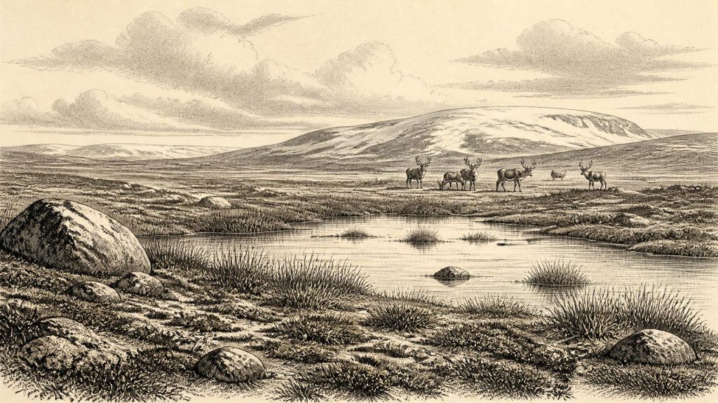
Derryvree preserves an unusually precious glimpse of an Irish landscape that later glaciation mostly destroyed or concealed. Mosses, sedges, herb pollen and cold-adapted beetles indicate open vegetation and a periglacial climate: ground subject to intense freezing and thawing, rather than a wooded country like modern Ireland. Sparse cover of grasses, sedges and low herbs would have occupied damp margins and more sheltered ground; exposed surfaces could have been stony, wind-scoured and seasonally frozen. This was tundra-like country, but it should not be pictured as a uniform white wilderness. Lakes, channels, wet hollows and patches of vegetation created local variety in a harsh landscape.
Other Fermanagh deposits, notably at Hollymount near Maguiresbridge and Greenagho near Belcoo, reinforce the wider conclusion that cold, non-glacial phases occurred between episodes of Irish glaciation. Their dating and correlation are less secure than a simplistic timeline suggests, and the Geological Survey warns against treating the separate exposures as neatly contemporary. Yet together they establish an important point: during parts of MIS 3, areas of Ireland were not continuously smothered by ice. At 31,890 BCE, it is more accurate to envisage a changing mosaic of exposed ground, local water bodies and advancing or retreating ice margins than either a wholly ice-covered island or a familiar temperate landscape.
Water, Ice and a Changing Coast
The climate was unstable on a scale beyond any modern Irish experience. Records from Crag Cave in County Kerry show that calcite formed episodically during warmer Greenland-interstadial conditions in the last glacial period. Because such formation required liquid water and temperatures sufficiently mild for it to circulate through the shallow cave system, these deposits demonstrate repeated climatic ameliorations rather than steady, unbroken cold. Their ages do not give a local weather forecast for the numbered year, but they support the picture of abrupt environmental shifts across Ireland during MIS 3.
Sea level was much lower than today because vast quantities of water were locked in northern ice sheets. The shape of the Irish Sea, the extent of coastlines and the practical distances between Ireland, Britain and continental Europe were consequently different. Recent ancient-DNA work from Castlepook Cave argues that fluctuating sea level and glacial corridors allowed recurrent faunal connectivity between Ireland and Eurasia before the Last Glacial Maximum. That is an important inference about animal movement, not proof of a permanently open, easily crossed land bridge at one specified date. Routes could have opened and closed, and movement by large animals need not imply equally easy travel for people.
Castlepook’s Animal Archive
In north County Cork, Castlepook Cave near Doneraile is the central southern Irish archive for this deep period. Its old excavations and more recent work have produced remains of reindeer, woolly mammoth, brown bear, wolf, Arctic fox, mountain hare, lemmings and spotted hyaena. Some of these animals were well suited to cold, open terrain; others remind us that the cave record accumulated through changing phases of the Late Pleistocene. They must not all be assembled into one imagined scene in 31,890 BCE. A cave bone deposit is a time-averaged archive, not a census of creatures standing together outside its entrance.
Carnivores make that warning especially necessary. Castlepook was used by hyaenas and other scavengers or predators, which could drag carcass parts underground, gnaw bones and rearrange material. Water, sediment movement, collapse and early twentieth-century excavation added further disturbance. The cave offers compelling evidence that large mammals reached Ireland before the climatic nadir of the Last Glacial Maximum, but it cannot by itself reveal herd sizes, migration routes, population continuity or a stable local ecosystem in a single year. Newly reported sedimentary ancient DNA strengthens the case for a pre-maximum Irish fauna linked with populations farther east, including mammoths and cave hyaenas, but that study is a 2026 preprint and its interpretations remain open to peer review.
The Reindeer Bone and Human Possibility
The year has particular significance because of one disputedly momentous object: a reindeer femur from Castlepook. Ruth Carden has interpreted a deep mark on it as damage made by a sharp stone tool while fresh bone was being processed. County Cork heritage publications place the bone at about 31,000 BCE and propose that the carcass was probably butchered outside the cave before discarded remains were carried inside by carnivores. If that reading is confirmed, it would indicate that a person or small party handled a reindeer in Ireland during an early Upper Palaeolithic phase, vastly earlier than the once conventional date for Irish settlement.
That proposition must be stated as evidence under examination, not as settled fact. The bone is not from an intact excavated camp floor with stone tools, hearths, animal-processing debris and human remains securely associated together. A radiocarbon result dates the animal’s death within a range; it does not itself prove the identity of the agent who marked the bone. Nor do marks on a single specimen demonstrate a resident community, a permanent settlement or continuous occupation of the island. The best cautious conclusion is that Castlepook supplies a potentially very early trace of human activity, while the material evidence for a human population at this date remains exceptionally thin.
No Polities, No Proven Trade
There is no evidence from Ireland around 31,890 BCE for political authority, diplomacy, warfare between communities, territorial kingdoms, formal religion, named languages or learning institutions. Nor can historians responsibly describe an Irish economy or trade network. If people did visit, their social world would have consisted of mobile hunter-gatherers whose decisions were shaped by weather, animal movements, fuel, shelter and safe routes through a dangerous landscape. But even that is an analogy drawn from better-known Upper Palaeolithic societies elsewhere in Europe, not a directly observed Irish social order.
The same restraint applies to culture. No securely dated Irish art, ornament, burial, dwelling, hearth or flint toolkit can presently be assigned to this period. It is tempting to fill that silence with images borrowed from French, Iberian or central European caves, where people demonstrably made art and sophisticated stone implements. Ireland’s evidence does not warrant it. The absence may partly reflect later glacial erosion, rising seas and the difficulty of locating short-lived camps, but an explanation for missing evidence is not evidence of what was missing.
Approaching the Ice Maximum
What is clear is that this phase preceded the fullest expansion of the last British–Irish Ice Sheet. Large-scale chronological reconstruction places widespread advance and maximum ice extent later, with a decisive turn towards deglaciation around 22,000 years ago. The following millennia would reshape Ireland profoundly: ice scoured bedrock, redistributed sediment, altered drainage and erased or buried many older land surfaces. Derryvree survived precisely because organic sediments became sealed between tills. Its sedges and mosses are therefore not minor botanical curiosities; they are rare witnesses to a landscape on the threshold of transformation.
For Ireland in the broad interval represented by 31,890 BCE, the major development was environmental rather than political: exposed, cold ground supported freshwater habitats and an intermittent Ice Age fauna, while climatic instability and expanding ice increasingly constrained that world. Derryvree offers direct evidence for tundra vegetation and periglacial freshwater conditions in Fermanagh. Castlepook offers a richer, but chronologically mixed, record of animals in Cork and a provocative possible sign of human butchery. Together they illuminate a country before recorded history—not an empty stage, but a fragile, shifting northern landscape whose traces survived only by chance.
Primary Sources
- A Middle Midlandian Freshwater Series at Derryvree, Maguiresbridge, County Fermanagh, Northern Ireland
- Early Midlandian–Middle Midlandian, Pleistocene, Northern Ireland
- Middle Midlandian Interstadial Deposits at Greenagho, Near Belcoo, County Fermanagh, Northern Ireland
- Inter-till Freshwater Deposit at Hollymount, Maguiresbridge, Co Fermanagh
- Episodic Speleothem Deposition Tracks the Terrestrial Impact of Millennial-Scale Last Glacial Climate Variability in SW Ireland
- Growth and Retreat of the Last British–Irish Ice Sheet, 31,000 to 15,000 Years Ago: the BRITICE-CHRONO Reconstruction
- Pattern and Timing of Retreat of the Last British-Irish Ice Sheet
- New Data for the Last Glacial Maximum in Great Britain and Ireland
- Dimensions and Chronology of the Last Ice Sheet in Western Ireland
- The Irish Quaternary Fauna Project
- New Insights on the Fauna of Ireland’s Younger Dryas and Early Holocene from Alice & Gwendoline Cave
- The Colonization of Ireland: A Human Ecology Perspective
- Heritage Artefacts of County Cork
- Archaeological Heritage of County Cork
- Archaeology Research Excavation Grant 2022: Final Report
- Sedimentary Ancient DNA Reveals Late Pleistocene Faunal Connectivity Between Ireland and Eurasia
- A North-Western Habitat: the Paleoethology and Colonisation of a European Peninsula
- Ireland: Submerged Prehistoric Sites and Landscapes
- The Archaeology of Caves in Ireland
- The Antiquity of Man in Ireland