
Castlepook’s Faunal Mosaic31736 BCE
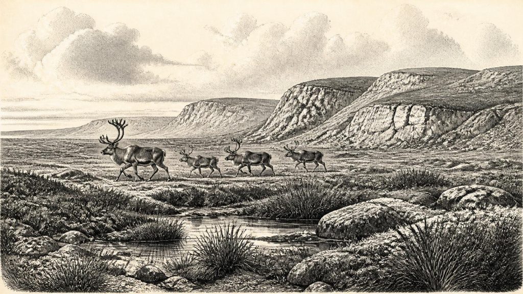
Labelled 31,736 BCE, this period cannot be dated in Ireland more closely than later Marine Isotope Stage 3, a climatically volatile phase preceding the Last Glacial Maximum. Evidence from Derryvree and Aghnadarragh indicates shifting environments, including open wetlands, cool-temperate episodes, periglacial ground and changing ice margins. Castlepook Cave preserves a time-depth assemblage of reindeer, mammoth, giant deer, bears, wolves, Arctic foxes, lemmings and hyaenas, demonstrating varied animal communities but not a single contemporaneous fauna. A possibly butchered reindeer bone suggests an Upper Palaeolithic visit, yet no settlement is proven. The record illuminates ecology and glaciation, while precluding year-specific human history.
Dateline
“31,736 BCE” is a modern calendar label, not a date that can be recovered from an Irish Ice Age deposit. It corresponds only approximately to 33.7 thousand years before the radiocarbon convention of AD 1950. No excavation, fossil layer or climatic record can presently distinguish this particular calendar year from the centuries around it. The responsible setting is therefore a broad one: later Marine Isotope Stage 3 (MIS 3), within the Midlandian Cold Stage of Irish Quaternary history. Calibrated radiocarbon ranges, sediment sequences and ice-sheet reconstructions illuminate that world; they do not yield an annal for a single year.
This was Ireland long before agriculture, villages, monuments, writing or named peoples. The island’s history at this depth is chiefly environmental and zoological. Caves in south Munster, buried organic beds in Ulster, marine sediments and the landforms left by later ice allow archaeologists and geologists to reconstruct fragments of a changing northern landscape. Their evidence is valuable precisely because it is fragmentary: it can show that animals lived in Ireland, that climates altered sharply and that ice advanced and retreated, while also defining the limits of what can be claimed about human life.
A Cold Stage Without Annual Dates
MIS 3 conventionally spans roughly 57,000 to 29,000 years ago. It was not one unchanging winter. Greenland ice-core chronologies reveal abrupt swings between comparatively milder interstadials and colder stadials across the North Atlantic world. Irish sequences preserve local expressions of these changes, but their dates are seldom precise enough to align confidently with one named climatic pulse, much less with 31,736 BCE. Older radiocarbon measurements also require particular care: at this age calibration produces broad probability ranges, and improvements in collagen extraction have materially altered the ages obtained from cave bones.
The broadest chronological point is secure. Ireland was moving towards the great expansion of the last British–Irish Ice Sheet, not yet living through its fullest island-wide glacial maximum. The precise extent of ice over Ireland around 33,700 years ago remains debated. Recent syntheses identify evidence for earlier, dynamic growth and retreat of ice during MIS 3, including signs of glacial loading around southern coasts. Yet the much firmer reconstruction of the ice sheet begins nearer 31,000 years ago, when constraints are still sparse. It would be wrong, therefore, to picture either a uniformly ice-covered Ireland or an entirely open island on the authority of this date alone.
Ground, Water and Vegetation
Evidence from beneath tills is crucial because later glaciers destroyed, displaced or buried so much of the earlier landscape. At Derryvree in County Fermanagh, organic silts between glacial deposits have been interpreted as the remains of a cold, open wetland: a treeless muskeg of mosses, sedges and aquatic plants rather than a familiar Irish woodland. Such deposits are assigned broadly to a middle Midlandian, MIS 3 phase, with some schemes placing the Derryvree phase at about 44,000–28,000 years ago. That is an informative range for this article, but it is not proof that precisely the same pool survived in 31,736 BCE.
At Aghnadarragh in County Antrim, freshwater deposits, pollen and beetle remains record other episodes of markedly less severe conditions during the same long cold stage. Pollen from trees and shrubs, together with insects whose modern distributions favour cool-temperate environments, demonstrates that the climate and vegetation could change profoundly over millennia. Taken together, Derryvree and Aghnadarragh warn against treating Ice Age Ireland as a single tundra tableau. Around this notional year, regional terrain may have included open herb-rich ground, wet hollows, streams and periglacial surfaces, while the positions of glaciers and the coastline were shifting on longer timescales.
Lower global sea levels altered the surrounding shelf seas, but they do not by themselves demonstrate an easy dry crossing between Ireland and Britain. The Irish Sea basin had a complicated topography and its relative sea level was affected both by global ocean volume and by the loading and flexing of the Earth’s crust beneath ice. Any routes used by animals, if they existed at a given time, remain matters for geological reconstruction. No Irish evidence identifies a trackway, a crossing point or a journey in this period.
The Castlepook Record
Castlepook Cave, near Doneraile in north County Cork, is the key Irish site for imagining the animal world of MIS 3. Its old excavations produced remains attributed to reindeer, woolly mammoth, giant deer, brown bear, wolf, Arctic fox, lemmings and spotted hyaena. This is not a census of one landscape on one day. Cave deposits accumulated over long periods, and a carnivore den can mix prey brought in at different times with animals that died naturally, material washed in by water and sediments disturbed by collapse. Early twentieth-century collecting removed large quantities of bone and left imperfect records of original position and association.
Nevertheless, the revised radiocarbon programme has changed the scale of the story. Re-dating of Castlepook, Foley and Shandon cave fauna with improved methods showed that several older determinations had underestimated the antiquity of the bones by thousands of radiocarbon years. The results support a substantially older MIS 3 presence in Ireland for mammals including giant deer and spotted hyaena, with some local populations apparently gone before the Last Glacial Maximum. Castlepook therefore preserves evidence for a succession of cold-stage animal communities, not merely the sparse fauna of the final thaw.
Reindeer and lemmings point towards cold, open habitats; hyaena and wolf demonstrate the presence of large carnivores; mammoth and giant deer evoke a productive but demanding grazing world. Yet these species should not be forced into a single, simultaneous “Ice Age herd”. Individual dates, cave context, preservation and later re-analysis matter. The strongest conclusion is that Ireland supported, at intervals in MIS 3, more varied large-mammal communities than its modern fauna would suggest. It does not establish the exact mix of species in 31,736 BCE, their seasonal movements or their population sizes.
The Human Question
A reindeer femur recovered at Castlepook has been reported as bearing a deep mark consistent with stone-tool butchery and has been publicised as possible evidence for people in Ireland about 33,000 years ago. If the mark was made on fresh bone by a human tool and is contemporary with the animal’s death, it would be exceptionally important: it would indicate an Upper Palaeolithic visit to Ireland more than twenty millennia before the better-established late-glacial evidence from Alice and Gwendoline Cave in County Clare.
But the distinction between possibility and demonstration is essential. A radiocarbon result dates the bone, not the hand that may have marked it. A single modified bone does not establish a camp, a resident population, a hunting party’s route or a continuous tradition of occupation. Castlepook’s disturbed history makes secure association especially difficult, and no closely associated hearth, lithic assemblage, dwelling surface, burial or human remains has yet defined a 32nd-millennium BCE settlement in Ireland. The most cautious interpretation is that a brief human incursion is conceivable, perhaps involving the processing of a reindeer carcass, but remains unproven as a settled presence.
What Cannot Be Recovered
There is no evidence from Ireland around this point for rulers, political communities, diplomacy, warfare, law or territorial boundaries. Nor can archaeology identify language, kinship rules, ritual, religious belief, formal learning, art or social rank. The absence of such evidence must not be mistaken for an assertion that any people who reached Ireland lacked culture. Upper Palaeolithic communities elsewhere in Europe possessed complex practical knowledge, social relations and symbolic traditions. The problem is evidential: Irish finds of this age are too few and too disturbed to transfer those details safely to the island.
The same restraint applies to economy and trade. If Castlepook’s reindeer mark proves anthropogenic, it would indicate a practical act of carcass processing: meat, hide, sinew, marrow or bone may have been valued. It would not demonstrate farming, regular exchange, a specialised hunting economy or a permanent coastal network. The cave fauna can describe ecological opportunity and hazard; it cannot reveal an Irish market, household or community.
Thus the most important development around 31,736 BCE was not a political event but an environmental threshold. Ireland lay within a volatile North Atlantic cold-stage system, inhabited at intervals by striking mammal communities and increasingly shaped by expanding ice. Castlepook, Derryvree and Aghnadarragh preserve different kinds of testimony to that deep past. They offer a richer history than silence, but not the false certainty of a year-by-year chronicle.
Primary Sources
- A Reconsideration of the Radiocarbon Dating of the Marine Isotope Stage 3 Fauna from Southern Ireland
- The Irish Quaternary Fauna Project
- Quaternary Deposits and Glacial Stratigraphy in Ireland
- Freshwater Organic Deposits and Stratified Sediments Between Early and Late Midlandian (Devensian) Till Sheets, at Aghnadarragh, County Antrim, Northern Ireland
- Growth and Retreat of the Last British–Irish Ice Sheet, 31,000 to 15,000 Years Ago: The BRITICE-CHRONO Reconstruction
- The Timing and Magnitude of the British–Irish Ice Sheet Between Marine Isotope Stages 5d and 2
- Pattern and Timing of Retreat of the Last British-Irish Ice Sheet
- New Data for the Last Glacial Maximum in Great Britain and Ireland
- Trimlines, Blockfields and the Vertical Extent of the Last Ice Sheet in Southern Ireland
- Vertical Dimensions and Age of the Wicklow Mountains Ice Dome, Eastern Ireland, and Implications for the Extent of the Last Irish Ice Sheet
- First Evidence of a Late Upper Palaeolithic Human Presence in Ireland
- New Insights on the Fauna of Ireland’s Younger Dryas and Early Holocene from Alice and Gwendoline Cave
- The Antiquity of Man in Ireland
- Ireland: Submerged Prehistoric Sites and Landscapes
- The Last Scottish Ice Sheet
- A Study of the Dynamics of the British Ice Sheet During Marine Isotope Stages 2 and 3
- The Role of Ocean and Atmospheric Dynamics in the Marine-Based Collapse of the Last Eurasian Ice Sheet
- A Stratigraphic Investigation of the Celtic Sea Megaridges Based on Seismic and Core Data from the Irish-UK Sectors
- Global Raster Dataset on Historical Coastline Positions and Shelf Sea Extents Since the Last Glacial Maximum
- The IntCal20 Northern Hemisphere Radiocarbon Age Calibration Curve (0–55 cal kBP)
- IntCal: International Radiocarbon Calibration
- The Exploration of Castlepook Cave, County Cork
