Derryvree’s Drumlin Wetland30927 BCE
Derryvree, County Fermanagh, preserves freshwater organic sediments between glacial tills, indicating that a northern locality was temporarily ice-free during later Marine Isotope Stage 3. Radiocarbon evidence places the wetland broadly between 34,950 and 29,750 BCE, encompassing 30,927 BCE without dating it precisely. Mosses, sedges and Arctic-alpine plants indicate a cold, treeless periglacial mosaic with shallow water and seasonal thaw. Southern cave fauna, including reindeer, mammoth, hyaena and Arctic fox, demonstrates ecological links with Europe. A possibly cut-marked reindeer bone suggests fleeting human presence, but remains disputed. Later ice buried Derryvree, illustrating Ireland’s dramatically changing glacial environments over successive climatic phases.

Dateline
“30,927 BCE” is a useful label for organising deep time, but it was not a year that anyone in Ireland could have named, recorded or experienced as a date on a calendar. Modern calendar-year precision is unavailable at this depth. In archaeological terms, the point falls about 32,876 calibrated years before present, where “present” conventionally means 1950. The appropriate setting is the later part of Marine Isotope Stage 3 (MIS 3), a climatically unstable phase of the last Ice Age. Ireland’s evidence is not a narrative of rulers or events, but a sparse archive of sediments, plant remains, insects, animal bones and changing ice.
The most illuminating Irish deposit for this notional year is at Derryvree, near Maguiresbridge in County Fermanagh. It does not prove what occurred on a particular day in 30,927 BCE. Rather, it preserves an environmental interval broad enough to include that date, and shows that at least one northern locality was, for a time, a cold freshwater wetland rather than ground sealed beneath glacier ice.
A Date Within a Range
In 1969, roadworks cut through a drumlin at Derryvree and exposed fine sands, freshwater silts and organic sediment between two thick layers of till. Till is the unsorted debris left by moving glacier ice. The order of the deposits matters greatly. A lower till records an earlier glacial episode; sediments accumulated when ice no longer covered the locality; an upper till shows that later ice returned or expanded across it. The sequence is therefore evidence of profound environmental change, not a frozen snapshot of a single year.
Organic material from the freshwater series produced the radiocarbon determination Birm-166: 30,500 radiocarbon years before present, with a substantial uncertainty of +1,170 and −1,030 years. Such a measurement cannot simply be converted by subtracting from 1950. Atmospheric radiocarbon levels changed through time, and calibration produces probability ranges rather than an exact historical date. Modern calibrations place the Derryvree horizon broadly within roughly 36,900–31,700 calibrated years before present, or approximately 34,950–29,750 BCE. The requested year lies inside that span, but cannot responsibly be pinned to a particular plant, pond margin or season within it.
This distinction is central. The evidence demonstrates that Derryvree was ice-free locally during part of a cold interval and supported freshwater life. It does not demonstrate that all Ireland was ice-free, that its climate was uniform, or that the entire deposit formed in 30,927 BCE. Ireland was an Atlantic island-region shaped by shifting ice margins, sea levels and drainage systems; conditions could differ sharply between Fermanagh, the southern lowlands, mountain uplands and the exposed continental shelf.
Cold Water Beneath the Drumlin
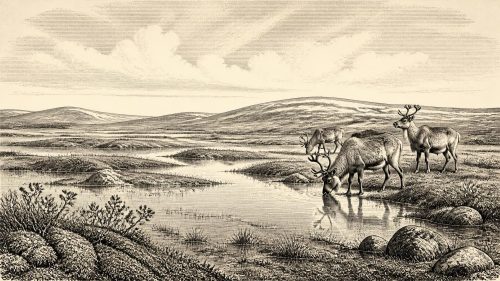
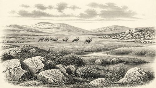
Derryvree’s fossils reconstruct a treeless, open landscape with wet ground and shallow freshwater. Mosses, sedges, grasses and other herbaceous plants dominate the evidence. The assemblage includes plants associated with northern and Arctic-alpine conditions, among them bogbean, dwarf willow, mountain avens and lesser clubmoss. Their presence does not mean that every one grew together in a neat modern plant community. Fossil assemblages accumulate over time and may draw material from different small habitats. Yet taken together they strongly support a cold, periglacial mosaic: damp hollows, sedge-rich margins, shallow pools and open ground, with sparse vegetation beyond the wetland.
“Periglacial” does not mean that Derryvree was simply a featureless snowfield. It describes a landscape shaped by severe cold and by the seasonal freezing and thawing of ground close to ice sheets. Summer warmth could briefly release meltwater and allow plants, insects and animals to exploit sheltered places; winter would have been long and exacting. The organic silts show that freshwater persisted long enough for biological remains to be trapped and preserved. The later upper till, however, is a reminder that this ecological opening was temporary in geological terms.
At this time the island’s familiar wooded appearance did not exist. There were no oak woods, hedgerows, improved fields or peatlands of the later Holocene. Nor should the evidence be stretched into an image of continuous barren tundra across the whole island. The safest reconstruction is regional and local: open, cold country in and around Derryvree, with vegetation concentrated where water and sheltered soils allowed it.
Animals in an Unfamiliar Ireland
Cave deposits in southern Ireland add a larger-animal dimension to the picture. Castlepook Cave, near Doneraile in County Cork, has yielded a notable Late Pleistocene fauna. Re-dating of selected bones has shown that some material once thought much younger belongs in MIS 3. The broader assemblage includes reindeer, woolly mammoth, giant deer, brown bear, wolf, Arctic fox, mountain hare, lemmings and spotted hyaena. Not every bone from the cave is necessarily the same age, and the cave was not a single undisturbed occupation floor. The fauna should therefore be read as a record of animals using, dying near, or being carried into a changing regional landscape over an extended period.
Even with that caution, the implications are striking. Reindeer indicate open grazing country and seasonal mobility; lemmings and Arctic fox point to cold conditions; hyaenas and wolves testify to a predator community absent from later Irish history. Mammoth remains show that very large grazers reached Ireland during an earlier part of the last glacial cycle. Their presence is evidence of ecological connection with north-west Europe, but it does not reveal a permanent migration route, a stable land bridge, or the exact coastline at the notional year in question.
Sea levels were lower globally because immense quantities of water were held in ice sheets. The surrounding shelf was correspondingly more exposed in places than it is today. Yet the routes available to animals and people depended not only on sea level, but on local ice, rivers, marshes, coasts and the changing configuration of the Irish Sea basin. It is safer to say that Ireland was repeatedly connected ecologically to the wider western European world than to imagine an uncomplicated dry road to the continent.
The Human Question
The greatest historical question is whether people entered Ireland during this phase. A reindeer femur from Castlepook Cave has been interpreted as bearing a deep mark made by a sharp stone implement while the bone was fresh. The animal has been presented as dating to around 33,000 years ago, and the mark has been proposed as evidence of carcass processing by Upper Palaeolithic hunters. If that interpretation is accepted, it would push evidence for human activity in Ireland far earlier than the well-established post-glacial settlement record.
But the claim must be kept in proportion. A modified bone is not a village, a people or a continuous occupation. There is no securely dated hearth, stone-tool assemblage, dwelling surface, burial, art object or settlement plan in Ireland that can be assigned to 30,927 BCE. The bone dates the animal, not necessarily the making of the mark; cave deposits may be disturbed; and distinguishing tool damage from carnivore action, trampling, weathering or excavation damage requires careful microscopic assessment. Castlepook is an important and provocative clue, not a licence to write a settled human history for Ice Age Ireland.
If visitors did reach the island, they were likely to have been highly mobile hunter-gatherers operating at the north-western edge of the Upper Palaeolithic world. That is an inference from the ecology and from comparable societies elsewhere in Europe, not a fact recovered directly from Derryvree or Castlepook. Such people would have needed intimate knowledge of animal movement, weather, fuel, stone and shelter. Reindeer, hides, bone, sinew and fat could have been valuable resources. A brief hunting visit, seasonal passage or small camp is more consistent with the present evidence than any claim of a large, permanent population.
No Kingdoms, No Known Wars
There is no evidence for political institutions, chiefs, kingdoms, diplomacy, territorial frontiers or organised warfare in Ireland at this date. There are no names, languages, oral traditions that can be securely traced back to this moment, or material signs from which religion can responsibly be reconstructed. The dramatic animals of Castlepook do not prove ritual; the wetland plants at Derryvree do not reveal beliefs. Nor is there evidence for trade in the later sense of sustained exchange networks, specialised production or maritime commerce.
This is not an empty past. It is a past in which environment governed possibility with unusual force. Freshwater, seasonal grazing, shelter from wind, access to stone and the movements of predators and prey would have mattered more immediately than any political boundary. In the absence of direct human evidence, however, those are conditions of life rather than documented aspects of Irish society.
An Island Approaching Ice
In the longer history of Ireland, Derryvree belongs to an interval before the fullest development of the Last Glacial Maximum. Later advances of the British–Irish Ice Sheet covered much of the island and reshaped its surface, leaving tills, drumlins, erratics and scoured rock. The two tills enclosing Derryvree’s organic bed make this sequence tangible: a cold wetland briefly occupied a gap between glacial phases, then became buried in the sediments of renewed ice.
That buried wetland is consequently more than a curiosity. It establishes that Ireland’s Ice Age history was not one unbroken freeze. Around the notional year 30,927 BCE, a northern Irish hollow supported freshwater plants and animals in a severe, open landscape. Elsewhere, large mammals moved through habitats unlike any seen in historic Ireland. People may have made a fleeting appearance, but the proof remains limited. The responsible story is therefore one of mosses, sedges, cold water, reindeer and advancing ice: a prehistoric Ireland known not through chronicles, but through the fragile traces that survived beneath a drumlin.
Primary Sources
- A Middle Midlandian Freshwater Series at Derryvree, Maguiresbridge, County Fermanagh, Northern Ireland
- A Reconsideration of the Radiocarbon Dating of the Marine Isotope Stage 3 Fauna from Southern Ireland
- The Irish Quaternary Fauna Project
- Early Midlandian–Middle Midlandian, Pleistocene, Northern Ireland
- Palaeoecology
- The Subdivision of the Quaternary Period in Ireland
- Late Pleistocene Chronostratigraphy and Ice Sheet Limits, Southern Ireland
- Pattern and Timing of Retreat of the Last British-Irish Ice Sheet
- Growth and Retreat of the Last British–Irish Ice Sheet, 31,000 to 15,000 Years Ago: the BRITICE-CHRONO Reconstruction
- The Last Eurasian Ice Sheets – a Chronological Database and Time-Slice Reconstruction, DATED-1
- Dimensions and Chronology of the Last Ice Sheet in Western Ireland
- Freshwater Organic Deposits and Stratified Sediments Between Early and Late Midlandian (Devensian) Till Sheets at Aghnadarragh, County Antrim, Northern Ireland
- Mammoth and Musk Ox ESR Dated to the Early Midlandian at Aghnadarragh County Antrim, Northern Ireland and the Age of the Fermanagh Stadial
- A 60,000 Year Greenland Stratigraphic Ice Core Chronology
- IntCal20 Northern Hemisphere Radiocarbon Age Calibration Curve (0–55 cal kBP)
- IntCal13 and Marine13 Radiocarbon Age Calibration Curves 0–50,000 Years cal BP
- AMS Radiocarbon Dating of Ancient Bone Using Ultrafiltration
- AMS Radiocarbon Dating of Middle and Upper Palaeolithic Bone in the British Isles: Improved Reliability Using Ultrafiltration
- The Explorations of Some Caves Near Castletownroche, Co. Cork
- The Exploration of Castlepook Cave, County Cork