Derryvree’s Buried Pool31423 BCE
31,423 BCE is a modern chronological label within unstable MIS 3, not a recorded Irish year. At Derryvree, County Fermanagh, freshwater organic sediments between glacial tills indicate a temporary ice-free, treeless wetland landscape, dated broadly to 36,900–31,700 calibrated years BP. Plant and insect remains show pools, mosses and open periglacial ground. Comparable Ulster deposits demonstrate fluctuating ice cover. Castlepook Cave’s MIS 3 fauna, including reindeer, mammoth and hyaena, shows periodic ecological connections with Europe, while ancient-DNA findings remain provisional. Possible tool damage on a reindeer bone suggests, but does not establish, human visitation. Later glaciation buried or destroyed older evidence.
Dateline
The label 31,423 BCE is a modern way of locating a very remote point in time, not a year that anyone then living in Ireland could have named, recorded or commemorated. It falls roughly 33,400 years before AD 1950, within the Late Pleistocene and Marine Isotope Stage 3 (MIS 3), a climatically unsettled part of the last Ice Age. At this depth of time, modern calendar-year precision is unavailable. The responsible history is therefore not an account of a single event in one Irish ‘year’, but a reconstruction from deposits, fossils and dating ranges that overlap this notional date.
The most important evidence comes from places which preserve a sequence rather than a story: sediments laid down by water, later sealed beneath glacial deposits; animal remains recovered from caves; and landforms that record the changing reach of ice. Such evidence can show that parts of Ireland supported life during portions of MIS 3. It cannot identify a government, tribe, language, belief system, household or individual active in 31,423 BCE.
A Pool Beneath the Drumlin
The closest Irish environmental archive to this date is Derryvree, near Maguiresbridge in County Fermanagh. Roadworks exposed a remarkable sequence beneath a drumlin: an older glacial till, freshwater silts and fine sands with organic material, and then a younger till. In plain terms, ice deposited the lower layer, a non-glacial interval allowed pools and wet ground to develop, and later ice overran and sealed the evidence. That order is secure even where exact dating remains broad.
Organic material from the Derryvree freshwater series produced a conventional radiocarbon age of about 30,500 ± 1,170 radiocarbon years BP. Published calibrated discussion places it broadly around 36,900–31,700 calibrated years BP, approximately 34,950–29,750 BCE. The modern label 31,423 BCE lies within that wide span, but it cannot be attached to one bed, season or episode at the site. Calibration is essential because radiocarbon years are not identical to calendar years, especially so far back in time; the range also includes uncertainty in both the measurement and the calibration curve.
What Derryvree responsibly reveals is an Irish landscape that was not continuously buried beneath the later Last Glacial Maximum ice sheet. During the interval represented by the freshwater deposits, north-central Ireland had ground open to water, plants and animals. It was a temporary environmental window, subsequently hidden by the advance that helped form the drumlin landscape familiar today. The deposit does not prove that every part of Ireland was ice-free at once, nor does it supply a map for one particular year. It does demonstrate that the history of the island’s last glaciation involved advances, retreats and long cold intervals rather than one uniform, unchanging blanket of ice.
Treeless Wet Ground
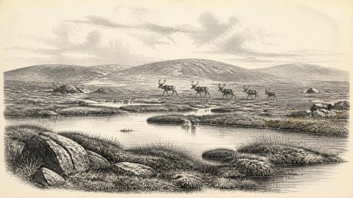
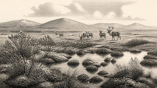
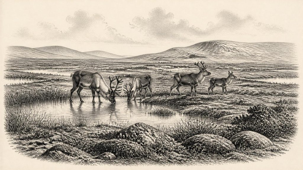
Plant, moss and insect remains from Derryvree indicate open, treeless country with freshwater and waterlogged patches. The best comparison is not modern rural Fermanagh, with its enclosed fields, hedges and woodland remnants, but a cold periglacial mosaic of sedgy wetland, shallow pools, mossy ground and exposed mineral soil. Plants able to withstand low temperatures, frost disturbance and short growing seasons occupied sheltered, damp places. The word ‘tundra’ is useful only if it is understood as a varied landscape: wet hollows and pool margins could be productive even while nearby ground was windswept and sparsely vegetated.
This was not necessarily a uniformly severe frozen desert. Freshwater sediments and biological remains require liquid water during at least part of the year. Yet the wider setting was cold enough for periglacial processes, in which repeated freezing and thawing rearranged soil and sediment. The climate fluctuated markedly during MIS 3. A deposit such as Derryvree averages across changing conditions and cannot tell us the weather on a particular day in 31,423 BCE. It does, however, give a more reliable picture of regional ecology than any imagined scene of permanent snow and ice.
Other Ulster sequences help establish the larger point. At Aghnadarragh near Lough Neagh, deposits between tills preserve evidence for earlier woodland phases, colder non-glacial conditions and later lowland glaciation. Greenagho in County Fermanagh has yielded organic material beneath till with a calibrated range broadly earlier than Derryvree’s. Together these local records show that the island’s climate and ice cover changed significantly over tens of millennia. They should not be treated as a seamless annual diary, but they rule out a simple claim that all of Ireland was permanently ice-covered around this date.
Animals at the Atlantic Edge
Caves in the south provide a complementary, though more difficult, record. Castlepook Cave, near Doneraile in north County Cork, has produced Ireland’s richest known assemblage of pre-Last Glacial Maximum vertebrate remains. Re-dating work has shown that a number of bones once assigned younger ages are in fact substantially older, placing part of the fauna in MIS 3. The assemblage includes animals associated with cold, open landscapes and, at different times, larger herbivores and formidable carnivores, including reindeer, giant deer, woolly mammoth, brown bear and spotted hyaena.
These bones establish ecological presence, not a single contemporaneous herd gathered at one place. Cave deposits were affected by carnivores, water movement, collapse and early excavations, so their contents must be disentangled specimen by specimen. A mammoth bone and hyaena material may signal scavenging, predation, denning or the transport of carcass parts rather than a tranquil herd scene. Equally, an animal radiocarbon date tells us when that animal lived or died, not how long its species endured on the island. The most careful conclusion is that Ireland was periodically part of a wider north-west European range for cold-stage mammals before the full growth of the last ice sheet.
That conclusion is strengthened, though not made final, by recent sedimentary ancient-DNA research from Castlepook. The study reports genetic traces of several animal taxa and links the maternal lineages of Irish mammoths and cave hyaenas to wider Late Pleistocene European populations. As a preprint, it remains developing research rather than settled consensus. Its significance is nonetheless clear: Ireland was not biologically isolated in the way the modern island may appear. Changing sea levels, coastlines and glacial corridors could permit animal movement at some stages, although the precise routes and dates remain debated.
The Human Question
The possibility of people in Ireland during this broader period deserves both attention and restraint. A reindeer femur from Castlepook has been reported as carrying a mark interpreted as damage made on fresh bone by a sharp stone implement. If that interpretation and its association are confirmed, it would be important evidence for a short-lived Palaeolithic human visit before the Last Glacial Maximum. Work supported by the Royal Irish Academy has accordingly sought surviving deposits, stone tools, charcoal and further modified bone at Castlepook.
But the evidence does not yet support a settled human population in Ireland around 31,423 BCE. No securely associated stone-tool assemblage, hearth, dwelling floor, burial, artwork or repeated occupation sequence of this age has been established there. The cave’s early excavations and complicated deposits make context especially important. A cut-like mark and a date on an animal bone are two separate evidential questions: one concerns the age of the animal, the other whether the mark was made by a human tool rather than natural damage. Until a fuller archaeological context is recovered, a possible visit is not proof of permanent settlement.
This limitation matters for every supposedly human theme. There is no evidence from Ireland at this date for political institutions, diplomacy, warfare between communities, formal trade, named territories, language or religion. Nor is there evidence for houses, clothing, boats, campsites or routine food preparation. It would be wrong to fill the silence by importing the better-known cultures of continental Europe into Ireland. If people did reach the island during a favourable interval, they may have travelled through a wider world of mobile hunter-gatherers; that is an inference from neighbouring regions, not an observed Irish social history.
Ice Yet to Come
The chief historical development surrounding this date was environmental rather than political: the approach of major ice-sheet growth. Later evidence shows that the Irish Ice Sheet became extensive during the Last Glacial Maximum, conventionally about 26,500–19,000 years ago, though the timing and thickness varied by region. Research on Derryvree and Greenagho indicates that north-central Ireland retained ice-free conditions until at least about 34,000 years ago, before the later expansion of the ice sheet. By the Last Glacial Maximum, much of the island would be reshaped beneath ice, while glacial erosion and deposition destroyed or buried many older landscapes.
For that reason, Derryvree’s buried freshwater deposits are more than a local curiosity. They preserve an interval otherwise largely erased: open ground with pools, plants and animals before later ice transformed the terrain. They also explain why Ireland’s record for this period is so fragmentary. Absence of evidence for a camp or a community cannot automatically be turned into proof that none ever existed; glaciers, rivers and quarrying have all removed evidence. Yet archaeology must work from what survives. Around 31,423 BCE, Ireland is best understood as a cold, changing Atlantic landscape, ecologically connected at intervals to Ice Age Europe, with a clear fossil and environmental record but only an unresolved and exceptionally slight indication of human presence.
Primary Sources
- A Middle Midlandian Freshwater Series at Derryvree, Maguiresbridge, County Fermanagh, Northern Ireland
- A Reconsideration of the Radiocarbon Dating of the Marine Isotope Stage 3 Fauna from Southern Ireland
- The Irish Quaternary Fauna Project
- Trimlines, Blockfields and the Vertical Extent of the Last Ice Sheet in Southern Ireland
- Freshwater Organic Deposits and Stratified Sediments Between Early and Late Midlandian (Devensian) Till Sheets, at Aghnadarragh, County Antrim, Northern Ireland
- Aghnadarragh
- Archaeology Research Excavation Grant 2022: Final Report
- Castlepook Cave, Castlepook South, County Cork: Excavation Report 2022
- Sedimentary Ancient DNA Reveals Late Pleistocene Faunal Connectivity Between Ireland and Eurasia
- New Insights on the Fauna of Ireland’s Younger Dryas and Early Holocene from Alice & Gwendoline Cave
- The IntCal20 Northern Hemisphere Radiocarbon Age Calibration Curve (0–55 cal kBP)
- IntCal Publications
- The Last Glacial Maximum
- Radiocarbon Constraints on the Age of the Maximum Advance of the British-Irish Ice Sheet in the Celtic Sea
- Dimensions and Chronology of the Last Ice Sheet in Western Ireland
- Last Glacial Maximum Cirque Glaciation in Ireland and Implications for Reconstructions of the Irish Ice Sheet
- The Evolution of the Terrestrial-Terminating Irish Sea Glacier During the Last Glaciation
- The Problem of a Late Quaternary Landbridge Between Britain and Ireland
- Deglaciation, Earth Crustal Behaviour and Sea-Level Changes in the Determination of Insularity: A Perspective from Ireland
- Could Brown Bears (Ursus arctos) Have Survived in Ireland During the Last Glacial Maximum?
- Stoats (Mustela erminea) Provide Evidence of Natural Overland Colonization of Ireland
- Timing and Pace of Ice-Sheet Withdrawal Across the Marine–Terrestrial Transition West of Ireland During the Last Glaciation
- Irish Caves Database: Mammoth Cave