
Derryvree’s Icebound Basin31302 BCE
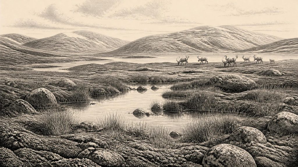
About 31,302 BCE, Ireland lay within the climatically unstable later Marine Isotope Stage 3, not a datable historical year. At Derryvree, Fermanagh, freshwater organic sediments between glacial tills preserve tundra wetland plants and cold-adapted insects, demonstrating life during an interval between ice advances. Crag Cave records intermittent milder conditions, while Castlepook Cave documents mammoths, giant deer, reindeer, predators and other open-country fauna over millennia. A cut-marked reindeer femur may indicate an early human visit, but proves neither settlement nor permanent population. Changing sea levels and expanding ice complicated access. Soon advancing British-Irish ice would transform and largely engulf the island.
Dateline
The label 31,302 BCE is a modern chronological convenience, not a year that anyone in Ireland could have named, recorded or experienced as a point in a calendar. It corresponds approximately to 33,251 years before AD 1950, the conventional “present” of radiocarbon dating, but that arithmetic equivalence must not be mistaken for archaeological precision. At this depth in time, dates come with substantial uncertainties and must be calibrated against changing atmospheric carbon-14 levels. The responsible subject is therefore Ireland during the later part of Marine Isotope Stage 3 (MIS 3), a fluctuating phase of the last Ice Age, rather than a recoverable sequence of events in one particular year.
A Date Within Broad Ranges
The closest useful Irish evidence is environmental rather than historical. In 1969, roadworks at Derryvree townland, about two kilometres north-east of Maguiresbridge in County Fermanagh, cut through a drumlin: a streamlined hill built and reshaped by glacier ice. Investigators found a remarkable sequence. A lower till, the unsorted sediment left beneath moving ice, was overlain by freshwater silts, fine sands and organic-rich layers; these in turn were sealed beneath another thick till. The order records an earlier glacial episode, a later interval in which water, plants and animals occupied the locality, and a renewed ice advance that buried the evidence.
Organic material from the intervening deposit produced radiocarbon determination BIRM-166, conventionally measured at 30,500 radiocarbon years BP, with an uncertainty of +1,170 and −1,030 years. Such a result cannot identify a particular year, season or human generation. Modern calibration confirms the general lesson rather than furnishing a neat date: the Derryvree deposits belong broadly within later MIS 3, not to an annual chronicle. The nominal date considered here falls plausibly within the wider environmental horizon illuminated by the deposit, but it cannot be pinned to one stratum, plant, animal or episode of standing water.
Wet Ground Between Ice Advances
Derryvree provides an unusually intimate view of a vanished Irish landscape. Its fossil flora and fauna indicate open tundra vegetation and a periglacial regime: a cold setting shaped by frost, seasonal thaw and saturated ground at or near the margins of ice. This was not the familiar green, wooded Ireland of modern imagination. Treeless or almost treeless ground supported mosses, sedges, grasses and hardy herbs, with freshwater habitats in pools and slow watercourses. Plant evidence includes taxa adapted to cold and wet conditions, among them bogbean, mountain-avens and lesser clubmoss. These remains establish local ecological conditions more directly than pollen alone, because seeds, leaves and moss fragments usually travelled only short distances before burial.
The freshwater silts also contained insects of cold northern aspect. Together with the plants, they suggest a mosaic rather than a featureless white wilderness: wet hollows, shallow pools, sedge margins and drier, wind-exposed patches of open ground. Summer growth may have been brief but biologically important. In a landscape where shelter, unfrozen water and forage were unevenly distributed, small variations in slope, drainage and snow cover could determine where plants thrived and where grazing animals lingered. This is evidence for habitat, not for a settled community. Derryvree tells us that a living wetland existed between ice advances; it does not prove that the whole island was simultaneously ice-free.
An Unstable Atlantic Climate
Ireland stood at the Atlantic edge of north-west Europe, exposed to abrupt climatic shifts associated with the North Atlantic system. MIS 3 was not a single, uniformly cold block of time. It contained warmer interstadial episodes and harsher stadials, with major changes sometimes occurring on millennial or shorter scales. Evidence from Crag Cave in County Kerry reinforces that point. Uranium-thorium dates show episodes of speleothem growth during the last glacial period; in a shallow cave, calcite formation required percolating liquid water and conditions generally above freezing on an annual basis. Particularly vigorous growth late in MIS 3 is consistent with intermittent climatic amelioration in south-west Ireland.
That does not mean a mild climate by present standards. It means that, within a long cold age, there were intervals in which liquid water circulated underground, soils became biologically active and landscapes could support more varied vegetation. The contrast with colder phases may have been dramatic. The Crag Cave research estimates temperature differences of at least 10°C between stadial and interstadial conditions at this ocean-margin site. Derryvree’s buried wetland should therefore be understood as part of a dynamic system, vulnerable to changing snowfall, summer warmth and the advance or retreat of nearby ice, rather than as a stable climatic province.
Animals of the Open Country
For the wider animal world, Castlepook Cave near Doneraile in north County Cork is indispensable. Also called Mammoth Cave, it is Ireland’s richest known archive of vertebrate remains from the period leading towards the Last Glacial Maximum. Excavations conducted in the early twentieth century recovered more than 2,000 bones from its galleries and chambers. Direct radiocarbon dating of individual bones has shown that the cave accumulated animal remains across a very long span, roughly 45,700 to 19,950 years BP. It is therefore a time-depth archive, not a single assemblage representing one moment or one local herd.
The fauna includes woolly mammoth, giant deer, reindeer, brown bear and spotted hyaena; later material includes wolves, Arctic foxes and lemmings. The most cautious conclusion is substantial: during parts of the pre-Last Glacial Maximum Ice Age, Ireland supported, or was accessible to, a markedly different community of large mammals and predators. Reindeer and giant deer could exploit open vegetation; hyaenas and wolves belonged to a food web in which carcasses were contested and bones were moved, chewed and accumulated. Cave deposits preserve that ecological drama imperfectly. Water movement, carnivore activity, antiquarian excavation and the mixing of deposits mean that one bone cannot straightforwardly be matched to another, nor can the cave be treated as a camp or kill site without further evidence.
The Reindeer Femur Question
One Castlepook specimen is especially important to Ireland’s human story: a reindeer femur fragment bearing a deep linear mark interpreted as a stone-tool cut or chopping trace made while the bone was fresh. Reassessment and dating of the bone have been widely presented as evidence of human activity in Ireland around 33,000 years ago. If that interpretation is sustained, it would push the Irish archaeological record far beyond the previously accepted Late Upper Palaeolithic evidence from the cut-marked brown-bear patella at Alice and Gwendoline Cave, County Clare, dated to about 12,810–12,590 calibrated years BP.
Yet the Castlepook femur must be kept in proportion. It is not a house floor, hearth, stone-tool scatter, burial, named cultural group or proof of a permanent population. No securely associated toolkit, shelter or repeat occupation horizon has yet been demonstrated. Nor does a single modified bone establish that people hunted the animal rather than encountered and processed a carcass. The mark is best treated as potentially transformative evidence for a brief human visit or encounter in Ice Age Ireland, while recognising that the cave’s complex formation history makes context crucial. Future excavation of undisturbed deposits and further microscopic, dating and spatial analyses may strengthen, qualify or alter the conclusion.
People Beyond the Evidence
It follows that political affairs, diplomacy, organised conflict and formal religion cannot responsibly be described for Ireland at this date. There are no contemporary names, monuments, ritual deposits, settlements or written traditions. There is likewise no evidence for farming, village life, metalworking, long-distance trade systems or institutions comparable to those of later prehistoric Ireland. The absence of evidence should not be converted into a claim that no human being ever reached the island, particularly in light of the Castlepook femur; but it does require restraint about society. Any visitors were more likely to have belonged to small, mobile hunter-gatherer groups whose activities left little durable material and whose traces were later damaged or erased by ice and erosion.
European Upper Palaeolithic communities elsewhere used sophisticated stone technologies, made personal ornaments and art, and organised themselves around mobility, kinship and seasonal resources. Those wider comparisons help explain what may have been possible for people who reached Ireland, but they are not evidence that the same objects, beliefs or practices occurred here. Ireland’s own record at this point is too thin to assign an archaeological culture, language or identity. It is more accurate to say that the island lay within an ecologically connected north-west European world of shifting animal movements and changing opportunities, while remaining geographically difficult to reach and preserve archaeologically.
Water, Distance and Coming Ice
Lower global sea levels altered the outlines of the Irish Sea basin, but they did not automatically create a dependable dry route between Ireland, Britain and continental Europe. Whether a land bridge existed depended on the interacting effects of sea level, crustal movement, ice distribution and local topography; such conditions could be short-lived and regionally variable. Any crossing may have required journeys along exposed shelf landscapes, across ice or water, or by boat. The evidence does not permit a specific route for humans or animals around 31,302 BCE.
What is clearer is the direction of long-term environmental change. The British-Irish Ice Sheet was growing rapidly during the later stages of MIS 3, although its expansion was asynchronous across different sectors. By roughly 31,000 years ago, ice was advancing strongly in north-western Britain and Ireland’s surrounding seas; later, during the Last Glacial Maximum, ice would cover almost all of Ireland and radically reshape its landforms. The two tills at Derryvree foreshadow that future. They sandwich a brief, precious environmental archive between episodes of glaciation.
Thus the most important history of Ireland around this nominal year is not a battle, ruler or founding, but survival in a changing Ice Age landscape. Derryvree’s silt, mosses, seeds and insects show cold freshwater habitats persisting between incursions of ice. Castlepook’s bones reveal an open-country fauna of extraordinary scale and diversity. A marked reindeer femur raises the possibility that people briefly entered this world. Together, these traces offer a rigorous but evocative picture: not calendar history, but deep time in which water, frost, animals and moving ice governed the possibilities of life.
Primary Sources
- A Middle Midlandian Freshwater Series at Derryvree, Maguiresbridge, County Fermanagh, Northern Ireland
- Early Midlandian–Middle Midlandian, Pleistocene, Northern Ireland
- A Reconsideration of the Radiocarbon Dating of the Marine Isotope Stage 3 Fauna from Southern Ireland
- Castlepook Cave: Cork County Geological Site Report
- 2022:564 – Castlepook Cave, Castlepook South, Cork
- Heritage Artefacts of County Cork
- The Irish Quaternary Fauna Project
- Episodic Speleothem Deposition Tracks the Terrestrial Impact of Millennial-Scale Last Glacial Climate Variability in SW Ireland
- The IntCal20 Northern Hemisphere Radiocarbon Age Calibration Curve (0–55 cal kBP)
- IntCal History
- Extent and Timing of the Last Glacial Maximum (LGM) in Britain and Ireland: A Review
- Growth and Retreat of the Last British–Irish Ice Sheet, 31,000 to 15,000 Years Ago: the BRITICE-CHRONO Reconstruction
- Late Pleistocene Chronostratigraphy and Ice Sheet Limits, Southern Ireland
- Response of the Irish Ice Sheet to Abrupt Climate Change During the Last Deglaciation
- Dimensions and Chronology of the Last Ice Sheet in Western Ireland
- Character of Advance and Retreat of the Southwest Sector of the British-Irish Ice Sheet During the Last Glaciation
- Quaternary Deposits and Glacial Stratigraphy in Ireland
- Deglaciation, Earth Crustal Behaviour and Sea-Level Changes in the Determination of Insularity: A Perspective from Ireland
- Ireland: Submerged Prehistoric Sites and Landscapes
- First Evidence of a Late Upper Palaeolithic Human Presence in Ireland
- The Mesolithic in Ireland: When Was It?
- New Insights on the Fauna of Ireland's Younger Dryas and Early Holocene from Alice & Gwendoline Cave
- Freshwater Organic Deposits and Stratified Sediments Between Early and Late Midlandian (Devensian) Till Sheets, at Aghnadarragh, County Antrim, Northern Ireland
