
Fermanagh’s Unburied Waters30275 BCE
Labelled 30,275 BCE, this interval cannot be tied to a specific Irish event or year. Derryvree, County Fermanagh, preserves freshwater organic deposits between glacial tills, indicating a locally ice-free or ice-margin phase within MIS 3, broadly dated to 34,950–29,750 BCE. Its plants and animals reveal cold, open tundra wetland, not permanent ice cover. Castlepook Cave, County Cork, documents fauna including reindeer, mammoth and giant deer, but not a single contemporaneous community. A butchered reindeer bone suggests human visits, yet no evidence demonstrates settlement. The record instead reveals dynamic, biologically active Ireland, while requiring caution over climate, geography and human activity.
Dateline
“30,275 BCE” is a modern chronological label, not a year that can be recovered from an Irish event, ruler, settlement or seasonal diary. At this depth in time, calendar-year precision is unavailable. The evidence comes from deposits that accumulated over long periods, from animal bones whose dates carry substantial margins of error, and from reconstructed climatic sequences. In radiocarbon convention the year falls about 32,225 years before AD 1950, within the Late Pleistocene and broadly within Marine Isotope Stage 3 (MIS 3). It can therefore illuminate an interval in Ireland’s Ice Age history, but not a particular day, generation or human episode.
The most useful Irish record for this horizon is not a habitation site but a buried freshwater deposit at Derryvree, near Maguiresbridge in County Fermanagh. It is an extraordinary survival: organic silts and fine sands, with fossil plants and small animals, caught between two thick layers of glacial till inside a drumlin. Its lesson is both vivid and limited. During part of the interval represented by the deposit, this locality was not beneath active glacier ice. It supported cold-climate wetland life. Before and afterwards, ice crossed the ground and left the deposits that enclosed it.
A Date Range, Not a Dateline
Road works exposed the Derryvree sequence in 1969. The lower till records an earlier phase of glaciation. Above it lie freshwater sands, silts and organic layers; above those, a second till records renewed ice cover. This stratigraphic order is direct physical evidence for an ice-free or ice-margin interval at the site between glacial episodes. It does not prove that the whole island was simultaneously free of ice, nor does it supply a national map of climate, vegetation or coastlines. Ireland’s landscape was regionally varied, while later glaciers and rising seas removed or obscured much of the evidence.
Organic material from Derryvree produced the conventional radiocarbon determination Birm-166: 30,500 radiocarbon years before present, with an uncertainty of +1,170 and −1,030 years. Radiocarbon years are not calendar years. Atmospheric carbon-14 levels have varied, so laboratory measurements must be compared with independently dated calibration curves. Expressed as a broad calibrated age range, the Derryvree horizon is often placed at approximately 36,900–31,700 calibrated years before present, or roughly 34,950–29,750 BCE. The notional year 30,275 BCE falls within that broad window, but cannot be identified with a particular stratum, pool, plant, animal or season.
This distinction is essential. The Derryvree deposits are a palaeoenvironmental archive, not a written source. Their date gives the likely age of an environmental phase, not an annual event. The wide range is not a failure of research: it accurately expresses the limits of material evidence so far into the past.
Open Tundra and Fresh Water
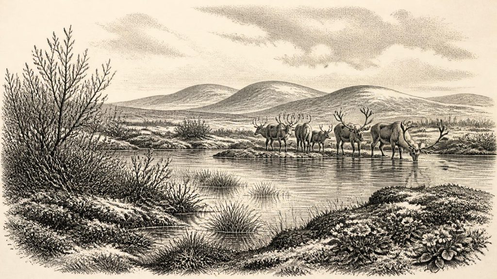
The flora and fauna preserved at Derryvree indicate open tundra vegetation and a periglacial regime: a severe landscape shaped by frost, short growing seasons and sparse tree cover. Fossil remains include wetland and aquatic plants alongside species associated with exposed cold ground, such as dwarf willow and mountain avens. Mosses, sedges and plants of shallow fresh water point to a basin with pools, saturated margins and slow-moving or standing water. Such a setting should not be imagined as barren white ice. In the brief productive season it could have been textured with low vegetation, muddy water margins, insects and birds, while winter frost transformed the ground.
The evidence supports a cold, open Fermanagh landscape rather than a continuous forest. Yet it does not justify an exact reconstruction of temperature, snowfall or the length of the summer at 30,275 BCE. MIS 3 was climatically unstable across the North Atlantic world, with abrupt shifts visible in ice, ocean and cave records. Local Irish wetlands would have responded to changing temperature, precipitation, drainage and the proximity of ice, but their precise sequence remains difficult to resolve.
At a larger scale, Ireland was moving towards the expansion of the last British–Irish Ice Sheet. The Last Glacial Maximum lay thousands of years ahead: marine and terrestrial reconstructions place major ice-sheet expansion and its maximum extent principally between about 27,000 and 19,000 calibrated years before present, varying by sector. Derryvree consequently belongs to a changing pre-maximum world, not to a simple story in which Ireland was either wholly frozen or wholly habitable. Its freshwater bed demonstrates local ecological opportunity between advances; its enclosing tills demonstrate how vulnerable that opportunity was to renewed ice.
Animals in a Changing Island
Irish cave deposits, especially in the limestone country of County Cork, add a second kind of evidence. Castlepook Cave near Doneraile has produced one of Ireland’s richest Pleistocene faunal collections. Its dated remains show that an Ice Age fauna occurred in southern Ireland during different parts of MIS 3, including reindeer, giant deer, woolly mammoth, spotted hyaena, brown bear, fox, hare and small cold-adapted mammals. The collection is invaluable, but its limits parallel those at Derryvree. A cave bone assemblage may represent animals accumulated at different times and through different processes, including carnivore activity. It does not mean that every species lived together at one locality in one year.
Still, the broad picture is clear. Ireland was not ecologically empty. Open habitats could support grazing animals and their predators, and caves could become dens, traps, shelters or repositories for bone. Reindeer are especially relevant to the cold, open environments suggested by Derryvree, although the evidence does not establish a single reindeer herd travelling from Fermanagh to Cork. Mammoth and giant deer likewise testify to wider Ice Age ecological connections, not to an exact local food web around Maguiresbridge.
Lower sea levels altered the geography of the Irish Sea basin, but it is unwise to turn that observation into a confident route map. Coastlines and lowlands of this period are now drowned, reshaped or buried, and ice movement later eroded wide areas. Potential travelling corridors, shorelines and camps may therefore be missing from the surviving record. The physical difficulty of reaching or moving around Ireland at this time remains part of the historical problem, rather than a question archaeology has fully solved.
People: Possibility, Not Settlement
The human question is the most compelling and the most uncertain. A reindeer femur from Castlepook Cave has been reported as dating to about 33,000 years ago and as carrying a mark interpreted as consistent with stone-tool butchery. If that interpretation and its association with the animal’s death are confirmed, it would indicate that people may have handled a reindeer in Ireland during MIS 3, broadly near the period considered here. It would not prove a village, a resident population or a continuously occupied island.
The caution is not pedantry. No securely dated Irish hearth, stone-tool assemblage, dwelling floor, burial, human bone or stratified occupation layer demonstrates a settled community around 30,275 BCE. Castlepook’s early excavations produced an important but complicated archive, and current work seeks securely stratified Pleistocene deposits and better dating. The scientifically responsible conclusion is that brief Upper Palaeolithic visits or incursions are possible; sustained settlement at this date remains unproven.
Even if people were present, they should not be projected backwards as an “Irish” people in any ethnic, linguistic or political sense. There is no evidence for named communities, leaders, territories, law, diplomacy, warfare or formal alliances. Nor is there Irish evidence from this horizon for farming, herding, exchange networks, monuments, writing, schools, organised religion or ceremonial structures. European Upper Palaeolithic societies elsewhere made sophisticated tools, images and ornaments, but continental parallels are context, not proof that equivalent cultural practices occurred in Ireland.
Everyday Life Beyond the Evidence
The evidence does permit a narrow statement about possible subsistence. Any visiting hunter-gatherers would have operated in a cold, resource-variable landscape where large herbivores, smaller game, freshwater and sheltered limestone spaces could matter greatly. But this is an inference from ecology and wider Upper Palaeolithic comparisons, not a recovered Irish household. Archaeology cannot currently say how many people came, whether they stayed overnight, what language they spoke, how they organised kinship or whether a marked reindeer bone records hunting, scavenging or a single episode of carcass processing.
There is likewise no responsible basis for describing trade or diplomacy. Material movement between Ireland and neighbouring lands may ultimately be detectable through stone sourcing, genetic evidence or securely dated artefacts, but none presently supplies a social history for this exact period. Absence of evidence should not be mistaken for proof that no person ever crossed the landscape; it means that the surviving record has not demonstrated those activities.
A Landscape Preserved by Burial
For this remote point in Ireland’s past, Derryvree is more revealing than any imagined event. Its silts preserve a moment of environmental possibility: cold freshwater, tundra plants and living ground between separate episodes of glaciation. Castlepook’s fauna supplies a complementary southern archive of Ice Age animals, while the debated reindeer femur keeps open the possibility of a human visit. Together they replace an old image of an unchanging frozen void with a more dynamic one—an island repeatedly altered by ice, water, vegetation and animal movement.
Yet the principal historical fact remains uncertainty. Around 30,275 BCE, there were no Irish polities to chronicle and no calendar that can be aligned with a modern numbered year. What survives is a set of stratified clues. They establish a cold but biologically active Ireland, regional variation between glacial phases, and a tantalising but unconfirmed prospect of human contact. That is not a thin story. It is the beginning of the long archaeological task of recovering Ireland’s earliest landscapes without claiming more than the evidence can bear.
Primary Sources
- A Middle Midlandian Freshwater Series at Derryvree, Maguiresbridge, County Fermanagh, Northern Ireland
- Middle Midlandian Freshwater Series at Derryvree, Maguiresbridge, County Fermanagh, Northern Ireland
- Early Midlandian–Middle Midlandian, Pleistocene, Northern Ireland
- Irish Pleistocene Biostratigraphy
- Freshwater Organic Deposits and Stratified Sediments Between Early and Late Midlandian (Devensian) Till Sheets, at Aghnadarragh, County Antrim, Northern Ireland
- Mammoth and Musk Ox ESR-Dated to the Early Midlandian at Aghnadarragh, County Antrim, Northern Ireland, and the Age of the Fermanagh Stadial
- Figure 6.—The Subdivision of the Quaternary Period in Ireland
- Ireland Under the Ice
- Growth and Retreat of the Last British–Irish Ice Sheet, 31,000 to 15,000 Years Ago: the BRITICE-CHRONO Reconstruction
- The Last Eurasian Ice Sheets – a Chronological Database and Time-Slice Reconstruction, DATED-1
- The Deglaciation of the Western Sector of the Irish Ice Sheet from the Inner Continental Shelf to its Terrestrial Margin
- Bed Erosion During Fast Ice Streaming Regulated the Retreat Dynamics of the Irish Sea Ice Stream
- Last Glacial Maximum Cirque Glaciation in Ireland and Implications for Reconstructions of the Irish Ice Sheet
- The IntCal20 Northern Hemisphere Radiocarbon Age Calibration Curve (0–55 cal kBP)
- IntCal Publications
- North Atlantic Ocean Circulation and Abrupt Climate Change During the Last Glaciation
- The Atlantic Meridional Overturning Circulation and Abrupt Climate Change
- A Reconsideration of the Radiocarbon Dating of the Marine Isotope Stage 3 Fauna from Southern Ireland
- Castlepook Cave
- Archaeology Research Excavation Grant 2022: Castlepook Cave Project Final Report
- Castlepook Cave, County Cork, 2022
- First Evidence of a Late Upper Palaeolithic Human Presence in Ireland
- The Colonization of Ireland: A Human Ecology Perspective
- Ireland: Submerged Prehistoric Sites and Landscapes
- New Insights on the Fauna of Ireland's Younger Dryas and Early Holocene from Alice & Gwendoline Cave
