Derryvree’s Moss Beds31743 BCE
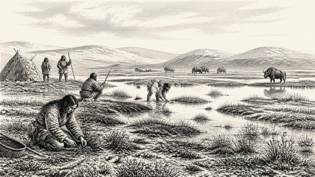
31,743 BCE is not a datable Irish event but an approximate point within unstable Marine Isotope Stage 3. At Derryvree, County Fermanagh, organic freshwater beds between glacial tills indicate a temporarily ice-free wetland, with mosses, sedges, open pools and treeless tundra vegetation. Cave calcite records show recurrent climatic warming episodes. Southern cave remains demonstrate that reindeer, mammoth, giant deer, bears and hyaenas occupied Ireland intermittently, although assemblages span long periods. A cut-marked Castlepook reindeer bone may indicate short human visits, not settlement. No institutions, farming or trade are evidenced. Before maximum glaciation, Ireland supported shifting habitats, fauna and transient foragers.
Dateline
The label 31,743 BCE offers a useful point on a modern timeline, not a date at which an Irish event can be identified. There are no written records, calendar systems, named communities or archaeological layers precise enough to describe a single year so far back. In conventional “before present” terms, this label lies roughly 33,700 calendar years before 1950, within Marine Isotope Stage 3 (MIS 3), a long, climatically unstable phase of the last Ice Age. The responsible history of Ireland at this point is therefore regional and probabilistic: it concerns what dated sediments, fossils, cave deposits and landforms can tell us about a changing landscape over centuries or millennia, rather than what happened on a particular day.
An Inter-Till Landscape
The closest major Irish environmental archive is at Derryvree near Maguiresbridge in County Fermanagh. Road works there exposed organic-rich freshwater silts and fine sands trapped between two layers of glacial till: deposits left by ice at different times. The Derryvree organic beds produced a radiocarbon measurement of 30,500 years BP, with a substantial uncertainty. When assessed against modern calibration, the evidence has been placed broadly within c. 31.7–36.9 thousand calibrated years BP. That range encompasses the modern calendar label used here, but it does not make Derryvree a snapshot of 31,743 BCE. It identifies an interval during which a freshwater environment existed in south Fermanagh between glacial advances.
This setting matters because it shows that Ireland was not uniformly buried beneath ice throughout the whole last glacial period. At Derryvree, an earlier ice sheet had laid down till; later, water, plant matter and fine sediment accumulated; eventually another glacial phase covered the sequence. The surviving organic layer is consequently both precious and incomplete. It records a local lowland basin, not the entire island, and its preservation depended on subsequent burial. Nevertheless, it is among the clearest windows into Irish conditions around the middle part of the Midlandian, the Irish name for this late Pleistocene glacial cycle.
Moss, Sedge and Open Water
The Derryvree fossils point to treeless, cold-country vegetation. Pollen of herbaceous plants, seeds and plant macrofossils, including several mosses, indicate open ground rather than forest. Sedges and wetland plants grew around shallow freshwater; beetle evidence suggests a mossy, organic-rich wetland or muskeg with open pools. The wider scene was not an empty sheet of snow, but a patchwork of wet hollows, mineral ground and sparse tundra vegetation. Summers may have allowed a brief burst of plant and insect activity, while winters were severe and the growing season short.
Such a reconstruction is evidence-led, but its limits should be kept in view. Fossil pollen may travel, preservation is uneven, and a wetland basin naturally over-represents nearby water-loving plants. It would be unsafe to claim that every Irish valley looked identical. Nor should modern Irish woodland, bog and coastline be projected backwards. The island’s terrain had already been repeatedly altered by ice, while its soils, drainage systems and vegetation were still vulnerable to abrupt climatic swings. Derryvree gives an unusually intimate view of one cold freshwater habitat, not a complete map of Ice Age Ireland.
Climate in Pulses
MIS 3 was neither a single steady freeze nor a warm interval. Greenland ice-core records reveal repeated abrupt warmings and coolings, often termed interstadials and stadials. Irish cave calcite offers an important local counterpart. At Crag Cave in County Kerry, uranium-thorium dating of speleothems shows that calcite formed episodically during the last glacial period. Because shallow cave calcite needs liquid water and conditions generally above freezing, these growth episodes imply intervals of climatic amelioration. The researchers found particularly frequent deposition in later MIS 3, consistent with warmer pulses affecting Ireland as well as the North Atlantic region.
For people and animals, the consequences of this volatility would have been profound. A modest warming could lengthen a growing season, alter snow cover, improve grazing and reconnect wetlands. Renewed cold could rapidly reduce productivity and make travel or survival harder. But exact temperatures for Derryvree in this particular calendar-labelled year cannot be recovered. The careful conclusion is that around the 33,700-calibrated-years-BP horizon, Ireland belonged to a periodically ice-free, periglacial north-west European world whose habitats shifted sharply with climate.
Animals on a Northern Margin
Southern Irish caves supply a different kind of evidence: animal bones. Castlepook Cave near Doneraile in north County Cork, along with caves at Shandon and Foley, has yielded remains dating to MIS 3. The Irish Quaternary Fauna Project showed that mammals including reindeer, woolly mammoth, giant deer, brown bear and spotted hyaena occurred in Ireland during parts of the period between at least about 45,000 and 20,000 years ago. Not every species was necessarily present together, nor at Derryvree itself, and cave assemblages were accumulated over long spans. Yet the finds demonstrate that an Irish landmass, or connected nearshore landscape, supported a recognisably cold-stage fauna before the Last Glacial Maximum.
At Castlepook, reindeer and mammoth bones evoke open landscapes with enough seasonal forage for large herbivores. Giant deer, despite the later popular name “Irish elk”, were not uniquely Irish; their presence is part of a wider Eurasian story. Carnivores complicate the picture. Spotted hyaenas and wolves could scavenge or carry bones into caves, while bears might use caves or fissures in quite different ways. A cave bone is therefore proof that an animal lived in the broader region, but not automatically proof of a kill, a den, or a human camp at the spot where it was recovered.
That distinction has become more important as dating techniques have improved. Re-dating of selected cave bones has shown that some earlier radiocarbon results underestimated their age by thousands of years, moving elements of the Castlepook fauna further back into MIS 3. The revised work suggests that giant deer and spotted hyaena may have disappeared locally before the Last Glacial Maximum, around 40,000 calibrated years BP. The animal record is consequently dynamic: Ireland was not a permanent refuge for a fixed Ice Age menagerie, but a marginal landscape repeatedly entered, abandoned or made unsuitable as habitats changed.
The Human Question
The most arresting, and most qualified, possibility concerns a reindeer femur from Castlepook. The bone bears a deep linear mark interpreted by zooarchaeologist Ruth Carden as damage made with a sharp stone implement during carcass processing. It has been publicly presented as evidence that people may have butchered reindeer in Ireland about 33,000 years ago. If that interpretation is upheld, it would bring human activity in Ireland dramatically earlier than the island’s securely evidenced post-glacial settlement.
It should not, however, be made to carry more weight than it can bear. The bone dates the animal, not an excavated campsite; Castlepook’s historical excavations disturbed deposits and did not produce a securely associated lithic assemblage, hearth, dwelling floor or burial of this age. The mark may be compelling evidence of a human action, but it does not establish a settled population, the number of visitors, their route, their season of arrival or their length of stay. The most defensible wording for the period around 31,743 BCE is that short Upper Palaeolithic visits to Ireland are possible, with one important bone offering potential evidence, while sustained occupation remains unproven.
No Polities, No Proven Trade
There is no Irish evidence at this date for political institutions, named leaders, territorial states, warfare, diplomacy, formal religion, monuments, farming or long-distance trade networks. It would be anachronistic to describe a government, tribe or conflict. Equally, silence about these subjects is not evidence that any visitors lacked social relationships, beliefs, skills or shared knowledge. Upper Palaeolithic groups elsewhere in Europe possessed sophisticated ways of making tools, acquiring food and communicating identity. The problem is specifically Irish: none of those cultural practices can yet be securely reconstructed from an Irish assemblage of this age.
If people did reach Ireland, their economy was almost certainly based on mobile foraging and the opportunistic use of seasonal animal and plant resources, not agriculture. Reindeer would have been a valuable source of meat, marrow, hide, sinew and bone; waterways and wetlands could supply other resources in warmer months. But this is a reasonable inference from the environment and the possible modified femur, not a documented Irish economy. There is no evidence that a 31,743 BCE community lived at Derryvree, hunted at Castlepook, or exchanged goods across a known route.
Before the Ice Peak
The longer trajectory gives the moment its significance. Within several thousand years, the last British-Irish Ice Sheet would expand to its maximum extent, profoundly reshaping Ireland and erasing or burying many earlier land surfaces. Reconstructions place maximum ice extent by about 27,000 years BP, with Irish ice extending across the continental shelf in several directions. The relatively open, wet tundra landscapes represented at Derryvree belonged to an earlier and unstable interval before that glacial culmination.
Thus Ireland around the modern label 31,743 BCE is best understood not as a year of kings, battles or inventions, but as a fragile environmental interval. Freshwater moss beds in Fermanagh, calcite growth in a Kerry cave, and animal remains in Cork caves collectively show that portions of the island supported life during MIS 3. They also show why caution is essential. The evidence illuminates cold wetlands, open tundra, mobile fauna and perhaps a fleeting human encounter; it does not yet yield a calendar-year history or a settled human past.
Primary Sources
- A Middle Midlandian Freshwater Series at Derryvree, Maguiresbridge, County Fermanagh, Northern Ireland
- Early Midlandian–Middle Midlandian, Pleistocene, Northern Ireland
- The Irish Quaternary Fauna Project
- The Irish Quaternary Fauna Project
- A Reconsideration of the Radiocarbon Dating of the Marine Isotope Stage 3 Fauna from Southern Ireland
- Episodic Speleothem Deposition Tracks the Terrestrial Impact of Millennial-Scale Last Glacial Climate Variability in SW Ireland
- Episodic Speleothem Deposition Tracks the Terrestrial Impact of Millennial-Scale Last Glacial Climate Variability in SW Ireland
- Pattern and Timing of Retreat of the Last British-Irish Ice Sheet
- Pattern and Timing of Retreat of the Last British-Irish Ice Sheet
- Maximum Extent and Dynamic Behaviour of the Last British–Irish Ice Sheet West of Ireland
- Early Deglaciation of the British-Irish Ice Sheet on the Atlantic Shelf Northwest of Ireland Driven by Glacioisostatic Depression and High Relative Sea Level
- Timing and Pace of Ice-Sheet Withdrawal Across the Marine–Terrestrial Transition West of Ireland During the Last Glaciation
- Trimlines, Blockfields and the Vertical Extent of the Last Ice Sheet in Southern Ireland
- The IntCal20 Northern Hemisphere Radiocarbon Age Calibration Curve (0–55 cal kBP)
- The IntCal20 Northern Hemisphere Radiocarbon Age Calibration Curve (0–55 cal kBP)
- High-Resolution Record of Northern Hemisphere Climate Extending into the Last Interglacial Period
- Continuity of Brown Bear Maternal Lineages in Northern England Through the Last-Glacial Period
- The Archaeological Heritage of County Cork
- Heritage Artefacts of County Cork
- Ireland’s Earliest Settlers: Evidence for an Irish Palaeolithic
- New Insights on the Fauna of Ireland’s Younger Dryas and Early Holocene from Alice & Gwendoline Cave
- New Insights on the Fauna of Ireland’s Younger Dryas and Early Holocene from Alice & Gwendoline Cave
- Excavations at Castlepook Cave, Co. Cork
