Derryvree’s Buried Lakebed31883 BCE
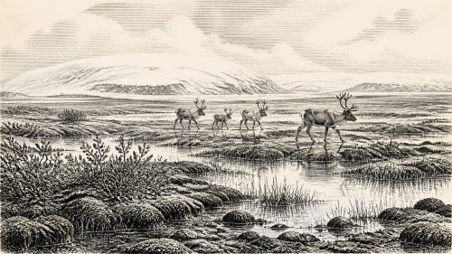
Around 31,883 BCE, Ireland lay within the unstable cold conditions of Marine Isotope Stage 3, rather than a documented historical era. Derryvree, County Fermanagh, preserves buried freshwater silts dated broadly to this period, demonstrating an ice-free, open tundra landscape before later glaciation. Climatic fluctuations occasionally created milder local conditions. Cave deposits, especially at Castlepook, record varied cold-adapted fauna, including reindeer, mammoth, giant deer and predators, but accumulated over millennia rather than simultaneously. A possibly cut-marked reindeer bone may indicate brief human activity around 33,000 years ago, though no settlement evidence exists. Subsequent ice expansion buried, eroded and obscured sparse record.

Dateline
The label 31,883 BCE offers a useful point on a modern timeline, but it cannot identify an event in Ireland in the way that a medieval annal or a state paper can. There were no local written records, named communities or calendars that can be correlated to a particular year. In simple calendar arithmetic, it lies about 33,832 years before the conventional radiocarbon reference year of AD 1950. Archaeology at this depth works differently: it uses deposits, bones and scientific date ranges, not annual narratives. The most responsible account is therefore of Ireland during the later part of Marine Isotope Stage 3 (MIS 3), a volatile phase of the last Ice Age.
The strongest evidence relevant to this notional year comes not from a human settlement but from a buried freshwater deposit at Derryvree, near Maguiresbridge in County Fermanagh. Organic silts and fine sands, sealed below later glacial deposits, produced a radiocarbon determination of about 30,500 years BP. A published calibration placed it broadly between about 36,900 and 31,700 calendar years BP. That range includes the modern chronological position of 31,883 BCE, but it does not mean that the Derryvree sediments formed in that exact year. The deposit accumulated over time, its samples have statistical uncertainty, and a single locality cannot stand for every district of Ireland.
An Ice-Free Inland Landscape
Even with those cautions, Derryvree is exceptionally important. It shows that north-central Ireland was ice-free during a part of MIS 3 before the main expansion of the last Irish ice sheet. Plant and animal traces in the silts point to an open, treeless or almost treeless tundra landscape under periglacial conditions. Mosses and sparse herbaceous pollen survived where later ice would bury the old ground beneath till. The evidence does not provide a picturesque, complete view of the countryside: pollen was poorly preserved, and the proportions of plants in a deposit do not translate simply into a map. Yet it firmly rules out a wooded, temperate Ireland.
The environment was cold, exposed and changeable rather than uniformly frozen. Ireland lay on the Atlantic edge of north-west Europe, where the position of sea ice, ocean circulation and the polar front could alter conditions markedly over centuries or millennia. Speleothems in Crag Cave, County Kerry, show that some warmer episodes during the last glacial period permitted liquid water to circulate through shallow caves and calcite to grow. Their episodic formation records the sharp climatic swings associated with Greenland interstadials and stadials. Thus the world represented by Derryvree was a tundra world, but not an unchanging one: relatively milder phases could briefly make particular valleys, springs and grazing grounds more hospitable.
Animals Before the Main Ice Advance
South-western and southern cave deposits provide another fragmentary archive. Castlepook Cave, near Doneraile in north County Cork, is the richest known Irish source for vertebrate life before the Last Glacial Maximum. Its collections include remains of reindeer, woolly mammoth, giant deer, brown bear, wolf, Arctic fox, mountain hare, collared lemming, Norwegian lemming and spotted hyaena. Together, these animals demonstrate that parts of the island could sustain, or at least be reached by, a varied cold-stage fauna over a long interval. They should not, however, be treated as a single herd or a single community living together in 31,883 BCE.
That distinction is central to the evidence. Castlepook’s bones accumulated in a complicated cave system across many thousands of years, and early excavations removed much material before modern recording standards existed. Carnivores carried prey and scavenged carcasses into caves; water, sediment movement and later digging could disturb remains. Subsequent accelerator mass spectrometry dating has shown that several old bone dates needed substantial revision, in some cases becoming thousands of radiocarbon years older. The secure conclusion is not that every animal listed shared one moment, but that Ice Age Ireland possessed changing faunal communities between at least about 45,000 and 20,000 years ago.
For a period around 33,800 years ago, reindeer are especially plausible inhabitants of open country, where seasonal grasses, sedges, herbs and dwarf shrubs offered grazing. Large herbivores would in turn have supported predators and scavengers. Hyaena bones and gnawing provide an important warning against imagining caves as human homes by default: caves were also animal dens, traps and repositories for naturally accumulated remains. Mammoth and giant deer are known from the wider MIS 3 record, but their dated bones do not licence a claim that either stood beside the Derryvree lakebed in this specified year. Fossils establish presence within ranges, not a census on a particular day.
A Possible Human Trace
The most provocative Irish evidence for people at this depth of time is a reindeer femur from Castlepook reported to bear a mark consistent with cutting by a sharp stone tool. The bone has been presented as dating to about 33,000 years ago and, if the mark is genuinely anthropogenic, it indicates that a person or small party processed an animal in Ireland far earlier than the island’s long-accepted Mesolithic settlement history. It would be an important sign that Upper Palaeolithic hunter-gatherers could reach this western edge of Europe during a favourable interval.
But it is not evidence for a permanent population, a village, a burial ground or an Irish “first people” who can be named or culturally identified. No securely associated hearth, stone-tool assemblage, dwelling floor or human remains of this age has been recovered from Ireland. Nor does the bone establish where an animal was killed, how many people were involved, or whether they returned. The careful interpretation is that it may record a fleeting episode of human presence or butchery. It cannot responsibly be expanded into a year-specific hunt, migration or settlement.
Routes, Shores and Limits
Sea level was substantially lower than today because much water was held in continental ice sheets, altering the outlines of the Irish Sea basin and exposing broad shelves. That did not necessarily create an easy, continuous route from continental Europe to Ireland. The geography was shaped by channels, estuaries, marine inlets, local ice and changing coastlines; the precise availability of crossings remains debated. Animal movement and any human arrival may have involved temporary land connections, ice, coastal routes or watercraft. No evidence presently allows one route to be chosen with confidence for a visit represented by the Castlepook bone.
Nor can political affairs, diplomacy or warfare be recovered for Ireland at this date. There is no evidence for kingdoms, tribal territories, leaders, alliances or organised conflict. In a social sense, any people who reached the island were likely mobile hunter-gatherers, as were contemporary Upper Palaeolithic populations elsewhere in north-west Europe, but Ireland has not yielded the camps and artefacts needed to describe local group size, kinship, clothing, language or gender roles. That comparison is interpretation, not direct Irish proof.
Culture Without a Record
Religion, ceremony and learning are equally beyond the available evidence. No cave art, carved object, grave, ritual deposit or musical instrument from this period is securely known in Ireland. A stone-cut mark, if accepted, implies practical knowledge of sharp-edged lithic technology; it does not reveal beliefs. Likewise, the likely economy was one of obtaining wild animal and plant resources rather than farming, but there is no Irish evidence from around this date for cultivation, domesticated stock, stored grain, trade networks or exchange goods. Absence of proof should not be confused with proof that nothing happened; it defines the narrow limits of what can currently be said.
The great historical development visible from 31,883 BCE is environmental rather than political. Derryvree preserves a rare interval when a cold, open landscape existed before a major ice-sheet advance. Reconstructions of the British-Irish Ice Sheet indicate that ice growth accelerated later, with Ireland and its surrounding shelves transformed as ice masses expanded. The old lake silts, mosses and animal bones survived largely because they were later sealed beneath glacial sediments. They are not merely evidence of a lost landscape: they also explain why its human record is so thin, repeatedly eroded, buried or carried away by ice.
For Ireland at this time, the past is best approached with disciplined imagination. There may have been tundra pools and sedge-rich ground in Fermanagh, roaming cold-adapted animals in several regions, and perhaps a brief human encounter with a reindeer in Cork. There were not yet documented Irish peoples, politics or monuments. The buried lakebed at Derryvree is valuable precisely because it preserves enough to illuminate a world before history, while reminding us how much remains unknown.
Primary Sources
- A Middle Midlandian Freshwater Series at Derryvree, Maguiresbridge, County Fermanagh, Northern Ireland
- Trimlines, Blockfields and the Vertical Extent of the Last Ice Sheet in Southern Ireland
- Growth and Retreat of the Last British–Irish Ice Sheet, 31,000 to 15,000 Years Ago: the BRITICE-CHRONO Reconstruction
- The Irish Quaternary Fauna Project
- A Reconsideration of the Radiocarbon Dating of the Marine Isotope Stage 3 Fauna from Southern Ireland
- Castlepook Cave
- The Exploration of Castlepook Cave, County Cork, Being the Third Report from the Committee Appointed to Explore Irish Caves
- Occurrence of Mammalia Relicts at Site Castlepook Cave
- 2022:564 – Castlepook Cave, Castlepook South, Cork
- Archaeological Heritage of County Cork
- Heritage Artefacts of County Cork
- Palaeoecology
- Episodic Speleothem Deposition Tracks the Terrestrial Impact of Millennial-Scale Last Glacial Climate Variability in SW Ireland
- The IntCal20 Northern Hemisphere Radiocarbon Age Calibration Curve (0–55 cal kBP)
- IntCal: History
- Pattern, Style and Timing of British–Irish Ice Sheet Retreat: Shetland and Northern North Sea Sector
- Persistent Millennial-Scale Glacier Fluctuations in Ireland Between 24 ka and 10 ka
- Deglaciation of the Burren Glacio-Karst, Western Ireland, During Termination 1: Implications for North Atlantic Climate and Karstification
- Archaeological Excavations at Killuragh Cave, Co. Limerick: A Persistent Place in the Landscape from the Early Mesolithic to the Late Bronze Age
- The Dungarvan Valley Caves Project: Second Interim Report
- Irish Pleistocene Biostratigraphy
- New Insights on the Fauna of Ireland’s Younger Dryas and Early Holocene