

The Maguiresbridge Interlude31066 BCE
31,066 BCE is a modern label within a broad Late Pleistocene range, not a recoverable Irish year. Derryvree, County Fermanagh, preserves freshwater organic deposits between tills, indicating a locally ice-free, treeless, waterlogged tundra interval, though not conditions across Ireland. Crag Cave speleothems record alternating milder and colder MIS 3 phases as ice generally expanded. Castlepook Cave’s mixed, imperfectly recorded fauna, including reindeer, mammoth, giant deer and hyena, confirms episodic animal access. Lower seas altered connections with Britain and Europe. No securely dated human remains, artefacts, settlements or political history exist; Ireland’s evidence instead reveals climate, wetlands, fauna and advancing ice.
Dateline
31,066 BCE is a modern chronological label, not a year that can be recovered from Ireland’s prehistoric record. In archaeological terms it falls about 33,016 calibrated years before AD 1950, within the Late Pleistocene and Marine Isotope Stage 3 (MIS 3), a climatically unstable part of the last Ice Age. No Irish calendar, writing, named people or datable historical event survives from this depth of time. The responsible subject is therefore not an anniversary but an interval: the cold, changing world that archaeological and environmental evidence can illuminate around this point.
The closest major Irish archive is at Derryvree, near Maguiresbridge in County Fermanagh. Its evidence is broad enough to be relevant, but not precise enough to identify conditions in a particular season, generation or year. Elsewhere, caves in Cork preserve animal remains from related phases of the Late Pleistocene. Together, these records show that Ireland was neither a familiar green island nor an unbroken, permanent ice sheet. It was a north-western European landmass undergoing rapid environmental change, where the availability of water, vegetation, animal routes and ice-free ground varied sharply across place and time.
A Date Within a Range
Road works in 1969 cut through a drumlin at Derryvree and exposed an exceptional sequence: freshwater silts and fine sands, including organic material, trapped between two deposits of till. Till is sediment laid down directly by glacier ice. The sequence establishes a secure relative order. Ice had earlier occupied the locality and formed the lower till; a period without overriding local ice then allowed water, plants and sediment to accumulate; later glacial activity buried the deposit beneath a second till.
Organic material from the freshwater deposit, BIRM-166, produced a conventional radiocarbon determination of 30,500 years BP, with a large uncertainty of +1,170 and −1,030 years. Calibration is necessary because atmospheric carbon-14 has varied through time. Published treatments place the result broadly in the middle-to-late 30,000s calibrated years BP, approximately 36,900–31,700 cal BP. The modern date 31,066 BCE, equivalent to about 33,016 cal BP, lies within that wide range. It does not date a specific layer, plant or occurrence at Derryvree.
This limitation matters. A radiocarbon determination dates carbon in sampled material, while the organic bed accumulated over time in a changing wetland. The calibrated range is also wide because radiocarbon uncertainty increases so far back in time. Derryvree is consequently compelling evidence for a cold, ice-free interval at that locality, not proof that all Ireland looked identical in 31,066 BCE. It is a local archive with national importance precisely because comparable Irish evidence is so rare.
Waterlogged Tundra in Fermanagh
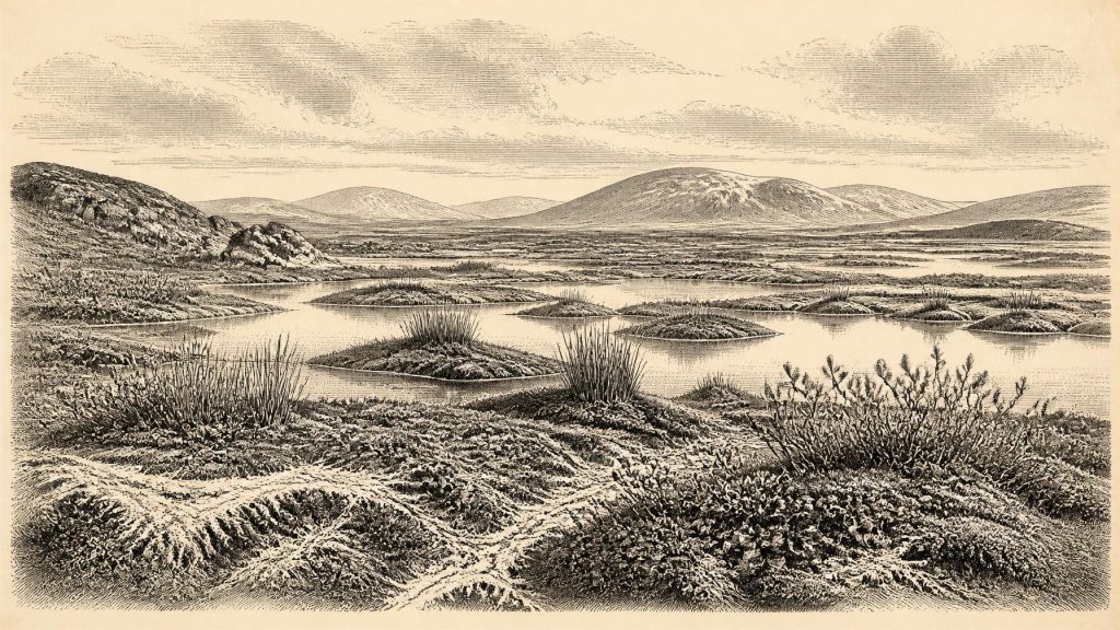
The Derryvree plants and animals indicate a treeless, periglacial landscape. Pollen was poorly preserved, but plant macrofossils, mosses and insect evidence recorded a wet, open environment. Sedges, mosses, dwarf shrubs and cold-adapted herbaceous plants belonged to a tundra-like mosaic rather than woodland. Bogbean and water-milfoil show that standing or slow-moving freshwater existed, while mountain-avens, dwarf willow and other cold-climate indicators point to exposed ground beyond the pools. The term muskeg, used by researchers for such waterlogged, peaty tundra terrain, is more useful than imagining either a modern Irish bog or a lifeless polar desert.
This was an environment of contrasts. Summer thaw could sustain shallow pools, damp ground and brief plant growth, but frost, snow cover, frozen soils and strong seasonal shifts constrained life. Sparse vegetation in drier places would have left soils vulnerable to wind and frost disturbance. Watercourses and wetlands would have been vital ecological corridors, concentrating plants, insects and visiting animals. These are reasonable inferences from the deposits; they should not be mistaken for evidence of a settlement beside a particular Derryvree pool.
At the Edge of Expanding Ice
The wider setting was one of climatic volatility. Speleothems from Crag Cave in County Kerry demonstrate that liquid water periodically moved through shallow cave systems during MIS 3. Because calcite deposition requires unfrozen water and conditions generally above the freezing threshold in the cave’s catchment, episodes of stalagmite growth register milder intervals. Their uranium-thorium dates show that these ameliorations alternated with colder phases, rather than producing a simple, steady descent into the Last Glacial Maximum.
At roughly this horizon, however, the direction of long-term change was towards more extensive ice. Reconstructions of the British–Irish Ice Sheet indicate rapid ice growth in the northern British Isles around 32,000–31,000 years ago and later expansion around Ireland. The greatest extent of the Irish and British sectors came later, principally around 30,000–26,000 years ago, with the overall ice-sheet maximum volume later still. Those reconstructions are increasingly detailed, but their authors stress that early growth is less securely dated than retreat. Around 31,066 BCE, it is therefore safer to describe Ireland as a region of unevenly advancing glacial conditions than to portray the whole island as already buried beneath a single uniform ice mass.
Lower global sea level altered the geography beyond Ireland’s present shores. Much of the continental shelf was exposed or lay beneath shallower seas, and movement between Ireland, Britain and continental Europe was more feasible for animals than it would later become. This does not establish a simple dry land bridge at every moment or every route. Ice, sea, estuaries and changing coastlines created barriers as well as corridors. The important point is that Ireland was part of a connected, though difficult and fluctuating, north-west European ecological zone.
Reindeer, Hyenas and Fragmentary Faunas
Castlepook Cave, also called Mammoth Cave, near Doneraile in County Cork provides the richest Irish collection of vertebrate remains from the period leading towards the Last Glacial Maximum. Its assemblage includes reindeer, woolly mammoth, giant deer, brown bear and spotted hyena, alongside smaller cold-adapted mammals in the wider cave record. The National Museum of Ireland and Geological Survey Ireland rightly treat the cave as central to understanding Ice Age fauna in Ireland.
Yet the cave should not be read as a census of animals alive together in one year. Much material was excavated in the early twentieth century, often from deposits whose stratigraphy had already been disturbed or was inadequately recorded. Individual bones can be directly dated, but the assemblage accumulated through numerous episodes: animals dying naturally, carnivores using cavities, water moving material, and later excavation. The evidence demonstrates that large herbivores and formidable predators reached Ireland during parts of the Late Pleistocene. It cannot reconstruct one intact herd, hunting ground or food chain for 31,066 BCE.
Even so, the combined Fermanagh and Cork records support a compelling broad picture. Open, cold landscapes could sustain grazing and browsing mammals, while predators followed or scavenged them. Reindeer in particular suit seasonally open country and are important indicators of northern connections. Spotted hyena remains show that Late Pleistocene Ireland was not simply an Arctic scene in the modern sense: the fauna belonged to a distinctive European cold-stage world, assembled under combinations of climate, habitat and access that no longer exist on the island.
No Political Ireland
There is no responsible basis for describing political affairs, diplomacy, rulers, tribal territories, warfare, religion or formal learning in Ireland at this date. Nor is there a securely dated Irish house, hearth, tool assemblage, burial or settlement that can be assigned to this interval. The earliest published direct evidence for human activity in Ireland remains far later: a cut-marked brown-bear patella from Alice and Gwendoline Cave in County Clare, dated to about 12,810–12,590 cal BP. That find cannot be projected backwards by twenty millennia.
People elsewhere in Upper Palaeolithic Europe possessed sophisticated stone technologies, social networks and symbolic cultures. It is plausible that any human group entering an Irish landscape during a temporary accessible phase would have required detailed knowledge of animal behaviour, fuel, shelter, weather and routes. But plausibility is not evidence. Ireland’s record around 33,000 cal BP provides no artefacts from which to identify a local technology, no bones from which to recover a population, and no material culture from which to infer ritual. The most honest conclusion is that human presence remains unproven for this particular Irish interval.
Economy Without Farmers or Markets
There was no agricultural economy, no permanent village system and no evidence for trade in the historical sense. If people ever visited, their subsistence would have depended upon mobile hunting and gathering, but that remains an inference rather than a documented Irish practice. The demonstrable economy was ecological: plants turned a short growing season into fodder; herbivores converted it into moving biomass; carnivores and scavengers exploited that abundance; and wetlands offered fresh water and concentrated resources.
The most important development around this notional year was environmental. Derryvree preserves an interval in which freshwater and tundra vegetation existed between glacial episodes. Crag Cave records rapid climatic oscillation. Castlepook shows that Ireland’s Late Pleistocene fauna was richer, and more continental in character, than its later historic fauna. Subsequent ice advance erased, displaced or buried vast amounts of evidence. What remains is incomplete, but it is enough to reveal an Ireland shaped not by kingdoms or chronicles, but by thawwater, tundra, animal movement and approaching ice.
Primary Sources
- Palaeoecology
- Figure 6.— The Subdivision of the Quaternary Period in Ireland
- The IntCal20 Northern Hemisphere Radiocarbon Age Calibration Curve (0–55 cal kBP)
- Episodic Speleothem Deposition Tracks the Terrestrial Impact of Millennial-Scale Last Glacial Climate Variability in SW Ireland
- Growth and Retreat of the Last British–Irish Ice Sheet, 31,000 to 15,000 Years Ago: The BRITICE-CHRONO Reconstruction
- The Deglaciation of the Western Sector of the Irish Ice Sheet from the Inner Continental Shelf to its Terrestrial Margin
- Trimlines, Blockfields and the Vertical Extent of the Last Ice Sheet in Southern Ireland
- The Irish Quaternary Fauna Project
- Castlepook Cave
- Spotted Hyena Skull
- Castlepook Cave, Castlepook South
- First Evidence of a Late Upper Palaeolithic Human Presence in Ireland
- New Insights on the Fauna of Ireland’s Younger Dryas and Early Holocene from Alice & Gwendoline Cave
- A North-Western Habitat: the Paleoethology and Colonisation of a European Peninsula
- The Colonization of Ireland: A Human Ecology Perspective
- Anthropogenic Changes to the Holocene Nitrogen Cycle in Ireland
- Ice Age – Overview
- Ireland Through Geological Time
- Our Ancient Landscapes: Hunter-Gatherers in Ireland
- The Ice Age in Ireland