Derryvree Grasslands31256 BCE
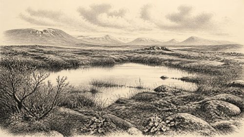
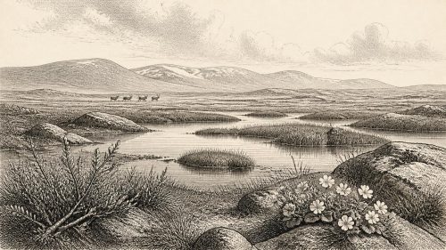
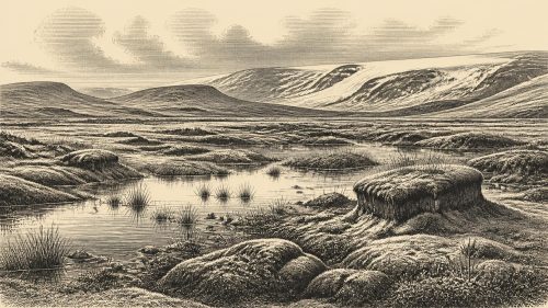
31,256 BCE cannot be identified precisely in Ireland’s archaeological record, but falls within Middle Midlandian MIS 3. At Derryvree, County Fermanagh, organic sediments between till sheets document an ice-free interval before later glaciation, with cold, open wetlands supporting grasses, sedges, juniper, mosses, aquatic plants and beetles. Comparable northern deposits indicate episodic periglacial, rather than continuously ice-covered, conditions. Castlepook Cave, County Cork, preserves diverse cold-stage fauna, including mammoth, reindeer, giant deer, hyena and Arctic fox, although dates and depositional contexts are broad. A possibly butchered reindeer bone suggests transient human activity, not settlement. Subsequent ice expansion erased much evidence from Ireland.
Dateline
31,256 BCE is a modern calendar label, not a date that can be recovered from the Irish archaeological record. There was no written chronology, no named community and no excavated event to assign to this particular year. In radiocarbon convention it falls roughly 33,205 years before AD 1950, but that arithmetic must not be mistaken for annual precision. The responsible frame is the later part of the Middle Midlandian, Ireland’s regional name for a phase of the last glacial cycle, within Marine Isotope Stage 3 (MIS 3). Evidence can illuminate broad spans of centuries or millennia, not a day, season or political moment in 31,256 BCE.
The closest useful Irish window is a buried freshwater deposit at Derryvree, near Maguiresbridge in County Fermanagh. Its conventional radiocarbon determination, BIRM-166, was 30,500 +1,170/-1,030 radiocarbon years BP. Published calibrations have expressed its probable calendar age broadly at about 36,900–31,700 cal BP. The requested year falls within that wide range, but the range neither proves that a particular layer formed in 31,256 BCE nor permits a country-wide reconstruction for that year. It does establish something important: before later glacier ice overrode the area, part of northern Ireland supported freshwater, wetland plants and small animals in a severe but living landscape.
A Basin Between Ice Advances
Derryvree was exposed during road works in 1969, when a cutting passed through a drumlin: an elongated hill moulded from sediment beneath moving ice. Geologists found thick till beneath and above fine sands, silts and organic-rich deposits. Till is debris laid down directly by glacier ice. The sequence therefore records an order of events rather than an exact date: an earlier glaciation; an intervening, locally ice-free phase in which water and organic matter accumulated; then a renewed ice advance which sealed the evidence beneath another till sheet.
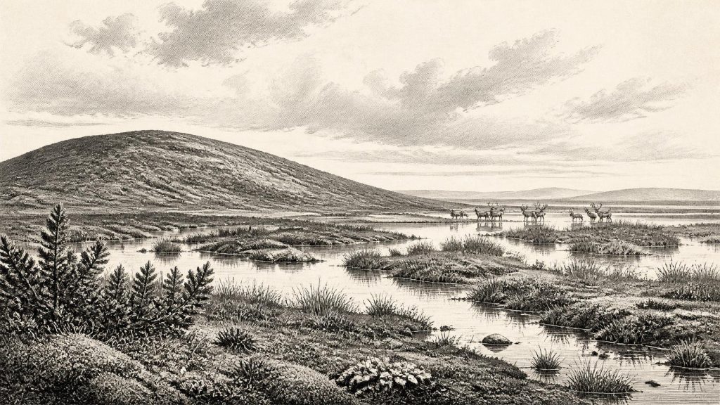
This is unusually valuable testimony. Much of Ireland’s earlier Pleistocene ground surface was eroded, displaced or buried by succeeding glaciers. Derryvree is not a preserved countryside awaiting excavation; it is a compressed environmental archive. Pollen, plant macrofossils, mosses and insects escaped destruction in waterlogged sediment. Their combined evidence indicates open, largely treeless tundra or muskeg: wet, peat-forming ground with pools and saturated margins, rather than forest or the familiar green agricultural landscape of modern Ireland.
Grasses, sedges, juniper and herb pollen point to low vegetation able to endure a short growing season. Mosses, including species associated with cold wet ground, and the remains of aquatic plants such as bogbean and water-milfoil show that at least some water remained unfrozen for long enough to sustain freshwater life and trap sediment. Beetles add another scale of observation. They provide evidence for open, cold conditions, damp plant-rich ground and pools, rather than merely confirming that the district was cold. The inference is not that every valley in Ireland looked identical. It is that this Fermanagh locality had a wetland mosaic within a regional climate harsh enough to prevent woodland from taking hold.
Cold Country, Not Permanent Ice
Around this horizon Ireland was part of a North Atlantic world in which climate changed sharply over long, irregular intervals. MIS 3 was not a single unbroken freeze. It included colder stadial phases and relatively milder interstadials, while ice margins advanced and retreated. The Derryvree organic layer is material evidence that this part of Fermanagh was not continuously ice-covered. Comparisons with Hollymount, also near Maguiresbridge, and Greenagho near Belcoo support the broader conclusion that northern inland areas experienced episodes of cold, non-glacial conditions before the fullest growth of the last Irish ice sheet.
That does not mean the island was safe from ice or that conditions were benign. Periglacial describes a landscape governed by frost, seasonal freezing and thawing near an ice margin. Soils would have been thin or unstable in many places, and vegetation vulnerable to wind, cold and short summers. Watercourses, ponds and wet hollows were disproportionately important: they concentrated life and, by preserving organic deposits, now dominate what can be known. Later, during the Last Glacial Maximum, ice expanded across much or all of Ireland and its surrounding shelf. Reviews place the major build-up after about 35–32 ka and the maximum broadly between 27 and 21 ka, although the timing varied between sectors. From the vantage of Derryvree, that destructive expansion still lay ahead.
Animals in the Southern Caves
County Cork offers a different, and less tidy, body of evidence. Castlepook Cave, also called Mammoth Cave, near Doneraile contains Ireland’s most important assemblage of mammals from the last cold stage. Finds include woolly mammoth, reindeer, giant deer, spotted hyena, wolf, Arctic fox, bear, mountain hare and two kinds of lemming. The National Museum of Ireland holds many specimens recovered during early twentieth-century cave investigations, while later work has added important material and improved dating.
The animals show that Ireland could be reached by a varied cold-climate fauna during MIS 3. Mammoth, reindeer and giant deer imply sufficient forage in open country; wolves and hyenas indicate a food web with large herbivores and carrion. Yet the cave collection cannot be read as a single herd grazing together beside a Cork cave in one year. Bone accumulations may derive from animal deaths, scavenging, predator activity and repeated use of caves over long periods. Historic excavation methods recorded contexts less precisely than modern standards require, and later reassessment has shown that some older radiocarbon dates needed revision. The best evidence is for the presence of species within broad periods, not a complete local census or a neat ‘mammoth-steppe’ scene replicated across Ireland.
Re-dating of identified bones at Castlepook and other southern caves has been especially consequential. It indicates that some mammals occupied Ireland earlier in MIS 3 than older measurements suggested, and that giant deer and spotted hyena may have disappeared locally before the Last Glacial Maximum, around 40,000 cal BP. A mammoth bone has yielded a Middle Midlandian age, while museum educational material places giant deer at Castlepook around 31,000 years ago. Such results make the Cork fauna broadly relevant to 31,256 BCE, but they do not tie individual animals to the named calendar year.
The Human Question
A reindeer femur from Castlepook has made this period archaeologically significant. A deep mark on it has been interpreted as damage caused by a sharp stone tool during butchery, and the bone has been publicly presented as dating to about 31,000 BCE. If that interpretation is confirmed, it would be striking evidence that one or more Upper Palaeolithic people handled a reindeer carcass in Ireland far earlier than the well-established terminal-Pleistocene evidence from Alice and Gwendoline Cave in County Clare.
It remains essential, however, to distinguish evidence from interpretation. The bone is real; its broad antiquity is relevant; and the mark warrants serious investigation. But a mark on one bone is not an excavated camp. It does not demonstrate a permanent population, a dwelling, hearth, burial, stone-tool assemblage, boat, art tradition, language or named cultural group. The radiocarbon result dates the animal’s death within a range, not necessarily the instant the mark was made. Because Castlepook’s deposits are complex and were investigated over a long period, human butchery and a short hunter-gatherer visit remain plausible possibilities rather than settled facts.
Accordingly, political history has no evidential footing here. There are no rulers, territories, alliances, wars, laws or diplomatic relations that can responsibly be attributed to Ireland at this time. Neither is there Irish evidence for formal religion, monuments, ritual, schooling or written learning. Upper Palaeolithic people elsewhere in north-west Europe possessed sophisticated stone technologies and expressive traditions, but continental parallels are context, not proof that equivalent practices occurred in Ireland. If people did reach Castlepook, the most cautious social interpretation is of a small, mobile party whose contact with the island may have been brief.
Economy Without Markets
The only economy securely visible is ecological. Plants fixed seasonal growth in pools, sedge beds and open ground; herbivores converted that vegetation into meat, hides and bone; predators and scavengers exploited living animals and carcasses. If the Castlepook incision proves human-made, it would add one possible act of carcass processing to that system. It would still not establish trade, exchange routes, farming or a settled seasonal round. Sea level was lower during the wider glacial period, changing the geography of the Irish Sea region and potentially easing animal movement at some times, but exact routes and conditions at a particular moment remain uncertain.
For Ireland around 31,256 BCE, then, the principal development was environmental rather than political: an unstable cold-stage landscape in which locally ice-free wetlands persisted, cold-adapted flora and fauna occupied available habitats, and future ice advances threatened to erase their traces. Derryvree’s silts and Castlepook’s bones do not offer a calendar chronicle. They offer something more fragile but still remarkable: evidence that Ice Age Ireland was not simply blank beneath glacier ice, but a changing set of habitats whose history survives in pollen grains, beetle fragments, waterlogged plants and cave fossils.
Source References
Hover over a number to see the source. Select it to open the source.

- [1] A Middle Midlandian Freshwater Series at Derryvree, Maguiresbridge, County Fermanagh, Northern Ireland
- [2] Middle Midlandian Interstadial Deposits at Greenagho, Near Belcoo, County Fermanagh, Northern Ireland
- [3] Freshwater Organic Deposits and Stratified Sediments Between Early and Late Midlandian (Devensian) Till Sheets, at Aghnadarragh, County Antrim, Northern Ireland
- [4] Early Midlandian–Middle Midlandian, Pleistocene, Northern Ireland
- [5] Irish Pleistocene Biostratigraphy
- [6] A Reconsideration of the Radiocarbon Dating of the Marine Isotope Stage 3 Fauna from Southern Ireland
- [7] The Irish Quaternary Fauna Project
- [8] Extent and Timing of the Last Glacial Maximum (LGM) in Britain and Ireland: A Review
- [9] Pattern and Timing of Retreat of the Last British-Irish Ice Sheet
- [10] Late Pleistocene Chronostratigraphy and Ice Sheet Limits, Southern Ireland
- [11] Ice Sheet Limits and Chronostratigraphy in the Southern Sector of the Last Irish Ice Sheet
- [12] Spotted Hyena Skull
- [13] Ice Age Ireland: Cool Fossils!
- [14] Prehistoric Details
- [15] The Archaeological Heritage of County Cork
- [16] Pleistocene Vertebrates in the British Isles
- [17] The IntCal20 Northern Hemisphere Radiocarbon Age Calibration Curve (0–55 cal kBP)
- [18] The Quaternary History of Ireland
- [19] The Geological Heritage of County Leitrim
- [20] Dimensions and Chronology of the Last Ice Sheet in Western Ireland
Primary Sources
- A Middle Midlandian Freshwater Series at Derryvree, Maguiresbridge, County Fermanagh, Northern Ireland
- Middle Midlandian Interstadial Deposits at Greenagho, Near Belcoo, County Fermanagh, Northern Ireland
- Freshwater Organic Deposits and Stratified Sediments Between Early and Late Midlandian (Devensian) Till Sheets, at Aghnadarragh, County Antrim, Northern Ireland
- Early Midlandian–Middle Midlandian, Pleistocene, Northern Ireland
- Irish Pleistocene Biostratigraphy
- A Reconsideration of the Radiocarbon Dating of the Marine Isotope Stage 3 Fauna from Southern Ireland
- The Irish Quaternary Fauna Project
- Extent and Timing of the Last Glacial Maximum (LGM) in Britain and Ireland: A Review
- Pattern and Timing of Retreat of the Last British-Irish Ice Sheet
- Late Pleistocene Chronostratigraphy and Ice Sheet Limits, Southern Ireland
- Ice Sheet Limits and Chronostratigraphy in the Southern Sector of the Last Irish Ice Sheet
- Spotted Hyena Skull
- Ice Age Ireland: Cool Fossils!
- Prehistoric Details
- The Archaeological Heritage of County Cork
- Pleistocene Vertebrates in the British Isles
- The IntCal20 Northern Hemisphere Radiocarbon Age Calibration Curve (0–55 cal kBP)
- The Quaternary History of Ireland
- The Geological Heritage of County Leitrim
- Dimensions and Chronology of the Last Ice Sheet in Western Ireland