Maguirebridge’s Tundra Pool31152 BCE
31,152 BCE is a modern approximation within a broad calibrated radiocarbon range, not a precisely recoverable Irish date. At Derryvree near Maguiresbridge, organic freshwater sediments between tills record a local ice-free MIS 3 interval, supporting treeless tundra wetland vegetation amid fluctuating cold conditions. Castlepook Cave preserves diverse pre-Last Glacial Maximum fauna, including mammoth, reindeer, giant deer, predators and scavengers, though remains accumulated over long periods. A possibly tool-marked reindeer femur may indicate brief Upper Palaeolithic human activity, but no settlement is proven. Ireland was nearing expanding glaciation, ecologically linked intermittently to north-west Europe through uncertain routes and changing sea margins.
Dateline
The label 31,152 BCE cannot denote an event, ruler, battle or season in Ireland. It is a modern calendar conversion, approximately 33,101 years before AD 1950, rather than a date recoverable from an Irish document or annual archaeological layer. At this depth of time, radiocarbon measurements require calibration and commonly produce ranges of centuries or millennia. The most relevant Irish evidence belongs broadly to the later part of Marine Isotope Stage 3 (MIS 3), a climatically unstable interval of the Late Pleistocene. It can illuminate an Ireland of cold open ground, freshwater hollows, caves and large mammals; it cannot provide a diary for one numbered year.
A Date Within a Range
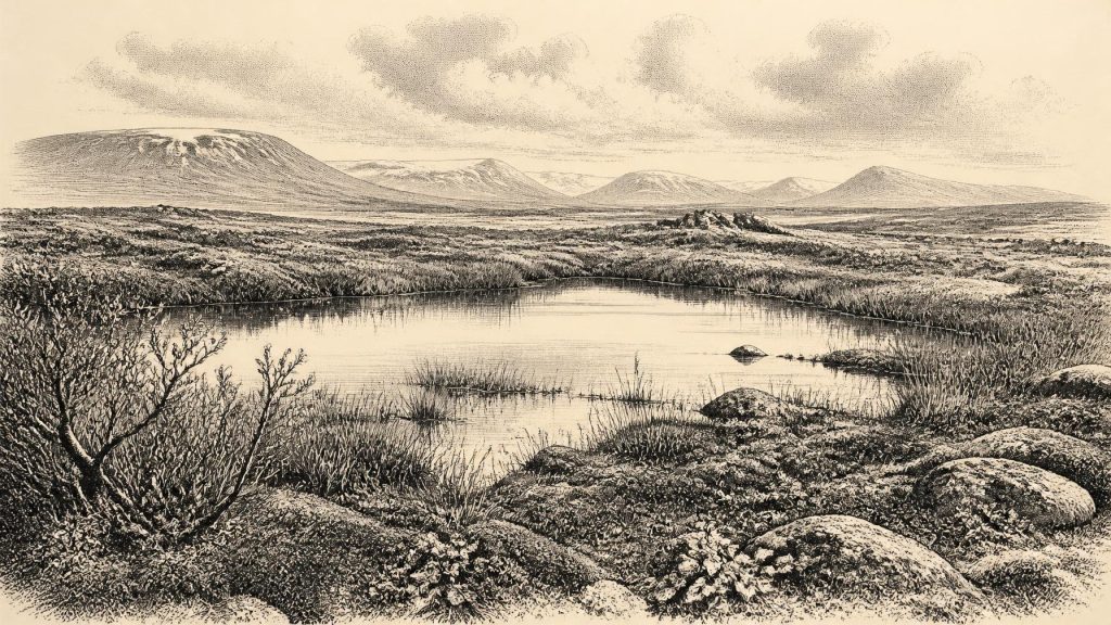
The strongest environmental anchor for this notional year is Derryvree, near Maguiresbridge in County Fermanagh. Roadworks in 1969 exposed a drumlin cut by a remarkable sequence: a thick lower till, organic freshwater silts and fine sands, then a distinct upper till. Till is the unsorted debris left by glacial ice. The order of the layers is therefore firm: ice affected the locality; an interval followed in which open water, sediment and living organisms accumulated; and a later glacier sealed the deposit beneath another blanket of debris. This is direct evidence for an ice-free episode at that site, not proof that every part of Ireland was simultaneously ice-free.
The Derryvree organic material yielded the conventional radiocarbon determination Birm-166, 30,500 years BP, with a substantial published uncertainty of +1,170 and −1,030 years. Scholarly discussion has placed the deposit broadly at about 36,900–31,700 calibrated years BP, or roughly 34,950–29,750 BCE. The modern label 31,152 BCE sits inside that broad span. It does not follow that a particular seed, insect, animal or pool can be assigned to that precise year. The useful conclusion is more modest and more important: Derryvree preserves a local environmental window close to this period, while the precision of the calendar label exceeds that of the evidence.
Fresh Water Between Ice Advances
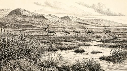
Derryvree was no forested landscape. Its fossil assemblage indicates a treeless, periglacial wetland or muskeg-like setting, with open tundra vegetation. Mosses, sedges, grasses and herbs grew around shallow water, while fossil remains include plants such as bogbean and lesser clubmoss, species able to survive in cold, open and wet conditions. Such finds are evidence of local ecology: plants grew in or beside the freshwater basin, and insects and other small organisms inhabited or reached it. They do not establish a settled human landscape, cultivated ground or a uniform climate across the island.
Even the term “Ice Age” needs care. MIS 3 was not a single, unchanging freeze. Greenland and North Atlantic records show repeated, abrupt shifts between harsher stadials and relatively milder interstadials. In south-west Ireland, uranium-thorium dates from broken speleothems in Crag Cave show that calcite formed episodically through MIS 3. Since cave calcite requires liquid water moving through the rock, this independently supports the view that temperate or at least above-freezing intervals punctuated the long cold stage. It does not tell us the weather at Maguiresbridge in 31,152 BCE, but it cautions against imagining uninterrupted, island-wide ice.
The broader trend was nevertheless towards a more formidable glacial world. Radiocarbon ages on sub-till organic deposits have been interpreted to show that much of Ireland remained largely ice-free until around 32,000 years ago, after which the last Irish Ice Sheet expanded. That reconstruction is continually refined, and the growth of ice was regionally uneven rather than an overnight transformation. By the later Last Glacial Maximum, ice would cover or profoundly reshape most of the island; at the date considered here, Ireland stood near the threshold of that expansion.
The Castlepook Fauna
County Cork provides the complementary record of animals. Castlepook Cave, also known as Mammoth Cave, near Doneraile in the Awbeg valley, is Ireland’s outstanding cave archive for pre-Last Glacial Maximum vertebrates. Its collections include woolly mammoth, giant deer, reindeer, brown bear, wolf, Arctic fox, mountain hare, lemmings and spotted hyaena. The assemblage demonstrates that Ireland could support, or be reached by, a much richer large-mammal fauna during parts of the cold stage than later historic Ireland.
That list should not be converted into a single crowded scene outside the cave in this particular year. Cave deposits collect remains over long intervals. Carnivores drag in prey; animals die in fissures or near entrances; water can disturb sediments; and the earliest Castlepook excavations, undertaken in the early twentieth century, did not record context to modern standards. Improved radiocarbon pretreatment has also shown that some earlier Irish cave dates were unreliable. Castlepook is compelling precisely because it preserves a long environmental record, but that longevity prevents its entire fauna from being treated as one simultaneous community.
Still, the fauna allows responsible ecological interpretation. Reindeer and giant deer imply available forage across open country; mammoth belongs to the wider cold-stage grassland-tundra world; and hyaena, wolf and bear indicate a food web in which large carcasses were contested or scavenged. Spotted hyaena remains are especially significant. Ireland has no living counterpart, and Castlepook is its sole securely documented Irish locality. The fossil skulls, bones and coprolites are evidence of the species’ former range, not evidence that every hyaena was resident rather than intermittently ranging through the landscape.
A Reindeer Bone and a Human Question
The period is also associated with Ireland’s most provocative possible early human trace: a reindeer femur from Castlepook reported as about 33,000 years old and bearing a deep mark interpreted by zooarchaeologist Ruth Carden as damage from a sharp stone tool during carcass processing. If that interpretation is sustained, it would indicate that people handled a reindeer in Ireland during the Upper Palaeolithic, far earlier than the securely established evidence for post-glacial human activity.
The appropriate conclusion remains deliberately narrow. A marked bone is not a settlement. No securely associated hearth, stone-tool assemblage, dwelling floor, burial, food store or repeatedly occupied surface of comparable age has been published from Castlepook. Nor can the bone identify the number, origin, language, kinship or duration of stay of any people involved. Its radiocarbon age dates the animal’s death, not necessarily the instant of marking. Natural breakage, carnivore action, water movement and the limited records of antiquarian excavation all require continued taphonomic scrutiny. Ireland around this time may have experienced a brief human visit or carcass-processing episode; permanent occupation is not demonstrated.
This caution matters because the later Irish archaeological record is clearer. A butchered brown-bear patella from Alice and Gwendoline Cave in County Clare has independent calibrated dates of about 12,810–12,590 cal BP, providing published evidence of Late Upper Palaeolithic human activity. That later find shows how direct dating and microscopic study can strengthen an old cave collection, but it cannot fill the vast chronological gap at Castlepook. The contrast explains why the Cork femur is important, yet still under assessment rather than a licence to invent an Ice Age population.
No Polity, No Proven Ritual
There is no evidential basis for political affairs, diplomacy, named peoples, leaders, warfare, territorial boundaries or institutions in Ireland at this date. Equally, no burial, shrine, artwork, dwelling, language, ritual deposit or learning tradition can responsibly be attributed to 31,152 BCE. The stone-mark interpretation on the Castlepook femur, if confirmed, would imply technical knowledge of a cutting edge and an encounter with an animal carcass. It would not reveal religious belief, social rank or a cultural identity. Silence in these categories is not a failure of imagination; it is the honest result of a record repeatedly disturbed by glaciers and preserved mainly as sediments and animal remains.
Everyday life is therefore best described through environmental constraints rather than invented scenes. Any humans who did reach Ireland would have needed mobility, knowledge of cold conditions and access to suitable stone, fuel, shelter and food. Those are reasonable inferences from the ecology and from Upper Palaeolithic lifeways elsewhere in north-west Europe, but they are not direct observations from Irish sites. There is no evidence here for farming, herding, pottery, metalwork, long-distance commerce or permanent villages. The practical economy visible in Ireland itself is the natural economy of wetland plants, grazing herbivores, predators, water, ice and shifting ground.
Routes Across a Changing Margin
Lower global sea levels expanded continental shelves and altered the geography around Ireland and Britain, but they did not guarantee a simple dry-land route. Ice margins, proglacial waters, changing coastlines and the Irish Sea basin could all create barriers or corridors at different times. The presence of mammals shows that dispersal into Ireland occurred during the cold stage; it does not map the route taken by a particular species, much less by people. The safest interpretation is that Ireland was connected to wider north-west European ecological networks intermittently and unevenly, while its insular position and growing ice made those connections precarious.
Thus the historical significance of 31,152 BCE lies not in an invented episode but in a landscape on the edge of profound change. At Derryvree, a tundra pool preserved plants and small life between two phases of glaciation. At Castlepook, caves retained traces of a lost fauna and perhaps one humanly modified reindeer bone. Together they show an Ireland capable of sustaining life during a fluctuating cold stage, shortly before expanding ice would erase, bury and fragment much of the evidence. That is a sparse archive, but it is enough to replace an empty prehistoric void with a more truthful picture: a changing island landscape, ecologically connected beyond its shores, and only faintly—still debatably—touched by people.
Primary Sources
- A Middle Midlandian Freshwater Series at Derryvree, Maguiresbridge, County Fermanagh, Northern Ireland
- The IntCal20 Northern Hemisphere Radiocarbon Age Calibration Curve (0–55 cal kBP)
- The Last Irish Ice Sheet: Extent and Chronology
- Growth and Retreat of the Last British–Irish Ice Sheet, 31,000 to 15,000 Years Ago: the BRITICE-CHRONO Reconstruction
- A Reconsideration of the Radiocarbon Dating of the Marine Isotope Stage 3 Fauna from Southern Ireland
- The Irish Quaternary Fauna Project
- Irish Quaternary Vertebrates
- Episodic Speleothem Deposition Tracks the Terrestrial Impact of Millennial-Scale Last Glacial Climate Variability in SW Ireland
- First Evidence of a Late Upper Palaeolithic Human Presence in Ireland
- New Insights on the Fauna of Ireland's Younger Dryas and Early Holocene from Alice & Gwendoline Cave
- Palaeoecology
- The Subdivision of the Quaternary Period in Ireland
- Castlepook Cave, County Geological Site Report
- Spotted Hyena Skull
- The Archaeological Heritage of County Cork
- Castlepook Caves
- Freshwater Organic Deposits and Stratified Sediments Between Early and Late Midlandian (Devensian) Till Sheets, at Aghnadarragh, County Antrim, Northern Ireland
- The Donegal Ice Dome, Northwest Ireland: Dimensions and Chronology
- Deglaciation Chronology of the Donegal Ice Centre, North-West Ireland
- Exploring Controls of the Early and Stepped Deglaciation on the Western Margin of the British Irish Ice Sheet