Crag Cave’s Thaw Pulses31249 BCE
31,249 BCE is a modern label for a broad MIS 3 horizon, not a precise Irish event. Ireland experienced unstable cold-stage conditions, with shifting ice, permafrost, meltwater and sparse vegetation before the Last Glacial Maximum. Derryvree’s sediments preserve a treeless freshwater wetland between glacial advances, while Crag Cave calcite indicates episodic thaw and water infiltration in south-west Ireland. Castlepook Cave fauna show cold-adapted mammals, including reindeer, mammoth and hyena, reached the island. A marked reindeer femur may indicate early human butchery, but remains unconfirmed. Changing coastlines allowed ecological connections, though routes remain uncertain; political or cultural history is largely unrecoverable.

Dateline
“31,249 BCE” is a useful modern filing label, not a date at which an event in Ireland can be placed. No writing, named community, annual deposit or human calendar survives from this depth of time. In relation to the radiocarbon convention of AD 1950, the number points broadly to about 33,200 calendar years ago, within the later part of Marine Isotope Stage 3 (MIS 3), during the Midlandian cold stage of the Irish Pleistocene. That apparent precision is misleading. The evidence is dated in wide calibrated ranges, and the landscape could alter profoundly over centuries or millennia. A responsible account therefore describes an archaeological and environmental horizon around the requested year, rather than inventing a day, a ruler or a human episode.
A Changing Cold-Stage Island
Ireland at this time was not the familiar green, wooded island of later millennia. It lay within the highly variable climate of the last glacial cycle. Conditions across the North Atlantic shifted repeatedly between colder stadials and relatively milder interstadials. Ice, permafrost, meltwater, bare ground and sparse vegetation each expanded or contracted in response. The Last Glacial Maximum, when the British–Irish Ice Sheet became much more extensive, still lay ahead; its peak is generally placed many thousands of years later, around 27,000–23,000 calibrated years BP. Yet this does not mean that Ireland was uniformly hospitable or ice-free in 31,249 BCE. Upland ice and glaciers existed in parts of the island during the broader period, while local conditions varied sharply with altitude, latitude, season and the advancing or retreating margins of ice.
The most important point is instability. Modern reconstructions of the British–Irish Ice Sheet show rapid growth during the late glacial cycle, but they also underline the limits of a single map or a single date. An ice margin is not a fixed frontier; its position can change, and an apparently open district may be separated from another by ice, waterlogged ground or severe cold. At this time Ireland should be envisaged as a northern Atlantic landscape in transition, not as either a wholly frozen wasteland or a permanently temperate refuge.
Derryvree Between the Tills
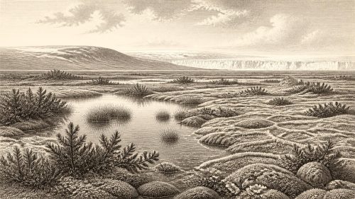
The closest Irish environmental archive for this broad chronological neighbourhood lies at Derryvree, near Maguiresbridge in County Fermanagh. Roadworks in 1969 exposed a drumlin containing freshwater silts and fine sands between two separate layers of till, the unsorted debris left by glacier ice. This sequence is unusually valuable because it preserves an order of events. First, ice deposited the lower till. Later, in a locality free of overriding ice, water accumulated sediment and organic remains. A subsequent glacial advance laid down the upper till and sealed the older freshwater deposit.
Material from the Derryvree organic bed produced the conventional radiocarbon determination Birm-166, about 30,500 radiocarbon years BP with a large laboratory uncertainty. Radiocarbon ages are not calendar ages: atmospheric carbon levels changed through time, so results must be calibrated against independently built curves. Calibration produces broad probability ranges rather than a single historical year. The Derryvree result has commonly been treated as overlapping an interval of roughly 37,000–32,000 calibrated years BP. Thus 31,249 BCE falls within the deposit’s very broad chronological vicinity, but cannot be identified as the moment when any particular Derryvree plant grew, a pool froze or sediment was buried.
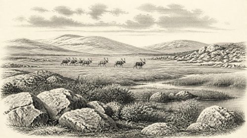
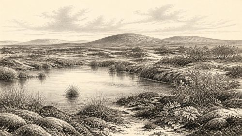
The preserved plant and small-animal evidence points to a cold, largely treeless wetland landscape, often described as muskeg or tundra-like. Mosses, sedges, aquatic plants and herbs could exploit sheltered, waterlogged ground during a short growing season. Such evidence is direct testimony to a particular Fermanagh locality, not a complete map of Ireland. It does, however, show that parts of the island supported freshwater habitats and vegetation between glacial episodes. Even in a harsh climate, the country contained ecological variety: pools, damp hollows, mineral sediments, exposed ground and likely more sheltered patches beside them.
Crag Cave and Climatic Pulses
Crag Cave in County Kerry supplies a different kind of evidence. Uranium-series dates on broken and reworked cave calcite show episodes of speleothem growth through much of the last glacial period, including the latter part of MIS 3. In a shallow cave system, dripstone growth requires liquid water percolating through ground above the cave. Researchers therefore interpret phases of deposition as signs that conditions in south-west Ireland periodically became mild enough for seasonal or longer-lived thaw, soil activity and infiltration; lengthy breaks in growth indicate colder conditions, potentially involving continuous frozen ground.
This does not allow historians to announce a thaw in 31,249 BCE. The dated material gives intervals and climatic patterns, not an annual weather record. Its significance is broader: Ireland responded to abrupt North Atlantic climate change. Derryvree’s wetland and Crag Cave’s calcite are complementary archives. One preserves a cold freshwater ecosystem between tills; the other records that the southern karst landscape experienced episodic conditions permitting water to move through soils and rock. Together they rebut the simple image of an unchanging ice-bound island.
Animals on the Limestone Country
Faunal remains from Castlepook Cave, also called Mammoth Cave, near Doneraile in County Cork provide the strongest evidence that larger animals reached Ireland during MIS 3. The cave collection includes reindeer, mammoth, giant deer, spotted hyena and other cold-stage animals; Arctic fox, wolf and lemmings occur in the wider southern Irish cave record. The National Museum of Ireland identifies Castlepook as the country’s most important site for mammal remains from the last cold stage. These animals imply open habitats capable, at least at particular times, of sustaining grazing herds and large predators.
But the cave bones must not be made to tell more than they can. Much of the material was excavated early in the twentieth century, before modern recovery and recording standards. Bones came from complicated deposits, and later re-dating has shown that several older radiocarbon results required revision. Not every specimen need be exactly contemporary with every other one, and a cave could accumulate remains through predator activity, natural deaths, water movement and changing use over long periods. The scientifically defensible conclusion is that a varied cold-climate fauna occupied or reached Ireland during MIS 3, not that a neatly reconstructed herd crossed a particular valley in this notional year.
The Castlepook Human Question
A reindeer femur from Castlepook has made this period especially important in Irish archaeology. It has been reported as dating to about 31,000 BCE and as carrying a deep mark interpreted by palaeozoologist Ruth Carden as having been made with a stone tool while fresh bone was butchered. If that interpretation is confirmed, it would be evidence that people handled a reindeer in Ireland far earlier than the previously accepted terminal-Pleistocene evidence from County Clare.
Its importance demands caution, rather than certainty. The femur is a single object from an old cave collection, not part of a securely excavated camp containing a hearth, stone-tool assemblage, dwelling floor, food-preparation area or burial. The National Museum of Ireland still states that no clear evidence of Palaeolithic human presence has emerged. These positions are not irreconcilable: the bone is a serious and potentially transformative indication of human activity, while the evidence for resident, continuous settlement remains unproven. It cannot establish population size, ancestry, language, kinship, seasonal routine or a permanent occupation of the island.
Society Beyond Recovery
There is consequently no responsible basis for describing political affairs, diplomacy or organised conflict in Ireland around 31,249 BCE. No chiefs, territories, alliances, weapons caches or defensive sites are known. Nor is there evidence for farming, herding, pottery, metalwork, built villages, formal trade routes or permanent maritime communities. If people did visit, comparison with Upper Palaeolithic groups elsewhere in north-west Europe makes small, mobile hunting parties a plausible possibility, perhaps drawn by animal resources. Yet that is an inference from neighbouring regions, not a demonstrated Irish social system.
The same boundary applies to religion, culture and learning. Ireland has no securely dated cave art, portable art, burial or ritual structure from this horizon. A cave’s later importance to people cannot be projected backwards onto its Ice Age deposits. The material record preserves plants, sediment, calcite and animal bones; it is silent about songs, stories, beliefs and names. Rather than treating that silence as an invitation to invention, it is part of the history: later ice movement, erosion, rising seas and the scarcity of occupation traces have left an exceptionally fragmentary archive.
Routes, Water and Regional Change
Lower global sea levels altered the geography around Ireland, exposing areas that are now seabed. Nonetheless, claims of a simple, permanent land bridge to Britain or continental Europe are disputed. Sea level, local crustal movement, ice loading and the shape of channels all mattered, and the best-known reconstructions concentrate on later phases of the glacial cycle. For 31,249 BCE, it is safer to say that regional distances and coastlines differed markedly from those of today, and that animal or human movement depended on shifting land, water and ice conditions. The presence of cold-stage mammals confirms that ecological connections existed at some stage; it does not by itself reveal the exact route, season or frequency of crossings.
The enduring development around this date was therefore environmental rather than political: Ireland formed part of a volatile north-west European glacial world. Fermanagh’s buried wetland demonstrates an ice-free interval and a sparse but living freshwater landscape. Kerry’s cave calcite registers climatic ameliorations and renewed freezing. Cork’s cave fauna records large mammals adapted to open country, while one marked reindeer bone poses an unresolved question about people. Those traces do not yield a conventional year in Irish history. They do reveal why the deep past of the island is a matter of changing ice, water, animal movement and carefully tested evidence.
Primary Sources
- A Middle Midlandian Freshwater Series at Derryvree, Maguiresbridge, County Fermanagh, Northern Ireland
- A reconsideration of the radiocarbon dating of the Marine Isotope Stage 3 fauna from southern Ireland
- Episodic speleothem deposition tracks the terrestrial impact of millennial-scale last glacial climate variability in SW Ireland
- Growth and retreat of the last British–Irish Ice Sheet, 31,000 to 15,000 years ago: the BRITICE-CHRONO reconstruction
- BRITICE-CHRONO
- The IntCal20 Northern Hemisphere Radiocarbon Age Calibration Curve (0–55 cal kBP)
- Figure 6.— The Subdivision of the Quaternary Period in Ireland
- Irish Quaternary Association Field Guide 16
- Prehistoric Details: Mell Flint Flake
- Spotted Hyena Skull
- Heritage Artefacts of County Cork
- Archaeological Heritage of County Cork
- First Evidence of a Late Upper Palaeolithic Human Presence in Ireland
- New Insights on the Fauna of Ireland’s Younger Dryas and Early Holocene
- The Colonization of Ireland: A Human Ecology Perspective
- Timing, Pace and Controls on Ice Sheet Retreat: An Introduction to the BRITICE-CHRONO Transect Reconstructions of the British–Irish Ice Sheet
- Spatio-temporal Dynamics of Speleothem Growth and Glaciation in the British Isles
- The Problem of a Late Quaternary Landbridge Between Britain and Ireland
- The Island of Ireland: Drowning the Myth of an Irish Land-Bridge?
- The Irish Quaternary Fauna Project
- Occurrence of Mammalia Relicts at Site Castlepook Cave
- Growth and Retreat of the Last British–Irish Ice Sheet, 31,000 to 15,000 Years Ago: the BRITICE-CHRONO Reconstruction