St Mary’s Church

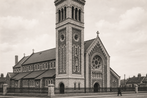
St Mary’s Church stands on Athlunkard Street in Limerick, occupying a site associated with Catholic worship since the eighteenth century. The present church opened in 1932, replacing an earlier chapel where Mass was first celebrated on December 10, 1749. Designed by Ashlin and Coleman of Dublin, the building reflects the scale and ambition of parish church architecture in early twentieth-century Limerick. Its tower, façade, railings and street setting mark an important local landmark, while the surviving holy water font from the former chapel links the modern church with the long religious history of St Mary’s parish community today.
King John’s Castle (1922)

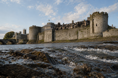
King John’s Castle stands beside the River Shannon at Curragower Falls, with broken water, river rocks and the castle’s stone frontage visible across the scene. The round towers, curtain walls and riverside defences remain central, while the burned Castle Barracks appears roofless and blackened within the enclosure. Thomond Bridge is visible to the left, with nearby trees, older buildings and a church tower rising beyond the castle walls. The river surface shows ripples, reflections and shallow movement below the fortifications. The image presents the castle after damage, set within the wider early twentieth century Limerick urban riverside landscape after 1922.

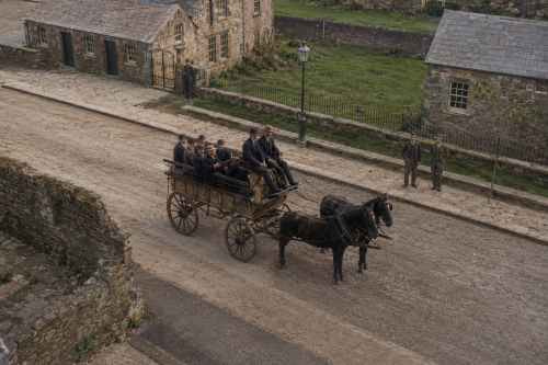
Limerick Horse Brake, 1900

By 1900, Limerick’s great long-distance stagecoach era had largely disappeared, replaced by the expanding railway network. Horse-drawn vehicles nevertheless remained essential throughout the city and surrounding countryside. Large brakes and passenger wagons carried groups on local journeys, outings and transfers, while hackney cars, jaunting cars, drays and private carriages crowded the streets. Horses also transported goods from the docks, breweries, distilleries and railway station. This reconstructed scene captures a group of formally dressed men aboard a substantial horse-drawn vehicle, reflecting a transitional age when steam powered intercity travel, but horses still firmly supported Limerick’s everyday commercial, urban and social life.

Limerick Stone Cottage, 1937

This February 1937 photograph shows a weathered stone cottage in Limerick, with children gathered at its doorway and along the narrow street outside. The rough masonry, patched walls, boarded upper windows and low, sloping roof reveal the building’s age and modest condition. Electrical wires cross above the house, suggesting the gradual arrival of modern services within an older urban landscape. The children’s presence brings warmth and life to the scene, contrasting with the severe exterior and surrounding ruins. The image provides a valuable record of working-class housing, childhood and community life in pre-war Limerick during a period of social change.

Fatal Confusion

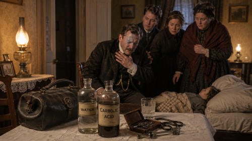
Cappamore and the surrounding district lost a medical practitioner in early February 1900 when Dr Charles Philip Tennant died after accidentally swallowing carbolic acid during an evening visit to a family at Rath. Tennant served patients across the Cappamore and Murroe area, where a country doctor might travel considerable distances to reach sick people in their homes. The surviving reports describe no deliberate act and no dispute over the cause. An ordinary medical call ended in tragedy because two liquids carried to the house were confused, turning a customary gesture of hospitality into a fatal emergency.

Thomond Bridge and Castle, 1881

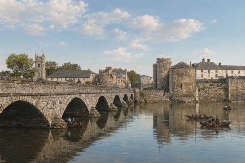
This 1881 reconstructed image is based on an engraving and depicts Thomond Bridge and King John’s Castle overlooking the River Shannon in Limerick, County Limerick. The original was published in Élisée Reclus’s geographical work The Earth and Its Inhabitants, the image presents one of the city’s most recognisable historic views. The medieval castle dominates the riverbank, while the bridge connects the city across the Shannon. Boats, buildings, and figures add detail to the busy riverside setting. The engraving reflects both the architectural importance of the castle and the strategic role of the crossing, preserving a valuable nineteenth-century representation of Limerick’s urban landscape and historic waterfront for future generations to appreciate.

Inside Gurranmore Police Cabin

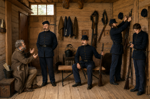
Around 1880, the interior of a police cabin at Gurranmore, near Pallas in County Limerick, reveals the modest conditions in which rural constables lived and worked. The small room is sparsely furnished, with simple wooden fittings, basic household utensils and few comforts. Uniformed officers occupy the cramped space, suggesting that the cabin served as both workplace and living quarters. Published in The Graphic in 1880, the image offers a rare glimpse of everyday policing in nineteenth-century Ireland. It preserves not only the appearance of the station, but also the disciplined, isolated life experienced by men posted in rural communities nearby.

Teampall Nua in Ruins

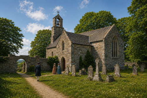
The old church near Holycross, County Limerick, was recorded as a ruin by 1642. In 1679, Rachael Bourchier, Countess of Bath, restored the building, just one year before her death. Thereafter it became known as the New Church, or Teampall Nua in Irish, and served local Church of Ireland parishioners. A belfry was added during the restoration, giving the structure a distinctive profile. Although the church later fell out of use and returned to ruin, its surviving walls, arched openings and graveyard remain important reminders of seventeenth-century religious life and the long history of worship at this historic site today.

O’Connell Street, 1937

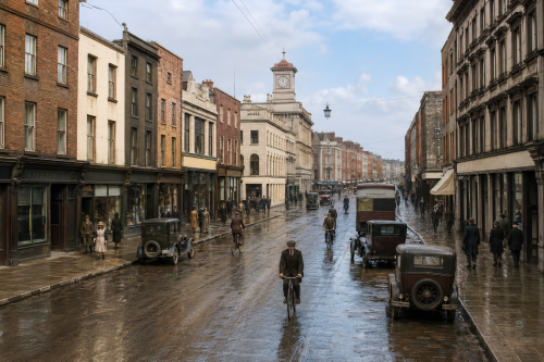
This 1937 view of O’Connell Street, historically known as George’s Street, captures Limerick’s principal commercial thoroughfare during a period of urban transition. Georgian façades, prominent shopfronts and the landmark clock tower frame a busy scene of pedestrians, cyclists, motorcars and public transport. Heavy coats and formal dress reflect everyday life before the Second World War, while traditional businesses line both sides of the street. Several buildings and upper storeys shown here were later altered or demolished during redevelopment. Despite extensive modernisation and pedestrianisation, O’Connell Street remains central to Limerick’s commercial, architectural and social identity within the changing modern city today.

Branches Demand

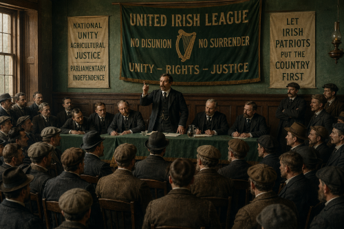
United Irish League branches pressed nationalist MPs to place national unity above personal disagreement as the organisation expanded during 1899. Founded at Westport in January 1898, the League combined agrarian agitation with a campaign to reconstruct the divided parliamentary movement. Local meetings and resolutions allowed tenant farmers, organisers and constituency workers to express impatience with leaders whose rivalries had weakened Irish representation since the fall of Charles Stewart Parnell. Branches possessed no constitutional power to command MPs, but their subscriptions, electoral labour and influence over candidate selection gave their appeals a force that Westminster politicians could not safely dismiss.

Now Sharing: Articles (154) Images (455) Total Items Archived (609)
Our Mission: 100,000 Items Total Percentage Achieved (0.61%)