Archived: 29 September 2026
Abstract
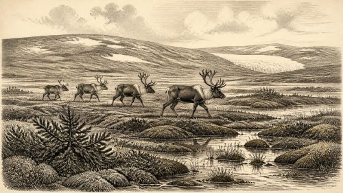
Around 30,494 BCE, Ireland was not continuously ice-covered but experienced unstable cold-stage intervals between glacial advances. At Derryvree, County Fermanagh, freshwater sediments beneath later till preserve juniper, grasses, sedges, mosses, aquatic plants and insects, indicating open tundra-like wetland with pools and seasonal extremes. Comparable deposits and cave calcite show episodic climatic amelioration elsewhere. Castlepook Cave fauna, accumulated across Marine Isotope Stage 3, includes reindeer, mammoth, giant deer, predators and other cold-adapted animals, demonstrating ecological connectivity. A possible tool-marked reindeer bone suggests transient human visits, but lacks secure corroborating artefacts. No settlements, polities, religion or calendar-year events can be established there.
Read Article

Archived: 29 September 2026
Abstract
30,498 BCE is a modern chronological reference, not a recorded Irish year. At Derryvree, County Fermanagh, freshwater silts between two glacial tills show a local ice-free interval during Marine Isotope Stage 3, although they cannot represent all Ireland or a single season. Radiocarbon calibration provides only a broad date range. Plant, moss, pollen and insect remains indicate treeless, cold, wet tundra with pools, sedges and short growing seasons. Cave fauna elsewhere confirms wider Pleistocene mammals, cautiously interpreted. No secure human settlement is known; a marked reindeer bone merely suggests possible Upper Palaeolithic activity. Later ice expansion buried and eroded record.
Read Article

Archived: 29 September 2026
Abstract
30,503 BCE is best understood through broad calibrated ranges rather than an annual event. Derryvree, County Fermanagh, preserves freshwater silts between glacial tills, indicating treeless tundra wetlands of sedges, mosses, bogbean, dwarf shrubs and cold-adapted insects during the Middle Midlandian. Ireland experienced shifting ice, permafrost, low sea levels and seasonal ice-free terrain before the Last Glacial Maximum. Castlepook Cave in County Cork records a diverse, changing fauna including mammoth, reindeer, giant deer and predators. No secure evidence establishes human settlement; a possibly cut-marked reindeer bone suggests only a tentative brief visit. The period is an environmental history from geological evidence.
Read Article
Archived: 28 September 2026
Abstract
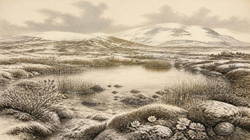
Thirty thousand five hundred and thirty-eight BCE cannot be reconstructed as a discrete Irish year; it falls within a broadly calibrated Late Pleistocene range. Derryvree, County Fermanagh, provides key evidence: freshwater silts and organic layers, sealed between glacial tills, record a locally ice-free interval with tundra, wetlands, mosses, sedges and cold-adapted insects. Plant remains indicate treeless, seasonally severe terrain. Southern cave faunas demonstrate wider Marine Isotope Stage 3 mammal communities, including reindeer, horse and mammoth. Possible butchery evidence is inconclusive, while secure human activity is much later. Fluctuating ice margins preceded maximum glaciation, making environmental change the period's central story.
Read Article
Archived: 28 September 2026
Abstract
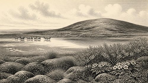
Around 30,545 BCE, Ireland experienced unstable Middle Midlandian glacial conditions, not a documented historical year. At Derryvree, County Fermanagh, freshwater silts sealed between tills preserve evidence of an ice-free interval with treeless tundra, wetlands, aquatic plants, mosses and invertebrates. Cave faunas, especially Castlepook in Cork, indicate intermittent presence of reindeer, mammoth, giant deer and predators, reflecting ecological connections with Europe when sea levels were lower. These assemblages span episodes rather than one moment. No secure human settlement is known; a possibly cut-marked reindeer bone suggests tentative Upper Palaeolithic contact. Derryvree chiefly reveals a cold, changing landscape preceding regional maximum glaciation.
Read Article
Archived: 28 September 2026
Abstract
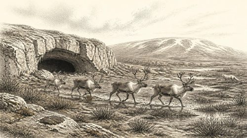
30,547 BCE is not a datable Irish event but an editorial point within unstable Marine Isotope Stage 3. Derryvree, County Fermanagh, preserves freshwater sediments between glacial tills, demonstrating an ice-free tundra wetland during a broad cold interval. Castlepook Cave, County Cork, contains diverse cold-adapted fauna accumulated over millennia. A marked reindeer femur may record stone-tool butchery and thus an early human visit, but lacks supporting tools, hearths or secure contexts. Ireland was environmentally varied, with ice, open ground, wetlands and large mammals, rather than uniformly frozen. Evidence permits possible intermittent human presence, not settlement, society or year-specific history in Ireland.
Read Article

Archived: 27 September 2026
Abstract
About 30,565 BCE, Ireland lay in the volatile MIS 3 phase of the Late Pleistocene, not a date recoverable as a single historical year. Freshwater sediments at Derryvree, County Fermanagh, dated broadly to this period, show an interval between glacial advances when treeless tundra wetlands supported mosses, sedges and Arctic-alpine plants. Cave deposits at Castlepook, County Cork, document cold-adapted fauna including reindeer, mammoth and hyaena. An incised reindeer bone may indicate brief human butchery, but cannot establish settlement. Later glaciation destroyed much evidence. No reliable evidence supports claims about population, society, culture or politics; environmental change dominates the Irish record.
Read Article
Archived: 27 September 2026
Abstract
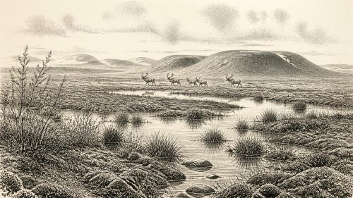
Around 30,577 BCE, Ireland lay within the volatile later Marine Isotope Stage 3 Ice Age, though no event can be dated to that precise year. Derryvree in Fermanagh preserves freshwater organic sediments between glacial tills, indicating cold, tundra-like wetlands during an ice-free interval. Castlepook Cave, Cork, yielded diverse fauna, including mammoth, reindeer, giant deer, hyaena and Arctic fox, demonstrating episodic connections with wider European animal ranges. Its mixed, imperfectly recorded deposits accumulated over time, so they are not a single landscape snapshot. A marked reindeer bone may indicate human butchery, but sustained settlement remains unproven. Evidence supports fragmentary environmental history.
Read Article
Archived: 27 September 2026
Abstract
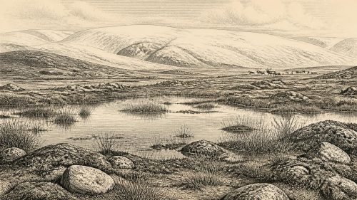
30,579 BCE is not a recoverable Irish year but an approximate point within Late Pleistocene climate change, near Greenland Interstadial 5.2. Derryvree, County Fermanagh, preserves freshwater silts and organic material between glacial tills, showing that an ice-free, tundra-like freshwater environment briefly existed amid unstable glaciation. Comparable deposits confirm regional variation rather than continuous ice cover. Cave faunas demonstrate connections with north-west Europe and include cold-adapted mammals, though assemblages cannot date species to one moment. Possible tool damage on a Castlepook reindeer bone suggests transient human activity, but settlement remains unproven. Ireland’s evidence records environmental transformation, not events, societies or politics.
Read Article

Archived: 27 September 2026
Abstract
Although 30,580 BCE cannot denote a recorded Irish event, it lies within a later Pleistocene interval documented by deposits and fauna. At Derryvree, County Fermanagh, freshwater organic sediments between glacial tills, radiocarbon dated broadly to 36,900–31,700 calibrated BP, record an ice-free phase of tundra-steppe, wetlands and severe periglacial conditions. Castlepook Cave, County Cork, preserves diverse cold-stage mammals, including mammoth, reindeer, giant deer, predators and lemmings, accumulated over extended periods. A possibly cut-marked reindeer bone suggests, but cannot prove, Upper Palaeolithic human activity. No evidence establishes settlement, institutions or economy; changing ice, habitats and animal movements define this uncertain Irish landscape.
Read Article
Archived: 27 September 2026
Abstract
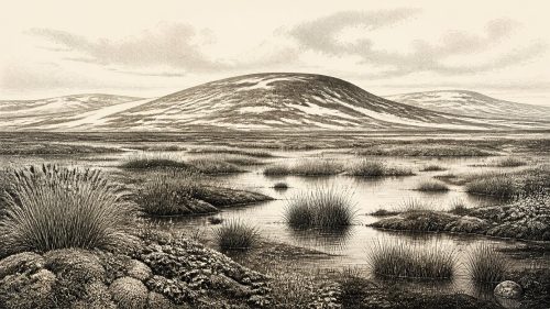
Around 30,581 BCE, Ireland lay within the unstable, cold Middle Midlandian phase of Marine Isotope Stage 3, before the Last Glacial Maximum. Dating is necessarily approximate, relying on calibrated radiocarbon ranges rather than annual history. At Derryvree, County Fermanagh, freshwater sediments between tills preserve evidence of sedges, mosses and herbs in open, wet tundra conditions. Castlepook Cave, County Cork, records diverse Pleistocene fauna, including mammoth, reindeer, giant deer, bear and hyaena, although deposits span long periods. A marked reindeer bone may indicate brief human activity, but lacks supporting settlement evidence. Ireland was environmentally varied, intermittently ice-free, and archaeologically fragmentary overall.
Read Article

Archived: 27 September 2026
Abstract
Around 30,584 BCE, Ireland’s evidence records environmental change rather than a datable event. At Derryvree, County Fermanagh, organic sediments between glacial tills indicate an ice-free interval, broadly 34,950–29,750 BCE, when a cold tundra wetland supported mosses, herbs, insects and freshwater pools. Ice conditions elsewhere remain uncertain. Castlepook Cave, County Cork, contains reindeer and mammoth remains; a possibly cut-marked reindeer femur may indicate human carcass processing, but not settlement. No continuous population, agriculture, polity or cultural sites are known. Lower sea levels altered coasts and routes. Later glaciation obscured much evidence, suggesting episodic human possibility within a shifting Ice Age landscape.
Read Article

Archived: 27 September 2026
Abstract
Around 30,587 BCE, a modern label within Marine Isotope Stage 3, Ireland has no historical record. Derryvree, County Fermanagh, preserves organic freshwater sediments between glacial tills, dated broadly enough to include this period. Its pollen, plants, mosses and insects indicate cold, open, wet periglacial terrain with pools, sedges, herbs and sparse scrub, rather than forest. Other Fermanagh deposits reveal variable glacial conditions. The British–Irish Ice Sheet was expanding towards its maximum. Castlepook Cave records cold-stage fauna and a possible cut-marked reindeer bone, but provides no secure evidence of settlement. No claims about peoples, politics, farming or routes can be sustained.
Read Article

Archived: 27 September 2026
Abstract
Around 30,593 BCE, Ireland’s history is represented not by a precise year but by a broad MIS 3 interval. At Derryvree, County Fermanagh, freshwater sediments dated BIRM-166 lay between glacial tills, demonstrating a local cold wetland between episodes of ice cover. Plant and insect remains indicate treeless tundra vegetation, standing water and severe seasonal conditions. Later expansion of the British–Irish Ice Sheet transformed the island, though timing varied regionally. Faunal remains show links with wider European cold-stage ecosystems. Possible early human activity remains unproven. No settlements, polities or cultural practices can be securely identified; environmental change is the principal evidence.
Read Article
Archived: 27 September 2026
Abstract
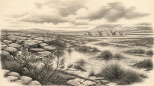
30,594 BCE is a modern label rather than a recoverable Irish date, within climatically unstable MIS 3. Before the Last Glacial Maximum, Ireland was a variable cold landscape, with lower seas, shifting ice, exposed terrain and changing ecological connections. Derryvree, County Fermanagh, preserves a buried freshwater wetland between glacial advances, indicating treeless, marshy habitats supporting plants, insects and animals. Castlepook Cave, County Cork, documents diverse cold-adapted fauna, although old excavations limit interpretation. A marked reindeer femur may record human butchery, but cannot prove settlement. Fragmentary evidence shows environmental transformation, intermittent mammal habitats, and possible human visits before glaciers obscured traces.
Read Article

Archived: 27 September 2026
Abstract
About 30,598 BCE, Ireland was not a recorded society but a changing Pleistocene environment within Marine Isotope Stage 3. At Derryvree, County Fermanagh, freshwater organic deposits between glacial tills demonstrate an ice-free wetland interval, dated broadly rather than precisely, amid recurring ice advances. Plants indicate cold, treeless tundra with shallow water and sedge-rich margins. Lower sea levels and shifting ice affected access to Ireland. Cave remains show reindeer, mammoth and other cold-adapted fauna. A cut-marked Castlepook reindeer bone suggests possible early human activity, but confirms neither settlement nor continuity. Together, evidence reveals intermittent habitats supporting life before later maximum glaciation.
Read Article
Archived: 27 September 2026
Abstract
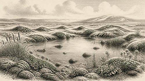
At 30,599 BCE, Ireland cannot be described through a precise historical event. Derryvree, County Fermanagh, preserves a freshwater wetland between glacial tills, radiocarbon-dated broadly to 36,900–31,700 years before present. Its fossils show treeless, periglacial tundra with pools, sedges, mosses and cold-adapted plants. The deposit demonstrates local ice-free conditions during unstable Marine Isotope Stage 3, not an island-wide landscape. Cave remains indicate intermittent mammals, including mammoth, reindeer and hyaena, but their contexts are fragmentary. A possibly tool-marked reindeer bone suggests human visits, yet secure evidence for people, settlement or society is absent. Later glaciation preserved and destroyed this rare, local record.
Read Article

Archived: 27 September 2026
Abstract
At Derryvree, County Fermanagh, freshwater silts sealed between glacial tills record a locally ice-free episode during Marine Isotope Stage 3. Radiocarbon dating of organic material, though incapable of fixing events to 30,610 BCE, places the deposit broadly within 36,900–31,700 calibrated years before present. Its wetland flora, insects and sediments reveal treeless tundra, cold shallow water and short growing seasons. Castlepook Cave, County Cork, preserves fauna including mammoth, reindeer, hyaena and Arctic fox, indicating cold open habitats. A possibly cut-marked reindeer bone suggests, but does not prove, fleeting human activity. Evidence supports an intermittently habitable, environmentally unstable Ireland, without settled communities.
Read Article
Archived: 26 September 2026
Abstract
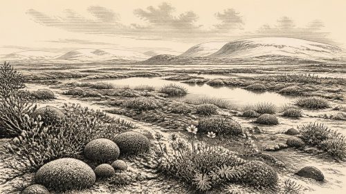
At 30,625 BCE, Ireland lay within the climatically unstable Marine Isotope Stage 3. Derryvree in County Fermanagh preserves freshwater sediments deposited during an ice-free interval, later sealed by glacial deposits. Pollen, plants, mosses and insects indicate a cold, treeless, periglacial wetland with sedges, pools and Arctic-alpine vegetation. Its broad radiocarbon range encompasses the nominated date but cannot identify a specific year or climate event. Ireland’s variable ice margins and North Atlantic climate permitted temporary ecological opportunities before major glaciation. Cave fauna document cold-stage mammals, while a possibly butchered reindeer bone suggests, but does not prove, fleeting human presence or settlement.
Read Article

Archived: 26 September 2026
Abstract
Although 30,627 BCE cannot identify a specific Irish event, Derryvree near Maguiresbridge, County Fermanagh, provides an ecological record broadly spanning this period. Freshwater organic sediments, trapped between glacial tills, preserve pollen, plants, mosses and insects from a cold, treeless periglacial wetland. Sedges, aquatic species, dwarf willow and arctic-alpine herbs indicate shallow water and open tundra-like ground. Cave remains, especially at Castlepook, demonstrate diverse Pleistocene fauna, including reindeer, mammoth and predators, though assemblages span long periods. A possibly cut-marked reindeer bone suggests human activity, but no secure settlement evidence exists. Later glaciation subsequently obscured or destroyed much contemporary landscape evidence there.
Read Article

Archived: 26 September 2026
Abstract
Labelled 30,632 BCE retrospectively, this Late Pleistocene period cannot be tied to a recorded Irish event. Derryvree, County Fermanagh, preserves freshwater sediments between glacial tills, radiocarbon dated broadly to 34,950–29,750 BCE, demonstrating a local ice-free interval before renewed glaciation. Bogbean, sedges, mosses, insects and Arctic-alpine plants indicate cold, treeless wetlands. Castlepook Cave in County Cork produced remains of reindeer, mammoth, predators and other cold-stage fauna, although its disturbed deposits span long periods. A possibly cut-marked reindeer bone suggests, but cannot confirm, human visits. No securely dated settlement, tools, hearths or social record exists there; advancing ice later obscured much evidence.
Read Article

Archived: 26 September 2026
Abstract
Around 30,633 BCE, Ireland lay within the climatically unstable Marine Isotope Stage 3, as the British–Irish Ice Sheet expanded unevenly before the Last Glacial Maximum. No evidence permits annual precision or a uniform description of conditions. Glacial erosion, changing sea levels and shifting ice created variable habitats. Castlepook Cave preserves remains of mammoth, reindeer, giant deer, predators and cold-adapted mammals, indicating intermittent food webs, while Derryvree records treeless wetlands between glacial advances. A possibly cut-marked reindeer bone suggests, but does not prove, brief Upper Palaeolithic human activity. No evidence supports settled communities, politics or culture. Environmental change defines this period.
Read Article

Archived: 26 September 2026
Abstract
30,636 BCE is a modern label within the unstable Late Pleistocene, not a recordable Irish year. At Derryvree, County Fermanagh, sediments between two tills document a local ice-free interval, dated broadly to about 34,950–29,750 BCE. Freshwater silts, mosses, sedges, clubmoss, bogbean, mountain-avens and insects indicate cold, wet, open tundra-like ground with pools. Other Irish cave deposits show that Ice-Age mammals, including mammoth and reindeer, occurred during wider periods, but cannot be treated as contemporaneous local evidence. No secure proof establishes human occupation, settlement or culture. Later ice expansion reshaped Ireland, leaving Derryvree as an exceptional, fragmentary environmental archive for science.
Read Article
Archived: 26 September 2026
Abstract
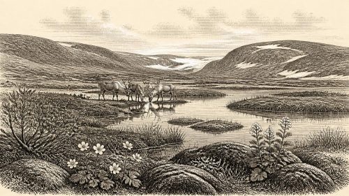
Although 30,638 BCE cannot identify a specific Irish event, Derryvree, County Fermanagh, records a later Marine Isotope Stage 3 ice-free interval. Freshwater sediments, bracketed by glacial tills and radiocarbon dated to about 30,500 BP, preserve tundra wetland plants, insects and pollen, indicating treeless, seasonal landscapes of pools, sedges and hardy shrubs. Faunal remains elsewhere, notably Castlepook Cave, show that mammoth-steppe animals, including reindeer, sometimes reached Ireland, but provide no population census. A possibly cut-marked reindeer bone suggests early human visits, not settlement. Subsequent ice buried Derryvree, foreshadowing the expanding glaciation that later profoundly reshaped Ireland during the Last Glacial Maximum.
Read Article
Archived: 26 September 2026
Abstract
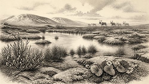
30,651 BCE is a modern label rather than a recoverable Irish historical year. Derryvree, County Fermanagh, preserves freshwater silts between glacial tills, radiocarbon dated broadly to a period encompassing this date. Its plants reveal treeless tundra, wet hollows and seasonal liquid water during an ice-free interval amid changing Midlandian ice conditions. Castlepook Cave, County Cork, records diverse Marine Isotope Stage 3 fauna, including mammoth, reindeer, giant deer and predators, but not a single contemporaneous community. Human presence remains unproven: possible cut marks require investigation, whereas secure evidence is later. The period documents Ice-Age environments, not kingdoms, settlement or recorded events.
Read Article

Archived: 26 September 2026
Abstract
30,659 BCE is a modern label within Marine Isotope Stage 3, not a recoverable Irish year. Evidence from Derryvree, County Fermanagh, records a freshwater wetland between glacial advances, later sealed beneath drumlin till. Its sediments, dated broadly to 36,900–31,700 calibrated years before present, contain bogbean, sedges, mosses and other plants indicating cold, treeless periglacial conditions. Castlepook Cave, County Cork, preserves bones of mammoth, giant deer, reindeer, bear, hyaena and later cold-adapted fauna, demonstrating changing open environments and movement routes. A possibly cut-marked reindeer bone may indicate transient human activity, but cannot securely establish settlement, chronology or social life with certainty.
Read Article
Archived: 25 September 2026
Abstract
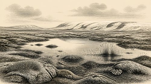
About 30,676 BCE, Ireland lay within the climatically unstable Middle Midlandian or Marine Isotope Stage 3, not a precisely dateable historical moment. At Derryvree, County Fermanagh, organic sediments between glacial tills preserve evidence of an ice-free interval: shallow freshwater pools, tundra vegetation, insects and seasonal thaw within a largely treeless periglacial landscape. Elsewhere, ice conditions varied regionally. Castlepook Cave, County Cork, records diverse Pleistocene fauna, including reindeer, mammoth, bear, wolf and hyaena, accumulated over millennia. A cut-marked reindeer femur may indicate brief human activity, but no secure settlement evidence exists. Political, cultural and religious life remain unknown for this period.
Read Article
Archived: 25 September 2026
Abstract
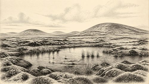
30,685 BCE is a modern label within Marine Isotope Stage 3, not a precisely recoverable Irish date. At Derryvree, County Fermanagh, freshwater sediments between two glacial tills indicate a local ice-free interval before renewed glaciation. Radiocarbon dating broadly encompasses the nominal year. Mosses, sedges and cold-adapted insects describe open, periglacial wetlands with liquid water and vegetation amid severe climate, rather than forest or cultivation. Comparable deposits and Kerry speleothems suggest fluctuating conditions, while cave fauna shows intermittent opportunities for cold-stage animals. No securely dated human settlement or politics is known. Derryvree preserves evidence of environmental change before the ice-sheet maximum.
Read Article
Archived: 25 September 2026
Abstract
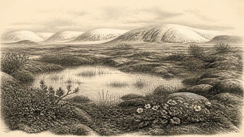
Around 30,687 BCE, Ireland was experiencing unstable Late Pleistocene conditions rather than a recordable historical year. At Derryvree, County Fermanagh, freshwater sediments preserved between glacial tills show an ice-free interval with cold, wet, treeless tundra vegetation. Mosses, sedges, aquatic plants, mountain avens, dwarf willow and other Arctic-alpine species indicate shallow water, saturated ground and brief growing seasons. Cave finds elsewhere confirm that reindeer, mammoth, hyaena and giant deer inhabited Ireland during broadly comparable periods, though not necessarily locally together. No secure evidence establishes human settlement then. Derryvree therefore records a local, changing ecosystem between glacier advances, not an inhabited society.
Read Article
Archived: 25 September 2026
Abstract
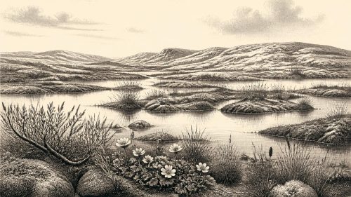
30,704 BCE is a modern label rather than a precisely recoverable Irish year. During late Marine Isotope Stage 3, Ireland experienced unstable glacial and periglacial conditions, with evidence limited to broad dated ranges. Derryvree, County Fermanagh, preserves freshwater sediments dated around 36,900–31,700 calibrated BP, indicating a cold, open, largely treeless wetland with tundra plants, insects and pools between glacial episodes. Castlepook Cave, County Cork, records mammoth, reindeer, giant deer, predators and cold-adapted fauna, though deposits are mixed. A marked reindeer femur may indicate brief human butchery, not settlement. No evidence supports societies, polities or recorded events; environmental change dominates overall.
Read Article

