
Derryvree’s Menyanthes Seed31754 BCE
Around 31,754 BCE, Ireland cannot be described through annual events, but Derryvree, County Fermanagh, preserves an environmental horizon from later Marine Isotope Stage 3. Freshwater silts, radiocarbon-dated broadly to 36,900–31,700 years BP, lay between glacial tills, indicating a cold, locally ice-free wetland between ice advances. Mosses, sedges, dwarf willow, mountain avens and bogbean, alongside northern insects, show treeless tundra-like conditions. Cave remains demonstrate intermittent Late Pleistocene mammals, including reindeer, mammoth and hyaena, without proving local coexistence. No secure evidence places humans in Ireland then. Shifting ice, coastlines and climate created varied landscapes, then sealed beneath glacial deposits in subsequent millennia.
Dateline
Modern calendar-year precision is not available for Ireland in 31,754 BCE. The number is useful chiefly as a point on a much broader timescale: it falls roughly 33,700 calendar years before present, within the later part of Marine Isotope Stage 3, a long and climatically unstable portion of the Last Glacial period. No Irish deposit can be assigned to that individual year, and no person, settlement, political act or journey can responsibly be dated to it. What can be described is an archaeological and environmental horizon whose calibrated ranges overlap this notional date.
A Date Within a Range
The key evidence comes from Derryvree, near Maguiresbridge in County Fermanagh. Road works in 1969 cut through a drumlin and revealed freshwater silts and fine sands sealed between two separate sheets of glacial till. The organic deposit produced a radiocarbon determination of 30,500 +1,170/−1,030 radiocarbon years BP. Radiocarbon years are not calendar years: changing atmospheric carbon levels mean that they must be calibrated against independent records. Published calibration of this legacy measurement gives a broad range of about 36,900–31,700 calendar years BP. Thus 31,754 BCE falls within the outer edge of a range relevant to the Derryvree sediments, not at a pinpoint in their formation.
That distinction matters. A radiocarbon result dates carbon in the sampled material, with analytical uncertainty and further uncertainty in calibration; sediment may also accumulate over a considerable interval. The Derryvree bed is therefore a window on conditions in part of later MIS 3, rather than an annual chronicle. Its importance lies precisely in being buried beneath later ice-laid sediment: it preserves a landscape that subsequent glaciation largely erased elsewhere.
A Freshwater Landscape Between Ice Advances
The layers beneath and above the organic silts record profound environmental change. The lower till indicates an earlier ice advance. Afterwards, at least locally, an ice-free depression held freshwater and accumulated silt, plant remains and insects. A later advance deposited the upper till, compressing the evidence into the core of the drumlin. This sequence does not prove that all Ireland was ice-free at one moment. It does show that northern inland ground could support a cold freshwater environment between glacial episodes.
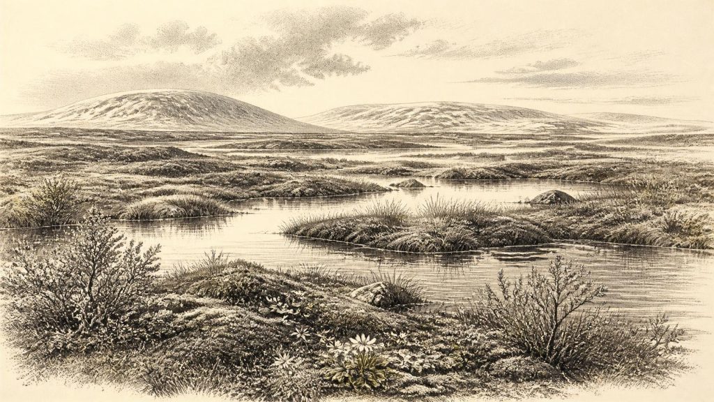
Researchers describe the Derryvree setting as treeless tundra or muskeg: a wet, peaty landscape of shallow pools, mosses, sedges and sparse low vegetation, shaped by harsh winters and periglacial conditions. Periglacial means a climate at or near an ice margin in which seasonal freezing, frost action and permanently or intermittently frozen ground could strongly affect soil and water. It does not mean that the site was necessarily beside a visible glacier every day. The image to retain is not of the familiar green, wooded Ireland, but of an exposed wetland under a severe continental-influenced climate.
Plants Recorded in Silt
Macrofossils and pollen offer the clearest local testimony. Mosses and sedges occur in the organic layers, while plants associated with cold, open ground include dwarf willow, mountain avens and bogbean. The last is especially evocative. A seed of Menyanthes trifoliata, the three-leaved bogbean, survived in the sediment. Its presence demonstrates freshwater or wetland habitat; it does not establish a continuous blanket of identical vegetation across the island. Pollen was poorly preserved, and some tree pollen may have travelled long distances rather than recording trees growing beside the pool. The responsible conclusion is an open, wet and cold flora, not a detailed map of every slope and valley.
Such vegetation would have been highly seasonal. Short growing seasons favoured plants able to flower, set seed and spread quickly during a brief summer. Moss cover and sedge-rich margins could retain water and organic matter, while exposed mineral ground remained vulnerable to wind and frost. There is no evidence here for fields, managed woodland or grazing by domestic stock. This was a naturally structured ecosystem, with its productivity dictated by climate, soil moisture and the repeated disturbance of freezing and thawing.
Animals and Uneven Evidence
Derryvree’s insect fauna has cold northern affinities, reinforcing the environmental interpretation. Elsewhere, especially in the limestone caves around Castlepook or Mammoth Cave near Doneraile in County Cork, bones attest a striking Late Pleistocene fauna. The cave assemblage includes reindeer, horse, brown bear, wolf, giant deer, woolly mammoth and spotted hyaena, though individual species and bones belong to different parts of a long interval and should not be treated as one simultaneous herd.
Castlepook is exceptionally valuable, but it is not a photograph of a single day. Caves accumulate bones through carnivore denning, natural deaths, water movement, collapse and disturbance during excavation. The Irish Quaternary Fauna Project showed that many cave finds require direct dating and careful re-evaluation of their context. Some reliable dates demonstrate that large mammals reached Ireland during the period from at least about 45,000 to 20,000 years ago. That makes the animal record directly relevant to the world around 31,754 BCE, while still preventing certainty about which species occupied any particular Irish locality in that calendrical year.
Spotted hyaena is a useful warning against imagining an exclusively Arctic menagerie. The species is known in Ireland from Castlepook and points to an open landscape capable of supporting substantial prey. Reindeer are likewise well suited to cold, open country, but their bones cannot tell us whether a herd crossed a particular Fermanagh wetland in the year selected here. Mammoth bones reveal that the island was not biologically isolated from wider north-west European faunas, yet neither they nor hyaena remains constitute evidence for human hunting in Ireland at this date.
No Irish Society Yet Demonstrated
There is no securely dated archaeological evidence for people living in Ireland around 33,700 calendar years ago. Accordingly there were no demonstrable Irish polities, leaders, alliances, wars, diplomatic exchanges, religious institutions, settlements, farms, markets, written learning or trade systems. These are not missing details awaiting imaginative reconstruction; they are categories for which the evidence is absent. It would be misleading to transfer the known practices of Upper Palaeolithic communities in Britain or continental Europe directly across the sea.
That restraint does not deny the presence of people in neighbouring regions. Humans were present in parts of Britain and mainland Europe during the Upper Palaeolithic, and their movements, hunting strategies and symbolic cultures form the wider European context. Ireland, however, has supplied no contemporary hearth, stone-tool assemblage, butchered animal securely tied to this horizon, dwelling floor or human bone. The earliest currently dated evidence of human interaction on the island is much later: a butchered brown-bear patella from Alice and Gwendoline Cave in County Clare, assigned to the Late Upper Palaeolithic at about 12,500 BP. It cannot be used to populate Derryvree more than twenty millennia earlier.
Routes, Coasts and Ice
Lower global sea levels during the glacial period altered the outlines of the Irish coast and exposed or narrowed parts of the surrounding shelf. Animal colonisation nevertheless should not be reduced to a simple claim that Ireland was continuously joined to Britain by dry land. Water depths, changing shorelines, ice margins and the timing of cold phases all mattered, and the precise routes followed by animals remain uncertain. The presence of mainland European and British-Irish faunal connections demonstrates movement over longer spans, not a dated corridor in 31,754 BCE.
Ice-sheet reconstruction adds another layer of caution. Evidence from Derryvree and Greenagho indicates ice-free conditions in north-central Ireland until roughly 34,000 calendar years ago, whereas broader reconstructions show the British–Irish Ice Sheet building in complex, regionally asynchronous ways before its later maximum. Around the target date, Ireland was therefore not a uniform white expanse nor securely a wholly ice-free island. Some uplands and northern sectors may have supported growing ice masses or glaciers, while lowlands could retain open ground and wetlands. The distribution shifted as climate changed.
Climate Without a Calendar
MIS 3 was marked across the North Atlantic by abrupt switches between colder stadials and relatively milder interstadials. Those changes could unfold far faster than the slow, steady ‘Ice Age’ of popular imagination. A sediment sequence may preserve the result of such a swing, but it cannot tell us the weather, season or exact temperature of 31,754 BCE. Nor can a fossil seed establish whether the locality was becoming colder or recovering from a cold pulse when it entered the pool.
The most defensible portrait is consequently modest but vivid. In the broad period overlapping this date, parts of Ireland contained cold, open and waterlogged terrain. At Derryvree, freshwater silts captured the remains of mosses, sedges and tundra plants before a later ice advance sealed them away. Across the island, mobile animal populations entered and disappeared over intervals measured in millennia. Human history, in the usual sense, had not yet been demonstrated there. Ireland’s record for this remote date is not a tale of kings or communities, but of a three-leaved wetland plant, an insect fauna, cave bones and the extraordinary survival of a landscape beneath a drumlin.
Primary Sources
- A Middle Midlandian Freshwater Series at Derryvree, Maguiresbridge, County Fermanagh, Northern Ireland
- Early Midlandian–Middle Midlandian, Pleistocene, Northern Ireland
- Palaeoecology: The Middle Midlandian Palaeoenvironment of South Fermanagh
- The Subdivision of the Quaternary Period in Ireland
- Trimlines, Blockfields and the Vertical Extent of the Last Ice Sheet in Southern Ireland
- Growth and Retreat of the Last British–Irish Ice Sheet, 31,000 to 15,000 Years Ago: the BRITICE-CHRONO Reconstruction
- Quaternary Deposits and Glacial Stratigraphy in Ireland
- Freshwater Organic Deposits and Stratified Sediments Between Early and Late Midlandian (Devensian) Till Sheets, at Aghnadarragh, County Antrim, Northern Ireland
- Middle Midlandian Interstadial Deposits at Greenagho, Near Belcoo, County Fermanagh, Northern Ireland
- Introduction to the Late Quaternary and Holocene of Northern Ireland
- The Irish Quaternary Fauna Project
- Castlepook Cave: Cork County Geological Site Report
- Spotted Hyena Skull
- Mammoth Cave
- Quaternary Site Descriptions
- Revisiting Alice and Gwendoline Cave, Co. Clare: New Light on the 1902 Excavations
- New Insights on the Fauna of Ireland's Younger Dryas and Early Holocene From Alice & Gwendoline Cave
- The IntCal20 Northern Hemisphere Radiocarbon Age Calibration Curve (0–55 cal kBP)
- European Vegetation During Marine Oxygen Isotope Stage 3
- Dansgaard–Oeschger Events in Climate Models: Review and Baseline Marine Isotope Stage 3 Protocol