BIRM-166’s Organic Bed31273 BCE
Although 31,273 BCE is a modern label rather than a precise lived date, Derryvree in County Fermanagh preserves evidence of an ice-free interval during late MIS 3. Its organic bed, deposited between glacial sediments, records open wetland with tundra plants, insects and freshwater pools. Ireland’s ice history was regionally uneven, with later maximum glaciation and climatic fluctuations indicated by Crag Cave. Castlepook Cave’s fauna demonstrates the presence of mammals and predators in southern Ireland; a cut-marked reindeer bone may indicate human butchery. These fragmentary archives suggest habitable landscapes and mobile people, but not settlement, polities, trade or annual historical events.
Dateline
The label 31,273 BCE cannot identify a day, season or year in the lived experience of Ice Age Ireland. It is a modern calendar conversion, roughly 33,200 years before AD 1950, and the scientific evidence available is nowhere near precise enough to distinguish one calendar year from another. The responsible historical setting is therefore a calibrated range: the late part of Marine Isotope Stage 3 (MIS 3), before the Last Glacial Maximum. Ireland’s strongest local evidence comes not from a settlement but from a small, waterlogged deposit exposed in a County Fermanagh drumlin at Derryvree, near Maguiresbridge. Its laboratory number, BIRM-166, has become shorthand for an exceptionally rare glimpse of an Irish landscape between episodes of glaciation.
A Date Within a Range
Derryvree was revealed by a road cutting in 1969. Beneath the drumlin’s surface lay a sequence of glacial sediments, then freshwater silts and fine sands rich in organic remains, then a further sheet of till. Till is debris laid down directly by glacier ice. The intervening organic bed records a time when plants grew, water stood or flowed locally, and sediment accumulated before later ice or ice-related processes sealed the evidence beneath it.
A radiocarbon determination from this deposit gave a conventional age of 30,500 radiocarbon years before present, with a substantial uncertainty. When calibrated, later scholarship has commonly expressed the probable calendar age as about 36,900–31,700 years before present: approximately 34,950–29,750 BCE. The notional year 31,273 BCE falls inside that broad interval, but it cannot be pinned to a particular layer, event or climatic episode within it. Calibration curves, sample contamination, the old age of the measurement and the fact that organic sediment can contain material of slightly differing ages all demand caution.
This is not a minor technical qualification. It defines what can honestly be said. Derryvree provides evidence for a cold, ice-free local environment sometime across a span of several millennia; it does not report what happened across all Ireland in one numbered year. The prehistoric past is reconstructed from such overlapping ranges, stratigraphic relationships and comparisons between sites, not from an annual chronicle.
A Wetland Between Glaciers
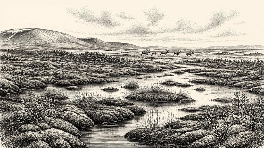
The plants and insects recovered from Derryvree indicate an open tundra or muskeg-like landscape. Mosses, sedges and cold-adapted herbs occupied wet ground, with shallow pools and organic mud in hollows. Fossil evidence includes aquatic and waterside plants such as bogbean and water-milfoil, alongside species associated with cold, exposed conditions. Insects reinforce the picture of a periglacial wetland: not a uniform frozen desert, but a patchwork of saturated ground, standing water, sparse vegetation and seasonally available plant matter.
That reconstruction is local, not a map of the island. A basin beneath a drumlin preserves what grew in and around its own catchment particularly well; it cannot tell us whether every coast, valley and upland looked the same. Yet it decisively challenges any simple image of Ireland as continuously buried beneath an unchanging ice sheet. At least at Derryvree, there was a phase in which the ground supported tundra vegetation and freshwater life.
Conditions would nevertheless have been severe. Winter cold, prolonged frost, short growing seasons and periglacial processes shaped the terrain. Ground repeatedly freezing and thawing could disrupt soils and move sediment. Trees were absent from the Derryvree record, so there was no woodland shelter, timber resource or forest canopy. The living landscape was low, open and exposed to wind. In productive summer weeks, however, pools and wet ground could have supported abundant small-scale plant and insect life, attracting grazers and predators to a landscape that was difficult rather than lifeless.
Ice Growth and Uneven Landscapes
At this date Ireland lay within the long, complex build-up towards the maximum of the last British–Irish Ice Sheet. The maximum extent of that ice sheet came later, chiefly around 26,000–23,000 years before present in Irish sectors, rather than at 31,273 BCE. Newer reconstructions emphasise that the advance was asynchronous: ice expanded, altered its flow and reached maximum limits at different times in different regions. It is therefore misleading to say simply that “Ireland was under ice” at the date in question.
The evidence also permits more than one interpretation of the wider glacial history. Derryvree and the older Greenagho organic deposits demonstrate episodes of ice-free ground in north-central Ireland before later glacier advance. Marine shells and sediments around Donegal Bay have been used both to investigate changing relative sea level and to argue about the size and timing of western Irish ice. Some syntheses favour extensive but regionally variable ice well before the global maximum; others emphasise a later major expansion from landscapes that had been at least partly ice-free. The uncertainty is genuine and is part of the history of research, not a gap to conceal.
Crag Cave in County Kerry supplies a separate kind of clue. Uranium-thorium dating shows that calcite formations grew episodically in the cave during MIS 3. In a shallow cave, dripping calcite requires liquid water moving through soil and rock, so these growth pulses are evidence for periods of climatic amelioration rather than permanently frozen conditions. They do not prove that every Irish region warmed at the same moment, but they support a picture of sharp, millennial-scale climatic fluctuations linked to North Atlantic change.
Animals at Castlepook
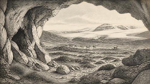
County Cork’s Castlepook Cave, near Doneraile, offers Ireland’s most important faunal archive for this general period. Its deposits have yielded remains attributed to reindeer, woolly mammoth, brown bear, wolf, spotted hyaena, arctic fox, hare and large deer. These animals were not a single herd photographed in time. Cave deposits accumulated through repeated carnivore activity, deaths, scavenging, water movement and nineteenth- and early twentieth-century excavation. Bone dates from the cave likewise span a long interval, and recent re-dating has shown that several older determinations required revision.
Still, the assemblage is valuable. Reindeer and mammoth point to open, cold grassland-tundra habitats; hyaenas and wolves indicate large carnivores able to exploit carcasses; bears and foxes reveal a more varied animal community than a bare ice sheet could sustain. Castlepook was probably a den, scavenging place and trap for bones more often than it was a human camp. The bones tell us that animals moved through southern Irish landscapes during parts of MIS 3. They do not establish stable animal populations across the whole island, nor do they make every identified species contemporary.
The Human Question
One Castlepook reindeer femur has particular importance. It bears a deep mark interpreted by specialist examination as having been made on fresh bone with a sharp stone tool during butchery. The bone has been publicised as dating to around 33,000 BCE, close in broad terms to the calendar label considered here. If that interpretation is sustained, it is evidence that one or more Upper Palaeolithic people processed a reindeer in Ireland far earlier than the formerly accepted record of human activity.
But the evidence is necessarily narrow. A cut-marked animal bone is not a house, hearth, tool-kit, burial ground or settlement. It cannot reveal the number of people involved, their language, kinship, identity, route to Ireland, length of stay or whether they returned. It does not prove continuous occupation. No securely associated stone-tool assemblage has yet supplied the fuller archaeological context that would turn this fleeting signal into a settled history of a community. The most prudent conclusion is that Ireland may have received very small, mobile human groups during this period, probably following seasonal resources, while the scale and continuity of their presence remain unknown.
No Polities, No Proven Trade
There is no evidence for political institutions, chiefs, territories, diplomacy, warfare or organised trade in Ireland at 31,273 BCE. Nor is there evidence for farms, crops, livestock, pottery, monuments, metalwork, writing or formal religious sites. To impose such categories on Derryvree or Castlepook would be to project much later Irish prehistory backwards into a radically different world.
If people were present, their economy would have depended on knowledge of animals, weather, stone and seasonal movement. Processing a carcass would imply practical skill, sharing and planning, but not necessarily permanent settlement. Any contact with Britain or continental Europe is an inference from geography and the wider distribution of Upper Palaeolithic populations, not something demonstrated by an Irish route, boat or traded object. Lower sea levels changed coastlines, yet the precise combinations of sea, ice, exposed shelf and passable terrain varied through time. The crossing problem remains open.
What This Year Can Mean
The central Irish development represented by 31,273 BCE is environmental possibility. At Derryvree, freshwater sediment, tundra plants and insects document a cold but habitable local landscape between glacial episodes. At Castlepook, animal remains show that large mammals and predators used parts of the island during the broader period; one marked reindeer bone raises the possibility of human butchery. Crag Cave records climatic pulses in the southwest. Together, these archives replace a blank Ice Age Ireland with a changing, regionally uneven world.
They do not yield an annual narrative, a named people or a national event. Their value lies precisely in their restraint: mud beneath a drumlin, calcite in a cave, and bones in a Cork limestone chamber show what was present, while reminding us how much remains beyond recovery. For this distant point in Irish history, the most accurate story is not of a kingdom or a battle, but of life persisting in the narrow intervals between ice.
Primary Sources
- A Middle Midlandian Freshwater Series at Derryvree, Maguiresbridge, County Fermanagh, Northern Ireland
- Middle Midlandian Interstadial Deposits at Greenagho, Near Belcoo, County Fermanagh, Northern Ireland
- Episodic Speleothem Deposition Tracks the Terrestrial Impact of Millennial-Scale Last Glacial Climate Variability in SW Ireland
- A Reconsideration of the Radiocarbon Dating of the Marine Isotope Stage 3 Fauna from Southern Ireland
- The Irish Quaternary Fauna Project
- Growth and Retreat of the Last British–Irish Ice Sheet, 31,000 to 15,000 Years Ago: the BRITICE-CHRONO Reconstruction
- Trimlines, Blockfields and the Vertical Extent of the Last Ice Sheet in Southern Ireland
- Exploring Controls of the Early and Stepped Deglaciation on the Western Margin of the British Irish Ice Sheet
- Radiocarbon Constraints on the History of the Western Irish Ice Sheet Prior to the Last Glacial Maximum
- Late Pleistocene Chronostratigraphy and Ice Sheet Limits, Southern Ireland
- Bayesian Modelling the Retreat of the Irish Sea Ice Stream
- Deglaciation Chronology of the Donegal Ice Centre, North-West Ireland
- New Insights on the Fauna of Ireland’s Youngest Pleistocene: Late Pleistocene to Early Holocene Bone Assemblages from Alice and Gwendoline Cave, County Clare
- A North-Western Habitat: the Paleoethology and Colonisation of a European Peninsula
- Proceedings of the Royal Irish Academy: Castlepook Cave Faunal Report
- Figure 6—The Subdivision of the Quaternary Period in Ireland
- Prehistoric Details
- Heritage Artefacts of County Cork
- Advance and Retreat of the Marine-Terminating Irish Sea Ice Stream into the Celtic Sea During the Last Glacial: Timing and Maximum Extent
- The Deglaciation of the Western Sector of the Irish Ice Sheet from the Inner Continental Shelf to its Terrestrial Margin
- Stratigraphic and Palaeo-Geomorphological Evidence for the Glacial-Deglacial History of the Last British-Irish Ice Sheet in the North-Western Irish Sea
- Reindeer Bone Found in Cork Cave Shows Human Activity in Ireland 33,000 Years Ago