Crag Cave’s Flowstone Record31196 BCE
31,196 BCE is not recoverable as a discrete Irish year, but falls within a Late Pleistocene interval of climatic instability. Derryvree, County Fermanagh, preserves an ice-free phase between glaciations, with freshwater sediments recording open, treeless tundra wetland. Flowstone at Crag Cave indicates groundwater and locally non-glacial conditions in south-west Ireland during wider transition towards renewed ice-sheet expansion. Castlepook Cave documents diverse cold-adapted fauna, although its deposits combine episodes and processes. A marked reindeer femur may indicate Upper Palaeolithic butchery, yet cannot demonstrate settlement. Evidence supports changing habitats, animal movements and possible brief human presence, rather than events or known societies.
Dateline
31,196 BCE is a modern chronological label, not a year that can be recovered from Irish evidence. At this depth in time, archaeology and earth science cannot identify a particular season, individual, journey or event. The most responsible approach is to place the date within a broader Late Pleistocene interval: roughly 33,145 years before AD 1950, during Marine Isotope Stage 3, a cold and climatically unstable part of the last Ice Age. The best Irish evidence provides calibrated ranges, environmental sequences and occasional animal remains, not an annal for one calendar year.
A useful local framework is the Derryvree freshwater series near Maguiresbridge, County Fermanagh. Organic silts there yielded a conventional radiocarbon determination of 30,500 +1,170/−1,030 radiocarbon years BP. Modern calibration places that result broadly at about 36,900–31,700 calibrated years BP, or approximately 34,950–29,750 BCE. Thus 31,196 BCE falls inside the range represented by this environmental archive, but it cannot be assigned to an exact layer, pool, animal or human action. Radiocarbon ages measure changing atmospheric carbon rather than directly supplying modern calendar years, and their uncertainties become especially important this far back.
An Ice-Free Fermanagh Wetland
Derryvree was exposed when roadworks in 1969 cut across a drumlin, a hill moulded by glacier ice. Beneath the surface lay two separate layers of till, the unsorted debris deposited by glaciers. Between them were freshwater silts, fine sands and organic material. The sequence establishes a clear relative history: ice had covered the site; an interval followed in which water, plants and insects accumulated in an ice-free landscape; then a later glacier advanced and sealed the deposit beneath a new layer of till. It is a remarkable survival, because later ice often erased or reworked the evidence of earlier landscapes.
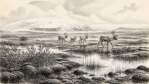
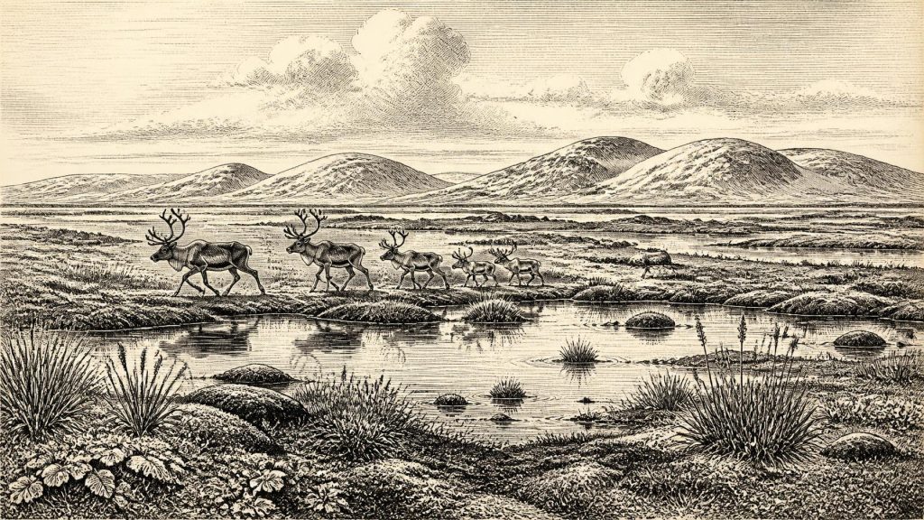
The fossils indicate a cold, open and largely treeless tundra or muskeg environment, not a forested Ireland. Pollen was dominated by herbaceous plants; plant remains included mosses and wetland species; and insect evidence points to waterlogged ground with open pools and abundant plant material. Grasses, sedges, herbs and low-growing shrubs could exploit short summers, while damp hollows supported mossy vegetation and shallow freshwater. A few grains of tree pollen do not demonstrate local woodland: they may have travelled long distances or been reworked from older sediments. The secure inference is of a sparse, periglacial wetland mosaic in south Fermanagh.
This was not a timeless frozen waste. Seasonal thaw, standing water and plant growth are all built into the Derryvree record. Yet the climate was severe enough to prevent closed woodland from developing. Frost action, snow cover, short growing seasons and wind exposure would have shaped the terrain. Such country offered patchy but real resources for grazing animals and their predators: forage along wetland margins, sheltered ground, freshwater and routes through open valleys. The landscape was productive in a cold-adapted sense, but it was neither mild nor densely vegetated.
Flowstone and Approaching Ice
Crag Cave near Castleisland, County Kerry, supplies a different kind of evidence. Uranium-series dates on cave flowstone show that speleothems formed in south-west Ireland during parts of the interval around the beginning of Marine Isotope Stage 2. Flowstone needs liquid water percolating through soil and limestone above the cave, so its growth is evidence against local, continuous deep permafrost or overriding ice at that precise cave location while it formed. It does not prove that the whole island was ice-free, nor does it provide an annual weather report. It does, however, reinforce the picture of an Ireland experiencing varied local conditions during a period of major climatic transition.
At the larger scale, Ireland stood close to the expansion of the last British–Irish Ice Sheet. Recent reconstructions trace growth and subsequent retreat of that ice sheet between about 31,000 and 15,000 years ago, while evidence from Derryvree and Greenagho indicates that north-central Ireland had remained ice-free until at least about 34,000 years ago. The date under consideration therefore belongs near a threshold: some Irish landscapes retained water, vegetation and animal life, but renewed glaciation was approaching and would later overwhelm much of the island. It would be wrong to map that changing ice margin too precisely for 31,196 BCE; the evidence supports regional sequences and broad phases, not a single island-wide snapshot.
Castlepook’s Animal World
Far to the south, Castlepook Cave near Doneraile in County Cork preserves Ireland’s richest known assemblage of pre-Last Glacial Maximum vertebrate remains. Its Ice Age fauna includes woolly mammoth, giant deer, reindeer, brown bear and spotted hyaena, with later cold-stage material including Arctic fox, wolf, collared lemming, Norwegian lemming and mountain hare. These finds demonstrate that Ireland was, at different times in the Late Pleistocene, part of a wider north-west European ecological world in which large herbivores, carnivores and cold-adapted small mammals moved through suitable habitats. They should not be treated as a single herd or community living simultaneously around the cave in 31,196 BCE: cave deposits were accumulated over long periods, were disturbed by water, and include material brought in by carnivores.
Spotted hyaenas are especially important to interpretation. Castlepook was not simply a human site with bones left after meals. Carnivores could drag prey and scavenged limbs into the cave, gnaw bones, leave droppings and mix remains from different episodes. Water could also transport or rearrange sediment. The cave is consequently a powerful record of fauna and taphonomy—the processes by which remains entered, altered and survived at a site—but a difficult place from which to reconstruct a single moment of life. Its unexcavated areas nonetheless retain major potential for carefully controlled future research.
The Reindeer Femur Question
The principal possible human evidence near this period is a reindeer femur from Castlepook, held in the National Museum of Ireland’s Natural History collection. It has been presented as dating to about 31,000 BCE and bears a deep mark interpreted by zooarchaeologist Ruth Carden as having been made on fresh bone by a sharp stone tool during carcass processing. If that interpretation is sustained, it would show that a person or small party handled a reindeer in Ireland during the Upper Palaeolithic, greatly extending the island’s potential human story beyond the better-established terminal Pleistocene evidence.
The limits are as significant as the possibility. There is no securely associated stone-tool assemblage, hearth, occupation floor, shelter, burial, human bone or repeated butchery area of comparable age. Nor can the femur reveal whether people killed the animal, scavenged it, removed meat or sinew elsewhere, or whether carnivores later took the limb into the cave. The bone is evidence for a possible episode of human activity, not proof of permanent settlement, a population of known size, or a named cultural group. Contemporary Upper Palaeolithic communities elsewhere in Europe show that mobile hunter-gathering was possible in cold environments; they do not fill the Irish evidential gap.
Society Without a Chronicle
Accordingly, there are no identifiable political affairs, rulers, territories, alliances or diplomatic encounters for Ireland at this date. There is no evidence for farms, villages, monuments, formal religion, writing, schools, markets or organised trade within Ireland. Such absences are not proof that every visitor lacked social rules, beliefs or knowledge. If people briefly reached the island, survival would have required practical learning: reading weather, moving across exposed ground, locating water, working hides and bone, maintaining cutting edges, sharing food and communicating routes and risks. But these are cautious inferences from the demands of Ice Age foraging, not recovered facts about a particular Irish group.
Nor should Ireland be imagined as necessarily joined to Britain by a dry, easily crossed land bridge. Sea levels were lower during the Ice Age, but the existence, timing and usefulness of a continuous land connection between Ireland and Britain have long been disputed. For later periods, research has generally rejected a simple, persistent land bridge and instead considers changing coastlines, ice connections, islands and sea crossings. Around 31,196 BCE, any human arrival remains geographically possible but archaeologically untraced; the route, frequency and season are unknown.
What This Date Can Bear
The historical importance of 31,196 BCE lies in the evidence’s fragility. Derryvree shows that, within a broad calibrated interval containing this date, part of Ireland supported open, wet, treeless tundra between glacial episodes. Crag Cave records groundwater moving through a south-western karst landscape during the wider transition. Castlepook reveals a fauna adapted to a cold European world and preserves a disputed but consequential sign of possible human carcass processing. Together they describe environmental change, animal movement and a human question—not an eventful year. The clearest Irish story is one of habitats briefly available before renewed ice transformed the country again.
Primary Sources
- A Middle Midlandian Freshwater Series at Derryvree, Maguiresbridge, County Fermanagh, Northern Ireland
- Palaeoecology: The Middle Midlandian Palaeoenvironment of South Fermanagh
- The Subdivision of the Quaternary Period in Ireland
- Quaternary Site Descriptions
- Castlepook Cave: Cork County Geological Site Report
- Heritage Artefacts of County Cork
- Growth and Retreat of the Last British–Irish Ice Sheet, 31,000 to 15,000 Years Ago: The BRITICE-CHRONO Reconstruction
- The Timing and Magnitude of the British–Irish Ice Sheet Between Marine Isotope Stages 5d and 2
- Spatio-Temporal Dynamics of Speleothem Growth and Glaciation in the British Isles
- Trimlines, Blockfields and the Vertical Extent of the Last Ice Sheet in Southern Ireland
- Character of Advance and Retreat of the Southwest Sector of the British-Irish Ice Sheet During the Last Glaciation
- Pattern and Timing of Retreat of the Last British-Irish Ice Sheet
- The Irish Quaternary Fauna Project
- Irish Cave Exploration
- New Insights on the Fauna of Ireland’s Younger Dryas and Early Holocene from Alice & Gwendoline Cave
- Pleistocene Vertebrates in the British Isles
- The IntCal20 Northern Hemisphere Radiocarbon Age Calibration Curve (0–55 cal kBP)
- The Problem of a Late Quaternary Landbridge Between Britain and Ireland
- The Island of Ireland: Drowning the Myth of an Irish Land-Bridge?
- New Data for the Last Glacial Maximum in Great Britain and Ireland