
Luimneach Meaning
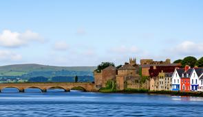
Luimneach is the Gaelic name from which the English placename Limerick derives. Scholars trace Luimneach to Old Irish elements such as loimeanach or lom, words glossed as bare, marshy, or exposed ground beside water in place‑name discussions. That derivation emphasises a landscape description rather than a personal name. Early medieval writers and later antiquarians repeatedly connected the form with marsh or river‑meadow features along the Shannon estuary. The linguistic argument appears across nineteenth‑century place‑name collections, nineteenth and twentieth‑century Ordnance Survey notes, and in modern scholarly summaries of Munster toponymy. Local usage preserved forms Luimnech and Luimneach in manuscript sources continuously.
Medieval annals and narrative sources record variant forms such as Luimnech and Luimneach, preserving the Gaelic spelling conventions used by scribes across Munster. These entries situate the name in the Shannon estuary and within the regional polity recorded in the annals. Over subsequent centuries English record‑keeping and mapmakers anglicised Gaelic forms into variants that yielded the modern name Limerick. Place‑name transmission appears in administrative records, ecclesiastical documents, and legal sources where Latin and English scribal practices altered orthography. Careful comparison of annalistic forms with later map and survey spellings supports this trajectory of adaptation from Gaelic to English usage elsewhere.
Originally the placename referred to a riverine island and the adjacent lowlands at the Shannon estuary, the area later known as King’s Island in the urban core. Early urban settlement, ecclesiastical foundations, and harbour features concentrated on that stretch of river and its quays, which naturally bore the local name. As administration, trade and cartography expanded the label Luimneach migrated to denote the surrounding town, the wider urban borough, and ultimately the county in English administrative usage. Thus the toponym remained rooted in that specific river and island landscape even as its referent broadened across political and cartographic contexts elsewhere.
Primary documentary sources for studying Luimneach include medieval annals and saga material, Down Survey mapping and name lists, and nineteenth‑century Ordnance Survey name books and six‑inch maps that record local spellings and field observations. The Royal Irish Academy manuscript collections preserve early modern glosses and genealogical compilations that comment on place‑name traditions. P. W. Joyce’s assembled place‑name notes and local informant testimony form a nineteenth‑century body of evidence for etymological claims. Hagiographical sources concerning the early church at Luimneach and later census and municipal records provide further attestations of usage over time across administrative and ecclesiastical records cartographic legal archaeological.
Interpretation of Luimneach’s meaning must remain evidence‑based and tied to landscape description in primary sources rather than later speculative reconstructions. Researchers should consult annalistic entries and saga references alongside Down Survey and Ordnance Survey field books to trace orthographic change. Examination of Royal Irish Academy manuscripts and P. W. Joyce correspondence helps contextualise early modern glosses and oral testimony. Hagiography and ecclesiastical records situate the name within local settlement history, while the 1901 census records show continuities and usage. Comparing these documentary strands permits cautious conclusions about Luimneach as a river‑meadow toponym rooted in the Shannon estuary landscape in Munster.
Primary Sources
- Annals of the Four Masters, entries referring to Luimneach (medieval annal references for the region now called Limerick).
- Annals of Ulster and Annals of Inisfallen: medieval entries mentioning Luimnigh or Luimneach in relation to Munster and the Shannon estuary.
- Ordnance Survey Name Books (c. 1839–1843) for County Limerick, field notes on the form and meaning of Luimneach recorded by surveyors.
- Six-inch and First Edition Ordnance Survey maps of County Limerick (c. 1830s–1840s) showing place‑name spellings and river islands (British/Irish Ordnance Survey map sheets).
- Down Survey maps and accompanying place‑name listings for the Limerick area (Atlas and name lists compiled 1655–1656).
- Royal Irish Academy manuscript collections: medieval Gaelic place‑name glosses and commentaries (e.g. early modern glosses on Luimneach in compiled Irish genealogical tracts).
- Census of Ireland 1901, County Limerick returns (household returns and street listings for Henry Street and King’s Island showing contemporary Irish/English usages). Source Link
- P.W. Joyce collection of place‑name notes and correspondence (19th century collected evidence and local informants discussing derivation from lom or loimeanach).
- Medieval charters, ecclesiastical records and the Life of Saint Mainchín of Limerick (hagiographical material referencing the early church of Luimneach).
- Contemporary Norse and Irish saga references to Hlymrekr / Luimnech in tenth and eleventh century sources (Viking town accounts and port‑naming records preserved in manuscript compilations).