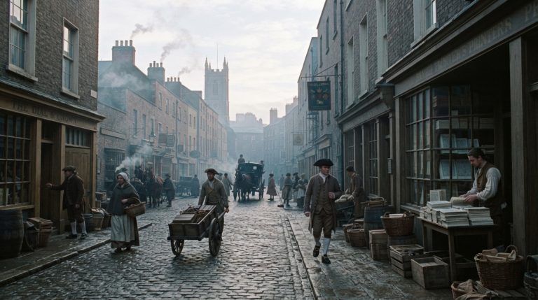

c.1920s
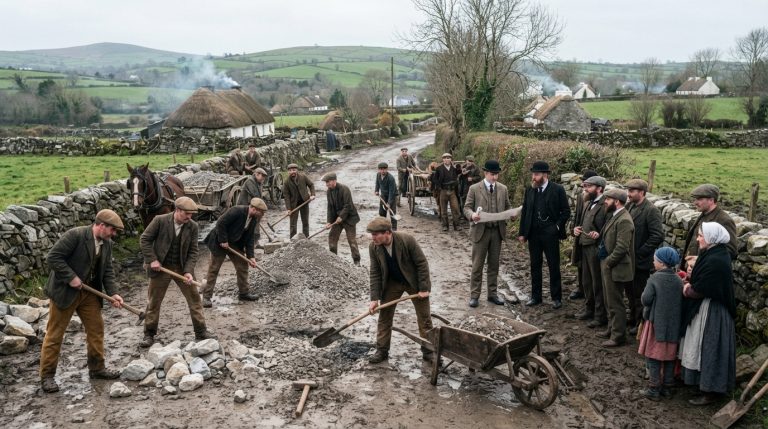
The 1920s brought independence but also violence, division and difficult reconstruction. Limerick experienced the stages of the War of Independence, followed by Civil War fighting in the city and conflict throughout the county. Families, neighbours and former comrades were divided by the Treaty, while businesses, transport and daily routines were disrupted. After the Irish Free State was established, local authorities faced housing shortages, unemployment, damaged infrastructure and finances. The Shannon hydroelectric scheme created employment and symbolised national ambition, although change was uneven. Ordinary citizens adapted to new institutions while enduring emigration, economic hardship, political bitterness and the return of stability.
1920 148 items
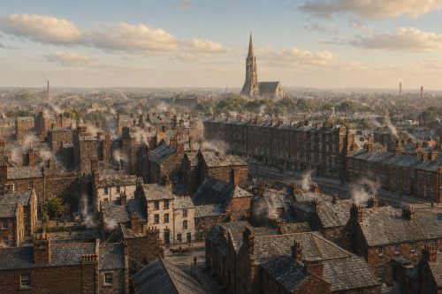
Industry Memory
A hazy bird’s-eye view of Limerick in the 1920s stretches across rooftops, chimneys, lanes, and terraces fading into mist. Smoke rises from houses and workshops, softening the city skyline and giving the scene a wintery industrial atmosphere. A tall church spire dominates the distance, standing above packed streets and modest dwellings, while long rows of buildings suggest dense urban life along the Shannon. The elevated perspective captures Limerick as a working city of faith, labour, and close-knit neighbourhoods. Though blurred by age and weather, the photograph preserves a rare panoramic impression of everyday Limerick between war, industry, and memory.
View ImageDock Road
In 1920, Dock Road in Limerick was a bustling artery of industry and trade, playing a crucial role in the city’s economic life. Lined with warehouses, mills, and factories, it echoed with the sounds of carts, early motor vehicles, and the footsteps of workers heading to the docks. The River Shannon nearby made Dock Road the lifeline for imports and exports, connecting Limerick to the wider world. The area around the Dock Road was a hive of activity, with local businesses depending on the constant movement of goods. It reflected both the promise and hardship of early 20th-century urban Ireland.
View ImageDock Road
In 1920, Dock Road in Limerick was a bustling artery of industry and trade, playing a crucial role in the city’s economic life. Lined with warehouses, mills, and factories, it echoed with the sounds of carts, early motor vehicles, and the footsteps of workers heading to the docks. The River Shannon nearby made Dock Road the lifeline for imports and exports, connecting Limerick to the wider world. The area around the Dock Road was a hive of activity, with local businesses depending on the constant movement of goods. It reflected both the promise and hardship of early 20th-century urban Ireland.
View Image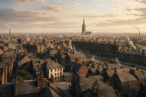
Industry Memory
A hazy bird’s-eye view of Limerick in the 1920s stretches across rooftops, chimneys, lanes, and terraces fading into mist. Smoke rises from houses and workshops, softening the city skyline and giving the scene a wintery industrial atmosphere. A tall church spire dominates the distance, standing above packed streets and modest dwellings, while long rows of buildings suggest dense urban life along the Shannon. The elevated perspective captures Limerick as a working city of faith, labour, and close-knit neighbourhoods. Though blurred by age and weather, the photograph preserves a rare panoramic impression of everyday Limerick between war, industry, and memory.
View ImageDock Road
In 1920, Dock Road in Limerick was a bustling artery of industry and trade, playing a crucial role in the city’s economic life. Lined with warehouses, mills, and factories, it echoed with the sounds of carts, early motor vehicles, and the footsteps of workers heading to the docks. The River Shannon nearby made Dock Road the lifeline for imports and exports, connecting Limerick to the wider world. The area around the Dock Road was a hive of activity, with local businesses depending on the constant movement of goods. It reflected both the promise and hardship of early 20th-century urban Ireland.
View ImageDock Road
In 1920, Dock Road in Limerick was a bustling artery of industry and trade, playing a crucial role in the city’s economic life. Lined with warehouses, mills, and factories, it echoed with the sounds of carts, early motor vehicles, and the footsteps of workers heading to the docks. The River Shannon nearby made Dock Road the lifeline for imports and exports, connecting Limerick to the wider world. The area around the Dock Road was a hive of activity, with local businesses depending on the constant movement of goods. It reflected both the promise and hardship of early 20th-century urban Ireland.
View Image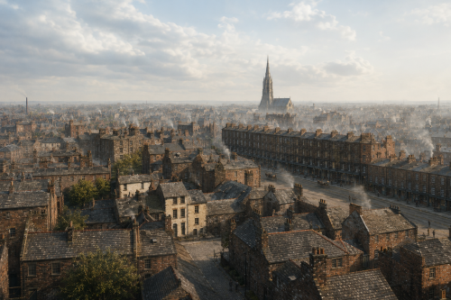
Industry Memory
A hazy bird’s-eye view of Limerick in the 1920s stretches across rooftops, chimneys, lanes, and terraces fading into mist. Smoke rises from houses and workshops, softening the city skyline and giving the scene a wintery industrial atmosphere. A tall church spire dominates the distance, standing above packed streets and modest dwellings, while long rows of buildings suggest dense urban life along the Shannon. The elevated perspective captures Limerick as a working city of faith, labour, and close-knit neighbourhoods. Though blurred by age and weather, the photograph preserves a rare panoramic impression of everyday Limerick between war, industry, and memory.
View ImageDock Road
In 1920, Dock Road in Limerick was a bustling artery of industry and trade, playing a crucial role in the city’s economic life. Lined with warehouses, mills, and factories, it echoed with the sounds of carts, early motor vehicles, and the footsteps of workers heading to the docks. The River Shannon nearby made Dock Road the lifeline for imports and exports, connecting Limerick to the wider world. The area around the Dock Road was a hive of activity, with local businesses depending on the constant movement of goods. It reflected both the promise and hardship of early 20th-century urban Ireland.
View Image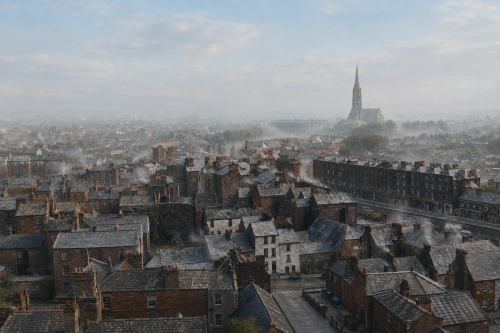
Industry Memory
A hazy bird’s-eye view of Limerick in the 1920s stretches across rooftops, chimneys, lanes, and terraces fading into mist. Smoke rises from houses and workshops, softening the city skyline and giving the scene a wintery industrial atmosphere. A tall church spire dominates the distance, standing above packed streets and modest dwellings, while long rows of buildings suggest dense urban life along the Shannon. The elevated perspective captures Limerick as a working city of faith, labour, and close-knit neighbourhoods. Though blurred by age and weather, the photograph preserves a rare panoramic impression of everyday Limerick between war, industry, and memory.
View ImageDock Road
In 1920, Dock Road in Limerick was a bustling artery of industry and trade, playing a crucial role in the city’s economic life. Lined with warehouses, mills, and factories, it echoed with the sounds of carts, early motor vehicles, and the footsteps of workers heading to the docks. The River Shannon nearby made Dock Road the lifeline for imports and exports, connecting Limerick to the wider world. The area around the Dock Road was a hive of activity, with local businesses depending on the constant movement of goods. It reflected both the promise and hardship of early 20th-century urban Ireland.
View Image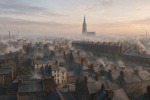
Industry Memory
A hazy bird’s-eye view of Limerick in the 1920s stretches across rooftops, chimneys, lanes, and terraces fading into mist. Smoke rises from houses and workshops, softening the city skyline and giving the scene a wintery industrial atmosphere. A tall church spire dominates the distance, standing above packed streets and modest dwellings, while long rows of buildings suggest dense urban life along the Shannon. The elevated perspective captures Limerick as a working city of faith, labour, and close-knit neighbourhoods. Though blurred by age and weather, the photograph preserves a rare panoramic impression of everyday Limerick between war, industry, and memory.
View ImageDock Road
In 1920, Dock Road in Limerick was a bustling artery of industry and trade, playing a crucial role in the city’s economic life. Lined with warehouses, mills, and factories, it echoed with the sounds of carts, early motor vehicles, and the footsteps of workers heading to the docks. The River Shannon nearby made Dock Road the lifeline for imports and exports, connecting Limerick to the wider world. The area around the Dock Road was a hive of activity, with local businesses depending on the constant movement of goods. It reflected both the promise and hardship of early 20th-century urban Ireland.
View ImageDock Road
In 1920, Dock Road in Limerick was a bustling artery of industry and trade, playing a crucial role in the city’s economic life. Lined with warehouses, mills, and factories, it echoed with the sounds of carts, early motor vehicles, and the footsteps of workers heading to the docks. The River Shannon nearby made Dock Road the lifeline for imports and exports, connecting Limerick to the wider world. The area around the Dock Road was a hive of activity, with local businesses depending on the constant movement of goods. It reflected both the promise and hardship of early 20th-century urban Ireland.
View Image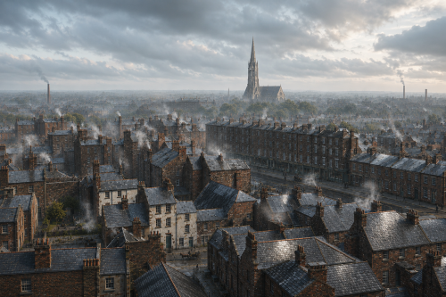
Industry Memory
A hazy bird’s-eye view of Limerick in the 1920s stretches across rooftops, chimneys, lanes, and terraces fading into mist. Smoke rises from houses and workshops, softening the city skyline and giving the scene a wintery industrial atmosphere. A tall church spire dominates the distance, standing above packed streets and modest dwellings, while long rows of buildings suggest dense urban life along the Shannon. The elevated perspective captures Limerick as a working city of faith, labour, and close-knit neighbourhoods. Though blurred by age and weather, the photograph preserves a rare panoramic impression of everyday Limerick between war, industry, and memory.
View Image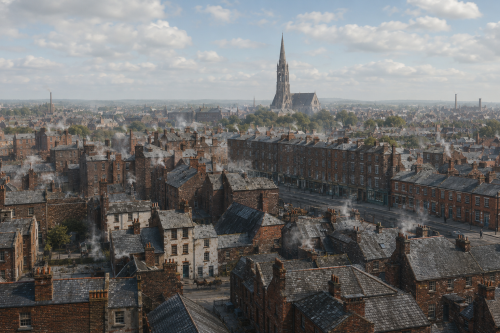
Industry Memory
A hazy bird’s-eye view of Limerick in the 1920s stretches across rooftops, chimneys, lanes, and terraces fading into mist. Smoke rises from houses and workshops, softening the city skyline and giving the scene a wintery industrial atmosphere. A tall church spire dominates the distance, standing above packed streets and modest dwellings, while long rows of buildings suggest dense urban life along the Shannon. The elevated perspective captures Limerick as a working city of faith, labour, and close-knit neighbourhoods. Though blurred by age and weather, the photograph preserves a rare panoramic impression of everyday Limerick between war, industry, and memory.
View ImageDock Road
In 1920, Dock Road in Limerick was a bustling artery of industry and trade, playing a crucial role in the city’s economic life. Lined with warehouses, mills, and factories, it echoed with the sounds of carts, early motor vehicles, and the footsteps of workers heading to the docks. The River Shannon nearby made Dock Road the lifeline for imports and exports, connecting Limerick to the wider world. The area around the Dock Road was a hive of activity, with local businesses depending on the constant movement of goods. It reflected both the promise and hardship of early 20th-century urban Ireland.
View ImageDock Road
In 1920, Dock Road in Limerick was a bustling artery of industry and trade, playing a crucial role in the city’s economic life. Lined with warehouses, mills, and factories, it echoed with the sounds of carts, early motor vehicles, and the footsteps of workers heading to the docks. The River Shannon nearby made Dock Road the lifeline for imports and exports, connecting Limerick to the wider world. The area around the Dock Road was a hive of activity, with local businesses depending on the constant movement of goods. It reflected both the promise and hardship of early 20th-century urban Ireland.
View ImageDock Road
In 1920, Dock Road in Limerick was a bustling artery of industry and trade, playing a crucial role in the city’s economic life. Lined with warehouses, mills, and factories, it echoed with the sounds of carts, early motor vehicles, and the footsteps of workers heading to the docks. The River Shannon nearby made Dock Road the lifeline for imports and exports, connecting Limerick to the wider world. The area around the Dock Road was a hive of activity, with local businesses depending on the constant movement of goods. It reflected both the promise and hardship of early 20th-century urban Ireland.
View ImageDock Road
In 1920, Dock Road in Limerick was a bustling artery of industry and trade, playing a crucial role in the city’s economic life. Lined with warehouses, mills, and factories, it echoed with the sounds of carts, early motor vehicles, and the footsteps of workers heading to the docks. The River Shannon nearby made Dock Road the lifeline for imports and exports, connecting Limerick to the wider world. The area around the Dock Road was a hive of activity, with local businesses depending on the constant movement of goods. It reflected both the promise and hardship of early 20th-century urban Ireland.
View ImageDock Road
In 1920, Dock Road in Limerick was a bustling artery of industry and trade, playing a crucial role in the city’s economic life. Lined with warehouses, mills, and factories, it echoed with the sounds of carts, early motor vehicles, and the footsteps of workers heading to the docks. The River Shannon nearby made Dock Road the lifeline for imports and exports, connecting Limerick to the wider world. The area around the Dock Road was a hive of activity, with local businesses depending on the constant movement of goods. It reflected both the promise and hardship of early 20th-century urban Ireland.
View ImageDock Road
In 1920, Dock Road in Limerick was a bustling artery of industry and trade, playing a crucial role in the city’s economic life. Lined with warehouses, mills, and factories, it echoed with the sounds of carts, early motor vehicles, and the footsteps of workers heading to the docks. The River Shannon nearby made Dock Road the lifeline for imports and exports, connecting Limerick to the wider world. The area around the Dock Road was a hive of activity, with local businesses depending on the constant movement of goods. It reflected both the promise and hardship of early 20th-century urban Ireland.
View ImageDock Road
In 1920, Dock Road in Limerick was a bustling artery of industry and trade, playing a crucial role in the city’s economic life. Lined with warehouses, mills, and factories, it echoed with the sounds of carts, early motor vehicles, and the footsteps of workers heading to the docks. The River Shannon nearby made Dock Road the lifeline for imports and exports, connecting Limerick to the wider world. The area around the Dock Road was a hive of activity, with local businesses depending on the constant movement of goods. It reflected both the promise and hardship of early 20th-century urban Ireland.
View ImageDock Road
In 1920, Dock Road in Limerick was a bustling artery of industry and trade, playing a crucial role in the city’s economic life. Lined with warehouses, mills, and factories, it echoed with the sounds of carts, early motor vehicles, and the footsteps of workers heading to the docks. The River Shannon nearby made Dock Road the lifeline for imports and exports, connecting Limerick to the wider world. The area around the Dock Road was a hive of activity, with local businesses depending on the constant movement of goods. It reflected both the promise and hardship of early 20th-century urban Ireland.
View Image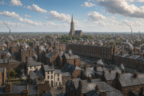
Industry Memory
A hazy bird’s-eye view of Limerick in the 1920s stretches across rooftops, chimneys, lanes, and terraces fading into mist. Smoke rises from houses and workshops, softening the city skyline and giving the scene a wintery industrial atmosphere. A tall church spire dominates the distance, standing above packed streets and modest dwellings, while long rows of buildings suggest dense urban life along the Shannon. The elevated perspective captures Limerick as a working city of faith, labour, and close-knit neighbourhoods. Though blurred by age and weather, the photograph preserves a rare panoramic impression of everyday Limerick between war, industry, and memory.
View Image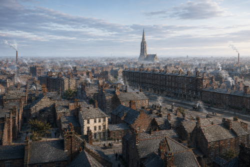
Industry Memory
A hazy bird’s-eye view of Limerick in the 1920s stretches across rooftops, chimneys, lanes, and terraces fading into mist. Smoke rises from houses and workshops, softening the city skyline and giving the scene a wintery industrial atmosphere. A tall church spire dominates the distance, standing above packed streets and modest dwellings, while long rows of buildings suggest dense urban life along the Shannon. The elevated perspective captures Limerick as a working city of faith, labour, and close-knit neighbourhoods. Though blurred by age and weather, the photograph preserves a rare panoramic impression of everyday Limerick between war, industry, and memory.
View ImageDock Road
In 1920, Dock Road in Limerick was a bustling artery of industry and trade, playing a crucial role in the city’s economic life. Lined with warehouses, mills, and factories, it echoed with the sounds of carts, early motor vehicles, and the footsteps of workers heading to the docks. The River Shannon nearby made Dock Road the lifeline for imports and exports, connecting Limerick to the wider world. The area around the Dock Road was a hive of activity, with local businesses depending on the constant movement of goods. It reflected both the promise and hardship of early 20th-century urban Ireland.
View Image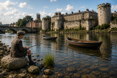
Castle River
A reconstructed view of the River Shannon at Limerick City shows King John’s Castle, Thomond Bridge and the surrounding riverside buildings in a calm heritage scene. A young boy sits fishing from the rocky bank in the foreground, while small wooden boats rest quietly on the reflective water. The castle walls, bridge arches, church towers and old houses combine to suggest the layered history of the city. Although not an original period photograph, the image presents an atmospheric AI-assisted reconstruction of old Limerick, designed to evoke memory, place, childhood, river life and the enduring presence of the Shannon itself there.
View Image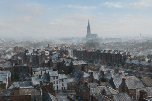
Industry Memory
A hazy bird’s-eye view of Limerick in the 1920s stretches across rooftops, chimneys, lanes, and terraces fading into mist. Smoke rises from houses and workshops, softening the city skyline and giving the scene a wintery industrial atmosphere. A tall church spire dominates the distance, standing above packed streets and modest dwellings, while long rows of buildings suggest dense urban life along the Shannon. The elevated perspective captures Limerick as a working city of faith, labour, and close-knit neighbourhoods. Though blurred by age and weather, the photograph preserves a rare panoramic impression of everyday Limerick between war, industry, and memory.
View ImageDock Road
In 1920, Dock Road in Limerick was a bustling artery of industry and trade, playing a crucial role in the city’s economic life. Lined with warehouses, mills, and factories, it echoed with the sounds of carts, early motor vehicles, and the footsteps of workers heading to the docks. The River Shannon nearby made Dock Road the lifeline for imports and exports, connecting Limerick to the wider world. The area around the Dock Road was a hive of activity, with local businesses depending on the constant movement of goods. It reflected both the promise and hardship of early 20th-century urban Ireland.
View ImageDock Road
In 1920, Dock Road in Limerick was a bustling artery of industry and trade, playing a crucial role in the city’s economic life. Lined with warehouses, mills, and factories, it echoed with the sounds of carts, early motor vehicles, and the footsteps of workers heading to the docks. The River Shannon nearby made Dock Road the lifeline for imports and exports, connecting Limerick to the wider world. The area around the Dock Road was a hive of activity, with local businesses depending on the constant movement of goods. It reflected both the promise and hardship of early 20th-century urban Ireland.
View ImageDock Road
In 1920, Dock Road in Limerick was a bustling artery of industry and trade, playing a crucial role in the city’s economic life. Lined with warehouses, mills, and factories, it echoed with the sounds of carts, early motor vehicles, and the footsteps of workers heading to the docks. The River Shannon nearby made Dock Road the lifeline for imports and exports, connecting Limerick to the wider world. The area around the Dock Road was a hive of activity, with local businesses depending on the constant movement of goods. It reflected both the promise and hardship of early 20th-century urban Ireland.
View ImageDock Road
In 1920, Dock Road in Limerick was a bustling artery of industry and trade, playing a crucial role in the city’s economic life. Lined with warehouses, mills, and factories, it echoed with the sounds of carts, early motor vehicles, and the footsteps of workers heading to the docks. The River Shannon nearby made Dock Road the lifeline for imports and exports, connecting Limerick to the wider world. The area around the Dock Road was a hive of activity, with local businesses depending on the constant movement of goods. It reflected both the promise and hardship of early 20th-century urban Ireland.
View ImageDock Road
In 1920, Dock Road in Limerick was a bustling artery of industry and trade, playing a crucial role in the city’s economic life. Lined with warehouses, mills, and factories, it echoed with the sounds of carts, early motor vehicles, and the footsteps of workers heading to the docks. The River Shannon nearby made Dock Road the lifeline for imports and exports, connecting Limerick to the wider world. The area around the Dock Road was a hive of activity, with local businesses depending on the constant movement of goods. It reflected both the promise and hardship of early 20th-century urban Ireland.
View ImageDock Road
In 1920, Dock Road in Limerick was a bustling artery of industry and trade, playing a crucial role in the city’s economic life. Lined with warehouses, mills, and factories, it echoed with the sounds of carts, early motor vehicles, and the footsteps of workers heading to the docks. The River Shannon nearby made Dock Road the lifeline for imports and exports, connecting Limerick to the wider world. The area around the Dock Road was a hive of activity, with local businesses depending on the constant movement of goods. It reflected both the promise and hardship of early 20th-century urban Ireland.
View ImageDock Road
In 1920, Dock Road in Limerick was a bustling artery of industry and trade, playing a crucial role in the city’s economic life. Lined with warehouses, mills, and factories, it echoed with the sounds of carts, early motor vehicles, and the footsteps of workers heading to the docks. The River Shannon nearby made Dock Road the lifeline for imports and exports, connecting Limerick to the wider world. The area around the Dock Road was a hive of activity, with local businesses depending on the constant movement of goods. It reflected both the promise and hardship of early 20th-century urban Ireland.
View ImageDock Road
In 1920, Dock Road in Limerick was a bustling artery of industry and trade, playing a crucial role in the city’s economic life. Lined with warehouses, mills, and factories, it echoed with the sounds of carts, early motor vehicles, and the footsteps of workers heading to the docks. The River Shannon nearby made Dock Road the lifeline for imports and exports, connecting Limerick to the wider world. The area around the Dock Road was a hive of activity, with local businesses depending on the constant movement of goods. It reflected both the promise and hardship of early 20th-century urban Ireland.
View Image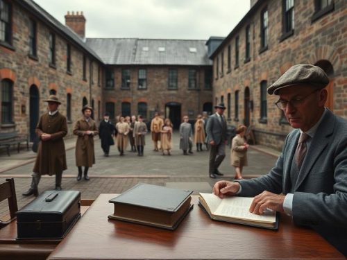
Institutional Children
Limerick children sent to industrial schools and reformatories appear within Corporation financial records because the Borough Council was responsible for maintenance payments. Presentment applications could record the child’s name, school register number, place and court of sentence, maintenance dates and total number of days supported. These details connect individual children with Limerick’s courts, rates and administrative decisions. They also show how a local judgement could create a continuing financial relationship with an institution elsewhere in Ireland. Although written as accounts, the files preserve important traces of young people whose personal experiences might otherwise remain difficult to recover from surviving records.
View ArticleDock Road
In 1920, Dock Road in Limerick was a bustling artery of industry and trade, playing a crucial role in the city’s economic life. Lined with warehouses, mills, and factories, it echoed with the sounds of carts, early motor vehicles, and the footsteps of workers heading to the docks. The River Shannon nearby made Dock Road the lifeline for imports and exports, connecting Limerick to the wider world. The area around the Dock Road was a hive of activity, with local businesses depending on the constant movement of goods. It reflected both the promise and hardship of early 20th-century urban Ireland.
View ImageDock Road
In 1920, Dock Road in Limerick was a bustling artery of industry and trade, playing a crucial role in the city’s economic life. Lined with warehouses, mills, and factories, it echoed with the sounds of carts, early motor vehicles, and the footsteps of workers heading to the docks. The River Shannon nearby made Dock Road the lifeline for imports and exports, connecting Limerick to the wider world. The area around the Dock Road was a hive of activity, with local businesses depending on the constant movement of goods. It reflected both the promise and hardship of early 20th-century urban Ireland.
View ImageDock Road
In 1920, Dock Road in Limerick was a bustling artery of industry and trade, playing a crucial role in the city’s economic life. Lined with warehouses, mills, and factories, it echoed with the sounds of carts, early motor vehicles, and the footsteps of workers heading to the docks. The River Shannon nearby made Dock Road the lifeline for imports and exports, connecting Limerick to the wider world. The area around the Dock Road was a hive of activity, with local businesses depending on the constant movement of goods. It reflected both the promise and hardship of early 20th-century urban Ireland.
View ImageDock Road
In 1920, Dock Road in Limerick was a bustling artery of industry and trade, playing a crucial role in the city’s economic life. Lined with warehouses, mills, and factories, it echoed with the sounds of carts, early motor vehicles, and the footsteps of workers heading to the docks. The River Shannon nearby made Dock Road the lifeline for imports and exports, connecting Limerick to the wider world. The area around the Dock Road was a hive of activity, with local businesses depending on the constant movement of goods. It reflected both the promise and hardship of early 20th-century urban Ireland.
View ImageDock Road
In 1920, Dock Road in Limerick was a bustling artery of industry and trade, playing a crucial role in the city’s economic life. Lined with warehouses, mills, and factories, it echoed with the sounds of carts, early motor vehicles, and the footsteps of workers heading to the docks. The River Shannon nearby made Dock Road the lifeline for imports and exports, connecting Limerick to the wider world. The area around the Dock Road was a hive of activity, with local businesses depending on the constant movement of goods. It reflected both the promise and hardship of early 20th-century urban Ireland.
View ImageDock Road
In 1920, Dock Road in Limerick was a bustling artery of industry and trade, playing a crucial role in the city’s economic life. Lined with warehouses, mills, and factories, it echoed with the sounds of carts, early motor vehicles, and the footsteps of workers heading to the docks. The River Shannon nearby made Dock Road the lifeline for imports and exports, connecting Limerick to the wider world. The area around the Dock Road was a hive of activity, with local businesses depending on the constant movement of goods. It reflected both the promise and hardship of early 20th-century urban Ireland.
View Image1921 1 item
Limerick Fatalities
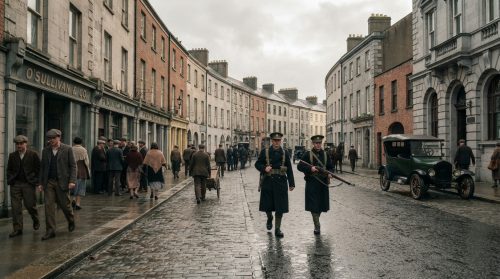
Estimates of fatalities in County Limerick during the Irish War of Independence, dated 1919 to 1921, vary between published compilations and local commemorations. Modern academic tallies commonly record about one hundred and twenty one confirmed deaths in the county for that period while municipal and commemorative notices sometimes cite a figure nearer one hundred and thirty. These totals combine civilians, Irish Republican Army volunteers, and members of police or Crown forces connected with Limerick city and rural districts. Differences arise from criteria used, inclusion or exclusion of deaths from wounds later sustained, and disputed incidents and identities in archival records.
View Article1922 609 items
Castle Restored
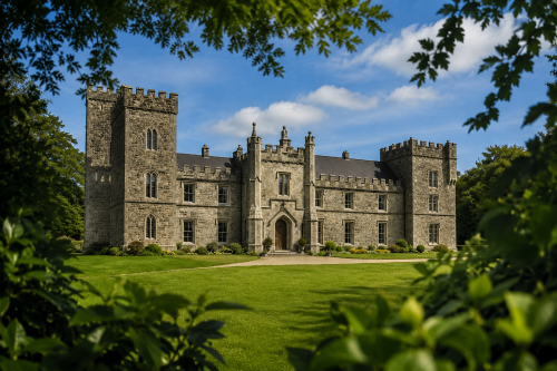
This reconstructed view presents Glenduff Castle in County Limerick as it may have appeared before its destruction in 1922. The imposing residence combines the fortified character of an earlier seventeenth-century tower house with the Gothic Revival additions created for the Ievers family around 1840. Tall crenellated towers, pointed windows, battlements and a formal central entrance give the building a commanding presence. Set within carefully maintained lawns and mature woodland, the castle reflects the scale and confidence of a nineteenth-century Irish country estate. The image offers a plausible visual impression rather than a definitive record of its original appearance or grandeur.
View Image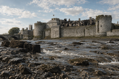
Limerick Castle
King John’s Castle stands beside the River Shannon at Curragower Falls, with broken water, river rocks and the castle’s stone frontage visible across the scene. The round towers, curtain walls and riverside defences remain central, while the burned Castle Barracks appears roofless and blackened within the enclosure. Thomond Bridge is visible to the left, with nearby trees, older buildings and a church tower rising beyond the castle walls. The river surface shows ripples, reflections and shallow movement below the fortifications. The image presents the castle after damage, set within the wider early twentieth century Limerick urban riverside landscape after 1922.
View Image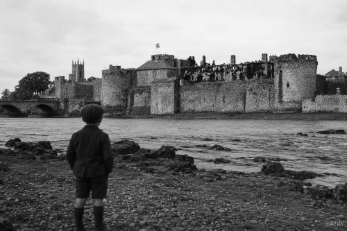
Limerick Castle
King John’s Castle stands beside the River Shannon at Curragower Falls, with broken water, river rocks and the castle’s stone frontage visible across the scene. The round towers, curtain walls and riverside defences remain central, while the burned Castle Barracks appears roofless and blackened within the enclosure. Thomond Bridge is visible to the left, with nearby trees, older buildings and a church tower rising beyond the castle walls. The river surface shows ripples, reflections and shallow movement below the fortifications. The image presents the castle after damage, set within the wider early twentieth century Limerick urban riverside landscape after 1922.
View Image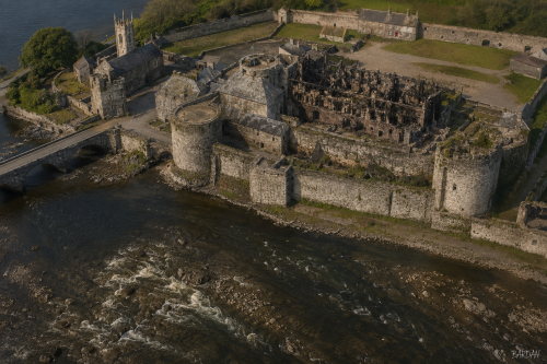
Limerick Castle
King John’s Castle stands beside the River Shannon at Curragower Falls, with broken water, river rocks and the castle’s stone frontage visible across the scene. The round towers, curtain walls and riverside defences remain central, while the burned Castle Barracks appears roofless and blackened within the enclosure. Thomond Bridge is visible to the left, with nearby trees, older buildings and a church tower rising beyond the castle walls. The river surface shows ripples, reflections and shallow movement below the fortifications. The image presents the castle after damage, set within the wider early twentieth century Limerick urban riverside landscape after 1922.
View Image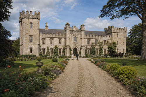
Castle Restored
Glenduff Castle is shown restored to its former splendour, standing proudly amid landscaped gardens in rural County Limerick. Built around 1840 for the Ievers family, the castellated country house incorporated an earlier tower house dating from about 1600. Its battlements, flanking towers, arched entrance and long stone façade created a striking Gothic Revival residence. The scene imagines the estate before its destruction, with residents, visitors and a horse-drawn carriage bringing the grounds to life. Glenduff Castle was burned during the Irish Civil War on 29 June 1922, leaving the picturesque ivy-covered ruin that survives on private farmland near Broadford today.
View Image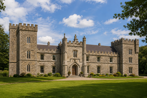
Castle Restored
This reconstructed view presents Glenduff Castle in County Limerick as it may have appeared before its destruction in 1922. The imposing residence combines the fortified character of an earlier seventeenth-century tower house with the Gothic Revival additions created for the Ievers family around 1840. Tall crenellated towers, pointed windows, battlements and a formal central entrance give the building a commanding presence. Set within carefully maintained lawns and mature woodland, the castle reflects the scale and confidence of a nineteenth-century Irish country estate. The image offers a plausible visual impression rather than a definitive record of its original appearance or grandeur.
View Image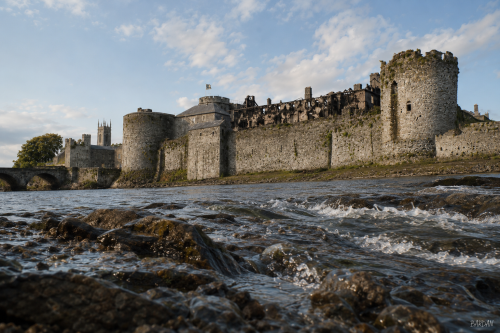
Limerick Castle
King John’s Castle stands beside the River Shannon at Curragower Falls, with broken water, river rocks and the castle’s stone frontage visible across the scene. The round towers, curtain walls and riverside defences remain central, while the burned Castle Barracks appears roofless and blackened within the enclosure. Thomond Bridge is visible to the left, with nearby trees, older buildings and a church tower rising beyond the castle walls. The river surface shows ripples, reflections and shallow movement below the fortifications. The image presents the castle after damage, set within the wider early twentieth century Limerick urban riverside landscape after 1922.
View Image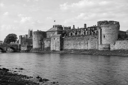
Limerick Castle
King John’s Castle stands beside the River Shannon at Curragower Falls, with broken water, river rocks and the castle’s stone frontage visible across the scene. The round towers, curtain walls and riverside defences remain central, while the burned Castle Barracks appears roofless and blackened within the enclosure. Thomond Bridge is visible to the left, with nearby trees, older buildings and a church tower rising beyond the castle walls. The river surface shows ripples, reflections and shallow movement below the fortifications. The image presents the castle after damage, set within the wider early twentieth century Limerick urban riverside landscape after 1922.
View Image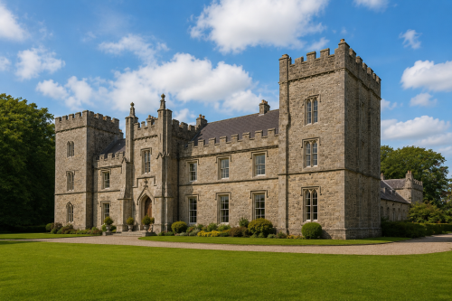
Castle Restored
This reconstructed view presents Glenduff Castle in County Limerick as it may have appeared before its destruction in 1922. The imposing residence combines the fortified character of an earlier seventeenth-century tower house with the Gothic Revival additions created for the Ievers family around 1840. Tall crenellated towers, pointed windows, battlements and a formal central entrance give the building a commanding presence. Set within carefully maintained lawns and mature woodland, the castle reflects the scale and confidence of a nineteenth-century Irish country estate. The image offers a plausible visual impression rather than a definitive record of its original appearance or grandeur.
View Image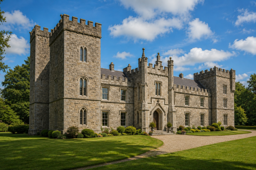
Castle Restored
This reconstructed view presents Glenduff Castle in County Limerick as it may have appeared before its destruction in 1922. The imposing residence combines the fortified character of an earlier seventeenth-century tower house with the Gothic Revival additions created for the Ievers family around 1840. Tall crenellated towers, pointed windows, battlements and a formal central entrance give the building a commanding presence. Set within carefully maintained lawns and mature woodland, the castle reflects the scale and confidence of a nineteenth-century Irish country estate. The image offers a plausible visual impression rather than a definitive record of its original appearance or grandeur.
View Image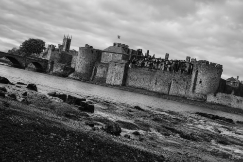
Limerick Castle
King John’s Castle stands beside the River Shannon at Curragower Falls, with broken water, river rocks and the castle’s stone frontage visible across the scene. The round towers, curtain walls and riverside defences remain central, while the burned Castle Barracks appears roofless and blackened within the enclosure. Thomond Bridge is visible to the left, with nearby trees, older buildings and a church tower rising beyond the castle walls. The river surface shows ripples, reflections and shallow movement below the fortifications. The image presents the castle after damage, set within the wider early twentieth century Limerick urban riverside landscape after 1922.
View Image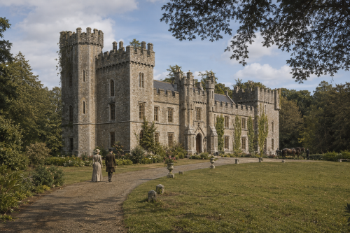
Castle Restored
Glenduff Castle is shown restored to its former splendour, standing proudly amid landscaped gardens in rural County Limerick. Built around 1840 for the Ievers family, the castellated country house incorporated an earlier tower house dating from about 1600. Its battlements, flanking towers, arched entrance and long stone façade created a striking Gothic Revival residence. The scene imagines the estate before its destruction, with residents, visitors and a horse-drawn carriage bringing the grounds to life. Glenduff Castle was burned during the Irish Civil War on 29 June 1922, leaving the picturesque ivy-covered ruin that survives on private farmland near Broadford today.
View Image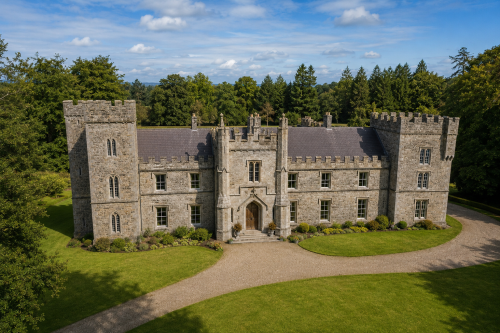
Castle Restored
This reconstructed view presents Glenduff Castle in County Limerick as it may have appeared before its destruction in 1922. The imposing residence combines the fortified character of an earlier seventeenth-century tower house with the Gothic Revival additions created for the Ievers family around 1840. Tall crenellated towers, pointed windows, battlements and a formal central entrance give the building a commanding presence. Set within carefully maintained lawns and mature woodland, the castle reflects the scale and confidence of a nineteenth-century Irish country estate. The image offers a plausible visual impression rather than a definitive record of its original appearance or grandeur.
View Image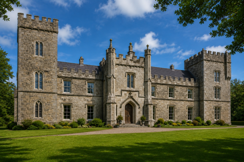
Castle Restored
This reconstructed view presents Glenduff Castle in County Limerick as it may have appeared before its destruction in 1922. The imposing residence combines the fortified character of an earlier seventeenth-century tower house with the Gothic Revival additions created for the Ievers family around 1840. Tall crenellated towers, pointed windows, battlements and a formal central entrance give the building a commanding presence. Set within carefully maintained lawns and mature woodland, the castle reflects the scale and confidence of a nineteenth-century Irish country estate. The image offers a plausible visual impression rather than a definitive record of its original appearance or grandeur.
View Image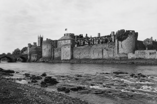
Limerick Castle
King John’s Castle stands beside the River Shannon at Curragower Falls, with broken water, river rocks and the castle’s stone frontage visible across the scene. The round towers, curtain walls and riverside defences remain central, while the burned Castle Barracks appears roofless and blackened within the enclosure. Thomond Bridge is visible to the left, with nearby trees, older buildings and a church tower rising beyond the castle walls. The river surface shows ripples, reflections and shallow movement below the fortifications. The image presents the castle after damage, set within the wider early twentieth century Limerick urban riverside landscape after 1922.
View Image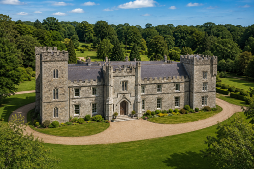
Castle Restored
This reconstructed view presents Glenduff Castle in County Limerick as it may have appeared before its destruction in 1922. The imposing residence combines the fortified character of an earlier seventeenth-century tower house with the Gothic Revival additions created for the Ievers family around 1840. Tall crenellated towers, pointed windows, battlements and a formal central entrance give the building a commanding presence. Set within carefully maintained lawns and mature woodland, the castle reflects the scale and confidence of a nineteenth-century Irish country estate. The image offers a plausible visual impression rather than a definitive record of its original appearance or grandeur.
View Image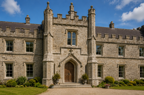
Castle Restored
This reconstructed view presents Glenduff Castle in County Limerick as it may have appeared before its destruction in 1922. The imposing residence combines the fortified character of an earlier seventeenth-century tower house with the Gothic Revival additions created for the Ievers family around 1840. Tall crenellated towers, pointed windows, battlements and a formal central entrance give the building a commanding presence. Set within carefully maintained lawns and mature woodland, the castle reflects the scale and confidence of a nineteenth-century Irish country estate. The image offers a plausible visual impression rather than a definitive record of its original appearance or grandeur.
View Image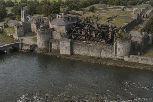
Limerick Castle
King John’s Castle stands beside the River Shannon at Curragower Falls, with broken water, river rocks and the castle’s stone frontage visible across the scene. The round towers, curtain walls and riverside defences remain central, while the burned Castle Barracks appears roofless and blackened within the enclosure. Thomond Bridge is visible to the left, with nearby trees, older buildings and a church tower rising beyond the castle walls. The river surface shows ripples, reflections and shallow movement below the fortifications. The image presents the castle after damage, set within the wider early twentieth century Limerick urban riverside landscape after 1922.
View Image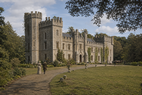
Castle Restored
Glenduff Castle is shown restored to its former splendour, standing proudly amid landscaped gardens in rural County Limerick. Built around 1840 for the Ievers family, the castellated country house incorporated an earlier tower house dating from about 1600. Its battlements, flanking towers, arched entrance and long stone façade created a striking Gothic Revival residence. The scene imagines the estate before its destruction, with residents, visitors and a horse-drawn carriage bringing the grounds to life. Glenduff Castle was burned during the Irish Civil War on 29 June 1922, leaving the picturesque ivy-covered ruin that survives on private farmland near Broadford today.
View Image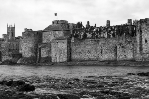
Limerick Castle
King John’s Castle stands beside the River Shannon at Curragower Falls, with broken water, river rocks and the castle’s stone frontage visible across the scene. The round towers, curtain walls and riverside defences remain central, while the burned Castle Barracks appears roofless and blackened within the enclosure. Thomond Bridge is visible to the left, with nearby trees, older buildings and a church tower rising beyond the castle walls. The river surface shows ripples, reflections and shallow movement below the fortifications. The image presents the castle after damage, set within the wider early twentieth century Limerick urban riverside landscape after 1922.
View Image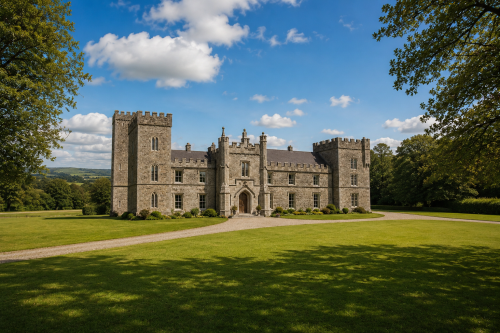
Castle Restored
This reconstructed view presents Glenduff Castle in County Limerick as it may have appeared before its destruction in 1922. The imposing residence combines the fortified character of an earlier seventeenth-century tower house with the Gothic Revival additions created for the Ievers family around 1840. Tall crenellated towers, pointed windows, battlements and a formal central entrance give the building a commanding presence. Set within carefully maintained lawns and mature woodland, the castle reflects the scale and confidence of a nineteenth-century Irish country estate. The image offers a plausible visual impression rather than a definitive record of its original appearance or grandeur.
View Image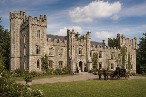
Castle Restored
Glenduff Castle is shown restored to its former splendour, standing proudly amid landscaped gardens in rural County Limerick. Built around 1840 for the Ievers family, the castellated country house incorporated an earlier tower house dating from about 1600. Its battlements, flanking towers, arched entrance and long stone façade created a striking Gothic Revival residence. The scene imagines the estate before its destruction, with residents, visitors and a horse-drawn carriage bringing the grounds to life. Glenduff Castle was burned during the Irish Civil War on 29 June 1922, leaving the picturesque ivy-covered ruin that survives on private farmland near Broadford today.
View Image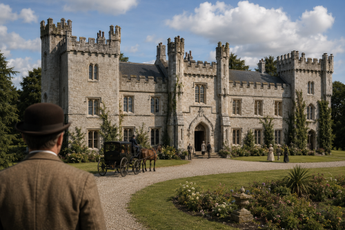
Castle Restored
Glenduff Castle is shown restored to its former splendour, standing proudly amid landscaped gardens in rural County Limerick. Built around 1840 for the Ievers family, the castellated country house incorporated an earlier tower house dating from about 1600. Its battlements, flanking towers, arched entrance and long stone façade created a striking Gothic Revival residence. The scene imagines the estate before its destruction, with residents, visitors and a horse-drawn carriage bringing the grounds to life. Glenduff Castle was burned during the Irish Civil War on 29 June 1922, leaving the picturesque ivy-covered ruin that survives on private farmland near Broadford today.
View Image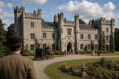
Castle Restored
Glenduff Castle is shown restored to its former splendour, standing proudly amid landscaped gardens in rural County Limerick. Built around 1840 for the Ievers family, the castellated country house incorporated an earlier tower house dating from about 1600. Its battlements, flanking towers, arched entrance and long stone façade created a striking Gothic Revival residence. The scene imagines the estate before its destruction, with residents, visitors and a horse-drawn carriage bringing the grounds to life. Glenduff Castle was burned during the Irish Civil War on 29 June 1922, leaving the picturesque ivy-covered ruin that survives on private farmland near Broadford today.
View Image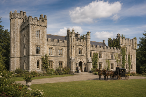
Castle Restored
Glenduff Castle is shown restored to its former splendour, standing proudly amid landscaped gardens in rural County Limerick. Built around 1840 for the Ievers family, the castellated country house incorporated an earlier tower house dating from about 1600. Its battlements, flanking towers, arched entrance and long stone façade created a striking Gothic Revival residence. The scene imagines the estate before its destruction, with residents, visitors and a horse-drawn carriage bringing the grounds to life. Glenduff Castle was burned during the Irish Civil War on 29 June 1922, leaving the picturesque ivy-covered ruin that survives on private farmland near Broadford today.
View Image
Castle Restored
Glenduff Castle is shown restored to its former splendour, standing proudly amid landscaped gardens in rural County Limerick. Built around 1840 for the Ievers family, the castellated country house incorporated an earlier tower house dating from about 1600. Its battlements, flanking towers, arched entrance and long stone façade created a striking Gothic Revival residence. The scene imagines the estate before its destruction, with residents, visitors and a horse-drawn carriage bringing the grounds to life. Glenduff Castle was burned during the Irish Civil War on 29 June 1922, leaving the picturesque ivy-covered ruin that survives on private farmland near Broadford today.
View Image
Castle Restored
Glenduff Castle is shown restored to its former splendour, standing proudly amid landscaped gardens in rural County Limerick. Built around 1840 for the Ievers family, the castellated country house incorporated an earlier tower house dating from about 1600. Its battlements, flanking towers, arched entrance and long stone façade created a striking Gothic Revival residence. The scene imagines the estate before its destruction, with residents, visitors and a horse-drawn carriage bringing the grounds to life. Glenduff Castle was burned during the Irish Civil War on 29 June 1922, leaving the picturesque ivy-covered ruin that survives on private farmland near Broadford today.
View Image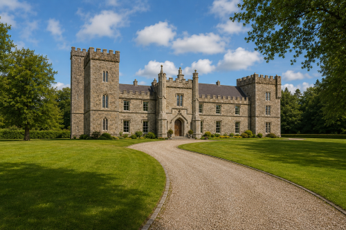
Castle Restored
This reconstructed view presents Glenduff Castle in County Limerick as it may have appeared before its destruction in 1922. The imposing residence combines the fortified character of an earlier seventeenth-century tower house with the Gothic Revival additions created for the Ievers family around 1840. Tall crenellated towers, pointed windows, battlements and a formal central entrance give the building a commanding presence. Set within carefully maintained lawns and mature woodland, the castle reflects the scale and confidence of a nineteenth-century Irish country estate. The image offers a plausible visual impression rather than a definitive record of its original appearance or grandeur.
View Image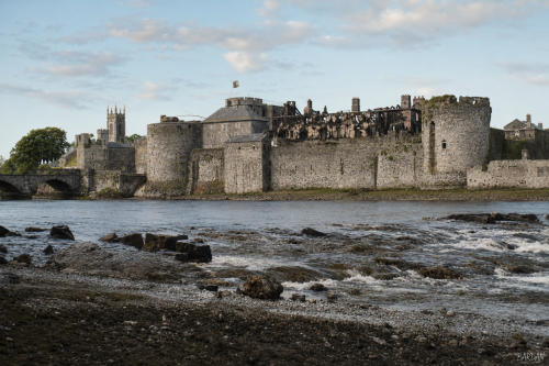
Limerick Castle
King John’s Castle stands beside the River Shannon at Curragower Falls, with broken water, river rocks and the castle’s stone frontage visible across the scene. The round towers, curtain walls and riverside defences remain central, while the burned Castle Barracks appears roofless and blackened within the enclosure. Thomond Bridge is visible to the left, with nearby trees, older buildings and a church tower rising beyond the castle walls. The river surface shows ripples, reflections and shallow movement below the fortifications. The image presents the castle after damage, set within the wider early twentieth century Limerick urban riverside landscape after 1922.
View Image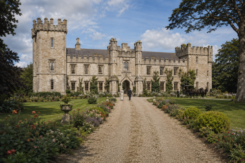
Castle Restored
Glenduff Castle is shown restored to its former splendour, standing proudly amid landscaped gardens in rural County Limerick. Built around 1840 for the Ievers family, the castellated country house incorporated an earlier tower house dating from about 1600. Its battlements, flanking towers, arched entrance and long stone façade created a striking Gothic Revival residence. The scene imagines the estate before its destruction, with residents, visitors and a horse-drawn carriage bringing the grounds to life. Glenduff Castle was burned during the Irish Civil War on 29 June 1922, leaving the picturesque ivy-covered ruin that survives on private farmland near Broadford today.
View Image1923 10 items
Barricades Limerick
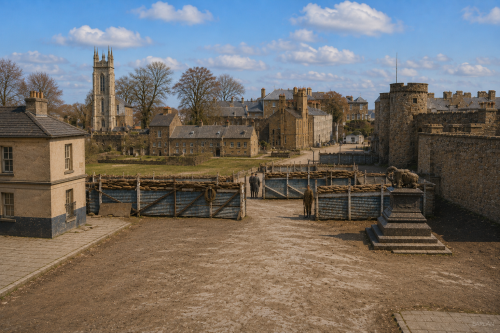
At Thomond Bridge in Limerick in 1923, a soldier stands guard beside a rough barricade near the Treaty Stone, a symbolic landmark now overshadowed by civil conflict. The scene evokes the tense aftermath of the Treaty split, when Anti-Treaty IRA forces and pro-Treaty National Army troops fought for control of the city. Sandbags, timber, stone, and street debris suggest hurried urban fortification, while the soldier’s watchful posture conveys danger and uncertainty. The bridge becomes both military checkpoint and historic threshold, linking Limerick’s medieval memory with the bitter street warfare that marked the Irish Civil War in the city that summer.
View Image
Barricades Limerick
At Thomond Bridge in Limerick in 1923, a soldier stands guard beside a rough barricade near the Treaty Stone, a symbolic landmark now overshadowed by civil conflict. The scene evokes the tense aftermath of the Treaty split, when Anti-Treaty IRA forces and pro-Treaty National Army troops fought for control of the city. Sandbags, timber, stone, and street debris suggest hurried urban fortification, while the soldier’s watchful posture conveys danger and uncertainty. The bridge becomes both military checkpoint and historic threshold, linking Limerick’s medieval memory with the bitter street warfare that marked the Irish Civil War in the city that summer.
View Image
Barricades Limerick
At Thomond Bridge in Limerick in 1923, a soldier stands guard beside a rough barricade near the Treaty Stone, a symbolic landmark now overshadowed by civil conflict. The scene evokes the tense aftermath of the Treaty split, when Anti-Treaty IRA forces and pro-Treaty National Army troops fought for control of the city. Sandbags, timber, stone, and street debris suggest hurried urban fortification, while the soldier’s watchful posture conveys danger and uncertainty. The bridge becomes both military checkpoint and historic threshold, linking Limerick’s medieval memory with the bitter street warfare that marked the Irish Civil War in the city that summer.
View Image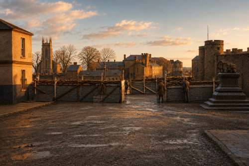
Barricades Limerick
At Thomond Bridge in Limerick in 1923, a soldier stands guard beside a rough barricade near the Treaty Stone, a symbolic landmark now overshadowed by civil conflict. The scene evokes the tense aftermath of the Treaty split, when Anti-Treaty IRA forces and pro-Treaty National Army troops fought for control of the city. Sandbags, timber, stone, and street debris suggest hurried urban fortification, while the soldier’s watchful posture conveys danger and uncertainty. The bridge becomes both military checkpoint and historic threshold, linking Limerick’s medieval memory with the bitter street warfare that marked the Irish Civil War in the city that summer.
View Image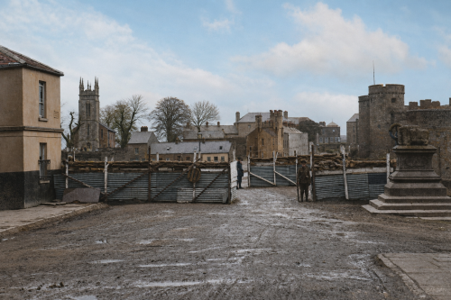
Barricades Limerick
At Thomond Bridge in Limerick in 1923, a soldier stands guard beside a rough barricade near the Treaty Stone, a symbolic landmark now overshadowed by civil conflict. The scene evokes the tense aftermath of the Treaty split, when Anti-Treaty IRA forces and pro-Treaty National Army troops fought for control of the city. Sandbags, timber, stone, and street debris suggest hurried urban fortification, while the soldier’s watchful posture conveys danger and uncertainty. The bridge becomes both military checkpoint and historic threshold, linking Limerick’s medieval memory with the bitter street warfare that marked the Irish Civil War in the city that summer.
View Image
Barricades Limerick
At Thomond Bridge in Limerick in 1923, a soldier stands guard beside a rough barricade near the Treaty Stone, a symbolic landmark now overshadowed by civil conflict. The scene evokes the tense aftermath of the Treaty split, when Anti-Treaty IRA forces and pro-Treaty National Army troops fought for control of the city. Sandbags, timber, stone, and street debris suggest hurried urban fortification, while the soldier’s watchful posture conveys danger and uncertainty. The bridge becomes both military checkpoint and historic threshold, linking Limerick’s medieval memory with the bitter street warfare that marked the Irish Civil War in the city that summer.
View Image
Barricades Limerick
At Thomond Bridge in Limerick in 1923, a soldier stands guard beside a rough barricade near the Treaty Stone, a symbolic landmark now overshadowed by civil conflict. The scene evokes the tense aftermath of the Treaty split, when Anti-Treaty IRA forces and pro-Treaty National Army troops fought for control of the city. Sandbags, timber, stone, and street debris suggest hurried urban fortification, while the soldier’s watchful posture conveys danger and uncertainty. The bridge becomes both military checkpoint and historic threshold, linking Limerick’s medieval memory with the bitter street warfare that marked the Irish Civil War in the city that summer.
View Image
Barricades Limerick
At Thomond Bridge in Limerick in 1923, a soldier stands guard beside a rough barricade near the Treaty Stone, a symbolic landmark now overshadowed by civil conflict. The scene evokes the tense aftermath of the Treaty split, when Anti-Treaty IRA forces and pro-Treaty National Army troops fought for control of the city. Sandbags, timber, stone, and street debris suggest hurried urban fortification, while the soldier’s watchful posture conveys danger and uncertainty. The bridge becomes both military checkpoint and historic threshold, linking Limerick’s medieval memory with the bitter street warfare that marked the Irish Civil War in the city that summer.
View Image
Barricades Limerick
At Thomond Bridge in Limerick in 1923, a soldier stands guard beside a rough barricade near the Treaty Stone, a symbolic landmark now overshadowed by civil conflict. The scene evokes the tense aftermath of the Treaty split, when Anti-Treaty IRA forces and pro-Treaty National Army troops fought for control of the city. Sandbags, timber, stone, and street debris suggest hurried urban fortification, while the soldier’s watchful posture conveys danger and uncertainty. The bridge becomes both military checkpoint and historic threshold, linking Limerick’s medieval memory with the bitter street warfare that marked the Irish Civil War in the city that summer.
View Image
Barricades Limerick
At Thomond Bridge in Limerick in 1923, a soldier stands guard beside a rough barricade near the Treaty Stone, a symbolic landmark now overshadowed by civil conflict. The scene evokes the tense aftermath of the Treaty split, when Anti-Treaty IRA forces and pro-Treaty National Army troops fought for control of the city. Sandbags, timber, stone, and street debris suggest hurried urban fortification, while the soldier’s watchful posture conveys danger and uncertainty. The bridge becomes both military checkpoint and historic threshold, linking Limerick’s medieval memory with the bitter street warfare that marked the Irish Civil War in the city that summer.
View Image1924 0 items
No published items are currently assigned to this period.
1925 0 items
No published items are currently assigned to this period.
1926 1 item
Telephone Streets
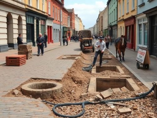
Limerick’s Telephone Works Expenditure volume for 1926 records how communications infrastructure affected the city’s streets, paving and drainage. Weekly entries identify the street where work occurred, the type of work undertaken and its cost. Categories include flagging, sett paving, cobble paving and broken stone. The volume also records the expense of constructing seven manholes and a sewer on Clare Street, divided among labour, watching and materials. These details connect technological development with practical urban disruption. Extending telephone works required streets to be opened, guarded, rebuilt and paid for through carefully monitored municipal expenditure across much of that year in Limerick.
View Article1927 0 items
No published items are currently assigned to this period.
1928 0 items
No published items are currently assigned to this period.
1929 18 items

GPO Reborn
When the Easter Rising ended in April 1916, Dublin’s General Post Office stood as one of the most dramatic ruins in the city. The building had served as headquarters of the insurgent leadership, but artillery fire, gunfire and flames devastated its interior during the final days of fighting. Roofs collapsed, floors burned, offices disappeared, and the great public hall was reduced to wreckage. Yet Francis Johnston’s monumental frontage facing Sackville Street survived with extraordinary stubbornness. The classical portico, its six Ionic columns, portions of the outer walls, and the sculptural figures above remained standing, scarred but recognisable amid surrounding destruction.
View Article