Archived: 9 September 2026
Abstract
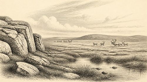
Approximately 33,800 years ago, Ireland lay within the climatically volatile Late Pleistocene, but neither its conditions nor ice extent can be fixed. Competing reconstructions suggest advancing ice alongside patches of open, treeless habitat supporting cold-adapted fauna. Organic deposits and cave assemblages document wetlands, grassland and mammals including deer, giant deer and spotted hyaena. Castlepook Cave provides MIS 3 evidence, revising animal chronologies and suggesting local disappearances before the Last Glacial Maximum. A marked reindeer bone may indicate an early human visit, but no secure settlement evidence exists. Uncertain sea routes, glacial erosion and records define this changing, intermittently habitable island.
Read Article

Archived: 9 September 2026
Abstract
Around 31,868 BCE, Ireland lay in the unstable later Marine Isotope Stage 3, as the British–Irish Ice Sheet expanded unevenly. Derryvree, County Fermanagh, preserves freshwater silts between tills, recording an ice-free, sedge-rich tundra wetland later buried by advancing ice. Castlepook Cave, County Cork, contains a complex fauna including mammoth, giant deer, reindeer, predators and cold-adapted species, indicating productive open landscapes during favourable intervals. Butchery marks on a reindeer femur may represent Ireland’s earliest human activity, but cannot prove settlement or continuity. Changing climate, sea levels and ice margins made access and survival precarious. Evidence supports intermittent opportunity, not permanent occupation.
Read Article

Archived: 9 September 2026
Abstract
Around 31,869 BCE, Ireland was a cold Late Pleistocene landscape, not a precisely datable historical moment. Before the Last Glacial Maximum, parts of the island remained ice-free, supporting open tundra wetlands, sedges, grasses, mosses and shallow freshwater habitats. Derryvree and Greenagho deposits in Fermanagh demonstrate these conditions, while cave evidence records climatic fluctuations and diverse fauna including mammoth, reindeer, giant deer, predators and smaller cold-adapted animals. Castlepook Cave suggests wider ecological links with north-west Europe, but its disturbed deposits limit precision. Human visits remain possible, yet no secure contemporary settlement exists. Expanding ice later reshaped and obscured much earlier evidence.
Read Article

Archived: 9 September 2026
Abstract
The label 31,870 BCE denotes an approximate Late Pleistocene, Marine Isotope Stage 3 horizon, not a datable Irish year. Ireland experienced cold, periglacial conditions and growing ice, with open tundra-like landscapes and changing routes to Britain and Europe. Castlepook Cave near Doneraile preserves fauna including reindeer, mammoth, giant deer, hyaena, wolves and bears, accumulated over separate episodes. A reindeer femur, possibly cut by a stone tool about 33,000 years ago, may indicate brief Upper Palaeolithic human activity. However, disturbed cave deposits and limited evidence preclude claims of settlement, society or continuous occupation. Climate, ice and faunal movement dominate the record.
Read Article

Archived: 9 September 2026
Abstract
About 31,874 BCE, Ireland lay within the climatically unstable Late Pleistocene, not a date recoverable as a discrete historical year. At Derryvree, County Fermanagh, freshwater silts between till layers indicate an ice-free interval marked by treeless, periglacial terrain, cold-adapted insects, mosses and sedges. The last British–Irish Ice Sheet was building towards its later maximum, while conditions varied regionally and abruptly. Cave remains show a wider Pleistocene fauna, although assemblages cannot define contemporaneous communities. Secure evidence for human settlement is absent; possible early contact remains unproven. This period is understood through fragmentary environmental archives, not political, social or cultural history alone.
Read Article

Archived: 9 September 2026
Abstract
Around 31,875 BCE, Ireland was entering a colder, increasingly glaciated Late Pleistocene landscape, not yet at the Last Glacial Maximum. Ice, low sea levels, permafrost and open tundra-like habitats shaped a changing island supporting reindeer, horse, mammoth, giant deer and predators. Later glaciation destroyed or disturbed much earlier evidence. Castlepook Cave, County Cork, preserves a reindeer femur, reportedly about 33,000 years old, with possible stone-tool butchery marks. It may indicate a brief pre-glacial human visit, but poor early excavation contexts prevent certainty. No securely dated settlement, tools, hearths, burials or enduring population are known. The date chiefly illustrates evidence's limits.
Read Article
Archived: 9 September 2026
Abstract
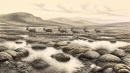
About 31,881 BCE, Ireland lay within the unstable cold conditions of Marine Isotope Stage 3, rather than a precisely datable historical year. Buried freshwater deposits at Derryvree and Greenagho, County Fermanagh, show that north-central areas were periodically ice-free before later glacial advances, supporting treeless, waterlogged tundra of mosses, sedges and shallow pools. Cave remains at Castlepook, County Cork, demonstrate intermittent connections to wider European fauna, including reindeer, mammoth, horse, predators and lemmings. Possible stone-tool marks on a reindeer bone suggest brief human visits, but cannot prove settlement. Expanding ice subsequently covered most of Ireland, preserving only valuable fragmentary environmental evidence.
Read Article

Archived: 9 September 2026
Abstract
Although 31,887 BCE cannot be treated as a recoverable Irish calendar year, it broadly falls within MIS 3, before the Last Glacial Maximum. Fragmentary evidence from Derryvree and Greenagho, County Fermanagh, records cold, open, wet tundra-like environments, with mosses, pools, sparse vegetation and later glacial burial. Castlepook Cave’s mixed fauna demonstrates varied cold-adapted animals, including reindeer, mammoth, giant deer and carnivores, but not a single contemporaneous community. A cut-marked reindeer bone may indicate brief human activity, yet remains uncertain. No settlements, culture, language or political organisation are known. Ireland’s surviving record chiefly reveals changing Ice Age ecology and advancing ice.
Read Article

Archived: 9 September 2026
Abstract
31,888 BCE is a modern label, not a securely datable Irish event. During Marine Isotope Stage 3, Ireland was a cold, open, climatically unstable landscape before maximum British–Irish Ice Sheet expansion. Derryvree sediments in Fermanagh indicate treeless marshes, with sedges, grasses and low shrubs. Castlepook Cave and other southern caves preserve mixed, imperfectly dated remains of mammoth, reindeer, giant deer, bears, wolves, hyaenas, foxes, hares and lemmings, demonstrating varied cold-stage fauna over time. No secure evidence establishes human settlement, politics or culture, although a possibly cut-marked reindeer bone merits investigation. Later glaciation reshaped Ireland and erased or buried earlier evidence.
Read Article

Archived: 9 September 2026
Abstract
At roughly 31,890 BCE, Ireland was a climatically unstable Late Pleistocene landscape rather than a documented society. Derryvree sediments near Maguiresbridge, Fermanagh, dated broadly to 36,900–31,700 calibrated years BP, show ice-free freshwater habitats with sedges, mosses, herbs, beetles and periglacial tundra conditions. Other deposits and Crag Cave indicate alternating non-glacial and milder phases amid advancing ice. Castlepook Cave preserves time-mixed remains of cold-adapted and other mammals, demonstrating intermittent faunal connections with Eurasia. A marked reindeer bone may record early human butchery, but remains disputed and cannot prove settlement. Subsequent ice-sheet expansion transformed, buried and destroyed much of this fragile landscape.
Read Article
Archived: 9 September 2026
Abstract
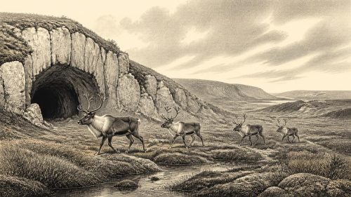
Castlepook Cave near Doneraile, County Cork, contains a reindeer femur whose deep mark may represent Ireland’s earliest evidence of human activity, perhaps from stone-tool butchery around 33,800 years ago. The date is a broad Late Pleistocene MIS 3 estimate, not a precise annual event, and bone dating records animal death rather than human handling. Excavated deposits were disturbed and include scavenger-accumulated fauna, limiting conclusions. Mammoth, reindeer, giant deer and carnivores indicate cold, open, intermittently habitable landscapes and changing access routes. The find suggests possible brief forager presence, but proves neither settlement, culture, identity nor permanent occupation in Ice Age Ireland.
Read Article
Archived: 9 September 2026
Abstract
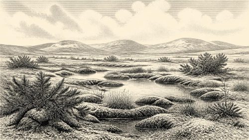
Around 31,894 BCE, Ireland lay within the unstable Late Pleistocene environment of Marine Isotope Stage 3. Derryvree, County Fermanagh, preserves a marshy, treeless tundra deposit between older and later glacier tills, indicating a temporary ice-free interval. Mosses, grasses, sedges, juniper, herbs and insects supported productive wetland ecosystems despite severe cold and seasonal freezing. Elsewhere, cave remains show that mammoths, giant deer, reindeer, bears, hyaenas and other mammals occupied Ireland during the broader period, though not necessarily simultaneously. Ice-sheet extent, coastlines and migration routes remain uncertain. No secure evidence demonstrates human settlement; possible butchery marks suggest only a tentative, brief visit.
Read Article

Archived: 9 September 2026
Abstract
At the notional date of 31,895 BCE, Ireland lay within the climatically unstable Marine Isotope Stage 3, before maximum glaciation. Its ice sheet, coastlines and habitats changed markedly across Ireland, precluding a precise national reconstruction. Buried lake sediments at Derryvree, Fermanagh, dated broadly to 36,900–31,700 years before present, demonstrate freshwater and sparse tundra-steppe life during an ice-free interval. Castlepook Cave, Cork, preserves MIS 3 fauna including reindeer, mammoth and predators, though not necessarily contemporaneous. No secure human settlement exists. A possibly tool-marked reindeer bone suggests provisional human activity. Radiocarbon calibration, stratigraphy and environmental proxies provide evidence, but retain substantial uncertainty.
Read Article
Archived: 9 September 2026
Abstract
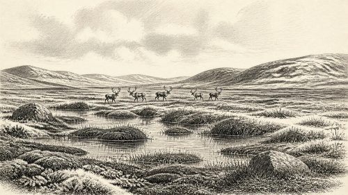
About 31,896 BCE, a modern label, Ireland lay in later Marine Isotope Stage 3, before the Last Glacial Maximum. Derryvree near Maguiresbridge preserves sediments beneath glacial tills, indicating ice-free northern ground with treeless tundra, wetlands, pools and cold-adapted plants and insects. Cave evidence from Cork records MIS 3 fauna including mammoth, reindeer, giant deer, bears and hyaenas, though remains span episodes and disturbed contexts. Kerry speleothems indicate milder conditions. Ice expansion was regionally varied and intensified later. No secure human settlement dates to this period; possible butchery evidence remains uncertain. Surviving sediments, bones and calcite reveal a diverse Ice-Age landscape.
Read Article
Archived: 9 September 2026
Abstract
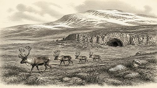
Circa 31,898 BCE, Ireland lay within the climatically unstable later Marine Isotope Stage 3, not a precisely datable historical year. Castlepook Cave in County Cork preserves the island’s richest faunal archive from this period, including mammoth, reindeer, giant deer, hyaena, wolf and Arctic fox, indicating changing cold, largely open environments. A reindeer bone bearing a possible stone-cut mark may record brief Palaeolithic butchery, but disturbed deposits and absent tools or occupation layers preclude claims of settlement. Altered coastlines may have enabled visitors’ arrival. Approaching glaciation later erased much evidence, making Castlepook’s fragmentary record vital yet necessarily cautious for Irish prehistory.
Read Article

Archived: 9 September 2026
Abstract
Around 31,899 BCE, Ireland lay within the cold, unstable Marine Isotope Stage 3, before the Last Glacial Maximum. Lower sea levels and shifting ice margins altered connections with Britain and Europe, without proving a continuous land route. Derryvree, County Fermanagh, preserves sediments showing an ice-free interlude of treeless wetlands, mosses, pools, grasses, insects and severe seasonal conditions. Castlepook Cave records diverse cold-stage fauna, including mammoth, reindeer, giant deer, wolves and hyaenas, though species did not necessarily coexist. A possibly tool-marked reindeer bone suggests early human activity, but requires testing. No settled communities, economy or social history can be securely reconstructed.
Read Article

Archived: 9 September 2026
Abstract
Circa 31,901 BCE, Ireland was a cold, seasonally varied Late Pleistocene landscape, not yet wholly covered by the expanding British-Irish Ice Sheet. Derryvree sediments in Fermanagh record open, treeless wetland vegetation, freshwater pools and cold-adapted insects during an ice-free interval, though dates remain broad. Castlepook Cave in Cork preserves mixed remains of mammoth, reindeer, giant deer, hyaena, wolf, Arctic fox and other fauna, accumulated over extended periods and partly modified by carnivores. A possibly butchered reindeer bone suggests fleeting human activity, but no secure settlement evidence exists. Together, the sites document environmental change, ecological connectivity and fragmentary survival of evidence.
Read Article

Archived: 9 September 2026
Abstract
About 31,902 BCE cannot be treated as a precise Irish historical year: evidence belongs broadly to Marine Isotope Stage 3, within the later Middle Midlandian. Ireland experienced severe, variable glacial conditions before the ice sheet’s maximum. Derryvree deposits in Fermanagh indicate local ice-free wet tundra, with sparse treeless vegetation, while Castlepook Cave in Cork preserves remains of reindeer, mammoth, giant deer, hyaena and other cold-adapted animals. Lower sea levels altered geography but did not ensure permanent land access. A possibly butchered reindeer bone suggests episodic Upper Palaeolithic visitation, yet remains unconfirmed. No secure evidence supports settlement, institutions, warfare or occupation.
Read Article

Archived: 9 September 2026
Abstract
Although 31,904 BCE cannot denote a precisely known Irish year, it falls within unstable Marine Isotope Stage 3. Derryvree, County Fermanagh, preserves freshwater organic deposits dated broadly to 36,900–31,700 cal BP, indicating cold, open periglacial environments with wetlands, tundra plants and insects. Ireland was not yet wholly ice-covered, but was moving towards major glaciation. Cave remains show varied mammals, though their dates and locations remain uncertain. No settled human population is securely demonstrated; a possibly butchered reindeer bone suggests only a tentative Upper Palaeolithic visit. Evidence supports changing landscapes, animal movement and freshwater life, not precise events, routes or societies.
Read Article

Archived: 9 September 2026
Abstract
Around 34,000 calendar years ago, corresponding to 31,907 BCE, Ireland lay within the climatically unstable Late Pleistocene MIS 3. Lower sea levels and variable ice margins created changing landscapes, not a fixed land bridge or wholly glaciated island. Derryvree sediments in Fermanagh indicate open, periglacial tundra supporting cold-adapted vegetation and animals. Castlepook Cave in Cork preserves Ireland’s richest Pleistocene fauna, including mammoth, reindeer, hyaena, bear and lemmings, though old excavations complicate interpretation. A reindeer femur possibly marked by a stone tool may indicate a human visit, but cannot demonstrate settlement. Subsequent glaciation obscured evidence; Castlepook remains an unresolved archaeological question.
Read Article

Archived: 9 September 2026
Abstract
31,908 BCE is a nominal point within a late Middle Midlandian interval, not a documented Irish event. Freshwater sediments at Derryvree, County Fermanagh, show that ice-free areas supported treeless tundra wetlands, pools, mosses, grasses and sedges amid severe climatic conditions before ice-sheet expansion. Cave remains at Castlepook, County Cork, attest to cold-adapted fauna, including mammoth, reindeer and predators, though disturbed contexts limit interpretation. Possible human butchery evidence remains unconfirmed and cannot demonstrate settlement. Ireland's geography, ice cover and access routes varied regionally. The period is best understood as an ecological frontier shaped by fluctuating climate, mobile fauna and encroaching ice.
Read Article

Archived: 9 September 2026
Abstract
About 31,909 BCE, Ireland lay in the later Marine Isotope Stage 3, approaching but preceding extensive Last Glacial Maximum ice cover. Greenagho deposits in County Fermanagh indicate cold, open, largely treeless ground with mosses, sedges and freshwater hollows. Castlepook Cave, County Cork, preserves a time-mixed faunal collection including mammoth, giant deer, reindeer, hyaena, bear, wolves, foxes, hares and lemmings, evidencing changing cold-country ecosystems rather than one moment. Lower seas may have permitted intermittent animal movement, though no certain land bridge is known. A possibly butchered reindeer bone suggests, but cannot prove, early human visitation. No communities or culture are evidenced.
Read Article

Archived: 9 September 2026
Abstract
31,911 BCE is not a securely identifiable Irish event but an approximate modern label for about 33.9 thousand calibrated years BP, during cold, unstable Marine Isotope Stage 3. Ireland was approaching major glaciation, with changing sea levels, exposed shelf, open vegetation and uncertain routes from Britain. Castlepook Cave in County Cork preserves important, mixed deposits of mammoth, reindeer, lemmings, predators and other fauna, although species did not necessarily coexist. A reportedly cut-marked reindeer bone may indicate human contact, but no secure settlement, tools or hearths confirm occupation. Ice and later seas destroyed much evidence, leaving Castlepook an unresolved ecological archive.
Read Article

Archived: 9 September 2026
Abstract
At roughly 31,915 BCE, Ireland lay within the unstable Late Pleistocene, before maximum glaciation, with open cold landscapes supporting diverse mammals. Castlepook Cave, County Cork, preserves bones of reindeer, mammoth, giant deer, predators and smaller cold-adapted species, although its deposits combine material from different periods and processes. A marked reindeer femur, approximately 33,000 radiocarbon years old, may record stone-tool butchery and potentially very early human activity. Yet it cannot prove settlement, population or social life. Ireland lacks securely contemporary human remains, tools, camps or ritual evidence. Subsequent ice advance destroyed much surviving evidence, leaving Castlepook a vital but uncertain archive.
Read Article

Archived: 9 September 2026
Abstract
Around 31,916 BCE, Ireland lay in the unstable, pre-Last Glacial Maximum conditions of Marine Isotope Stage 3, not beneath uniform ice. Open, treeless habitats in southern Ireland supported cold-adapted fauna. Castlepook Cave near Doneraile preserves Ireland’s richest pre-maximum vertebrate assemblage, including mammoth, reindeer, giant deer, hyaena, wolves and Arctic foxes, although its bones accumulated across long periods and contexts are disturbed. Redating confirms several animals lived during MIS 3. A possibly cut-marked reindeer femur suggests human butchery, but no secure tools, hearths or settlement evidence exists. Thus Castlepook documents an Ice Age ecosystem while human presence remains plausible yet unproven.
Read Article
Archived: 9 September 2026
Abstract
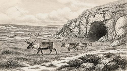
About 31,918 BCE, Ireland lay within the later Last Glacial Period, as climate deteriorated before the Last Glacial Maximum. Castlepook Cave near Doneraile, County Cork, preserves remains of reindeer, mammoth, hyaena and other cold-adapted fauna, demonstrating repeated animal presence rather than one contemporaneous landscape. A reindeer femur bearing probable stone-tool butchery marks, dated to roughly 33,000 years ago, may indicate Ireland's earliest human visit. However, disturbed cave deposits and limited evidence preclude claims of settlement. Lower sea levels may have facilitated movement, though routes remain uncertain. Expanding ice later transformed this exposed, seasonal frontier. Research may revise this fragile picture.
Read Article
Archived: 9 September 2026
Abstract
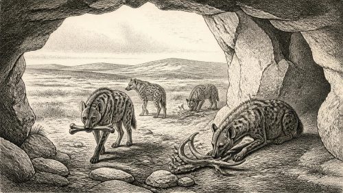
Castlepook Cave near Doneraile, County Cork, preserves a disturbed, important Late Pleistocene animal archive rather than evidence for a dated event in 31,920 BCE. Fossils, individually dated across approximately 45,700–19,950 years ago, include mammoth, giant deer, reindeer, bear, spotted hyaena, wolf, Arctic fox and lemmings. Gnawed bones indicate repeated hyaena use, not a local fauna. Revised dating suggests giant deer and hyaenas may have vanished locally before 40,000 years ago. A reindeer femur possibly bearing butchery marks suggests an early Upper Palaeolithic human visit, but proves neither settlement nor community. These changing landscapes supported habitats before ice-sheet advance erased evidence.
Read Article

Archived: 9 September 2026
Abstract
Around 34,000 calibrated years BP, Ireland experienced severe climatic change before the Last Glacial Maximum. Cold open grassland, steppe and tundra supported diverse mammals, documented chiefly at Castlepook Cave, County Cork. Its disturbed, long-lived deposits contain reindeer, bears, wolves, arctic foxes, mammoths, giant deer and Ireland’s only spotted-hyaena remains, but do not represent one moment. A reindeer bone possibly cut by tools suggests human contact around 33,000 years ago, yet lacks secure context. No hearths, tools, settlements or burials confirm permanent occupation. Expanding ice later erased landscapes and deposits, leaving Castlepook crucial evidence for pre-glacial environments but unresolved human history.
Read Article

Archived: 9 September 2026
Abstract
About 33,900 calibrated years before present, Ireland experienced unstable MIS 3 conditions, with fluctuating ice, sea levels and open steppe-tundra habitats. Castlepook Cave, County Cork, preserves fauna including mammoth, reindeer, giant deer, hyaena, wolf and Arctic fox, although disturbed deposits and revised dates demand caution. Evidence indicates a cold-adapted animal community and carnivore activity, not a single contemporaneous landscape. A cut-marked reindeer femur plausibly suggests Upper Palaeolithic visitors butchered game, but cannot prove settlement. No associated tools, hearths or human remains exist. Later glaciation destroyed or buried evidence, leaving caves as fragile archives of possible early human presence in Ireland.
Read Article

Archived: 9 September 2026
Abstract
31,923 BCE is an approximate modern label within Marine Isotope Stage 3, not a datable Irish event. Castlepook Cave in north Cork preserves disturbed pre-Last Glacial Maximum faunal remains, including reindeer, bears, wolves, Arctic foxes, lemmings, giant deer, mammoths and hyaenas. These animals indicate a fluctuating, open, cold environment rather than permanent ice cover. A reindeer femur dated to 31,000 BCE may bear a stone-tool butchery mark, potentially Ireland’s earliest human evidence. However, no associated tools, hearths or settlement survive, and the mark remains contested. The evidence suggests possible hunter-gatherer visits, not proven occupation, during a landscape transformed by glaciation.
Read Article

