Membership is completely free, giving members unlimited access to all available resources, services, features, and benefits without any restrictions or fees.
Welcome back. Sign in to continue enjoying unlimited access to all available resources, services, features, and member benefits at no cost.
The most informative Irish evidence relevant to this date comes from Derryvree near Maguiresbridge, County Fermanagh. Roadworks exposed a remarkable section within a drumlin: a lower glacial till, then sands, silts and organic freshwater deposits, followed by a second till. Till is unsorted material deposited by glacier ice. The order of the layers matters more than any picturesque reconstruction. Ice had occupied the locality; a period then followed in which water, plants and animals could leave traces; later ice returned and sealed the record beneath a new mass of sediment.
The most important Irish environmental record relevant to this horizon lies at Derryvree, near Maguiresbridge in County Fermanagh. Roadworks in 1969 cut through a drumlin and exposed organic freshwater silts and fine sands trapped between two separate sheets of glacial till. The original investigators obtained a conventional radiocarbon determination of 30,500 years before present, BIRM-166, with a substantial error range of +1,170 and −1,030 years. Later discussion has expressed this as an approximate calibrated range of 36,900–31,700 calendar years before present. In modern BCE notation that spans roughly 34,950–29,750 BCE. The label 30,211 BCE therefore sits within the broad tail of a dated environmental interval; it cannot be isolated as a moment in the life of the wetland.
The date 30,212 BCE is roughly 32,160 years before the radiocarbon convention of “present” in 1950. That apparent precision is misleading. Radiocarbon results of this antiquity must be calibrated because atmospheric carbon-14 levels have varied over time; their calendar equivalents can span centuries or millennia. The most relevant Irish measurement is BIRM-166, obtained from organic deposits at Derryvree near Maguiresbridge, County Fermanagh. It produced an age of 30,500 radiocarbon years before present, with an uncertainty of about 1,100 years. Modern calibration makes clear that this is a wide chronological window, rather than a date for one moment. It is therefore reasonable to discuss Derryvree as evidence relevant to the early thirty-second millennium BCE, but not to assign its plants, insects or waters to 30,212 BCE precisely.
At this depth of time, dates must be handled with particular care. A radiocarbon result is not automatically a calendar date: it measures the remaining carbon-14 in once-living material and must be calibrated against changing atmospheric carbon levels. Calibration produces ranges, often broad ones, rather than a single secure year. The internationally used IntCal20 curve extends to 55,000 calibrated years before present, but it does not turn an Irish Ice Age deposit into an annual chronicle.
Roadworks in 1969 cut through a drumlin at Derryvree and revealed an exceptional sequence: freshwater sands, silts and organic deposits lying between two bodies of glacial till. Till is the mixed sediment left directly by glacier ice. The order of layers is crucial. An earlier glacial episode had affected the locality; water, sediment, plants and small animals then accumulated in an ice-free interval; later glacier ice or ice-related sediment buried and preserved the wetland beneath another till.
Deep prehistory has its own chronology, and it does not fit neatly into BCE labels. Radiocarbon laboratories report ages in radiocarbon years BP, not calendar years; the amount of atmospheric carbon-14 has varied through time, so measurements must be calibrated against independently dated records. At ages around 30,000 radiocarbon years, both laboratory uncertainty and the shape of the calibration curve can generate broad, sometimes discontinuous calendar ranges. A date such as 30,215 BCE should therefore be treated as a useful modern point of reference, not as evidence for a precise Irish season, generation or occurrence.
Derryvree is valuable precisely because it has no historical narrative attached to it. Roadworks in 1969 cut through a drumlin and revealed organic silts and fine sands trapped between two separate tills: layers of sediment laid down by glacier ice. The intervening deposit was once freshwater wet ground. A conventional radiocarbon determination, Birm-166, returned 30,500 radiocarbon years before present, with a substantial uncertainty of +1,170 and −1,030 years. Subsequent calibration places the deposit broadly within about 36,900–31,700 calibrated years before present. The requested calendar point lies within that large window, but cannot be isolated as its precise age.
Radiocarbon dates from this period are not calendar years. They measure residual carbon-14 against AD 1950 and must be calibrated because atmospheric carbon-14 levels changed markedly through time. IntCal20, the internationally used Northern Hemisphere curve, extends to 55,000 calibrated years before present, but its older section necessarily combines several kinds of evidence and retains substantial uncertainty. A single laboratory determination can therefore calibrate to broad probability ranges, sometimes with separate possible spans, rather than to one year. It would be misleading to describe 30,217 BCE as the date of a known Irish occurrence, or to convert an old radiocarbon age directly into a BCE date.
The key determination from Derryvree, laboratory sample BIRM-166, gave a conventional radiocarbon age of 30,500 years BP, with an uncertainty of +1,170 and −1,030 years. A radiocarbon age is not the same thing as a calendar age: atmospheric carbon-14 has varied through time, and very old results require calibration against internationally maintained curves. Recent modelling places the Derryvree evidence broadly in the earlier part of the last glacial cycle’s great advance, with an estimated calendar age around 33,500 years before present and a substantial uncertainty. Consequently, 30,218 BCE falls near, rather than precisely upon, the time-range for which the deposit is informative.
Derryvree’s importance lies in its stratigraphy. Roadworks in 1969 cut through a drumlin, exposing silts and fine sands containing organic material between two thick tills. Till is the unsorted mixture of clay, stones and other debris laid down directly by glacier ice. The lower till records an earlier episode when ice overrode the locality. The organic sediments show that, afterwards, a freshwater environment formed there. The upper till demonstrates that glacier ice later returned and sealed the deposit beneath it.
Ireland at this broad point was in the Midlandian cold stage, the Irish expression of the last glacial cycle. It was not yet the climatic low point conventionally called the Last Glacial Maximum: scholarship commonly places that severe interval at about 28,200–20,400 calibrated years BP, while the greatest extent of particular British–Irish Ice Sheet sectors was asynchronous. The ice sheet did not simply switch on across every district at once. Ice caps and ice streams grew, merged, advanced and later retreated at different rates in response to snowfall, temperature, sea level, seabed topography and the changing weight of the ice itself.
Radiocarbon dating does not produce an ancient calendar date. It measures remaining radiocarbon in once-living material; the result must then be calibrated against long-term changes in atmospheric radiocarbon. At around 32,000 years ago, the resulting calibrated ranges can be broad, and an animal bone dates the death of the animal rather than every later action or disturbance associated with it. Ireland therefore has no documentary, political or archaeological record from which to reconstruct a particular year in the thirty-first millennium BCE.
The closest major Irish chronological anchor is the Derryvree sequence near Maguiresbridge, County Fermanagh. Roadworks exposed organic silts and fine sands between two separate bodies of till, the unsorted sediment laid down directly by glacier ice. The sequence establishes a secure relative order: ice affected the locality; an interval followed in which freshwater and organic sediment accumulated; then later ice or glacial sediment sealed that former wetland beneath a further till layer. It is among the most important pieces of evidence that parts of Ireland were not continuously ice-covered throughout the last cold stage.
The closest and most informative Irish record is at Derryvree, near Maguiresbridge in County Fermanagh. Roadworks in 1969 cut through a drumlin and revealed freshwater silts, fine sands and organic layers trapped between two thick tills: unsorted debris left by glacier ice. The stratigraphic sequence is important. A glacier had first occupied the site and laid down the lower till; later, water, plants and small animals occupied an ice-free basin long enough for sediment to gather; subsequently, renewed ice laid down the upper till and sealed that local archive.
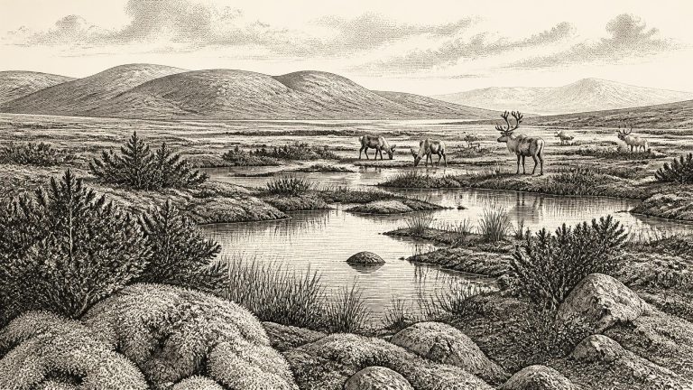
Ireland was moving through a volatile phase of the last glacial cycle. MIS 3 was not one uniformly frozen age: Greenland ice-core records and North Atlantic evidence show repeated swings between colder stadials and relatively milder interstadials. Those wider climatic reversals affected Irish ice, vegetation, rivers and animal habitats, although they cannot be translated mechanically into a local weather report for any one place or year. The full Last Glacial Maximum, when the British–Irish Ice Sheet achieved its widest extent, belongs later, conventionally around 26,500–19,000 calibrated years before present. Around the notional date represented here, the island was approaching that severe phase rather than already existing as the wholly ice-covered landscape often imagined by later visitors.
The most revealing Irish record for this broad interval comes from Derryvree, near Maguiresbridge in County Fermanagh. Roadworks in 1969 cut through a drumlin and exposed an extraordinary sequence. A lower layer of till, the unsorted debris laid down by glacier ice, was overlain by freshwater silts, fine sands and organic deposits. A second thick till later sealed the wetland. The order of events is secure even if its exact calendar timing is not: ice had occupied the locality; an interval followed in which open water, wet ground and vegetation developed; then renewed glaciation buried that landscape.
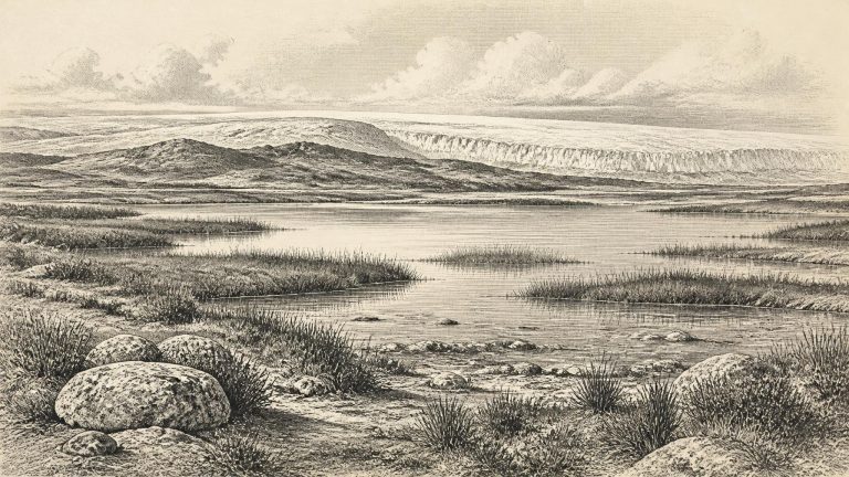
Ireland around this broad horizon was not simply a white, uniformly frozen island. The last British–Irish Ice Sheet was dynamic, expanding and contracting over long intervals, while conditions varied sharply by region, season, altitude and proximity to ice margins. Reconstructions agree more securely about the later maximum than about this earlier stage: at its fullest extent, around 27,000–23,000 cal BP, ice covered Ireland and extended across much of the continental shelf. Around 32.2 ka, by contrast, the extent, thickness and exact configuration of ice over any particular Irish district remain debated. It is safer to speak of a cold landscape in transition than to draw a firm national ice boundary.
Derryvree was exposed during roadworks in 1969, when geologists recorded a sequence of deposits in a drumlin. A lower glacial till was overlain by fine sands and organic silts, which were in turn sealed beneath a later till. Till is the unsorted mixture of clay, stones and debris laid down directly by ice. The sequence demonstrates that glacier ice affected the site, that a period followed in which water and organic sediment accumulated, and that ice later returned or advanced across the locality.
Derryvree was exposed by roadworks in 1969, when a cut through a Fermanagh drumlin revealed a remarkable sequence. A lower till, the unsorted debris left directly by glacier ice, was overlain by freshwater silts, sands and organic deposits. These were in turn sealed beneath another till. The sequence is direct evidence: ice had occupied the locality; later, in an interval when the site was not under glacier ice, a freshwater basin and wet ground developed; subsequently, ice crossed or expanded over the area again. The upper till preserved the earlier landscape while also destroying any open surface from which a conventional archaeological site might otherwise have survived.
The best local chronological anchor is Derryvree, near Maguiresbridge in County Fermanagh. Road-cutting through a drumlin in 1969 exposed freshwater silts and fine sands between two distinct sheets of glacial till. Organic material from this deposit produced radiocarbon determination BIRM-166: 30,500 radiocarbon years before present, with a substantial uncertainty of +1,170 and −1,030 years. Radiocarbon years are not calendar years. Because atmospheric carbon-14 has varied through time, determinations must be calibrated, and the conversion becomes especially broad at this depth in the past.
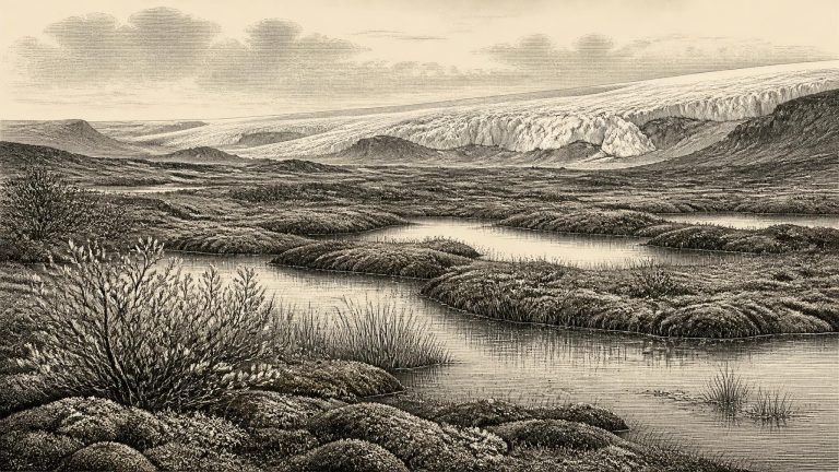
Derryvree was exposed during road works in 1969, when a cutting through a drumlin revealed a remarkable sequence: thick glacial till below, freshwater sands and organic silts in the middle, and another substantial till sheet above. The arrangement is decisive. It records a landscape that was free of local ice long enough for water, sediment, plants and small animals to accumulate, followed by a renewed glacial advance. The deposit is therefore not simply evidence of cold weather. It is evidence of environmental change: a habitable, if severe, interval between phases of glaciation.
30,231 BCE is a modern chronological label, not a year that can be isolated in Ireland’s archaeological record. It falls roughly 32,180 calendar years before AD 1950, the conventional reference point for radiocarbon dating, in the later Pleistocene and broadly within Marine Isotope Stage 3. No Irish document, settlement layer, burial or individual artefact can be assigned to this particular calendar year. The responsible history of Ireland at this distance is therefore a history of deposits, bones, pollen, seeds, insects, cave sediments and ice-made landforms. These sources can illuminate conditions across long intervals; they cannot supply an annual chronicle.
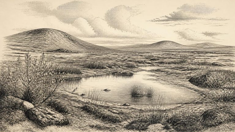
Ireland at this point was not the familiar green island of later prehistory. It was also not yet simply an island buried beneath the fullest extent of the last ice sheet. The Last Glacial Maximum lay ahead: the British–Irish Ice Sheet later expanded across Ireland and far onto the surrounding continental shelf, broadly during the period after about 27,000 calibrated years before present. Around the notional date of 30,232 BCE, conditions were cold, variable and regionally uneven. Ice margins advanced and retreated over longer timescales, while shorter climatic oscillations altered vegetation, water supply and animal habitats.
Radiocarbon years are not calendar years. The amount of radioactive carbon in the atmosphere has altered through time, and the calibration of very old samples carries wide statistical ranges. Nor does a date from an organic layer specify when every seed, insect fragment or grain of silt entered the deposit. The sensible conclusion is modest but significant: sometime within a long interval relevant to the thirty-first millennium BCE, the Derryvree locality was sufficiently free of overriding ice for a cold freshwater environment to form. It is evidence for local conditions, not a map of the entire island and not a proof that every region was ice-free simultaneously.
Derryvree was revealed by roadworks in 1969, when an excavation cut through a drumlin: the streamlined hill of glacial sediment characteristic of much of the Fermanagh landscape. The section contained a lower till, then freshwater silts, fine sands and organic muds, followed by an upper till. Till is unsorted debris laid down directly by glacier ice. The sequence is therefore unusually clear in its basic implication. Ice had occupied this locality; an interval then followed in which water, sediment and plants accumulated in an ice-free basin; ice subsequently returned and sealed the wetland under another layer of debris.
The label 30,235 BCE is a modern conversion, equivalent to roughly 32,184 years before AD 1950, the conventional reference point for radiocarbon ages. It should not be mistaken for a date that archaeology can identify on the ground. The closest important Irish chronological marker is the Derryvree deposit, which produced the radiocarbon determination BIRM-166: 30,500 years BP, with a large uncertainty of +1,170/−1,030 years. Radiocarbon years are not calendar years because atmospheric carbon-14 levels have varied substantially through time.
Road works in 1969 cut through a drumlin at Derryvree and revealed fine sands, silts and organic material trapped between two layers of glacial till. Till is sediment deposited directly by glacier ice. The sequence is consequently valuable not because it dates a single moment, but because it records change: an earlier glacial episode, a phase in which freshwater sediments accumulated locally, and a later advance that buried the wetland beneath new till. The upper ice cover helped preserve an otherwise fragile fragment of Ireland’s Middle Midlandian landscape.
About this notional date, Ireland lay within the later part of the Pleistocene and Marine Isotope Stage 3, shortly before the fullest expansion of the last British–Irish Ice Sheet. It was not yet the uniform, island-wide ice cover often imagined by later Ice Age pictures. The timing and reach of ice varied sharply between regions, and the history has been revised repeatedly as new dating programmes have tested older landform interpretations. Broad syntheses place the build-up of the last major ice sheet after roughly 35,000–32,000 years ago, while its maximum extent in the Irish Sea and around Ireland belongs principally to a later interval, conventionally around 27,000–21,000 years ago, with some sector-specific maxima around 26,000–23,000 years ago.
The key Irish record for this broad horizon lies at Derryvree near Maguiresbridge in County Fermanagh. Road construction in 1969 exposed a drumlin section with two thick deposits of glacial till — unsorted material laid down directly by ice — separated by freshwater sands, silts and organic sediments. The order of the layers is decisive evidence. Ice had once occupied the locality; afterwards, water and vegetation accumulated there; then ice returned and sealed the deposit beneath another till.
Ireland lay on the Atlantic edge of north-west Europe during a climatically volatile part of the last Ice Age. Temperatures did not simply decline in a smooth progression towards a single frozen maximum. Greenland ice-core records and North Atlantic evidence show abrupt warmings and coolings, while Irish glaciers advanced, altered their margins and later grew into the much larger British–Irish Ice Sheet. Modern reconstructions place the major build-up of that ice sheet in the period after roughly 32,000 years ago, with its greatest extent later, during the Last Glacial Maximum.