Membership is completely free, giving members unlimited access to all available resources, services, features, and benefits without any restrictions or fees.
Welcome back. Sign in to continue enjoying unlimited access to all available resources, services, features, and member benefits at no cost.
Dates this remote are produced by scientific measurements with margins of uncertainty, not by calendars. Radiocarbon ages must be calibrated against changing atmospheric carbon levels; even then, the results are ranges, sometimes broad ones. Sediments can be displaced by ice, bones can be redeposited within caves, and material from different episodes can become mixed. A fossil collection labelled “Ice Age” is not automatically a single living community or a single moment in time.
Radiocarbon dating does not deliver a direct calendar anniversary. A measurement estimates the remaining radioactive carbon in once-living material; it must then be calibrated against independently built records of changing atmospheric carbon. The resulting calendar range can be broad, particularly this far back in time. Moreover, a date on a bone establishes, within statistical limits, when the animal died. It does not automatically date a human action on that bone, identify where the animal was killed, or prove that people lived nearby.
The label 31,836 BCE gives a useful position on a modern timeline, but it cannot identify an event in Ireland during a particular year, season or generation. There are no written records, settlements, graves or securely dated occupation surfaces from which such precision could be claimed. In conventional “before present” notation, where present means 1950, the calendar arithmetic places this notional year at about 33,785 years BP. That is not itself a laboratory age. Radiocarbon measurements carry statistical uncertainty and must be calibrated against changing atmospheric carbon-14 levels; at this depth of time, their calendar ranges can span centuries or millennia.
Radiocarbon determinations are not calendar dates in themselves. They must be calibrated against changing atmospheric carbon levels, and at more than 30,000 years ago the resulting ranges can be broad or irregular. The current IntCal20 calibration framework extends to 55,000 calendar years before present, but it does not turn a single bone into an exact annual timestamp. The Castlepook femur should therefore be understood as belonging to a period around the mid-30th millennium before present, rather than as proof that butchery occurred in this particular numbered BCE year.
There were no Irish kingdoms, chiefs, borders, treaties or named peoples that can responsibly be assigned to this date. There is no evidence for a permanent population, village, house, burial ground, shrine, tool-making floor, hearth or cultivated field in Ireland in c. 31,838 BCE. Nor can archaeology identify an Irish language, religion, artistic tradition or system of learning at this time. Such absences are historically important. They mean that political affairs, diplomacy, formal conflict, trade and institutions are not merely unknown in detail: they are unsupported categories for this particular Irish horizon.
MIS 3, broadly between about 57,000 and 29,000 years ago, contained sharp shifts between comparatively milder interstadial episodes and colder stadials. These changes matter greatly for Ireland. Whether a valley, cave entrance or coastal lowland could support plants and grazing animals depended on temperatures, snowfall, permafrost, sea level and the proximity of glaciers. A calendar label such as 31,839 BCE therefore conveys a false exactness. Radiocarbon determinations require calibration against internationally maintained curves, and their probability ranges are not interchangeable with an invented BCE anniversary. Geological and ice-core chronologies provide broad correlation, not a diary of Ireland.
The difficulty begins with chronology. Radiocarbon determinations are not calendar dates: they measure the remaining carbon-14 in organic material and must be calibrated against changing atmospheric carbon levels. For periods more than 30,000 years ago, the resulting calendar ranges can be broad. The most relevant Irish reference point is the Derryvree freshwater deposit near Maguiresbridge in County Fermanagh. Organic silts and fine sands there produced a conventional radiocarbon age of 30,500 years BP, with a substantial uncertainty range. Modern calibration places such an age within a several-thousand-year calendar interval rather than at a single securely identifiable year.
Radiocarbon dates are normally expressed in years before AD 1950 and must be calibrated against independently dated records of past atmospheric carbon. Calibration produces ranges rather than a single exact historical year, and the uncertainties become especially important this far back. The modern IntCal20 calibration curve reaches to 55,000 calibrated years before present, but it does not convert an Ice Age bone into evidence for activity in one numbered BCE year. The numerical date in this article should thus be read as an approximate pointer within a much longer span.
Ireland was approaching, rather than already deep within, the Last Glacial Maximum. The great British–Irish Ice Sheet later attained its greatest extent during roughly 27,000–19,000 years ago, but its growth was neither instantaneous nor uniform. Evidence from glacial landforms, offshore sediments and dated deposits points to a prolonged expansion from initially less extensively ice-covered conditions. At this earlier horizon, parts of Ireland could still support freshwater environments, vegetation and large mammals, even as colder conditions and advancing ice were reshaping the island.
This was the later part of Marine Isotope Stage 3, a long and climatically unstable interval of the Late Pleistocene. Ireland was approaching, but had not yet reached, the fullest expansion of the last British–Irish Ice Sheet. Modern reconstructions show that ice growth and retreat were uneven between regions rather than one simple island-wide advance. The principal maximum came later, broadly between about 27,000 and 23,000 calibrated years before present, although individual sectors behaved differently. Around the notional year in question, ground in some areas was still available to plants and animals, while glaciers and ice masses were expanding elsewhere.
The position of the Derryvree beds is itself important. They lie between tills: sediments laid down by glaciers or ice sheets. They show that, before a later advance overrode the district, freshwater conditions existed in at least this part of Fermanagh. The discovery overturns any simple picture of Ireland as continuously entombed beneath ice throughout the whole last glacial period. Instead, the island experienced shifting arrangements of ice, bare ground, periglacial terrain, lakes, marshes and drainage channels. Precisely how much of Ireland was ice-free at any particular moment around 31,844 BCE remains uncertain, because surviving deposits are rare and later ice repeatedly eroded or buried earlier landscapes.
In archaeological convention, “before present” means before 1950, while radiocarbon measurements require calibration before they can be expressed as calendar ages. Those procedures produce probability ranges rather than annual anniversaries, especially this far back. Around 31,845 BCE—roughly 33,795 years before 1950—Ireland was approaching the major expansion of the last British–Irish Ice Sheet, but was not necessarily uniformly ice-covered. The island’s conditions differed greatly between regions and changed repeatedly over long human timescales.
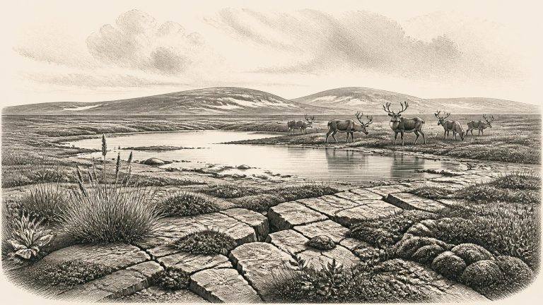
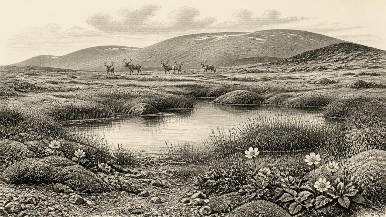
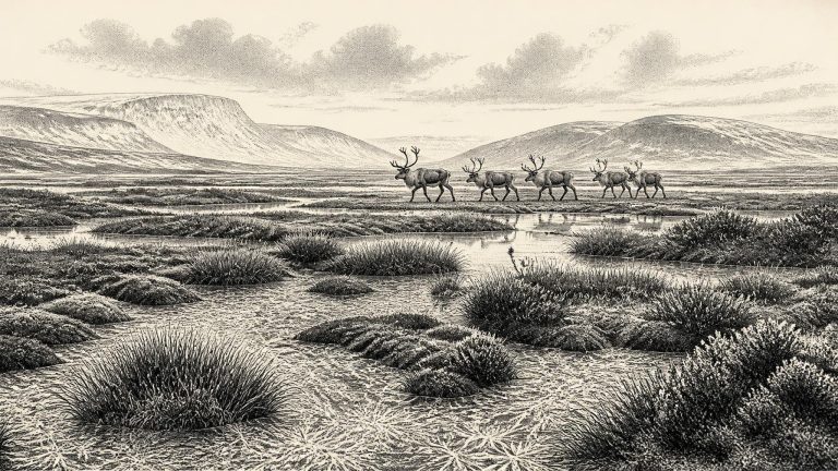
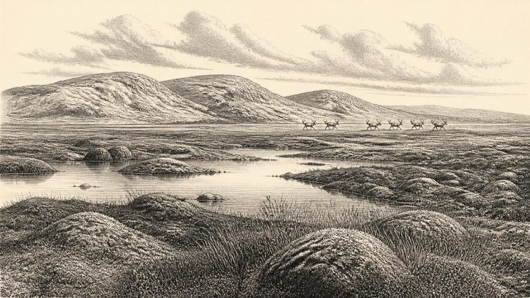
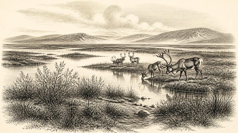
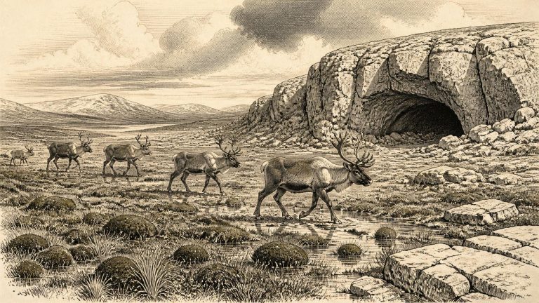
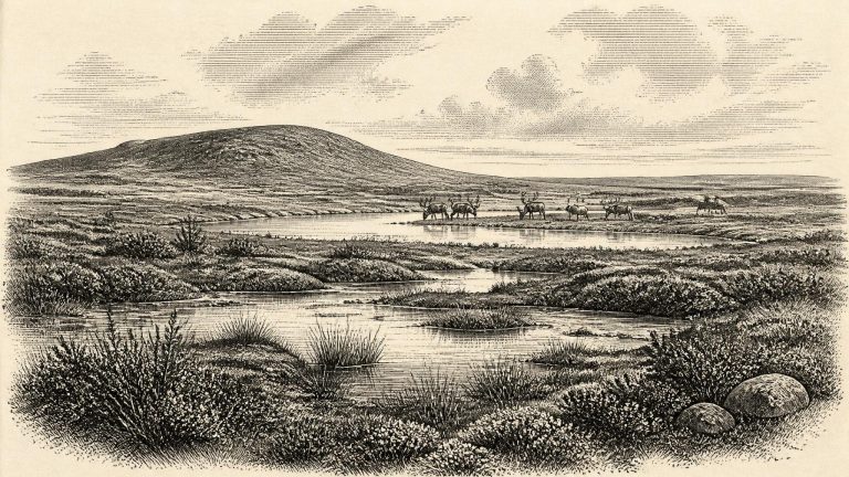
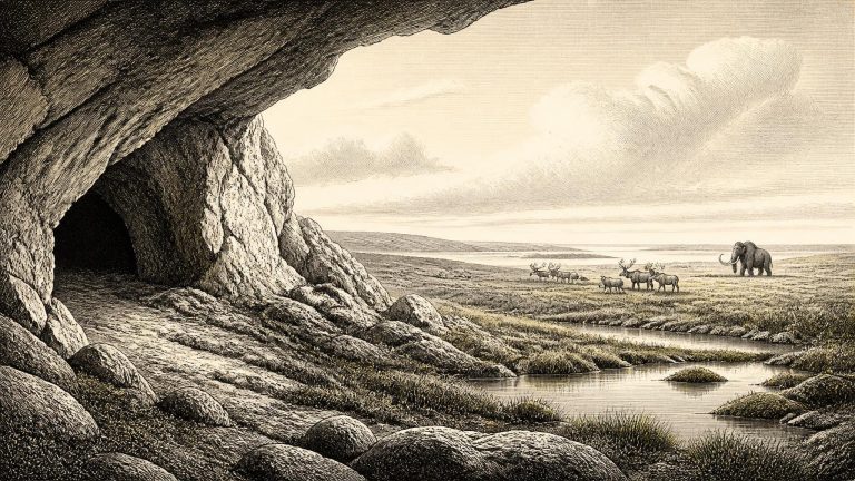
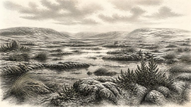
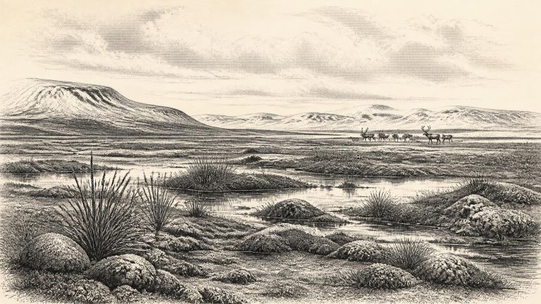
Derryvree’s pollen, plant macrofossils, mosses and insects provide a rare view of an Irish landscape before the great expansion of the last British-Irish Ice Sheet. They indicate open tundra or muskeg: wet, treeless ground with pools, sedges, grasses, herbs, mossy margins and low shrubs, rather than the oak, hazel and ash woods familiar from much later Irish prehistory. The evidence points to severe winters, short growing seasons and periglacial conditions in which frost was a major force shaping soil and watercourses.
Ireland was approaching, but had not yet reached, the maximum expansion of the last British–Irish Ice Sheet. That later maximum is now generally placed around 26,000 calendar years ago, with the greatest ice volume following several millennia later. Around the notional year considered here, cold conditions certainly prevailed, but neither temperature nor ice cover was uniform across the island. MIS 3 was punctuated by abrupt shifts between relatively milder interstadials and severe stadials. The island’s terrain was consequently altered by frost, seasonal thaw, wind, snow and moving water as well as by the fluctuating margins of ice.
About 33,800 calibrated years ago, Ireland lay within the broad North Atlantic world affected by abrupt climatic shifts recorded especially clearly in Greenland ice cores. In that record, this approximate horizon falls close to the beginning of Greenland Interstadial 7, one of several comparatively milder interruptions within an overall cold glacial period. Such labels are valuable for comparison, but they must not be treated as a weather report for a given Irish valley or a single year. Climate signals took time to travel through different environments, while Irish terrestrial sequences are few and often difficult to date precisely.
The most useful Irish evidence for the broad environmental setting comes from Derryvree near Maguiresbridge, County Fermanagh. There, organic freshwater silts and sands occur between layers of glacial till. They preserve a rare indication that north-central Ireland experienced an ice-free interval before later ice advances. A published radiocarbon determination associated with the sequence calibrates broadly to about 36,900–31,700 cal BP. The nominal year considered here falls within that wide bracket, but that does not mean the sediments provide a diary entry for 31,849 BCE. They offer a time-window, not a snapshot.
The wider North Atlantic climate was unstable. Greenland ice-core records show repeated swings between colder stadials and comparatively milder interstadials, sometimes over periods much shorter than conventional archaeological eras. Around the notional date used here, conditions in and around Ireland were cold, but “Ice Age” should not suggest a single unchanging white wilderness. Temperature, snowfall, sea level, vegetation and the reach of glaciers varied substantially through time and from one region to another. The landscape that future ice would scour was already being shaped by frost, wind, meltwater and changing ice margins.
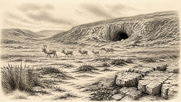
Radiocarbon dating does not yield a single, self-evident ancient calendar year. A laboratory measurement must be calibrated against independently constructed curves, and dates this old commonly produce ranges rather than a neat historical timestamp. In addition, the surviving Irish evidence was rarely laid down in one undisturbed sequence. A bone may date an animal’s death, not its arrival at a cave; a cave floor can combine material accumulated over many centuries or millennia; and early excavators often had neither the methods nor the records now expected.
Radiocarbon measurements do not translate directly into calendar years. They must be calibrated against internationally maintained curves, and uncertainty becomes substantial at this depth of time. A useful local comparison is Derryvree, near Maguiresbridge in County Fermanagh. There, organic-rich freshwater silts and fine sands lay between two tills: deposits left by separate phases of glaciation. The material produced a conventional radiocarbon determination of about 30,500 years before present, with a large error margin; published calibration places it approximately between 36,900 and 31,700 calendar years before present. That broad interval encompasses the modern label 31,852 BCE.
At about 33,800 cal BP, Ireland had not yet reached the Last Glacial Maximum, when the British–Irish Ice Sheet would cover all or almost all low ground on the island. That maximum expansion came substantially later, broadly between c. 27,000 and 21,000 years ago, with major ice-sheet growth and shifting margins rather than one simple, uniform advance. Around the date represented by 31,853 BCE, parts of Ireland were demonstrably ice-free, although the geography of ice, exposed land and sea changed repeatedly over centuries and millennia.
About 33,800 years ago, Ireland was in the Midlandian glacial stage, the Irish expression of the last glacial cycle. It was not yet necessarily the uniformly ice-covered island of the Last Glacial Maximum. Recent ice-sheet syntheses show that the growth, maximum extent and retreat of the British–Irish Ice Sheet were asynchronous: different sectors advanced and later withdrew at different times. Broad reconstructions place substantial build-up after roughly 35,000–32,000 years ago, while maximum ice extent in many sectors came appreciably later, around 27,000–23,000 years ago.
Ireland was then in the last Ice Age, but it was not simply a country buried beneath an unchanging white sheet. The climate of Marine Isotope Stage 3 swung repeatedly between relatively milder interstadials and severe cold phases. Ice expanded and contracted across the wider British–Irish region over long timescales, while the extent of ice within Ireland varied by region and remains an active subject of research. The great ice-sheet maximum lay later, broadly during the period after c. 27,000 years ago, rather than providing a fixed setting for every earlier millennial moment.
This was long before Irish written history, agriculture, monuments or identifiable peoples. It also preceded the climatic low point conventionally called the Last Glacial Maximum, dated globally to about 26,500–19,000 years ago. Ireland was not yet uniformly buried beneath the ice sheet that later reshaped much of the island. Evidence from sediments, fossil remains, cave deposits and ice-sheet reconstructions instead indicates a varied and unstable world: some districts were ice-free, conditions were cold and strongly seasonal, and the growth of the last Irish Ice Sheet still lay ahead.
The most important Irish archive for this broad interval lies at Derryvree near Maguiresbridge in County Fermanagh. Roadworks in 1969 cut through a drumlin and exposed organic silts and fine sands trapped between two separate beds of glacial till. Such a sequence matters because it records a time when water, plants and animals occupied ground that was later overridden or enclosed by ice-derived sediment. The organic layer produced a radiocarbon determination of 30,500 years before present, with a large original uncertainty of roughly a millennium either side. The deposit is not a diary entry for a single season, still less for a single calendar year; it accumulated over time and its date must be calibrated against changing atmospheric radiocarbon levels.
Radiocarbon dating does not normally yield a single prehistoric calendar year. It measures the decay of radioactive carbon in once-living material, produces a result with an error range, and must then be calibrated against changing atmospheric carbon levels. A date expressed as 31,858 BCE should consequently be read as an approximate place on a deep-time timeline, not as a day or season fixed in the Irish archaeological record. The best chronological language is “around 34,000 calendar years ago”, while recognising that individual bones and sediments may be older or younger than that broad reference point.
Ireland was not a timeless, uniformly frozen wasteland. MIS 3 was marked by sharp climatic fluctuations, and the growth of the British–Irish Ice Sheet was neither simple nor simultaneous in every region. Recent reconstructions emphasise that ice-sheet expansion and retreat differed around its perimeter. Modelling of conditions around 31,000 years BP has even produced small ice caps in north-west Ireland while not requiring an island-wide marine-based ice sheet at that moment. Other work argues that significant ice may have developed earlier in parts of the wider British–Irish system. The exact extent of ice over Ireland around 33,800 calendar years ago consequently remains debated.
Radiocarbon results are not calendar dates in themselves. They must be calibrated against independently constructed curves that allow for past variation in atmospheric carbon-14. The modern IntCal20 curve extends to 55,000 calibrated years before present, with “present” conventionally fixed at 1950. Even then, a measurement is expressed as a probability range, often hundreds or more years wide. The further back one goes, the less defensible it is to translate a numbered BCE year into a precisely observed moment. Around 31,860 BCE, therefore, the proper historical unit is a dated environmental interval.
Radiocarbon chronology provides the essential caution. “Before present” conventionally means before 1950, while calibrated ages are estimates of calendar age derived from changing atmospheric carbon levels. A modern BCE year can be converted only approximately at this antiquity. The closest Irish environmental sequence is at Derryvree in County Fermanagh, where organic-rich freshwater silts lay beneath later glacial deposits. A published radiocarbon determination of about 30,500 radiocarbon years BP calibrates broadly to approximately 36,900–31,700 calendar years BP. That range encompasses the notional year considered here, but it does not prove that every feature of the Derryvree deposit formed in one particular season, generation or calendar year.
This was long before the Last Glacial Maximum, when the British–Irish Ice Sheet reached its greatest known extent, broadly around 27,000–23,000 years ago. Around 33,800 years ago, ice did not simply cover all of Ireland in one uniform mass. The extent, thickness and timing of ice changed across the island and through time. Geological evidence indicates that north-central Ireland was ice-free until at least roughly 34,000 years ago, while other evidence points to glacier growth and fluctuating ice margins in the wider Irish and British region. That distinction matters: an ice-free district was not a mild refuge, but a severe periglacial environment beyond or between advancing ice.
At roughly 31,863 BCE, Ireland lay in a climatically unstable portion of the Late Pleistocene. The island’s landscapes did not resemble the green, wooded country familiar today. Deposits preserved at Derryvree near Maguiresbridge, County Fermanagh, are especially important. Organic silts and sands trapped between two layers of glacial till have produced a radiocarbon chronology calibrated broadly to about 36,900–31,700 years before present. That range overlaps the date in question, though it emphatically does not identify conditions in every part of Ireland in a single year.