Membership is completely free, giving members unlimited access to all available resources, services, features, and benefits without any restrictions or fees.
Welcome back. Sign in to continue enjoying unlimited access to all available resources, services, features, and member benefits at no cost.
Organic material from the Derryvree silts produced the conventional radiocarbon determination BIRM-166: 30,500 radiocarbon years before present, with a large uncertainty of +1,170 and −1,030 years. “Present” in this technical convention means AD 1950, not today. Because atmospheric radiocarbon has varied through time, a radiocarbon result cannot simply be converted into a BCE year by subtraction. Published calibrations place the deposit broadly around 36,900–31,700 calibrated years before present. The modern label 30,596 BCE falls within that wide span, but the evidence cannot establish what happened at Derryvree in that particular year, decade or even century.
The closest major Irish environmental archive is at Derryvree, near Maguiresbridge in County Fermanagh. Roadworks in 1969 exposed a drumlin cut by a remarkable sequence: an older glacial till below, freshwater silts and fine sands with organic material in the middle, and a later till above. This establishes the essential local sequence. Ice had covered the site; an interval without local ice allowed water, sediment and living things to accumulate; then ice returned and sealed the deposit.
The most informative evidence close to this nominal date comes from Derryvree near Maguiresbridge, County Fermanagh. Roadworks exposed a sequence within a drumlin: glacial till below, freshwater and organic deposits in the middle, and another thick till above. Till is sediment laid down directly by glacier ice. The sequence therefore establishes an important order of events. Ice had covered the locality; a period followed in which open or slow-moving freshwater and wet ground developed; then ice returned and sealed the deposits beneath later glacial material.
Derryvree was exposed during roadworks in 1969, when a cutting passed through a drumlin. Beneath one mass of glacial till and above another lay silts, fine sands and organic material deposited in freshwater. The stratigraphy is the fundamental evidence. Ice had laid down the lower till; subsequently, local conditions allowed water, plants, insects and sediment to accumulate; later ice deposited the upper till and sealed the earlier landscape. Organic material from the freshwater bed produced radiocarbon determination Birm-166, 30,500 radiocarbon years before present, with a substantial uncertainty of +1,170/−1,030 years.
Ireland was then part of the north-western fringe of Europe, exposed to rapid climatic shifts and to the growth and movement of the British–Irish Ice Sheet. The familiar coastline, woods, fields, bogs and settlements of later Ireland did not exist. Sea level was far lower than it is now because immense quantities of water were held in continental ice sheets. The extent of dry land, marine channels, seasonal sea ice and glacier margins changed through time, so it is unsafe to imagine a fixed modern island or a single permanent route into it. What is clear is that Ireland’s geography was environmentally connected to Britain and the wider European north-west in ways later seas would greatly reduce.
Derryvree was revealed by road-cutting through a drumlin in 1969. The exposure contained a lower layer of till, laid down by glacier ice; above it lay silts, fine sands and organic-rich freshwater sediment; an upper till later sealed the whole sequence. This order is the central fact. It shows that glacier ice had occupied the locality, that an interval followed in which standing or slow-moving freshwater and wet ground persisted long enough to trap sediment and biological remains, and that ice later returned. It does not show the weather on any particular day in 30,601 BCE, nor does it prove that every part of Ireland experienced the same conditions simultaneously.
The most informative Irish evidence close to this horizon comes from Derryvree, near Maguiresbridge in County Fermanagh. Roadworks in 1969 cut through a drumlin and exposed fine sands, freshwater silts and organic sediment caught between two distinct tills: unsorted material deposited directly by glacier ice. The sequence gives an unusually clear order of events. Ice had first occupied the locality and left the lower till. A later interval allowed freshwater, sediment, plants and small animals to establish. Finally, renewed glaciation sealed the wetland beneath upper till.
The strongest environmental comparison is Derryvree, near Maguiresbridge in County Fermanagh. Road works in 1969 cut through a drumlin and exposed freshwater silts and fine sands trapped between two separate layers of glacial till. The deposit produced a conventional radiocarbon age of 30,500 years before present, with a large uncertainty. When calibrated using modern radiocarbon curves, this represents a broad span rather than a precise point, commonly placed at approximately 36,900–31,700 calibrated years before present. The modern label 30,603 BCE falls within that wide interval, but it cannot be pinned to a particular level in the Derryvree sediments.
The most useful Irish archive for this horizon lies at Derryvree, near Maguiresbridge in County Fermanagh. Roadworks in 1969 cut through a drumlin and exposed freshwater silts and fine sands caught between two substantial layers of glacial till. The deposit was not a settlement floor. It was a buried wetland landscape, sealed first by later sediment and ultimately by ice. Organic material from it produced a conventional radiocarbon determination of 30,500 years BP, with a large uncertainty of +1,170 and −1,030 years. Such measurements are not equivalent to modern calendar years. Their calibration gives a broad late-MIS-3 placement, approximately 37,000–31,700 calibrated years BP, or about 35,050–29,750 BCE.
Derryvree was revealed by roadworks in 1969, which cut through a Fermanagh drumlin. The exposure contained glacial till below, freshwater silts, sands and organic material in the middle, and a second till above. This sequence matters because till is debris deposited directly by glacier ice. It establishes that ice occupied the locality, that an interval followed in which water and organic sediment accumulated, and that a later advance sealed the evidence beneath more glacial material.
The nearest important Irish environmental anchor is the freshwater deposit exposed at Derryvree, near Maguiresbridge in County Fermanagh. Roadworks in 1969 cut through a drumlin and revealed silts, sands and organic material lying between two thick layers of till: sediment deposited directly by ice. This sequence is unusually revealing. It demonstrates that ice had occupied the locality, that a period sufficiently free of local glacier ice followed for freshwater and wetland deposits to accumulate, and that ice later returned and sealed the evidence beneath another till sheet.
Radiocarbon dates must not be converted mechanically into calendar years. A radiocarbon result is expressed in years before present, where “present” conventionally means 1950, and must be calibrated because the amount of radioactive carbon in the atmosphere has altered through time. The internationally used IntCal20 curve extends far enough to address this period, but calibrated ranges remain broad. That is why 30,607 BCE can be used as a filing point for an annual archive, but cannot denote an Irish anniversary or a precisely dated human action.
Derryvree was exposed during roadworks in 1969, when a cutting through a drumlin revealed a remarkable sequence. An older glacial till lay below sands, silts and organic material; another till, left by a later ice advance, sealed them above. This simple arrangement is powerful evidence: ice had formerly crossed the locality, then an interval of exposed land and freshwater allowed sediments and plant remains to accumulate, before glacier ice returned. The organic bed produced the radiocarbon determination BIRM-166, conventionally dated to about 30,500 radiocarbon years BP, with a substantial error range.
Derryvree was revealed by roadworks in 1969, which cut through a drumlin: a streamlined hill made largely of till, the unsorted mixture of clay, stones and debris left by glacier ice. The exposure showed two thick and distinct till sheets. Between them lay fine sands, freshwater silts and organic deposits. The basic sequence is unusually eloquent. Ice had occupied the locality and deposited the lower till. Later, the site held fresh water and wet ground long enough for sediment, plants and small animals to accumulate. A renewed advance of ice, or at least ice depositing glacial debris, then buried and protected that interval beneath the upper till.
Derryvree was exposed during roadworks in February and March 1969, when a cutting passed through a drumlin about two kilometres north-east of Maguiresbridge. The sequence was remarkable. Two thick sheets of till – unsorted sediment laid down by glacier ice – enclosed freshwater silts, fine sands and organic mud. The basic history is secure even if its dates are broad: ice deposited the lower till; a period of standing or slowly moving freshwater followed, allowing sediment, plants and animals to accumulate; then a later advance of ice sealed the deposit beneath the upper till.
This was part of the Midlandian cold stage, Ireland’s name for the last major glacial phase, and before the fullest expansion of the British–Irish Ice Sheet. The word “before” needs care. Ice did not arrive everywhere at once, nor did it behave as a single fixed blanket. Glaciers and ice sheets advanced, stagnated, thinned and redirected their flow in response to changing snowfall, temperature, sea level and terrain. Later ice also scoured away or buried large stretches of the older landscape. That destruction helps explain why Ireland has so few surviving deposits from this deep past and why one road-cut exposure in Fermanagh has exceptional importance.
Derryvree does not show that the whole island was ice-free at once. It demonstrates that this part of Fermanagh supported a non-glacial landscape during an interval between local ice advances. That distinction matters. The later Last Glacial Maximum, conventionally placed around 25,000–23,000 years ago for the British–Irish Ice Sheet’s greatest extent, was still ahead. Ice margins, sea level, vegetation and animal ranges had already changed repeatedly, however, and the evidence does not justify imagining a stable, mild Ireland waiting quietly for the main freeze.
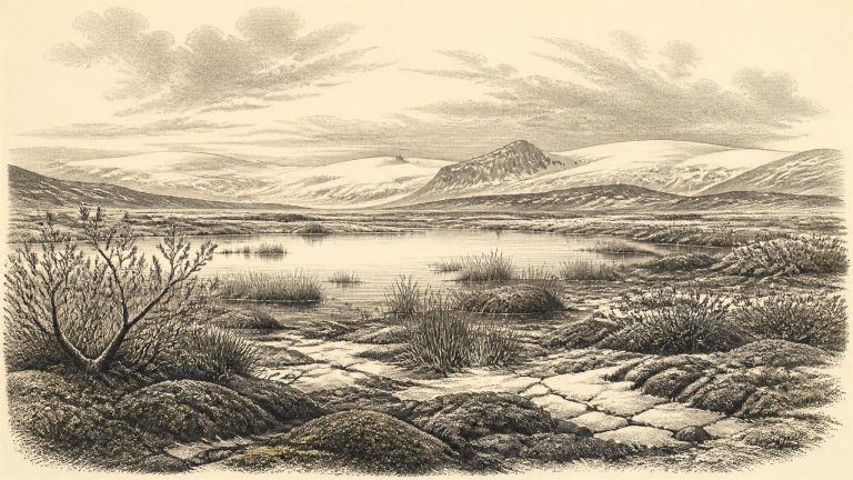
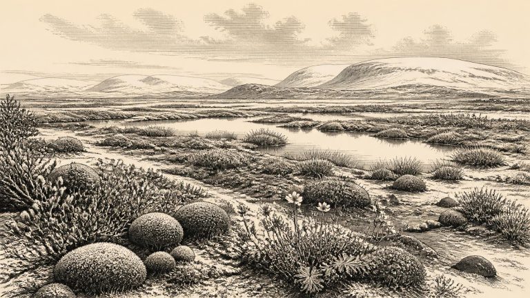
Ireland at this broad horizon was not the familiar green, wooded island of later millennia. It was part of the north-western fringe of Ice Age Europe, where climate, ice and sea level altered the shape and habitability of the land repeatedly. The Last Glacial Maximum, when the British–Irish Ice Sheet reached its greatest later extent, still lay ahead; recent reconstructions place its maximum extent in different sectors between about 30,000 and 22,000 years ago, with peak ice volume later, around 23,000 years ago. Around 30,613 BCE, therefore, Ireland was in a phase of severe climatic instability and ice-sheet growth rather than securely at that later maximum.
The closest unusually informative Irish sequence is at Derryvree, near Maguiresbridge in County Fermanagh. Roadworks in 1969 cut through a drumlin and exposed freshwater silts and fine sands enclosed between two thick layers of till: unsorted material deposited directly by glacier ice. Organic material from the freshwater bed produced the radiocarbon determination Birm-166, conventionally reported as 30,500 +1,170/−1,030 radiocarbon years BP. Published calibrations have expressed this as a broad calendar interval of approximately 36,900–31,700 cal BP, or roughly 34,950–29,750 BCE. The nominal date of 30,614 BCE falls within that wide window, but cannot be identified with a particular season, sediment layer, generation, animal or human action.
In radiocarbon practice, “before present” means before AD 1950. The key Derryvree determination, BIRM-166, produced a conventional age of 30,500 ± 1,100 radiocarbon years BP from organic material in moss-rich mud. It cannot be converted mechanically into one BCE year, because atmospheric radiocarbon levels varied markedly in the past. Calibrated estimates place the deposit broadly around 36,900–31,700 calendar years BP. In other words, 30,615 BCE, approximately 32,565 years before AD 1950, lies towards the younger end of a wide scientific range rather than at a pinpointable moment in the deposit’s history.
The closest major Irish environmental archive is at Derryvree townland, about two kilometres north-east of Maguiresbridge in County Fermanagh. Roadworks in February and March 1969 cut through a drumlin and revealed an extraordinary sequence: a thick lower till, freshwater silts and fine sands with organic material, then a second thick till. Till is the unsorted clay, stones and debris laid down by glacier ice. The order of deposits supplies a firm relative sequence. Ice had occupied the locality; a period without ice at that particular place allowed water and organic sediments to accumulate; later glacial activity buried and protected the deposit.
Derryvree was exposed by roadworks in 1969, when a cutting passed through a drumlin: an elongated hill shaped from glacial sediment. Investigators found silts, fine sands and organic muds sandwiched between two thick layers of till, the unsorted debris left by glacier ice. The sequence is unusually eloquent. Ice had previously occupied the site; then water and vegetation accumulated in an ice-free hollow; later, advancing ice buried the deposit beneath a second till.
Nothing resembling political affairs, diplomacy, formal warfare or government can be recovered for Ireland at this depth of time. There are no settlements, burials, structures, tool assemblages or written records securely attributable to this particular year. Nor can archaeologists identify a people, language, religion or enduring community. To fill those absences with an Ice Age “tribe” or a named migration would be invention.
Derryvree is important precisely because so little of Ireland’s earlier Ice Age landscapes survived later glaciation. Roadworks in 1969 cut through a drumlin two kilometres north-east of Maguiresbridge. Beneath and above the freshwater deposits lay separate sheets of till: unsorted clay, stones and debris deposited by glacier ice. Between them were silts, fine sands and organic material formed when the locality was not beneath active ice. The sequence gives a clear order of events. An earlier glacier had occupied the area; standing or slow-moving freshwater then accumulated sediment and organic remains in a hollow; later glacial action buried and protected that short-lived archive.
The closest important Irish environmental sequence is the Middle Midlandian deposit at Derryvree. Road works in 1969 cut through a drumlin and exposed a striking order of deposits: a lower layer of glacial till, freshwater silts and fine sands containing organic material, and a second thick till above. Till is the unsorted debris left directly by glacier ice. The sequence shows, beyond reasonable doubt, that ice had occupied the locality; that an interval followed in which water, plants and sediments accumulated; and that later ice again covered and sealed the site.
Derryvree’s sequence is powerful because of its order. A lower till shows that glacier ice had formerly crossed the site. Above it, freshwater and wetland sediments accumulated during an interval when ice was absent locally. An upper till shows that later glacial activity sealed the deposits. This is firm evidence for changing conditions at one Fermanagh locality. It is not proof that every part of Ireland was ice-free, equally hospitable or inhabited at the same time.
The principal Derryvree organic deposit yielded the conventional radiocarbon determination Birm-166: 30,500 years BP, with a substantial uncertainty of +1,170/−1,030 years. A radiocarbon age is not identical to a calendar age. The amount of atmospheric carbon-14 has changed through time, so measurements must be calibrated against independently dated records; at this depth in time, calibration produces broad and sometimes complex probability ranges rather than a precise answer. The Derryvree date has commonly been expressed as broadly c. 36,900–31,700 calibrated years BP, or approximately 34,950–29,750 BCE.
Derryvree was exposed during road works in 1969, when a cutting passed through a drumlin. Beneath a later glacial till, and above an older one, lay freshwater silts and fine sands containing organic material. This sequence is exceptionally important because its order is clear: an ice-free basin supported water and vegetation between two episodes that left till, the compact sediment deposited by glacial ice. The deposit was assigned the radiocarbon determination BIRM-166, 30,500 ± roughly 1,100 radiocarbon years BP. Its calibrated calendar placement is necessarily broad—commonly expressed as approximately 36,900–31,700 calibrated years BP, with modelling assumptions affecting the precise range.
The key Irish evidence is the Derryvree freshwater deposit near Maguiresbridge in County Fermanagh. In 1969, a road cutting through a drumlin revealed organic silts and fine sands lying between two thick sheets of glacial till. The deposit was thus sealed between episodes of ice advance. Its conventional radiocarbon determination, BIRM-166, was 30,500 radiocarbon years before present, with a large error range. Later scholarship has treated its calibrated age as broadly about 31.7–36.9 thousand calibrated years before present. The modern label 30,624 BCE falls within that wide interval, but cannot be matched to a particular layer, season or moment in the Derryvree sequence.
Derryvree was revealed when roadworks cut into a drumlin: a streamlined hill built and reshaped by glacier ice. Beneath later glacial deposits lay organic-rich muds and fine sands; below them lay older till. This sequence is direct evidence for a local order of events. Ice had affected the site, then a period without overriding ice allowed freshwater sediment and biological remains to accumulate, and later ice or ice-related deposits sealed the record. It is among the clearest Irish reminders that the last glacial cycle was not one uninterrupted freeze.