
Limerick Foundation(c.1190s)
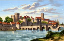
Limerick occupies a strategic bend of the River Shannon where an island at the river throat provided defensive advantage and a focal point for settlement. Archaeological, annalistic and cartographic evidence indicate human occupation here before the medieval period. Medieval sources record monastic houses and Gaelic ringforts and later topography suggests their locations. By the early tenth century maritime activity intensified and a Norse longphort or ship camp became established on King’s Island. Later narratives compress centuries but the city’s enduring urban nucleus traces to a Viking shore base established on the island in the early medieval era in regional history.
The year 922 is commonly cited as the date when a permanent Norse stronghold was established on King’s Island, based on annalistic entries noting Viking activity in the Shannon. Contemporary and near contemporary annals record raids, settlements and the foundation of a fortified base at an island identified with the later city centre. Viking leaders integrated into local politics and trade, using the island for ship repair, commerce and settlement. Over the tenth and eleventh centuries the Norse town grew, minted coinage and interacted with Irish kingdoms, shaping an urban plan that influenced later medieval Limerick and regional economic networks.
Before and alongside Viking occupation there were Gaelic and Christian presences whose traces survive in documentary references and place names. Medieval annals, hagiographies and ecclesiastical records refer to churches, saints and monastic lands in the wider Shannon meander. Toponyms such as Inis Sibhtonn and Athlunkard preserve older Gaelic descriptions of islands and fords and indicate continuity. These elements show Viking settlement did not create habitation ex nihilo but reshaped an existing human landscape. The Norse longphort converted a riverine monastic and farming zone into a maritime entrepot with an urban character and a fortified nucleus that endured into later centuries.
Limerick’s municipal identity was later formalised by royal charter in 1197 when Prince John, Lord of Ireland, granted civic privileges and corporate status, a legal recognition recorded in surviving charters. Municipal rolls and later civic minute books demonstrate continuities from the Viking town through Anglo-Norman reorganisation into a chartered borough and then a medieval and early modern county town. Urban features such as King’s Island fortifications, King John’s Castle site and the medieval street pattern preserve that institutional evolution. The charter did not found the settlement but enshrined legal and administrative structures which shaped the city’s subsequent governance and growth
The question of when Limerick was founded is therefore nuanced: archaeological traces, annalistic entries and documentary charters mark different stages in its development and offer varying criteria for foundation. If one means the durable urban nucleus recognised today, the Viking establishment on King’s Island around 922 AD is the conventional founding date cited by historians and local tradition. Earlier Gaelic habitation and monastic activity remain integral and archaeological investigation continues to refine chronologies. For researchers seeking original records, annals, medieval charters, archaeological reports and early maps provide complementary evidence to reconstruct the city’s formation and evolving urban identity over time.
Primary Sources
- Annals of Ulster, entry for 922 (manuscript annalistic record of Viking activity in the Shannon).
- Annals of Inisfallen, references to Norse settlement and events in Munster, tenth century entries. Manuscript copies held in national collections.
- Charter of Prince John, Lord of Ireland, 18 December 1197 granting borough status to Limerick (city charter recorded in municipal collections and national archives).
- King John’s Castle archaeological assessment reports and excavations on King’s Island recording medieval and Viking-period features. Limerick City archaeology reports, local authority archives.
- Ordnance Survey six inch maps and nineteenth century town plans showing King’s Island, St Mary’s Cathedral site and historic street pattern. National mapping collections.
- Contemporary medieval muniments and municipal rolls of Limerick Corporation, including early lists of mayors and freemen, held in local and national archives.
- Silver coin finds and numismatic records (including Cnut-period coinage) discovered in the Limerick area and catalogued in the national museum collections.
- Early cartographic sources and port records noting a longphort or ship camp at Limerick in the ninth to tenth centuries, referenced in maritime and port archives.
- Medieval hagiographies and ecclesiastical records referring to churches and monastic lands around the Shannon meander, held in diocesan and national manuscript collections.
- Excavation reports and environmental assessments prepared for development on King’s Island and environs, including evaluation of Viking period deposits in planning archive submissions.